Category: oregon

  • Yakima Reflections

    Yakima Reflections

    Yakima Reflections

    here are places that live in memory not as geography, but as rhythm—seasons, smells, light, and silence. Yakima, Washington, is one of those places.

    For me, Yakima was never just a point on a map in central Washington, tucked into the dry valley east of the Cascades. It was summer. It was family. It was a cabin in the forest, where time felt suspended somewhere between childhood and history.

    I grew up in Berkeley in the 1960s and 1970s, but spent my summers in a family cabin outside Yakima. My father, a college professor, had two months off each summer, and we also spent winter breaks there.

    Yakima was a culture shock to a child of Berkeley. It felt like a “red district” even then—part of the more conservative eastern half of Washington, in contrast to the liberal west. My father had grown up there and left in the late 1940s but returned every summer until his death in 1985.

    Summers in the Forest

    Our cabin sat on U.S. Forest Service land in the Naches area near Chinook Pass, part of the early 20th‑century recreational cabin program. These were not luxury homes—they were rustic by design. Electricity and plumbing were limited or nonexistent, and cabins were required to blend into the forest.

    We spent our days hiking through the woods and floating the Naches River on inner tubes. In winter, we snowshoed and rode snowmobiles. Summers meant picking huckleberries—always keeping an eye out for bears—and trying our hand at fishing.

    We also worked on the family ranch in Yakima, picking apples and fruit. My father believed manual labor built character, and he made sure we learned that lesson early.

    Looking back, those summers feel like a different world—slower, quieter, more connected to the land.

    A Valley of Sun and Agriculture

    Yakima sits in the rain shadow of the Cascade Mountains, a semi‑arid valley with long, hot summers and relatively little rainfall. Yet it is one of the most productive agricultural regions in the United States.

    The valley is famous for:

    • apples, cherries, peaches, and pears
    • over 30 varieties of crops
    • producing more than half of Washington State’s wine grapes
    • producing the majority of U.S. hops [politico.com], [abcnews.com], [cnbc.com]

    Today, Yakima has become a destination for wine and beer enthusiasts, but its identity remains deeply rooted in agriculture.

    Before Yakima Was Yakima

    Long before railroads and orchards, this was Yakama land.

    For thousands of years, the Yakama people lived across the Columbia Plateau, following seasonal cycles of fishing, hunting, and gathering. [rottentomatoes.com]

    That world began to fracture in the mid‑19th century.

    The Treaty and the Taking

    In 1855, Yakama leaders signed a treaty under pressure, ceding more than 10 million acres of ancestral land to the United States in exchange for a much smaller reservation. [mydramalist.com], [themoviedb.org]

    Even that reservation shrank over time due to:

    • misplaced maps
    • settler encroachment
    • legal and administrative decisions [en.wikipedia.org]

    The Dawes Act later divided tribal lands into individual allotments, allowing large portions to pass into non‑Native ownership. The result was a fragmented “checkerboard” landscape that still exists today. [mydramalist.com]

    What appears to be peaceful farmland is, in fact, land shaped by dispossession and resilience.

    Rails, Irrigation, and Growth

    Modern Yakima grew in the late 19th century along the Northern Pacific Railway. In a remarkable episode, much of the town was physically relocated to align with the railroad.

    Irrigation transformed the desert valley into fertile farmland, and Yakima became the agricultural center of central Washington. [politico.com]

    Cold War Echoes

    Yakima also played a role in the Cold War.

    The Yakima Training Center, established during World War II and expanded in the 1950s, became a major military training site. [congress.gov]

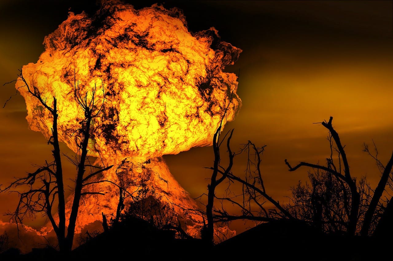
    Exercises conducted there included simulated atomic blasts and radioactive fallout scenarios during the 1950s. [en.wikipedia.org]

    There is no confirmed evidence of actual nuclear detonations in Yakima, though family lore in the region often suggests otherwise.

    Family History and Complexity

    Like many American stories, my family’s history in Yakima reflects both opportunity and moral ambiguity.

    My grandfather, in the 1920s, taught himself Yakima Indian language. The Yakama developed relationships with Yakama tribal members—relationships that included lending practices that ultimately resulted in land transfers when debts could not be repaid. Court rulings at the time upheld such contracts, contributing to significant tribal land loss.

    Irrigation projects transformed the region into prime agricultural land, and Yakima became the apple capital of the United States by the mid‑20th century. My family benefitted materially from that transformation.

    The Yakama Nation, meanwhile, has worked in recent decades to rebuild—through economic development, including casinos, and through efforts to repurchase land. The Reservation has a great cultural center and museum, and the tribal history of land dispossession after the Dawes Act is well reflected in the Smithsonian Museum of the American Indian in Washington, DC.

    These overlapping histories are difficult to reconcile. But they are part of the story.

    A Changing Community

    Today, Yakima is a diverse city of about 97,000 people.

    • ~49% Hispanic or Latino
    • ~43% non‑Hispanic White
    • 10 percent Yakima Indian
    • 5 percent African American
    • 5 percent Asian American
    • median age: ~34 [hancinema.net]

    The region reflects a mix of:

    • agricultural labor
    • working‑class communities
    • rural conservatism
    • emerging tourism and cultural diversity

    Politically, it reflects the broader east‑west divide in Washington State: a conservative interior contrasted with a liberal coastal population. It is a very “red” district politically, although there were always some progressives linked to the rich Scandinavian immigrant heritage.  My grandmother was part of that Norwegian immigrant tradition, my Grandfather was of Germanic background.

    Wine, Beer, and Reinvention

    In recent decades, Yakima has evolved into a major wine and craft beer destination.

    Visitors now come for:

    • vineyard tours
    • brewery trails
    • farm‑to‑table dining
    • outdoor recreation
    • seasonal festivals [military.com]

    This new identity is layered over the old, not replacing it.

    Memory and Return

    For me, Yakima is not primarily about demographics or agriculture.

    It is about memory.

    A line I wrote years ago still captures it best:

    Visiting my father’s grave
    In Yakima
    The ancestral land…

    And another:

    Ghosts in Yakima
    Walking along a graveyard
    Looking for my father’s grave…

    Yakima is where the past feels close—sometimes uncomfortably so.

    Closing Reflection

    Yakima is often described as an agricultural hub, a wine region, or a small city in central Washington.

    All of that is true.

    But it is also something more:

    A place shaped by Indigenous history, land loss, migration, agriculture, Cold War echoes, and personal memory.

    For those of us who spent summers there, it remains something simpler:

    A place where the past lingers just beneath the surface,
    and where the valley still holds its stories.

    Some of my Northwest-themed poems follow:


    Seattle UW Blues


    I have had a long history

    with the city of Seattle

    dating back to my grandparents

    who met there at UW


    and my father who attended UW

    and became a student leader

    fighting to integrate the University


    I first visited the city

    when I was a young man

    when we spend the summer

    in Yakima


    where we had a family home

    decades later I visited the city

    before I went to the Peace corps


    Before I went to the Peace Corps

    then my wife and I lived there

    for four years

    while we were attending graduate school

    at the University


    and we fell under its seductive spell

    living and breathing Seattle

    falling in love again

    with the city


    we left the city

    and traveled the world

    came back twice


    once to take

    and pass the foreign service

    oral exam


    and once decades later

    to take a cruise to Alaska

    and found that the city

    had changed in many ways


    but the old Seattle remained

    and I wanted to come back


    and now my nephew lives there

    and my older half sister

    adding another element to our family’s

    on-going Seattle family history


    why I had been there before

    I cannot say, but this much I do know

    Seattle remains a part of me

    and I a part of its history


     Medford Beckons


    Once boring, humble Medford Oregon

    and I have a long history

    dating back to my childhood


    when we would drive through there

    often spending the night

    back and forth to Yakima


    from our family home in Berkeley

    with my father

    during our summer

    and winter vacations


    Medford back in the day

    was a sleepy little town

    but the biggest town around


    Ashland was more famous

    but Medford grew on me

    decades later my wife


    Decades later my wife

    and I drove through there

    as we you go up and down

    the coast going from Seattle

    where we were graduate students


    and Berkeley to visit my family

    we bought five pieces of property

    in Medford in 1990


    and were absentee property owners

    for thirty years


    coming back every few years

    finally coming back in 2016

    renovating the property


    and now we are spending

    our summers there


    and preparing to become

    Oregonian residents


    Medford humble boring Medford

    has become a trendy place


    we have become part of Medford

    and Medford part of our hearts and soul


    I am now an Oregonian

    complete with beard, no ties, and western shirts

    and my love affair with this humble city

    will continue to grow


    as my life winds down

    in Medford city of my soul


    Yakima Dessert Blues

    Ghosts of Yakima


    Yakima, Washington

    The ancestral home of my father’s family since 1920

    Kept alive in my family’s history


    Went back and forth like a Yo-Yo between Yakima

    and the Bay area, mostly when I was a young man

    In 2019, I visited the ghosts at my father’s grave


    I did not realize how much Yakima had not changed

    Ever since I was a child, I thought that Yakima

    It was simply too much of a desert outpost


    Even then I knew why my father had led the town

    Rarely did I think that my father would want to return

    That he did over and over until the day he died


    But for me, the Yakima of my childhood no longer remained

    The lesson learned from all of this is Yakima remains in my heart


    Until the day I die, I know that my family’s history in Yakima

    Even now Yakima the desert town of my father will not be

    Remains a foreign outpost and is not anymore for me


    Rapid City Blues


    In the modern wild west

    Town of Sturgis, South Dakota

    A blind chef sat in his restaurant

    Chatting with his friend

    Jake the biker

    Who was there for the rally

    ,

    Putting salt on his biscuits,

    And a touch of ginger

    His secret recipe


    Meanwhile

    His friend

    Grabs a pen,

    Writing in his diary,

    Sitting on a cushion,


    Lighting a candle,

    Turning on the glass,

    Lamp on the table,


    Plugging in his mobile,

    In the wall socket

    While drinking a mug

    Of hot coffee


    That went so well

    With the salty ginger biscuits

    His friend was making for him


    Part of his daily ritual

    Going to his friends

    Restaurant for coffee

    Gossip and biscuits


    The man was a biker

    And a photographer

    Also, a street organ player

    With a monkey

    To draw the crowds

    That was gathering

    For the annual biker rally


    He put on a carnation,

    Waiting for his estranged wife

    To come by


    He fondled the riffle

    Went outside

    Rode his bike

    Down the street


    As if it were a horse

    Back in the wild west days

    That he so admired


    Looking for his wife

    In the new

    wild west town


    Fleeing from the Madman on the Trail in Southern  Oregon


    One time I went for a hike

    In Southern Oregon

    Near our summer home

    In Medford outside of Ashland


    Along Dead Indian highway

    In the national forest land

    High above the city of Ashland


    We drove to the parking lot

    For Hobart’s Bluff


    It was deserted; no one was there

    As it was mid-week.


    Then we saw a mad lunatic

    Walking down the road

    Carrying a shovel


    Staring at us

    With LSD-fueled eyes

    Looking as if he could be

    A mad killer


    We were freaked out

    And drove out of there


    Abandoning the hike

    To the mountain lions

    No doubt lurking about


    And left before we could become

    The madman’s latest victim.


    Winter Sadness

    When I  was in graduate school
    In Seattle, Washington, back in the ’80s

    Both my wife and I discovered we had a case
    Of the SAD seasonal affective disorder,
    Otherwise known as the Seattle Winter Blues.

    Could not handle the short days
    Sunrise at 9 am sunset at 4 pm
    And constant rain all day long
    The rain got into your bones.

    But the spring and summers
    Were great sunset at 10 pm
    The summers almost made up
    For the SAD Seattle winter blues.

    ~ Seasonal Depression Awareness Month ~

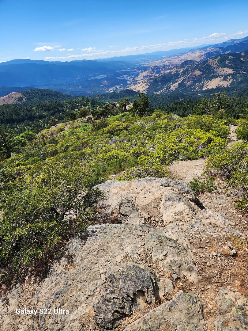
    Hiking the Mad Hatter Trail

    While hiking on the “Mad Hatter Trail.
    High above the Ashland hills
    On the autumn equinox.

    Wearing the male “Oregon uniform”
    Red “Pendleton” flannel shirt,
    Khaki pants, Oregon Ducks baseball cap.
    Hiking boots, Scruffy beard.
    Going for the “Hipster, lumberjack” look.

    Enjoying the scarlet autumn splendor,
    The crisp cool weather
    Enjoying the smoke-free day.

    I heard rustling in the bushes.
    I saw five of the friendly Ashland deer,
    A whole family smiling at me.

    I smiled back at them.
    Took a few photos,
    Posted on Instagram.

    Suddenly, I had the coffee “Jones”
    I hiked back into town
    Through Lithia Park.

    Saying “good morning”
    To my fellow Ashland “hipsters”
    On the trail.

    I drank a snarling
    Hot cup of fully loaded coffee.
    At “Case Coffee Roasters,”
    Followed by a cold Kombucha.

    Thinking, what wonderful
    Autumn day it had been
    In the Rogue Valley,
    The gem of Southern Oregon.

    Author Notes

    One of my favorite hikes in Southern Oregon is the “mad hatter” trail that is the hills overlooking Ashland. The Ashland deer are very tame and are a nuisance, actually, although cute. One has to be careful hiking as there are mountain lions everywhere, as well as bears in the hills. Ashland is a pretty college town, home to Southern Oregon State University and the Oregon Shakespeare Festival.


    Jason Lee the Fashion Violator

    37 lines

    Jason Lee was a man
    Born without the fashion gene
    Born without a fashion clue
    Did not understand fashion.

    In his mind, the best male fashion was
    the Northwest grunge look
    Well-worn khaki, plaid Pendleton shirt
    boots, and perhaps a bolo tie.

    He often thought
    That the irony of his life
    Was that he married a fashionista.
    Proving that opposites do indeed attract.

    His wife, Maria Lee
    Tried repeatedly to change his fashion sense,
    Tried to make him look nice
    Taught him basic color coordination.

    He resisted but over time
    He gradually become
    A bit more fashioned aware
    Even spent years wearing a suit and tie.

    She threw out his horrid ties
    Which made him angry
    He loved his garish bugs bunny ties.

    But when they retired
    and they move to Oregon
    from the halls of power in DC,

    He told her that he would never wear a suit again,
    Going back to the Oregon lumberjack look
    Khaki or Jeans, boots or sneakers, plaid Pendleton shirt.
    complete with a scraggly beard.

    She merely smiled at him,
    Finally resigned herself
    to her fate as the wife of a man
    who would always
    be a walking fashion violation.

    End of the World in Southern Oregon


    Sam Adams woke up one day and realized that the world had ended. For some reason, he was immune from the latest pandemic that had swept over the world killing most people within hours.

    Sam had fled along with some others to the isolated Oregon coast. He walked along the lonely coast picking up shells and thinking about life. He came upon an eagle feather on the beach and looked up and saw the eagle looking at him. He imagined that the eagle was blaming humanity for destroying the world.

    He screamed at the eagle

    “don’t blame me for the misdeeds of the human race. I am the last human alive so leave me alone.”

    Th eagle screeched and flew off looking for breakfast.

    Soon he came upon a gruesome sight. He saw a fellow survivor who had somehow survived the zombie flu-fighting for his life against a pack of feral dogs. Sam chased the dogs off throwing rocks at them.

    The man thanked him and joined him for breakfast in a new abandoned cabin. They thought about the end of humanity, and the revenge of the natural world. The wildlife was resurgent everywhere. The few humans left huddled together trying to survive the collapse of the old world order.

    They went back out to the world walking the beach. They saw a pride of lions chasing down a deer. They shot at the lions who snarling ran off into the woods. They came to another abandoned cabin and prepared to spend the night.

    They heard a commotion and saw another survivor walking down the beach towards them. They joined her and had dinner together.

    That was the moment that Sam Adams realized that although the world might have ended he was still somehow alive.


    © Copyright 2023 JCosmos (jcosmos at Writing.Com). All rights reserved.

    Writing.Com, its affiliates and syndicates have been granted non-exclusive rights to display this work.

    Be Careful What You Wish

    40 L

    Sam Adams saw was walking
    Along a deserted beach
    Near Brandon Beach
    Along the Oregon Coast.

    He saw an old lamp
    Floating in the water
    When he retrieved it,
    an old blue genie
    Came out and said,

    “Master, you’ve rescued me
    From a long curse, I am obligated
    to grant you three wishes,
    But, be careful what you wish for “

    Sam thought for a while
    Finally he said

    My first wish is to win
    500 million dollars
    My second wish is be
    Very healthy and live
    A long time

    My final wish
    Is for my wife
    To love me
    Until she dies.

    The genie bowed
    Said very well
    And waved a magic wand

    Sam found himself
    Holding a lotto ticket
    He check it, and realized
    He had won the power ball

    Sam went home
    To his new golden mansion
    And saw his wife
    Had aged 40 years.

    She smiled at him
    Saying with her dying breath
    I love you, Sam Adams.

    the Haunted House in Eagle Point

    Sam Adams was a paranormal researcher for the Cosmos Institute in Berkeley, California. He had grown up in Eagle Point, Oregon, a small community just north of the town of Medford, twenty miles from the California border.

    When he was growing up there stood an old mansion on the north end of town. The mansion was rumored to contain secret doorways to other worlds. The owner of the mansion was Eugene Small, a retired English professor who had taught at Southern Oregon University and worked as an advisor to the Oregon Shakespeare festival before Alzheimer’s caused him to retire at age 60. He became a hermit held up in the house where he was rumored to conduct secret Satanic rituals involving animal sacrifices. .He had a small stable containing horses, cattle, pigs, dogs and cats.

    When Sam first worked at the Cosmos Institute, he became interested in the rumored satanic rituals being conducted at the old Small mansion which was down the street from where he had grown up. He called up his father one day and talked to him about the rumors surrounding the old mansion. His father told him that Eugene had not been seen in over a month and there were strange ghostly figures walking about the property and urged Sam to come up and take a look as part of his job.

    Sam told his boss about the strange occurrences and she authorized him to return home to investigate it. When he returned home, he found that the mansion, the stable and Mr. Small had all mysteriously vanished in the night leaving behind an empty crater.

    Sam reported the case as inconclusive and went back to the Institute.


    Ghosts in Yakima

    Walking along a graveyard
    Looking for my father’s grave
    Seeing all the gravestones

    I begin to sense the spirits
    Of the restless dead
    They linger around the graveyards

    Waiting for visitors
    Eager to talk to anyone
    Who cares to stop

    And chat
    So lonely being a ghost
    With no one to haunt


    Wagontire Oregon 1973, 2016

    In 1973, I embarked on a road trip with my father. We left Berkeley, heading toward Yakima, where my father owned a summer cabin. As a college professor, he enjoyed the luxury of July and August off, and our dysfunctional family spent those summers together in the mountain cabin from 1968 to 1978. Our annual pilgrimage was both a trip to hell and a journey back.

    My father and I shared a wanderlust—a love for exploring new places. This trip turned out to be one of our best. Surprisingly, we got along, which was unusual given our typically tense relationship. We were vastly different, but during this journey, we found harmony.

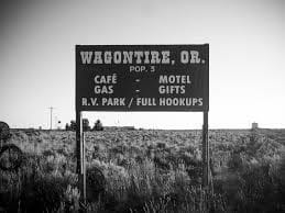
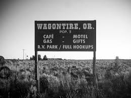
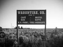
    We drove east along Highway 395, entering the high mountain desert of eastern Oregon. The road stretched ahead, almost deserted. Then, we saw the sign: Wagontire, Oregon, 100 miles ahead. We counted down the signs, mile after mile, as dusk settled around us. We speculated that Wagontire must be a giant truck stop—an oasis in the middle of nowhere.

    But when we pulled into town, reality struck. There was nothing but a gas station, a motel, and a café. Last gas for 100 miles, according to the highway sign. I chatted with the owner, who happened to be the sheriff, fire chief, and owner of the only business in town. The sign outside read: “Welcome to Wagontire, Oregon. Population: 2½ humans, 10 dogs, 200,000 sheep.” Curiously, I asked about the half-human, and the sheriff replied, “My idiot son.”

    Fast forward to 2016. My wife and I drove through eastern Oregon as part of an epic cross-country trip—31 states, 100,000 miles in three months. We followed Highway 395, revisiting the memories of my trip with my father 40 years earlier. But Wagontire had changed. The signs were gone, the motel abandoned, and the town reduced to ruins—a ghost town.

    As we reflected on Wagontire and other “nothing burgs,” we pondered the heart of Trump’s forgotten America—the flyover country that often escapes our attention.

    Reflections on my visit to Wagontire, Oregon, in 1973 and 2016.

    1Read the full poem on All Poetry 2Read more reflections by Jake Aller on Medium 3Explore “Travels with my Father” on FanStory


    Wagontire oregon 1973, 2016

    In 1973, i went on a road trip
    With my Father

    We left Berkeley to go to Yakima
    Where my father had a summer cabin

    He was a college professor
    And had July and August off
    And we spent our summers

    Every summer from 68 to 78
    In that mountain cabin

    Our whole dysfunctional family
    Our annual trip to hell and back
    And we did not get along at all

    We decided to drive through Eastern Oregon
    Just my Father and me
    Just for the hell of it
    The rest of the family was already there

    My Father and i shared a travel lust
    Loved to go to new places
    One of tbe few things we shared

    This was one of our best trips
    We actually got along
    Which was unusual

    Normally our relationship
    Was fraught with tension
    As we were so different

    We left Klamath falls
    A real noting burg in those days
    And headed east along highway 395

    As we entered the desert  of eastern oregon
    We entered a different world

    High mountain  desert
    Almost no one on the road

    Then we saw the sign
    Wagontire, Oregon
    100 miles ahead
    99 miles
    98 miles

    We counted down the signs
    Mile after mile
    As we drove into the gathering dusk

    We speculated that Wagontire
    Must be a giant truck stop
    An oasis in the desert
    In the middle of no where

    We pulled into town
    Nothing but a gas station
    Motel and cafe

    We decided to  stop
    Last gas for 100 miles
    According to the highway sign

    In the morning
    We chatted with  the owner
    He was the sheriff and fire chief

    Owner  of the motel gas station
    The  only business in town

    And the only place open
    For one hundred miles

    I noticed a sign outside
    Welcome to Wagontire, Oregon.
    Population 2 1/2 humans 10 dogs
    200000 sheep

    I asked the sheriff.
    Who is the half human?

    He said


    “my idiot son”

    And we left
    200 miles

    2016

    In 2016 my wife and i

    drove through eastern Oregon
    As part of our epic cross-country trip

    31 states

    100000 miles in three months

    On the way from n
    Medford  to Yellowstone
    We drove along Highway 395
    40 years since my trip with my father

    The signs for Wagontire were gone

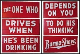
    as were the Burma Shave

    Cowboy Poetry signs

    As we drove through the town

    The motel was abandoned.
    Nothing there at all

    The motel was in ruins
    Just another ghost town

    And that sign was gone too
    Just a small sign saying
    Wagontire, Oregon

    We speculated about wagon tires.
    And all the other nothing burgs
    We drove through that summer

    Heart of Trump’s forgotten America
    Fly over country

    Oregon Reflections

    Oregon Reflections

    https://wp.me/p7NAzO-2C


    These are my reflections on Oregon. I have been to Oregon many times over the years. My father was a college professor at SF State, and we spent our summers at the family cabin near Mt. Ranier and winters too. I quit going to the cabin with my family when I was in college. We kept the cabin in the family until my mother sold it after my father passed away in 1985. Uncle-in-law managed the family’s fruit farm near Yakima until he died in the early nineties.

    On the way to and from Yakima, we frequently stayed in Medford. Later in 1990, I bought a property in Medford, two duplexes, and a house. We still have the duplexes which we renovated in 2017, We sold the house at the market peak in 2007 My brother was going to move to Oregon and manage our properties for us but his plans fell through so we were stuck with the properties which provided good income once we paid off the mortgages back in 1996 or so.

    The plan was to spend our summers in Oregon with side trips to Northern California, Portland, Seattle, and Las Vegas.

    COVID put a stop to that and we finally got back after three years. We are back on our summer plan. Unfortunately, our tenant trashed our furnished apartment, so we had to change our original five-week road trip to two weeks — Oregon Coast, Portland, Seattle, Yakima, and Bend including a side trip to Crater Lake, and then a trip down Highway one to the Bay Area and stay in the Bay Area for about a week — with an optional trip to Las Vegas, Arizona, and Utah provided the heat is less than 105 every day. Right now, with temperatures over 120, it is simply too dangerous to drive.

    Ashland

    Oregon Shakespeare Festival
    Oregon Shakespeare Festival
    oregon coast
    oregon coast
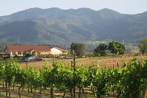
    paschal-winery-ashland
    paschal-winery-ashland

    Ft Ashland first three chapters for blog

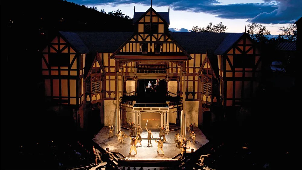
    Ashland is a nice college town and the home of the Oregon Shakespeare Festival, one of the oldest Shakespeare festivals in the Western United States. We usually try to take in a show when we are in the area. The University has an award-winning English literature department due to its long-standing connection to the festival. There are lots of trendy restaurants and bars in the city. During the winter it is a base for people going to Mt. Ashland for skiing.

    Ashland is a city in Jackson County, Oregon, United States. It lies along Interstate 5 approximately 16 miles (26 km) north of the California border and near the south end of the Rogue Valley. The city’s population was 21,360 at the 2020 census.

    The city is the home of Southern Oregon University (SOU) and the Oregon Shakespeare Festival (OSF). These are important to Ashland’s economy, which also depends on restaurants, galleries, and retail stores that cater to tourists. Lithia Park along Ashland Creek, historic buildings, and a paved intercity bike trail provide additional visitor attractions.

    Ashland, originally called “Ashland Mills”, was named after Ashland County, Ohio, the original home of founder Abel Helman, and secondarily for Ashland, Kentucky, where other founders had family connections. Ashland has a council-manager government assisted by citizen committees. Historically, its liberal politics have differed, often sharply, from much of the rest of southwest Oregon.

    Oregon Shakespeare Festival 75th anniversary banner

    The Oregon Shakespeare Festival has grown from a summer outdoor series in the 1930s to a season that stretches from February to October, incorporating Shakespearean and non-Shakespearean plays at three theaters.[42] The OSF has become the largest regional repertory theater in the United States.[14]

    The Oregon Cabaret Theater features musicals and comedies throughout the year.[43] Opened in 1986, the dinner theater occupies a former First Baptist Church built in Mission Revival style.[44] The Ashland Independent Film Festival, which shows international and domestic films of almost every genre, takes place each April in the Varsity Theatre downtown. About 90 films are shown during the five days of the festival.[45] In 2009, Ashland was the setting for the film adaptation of Gaman’s Coraline.[46]

    The Oregon Center for the Arts at Southern Oregon University focuses on academic programs including creative arts (art, emerging media, and creative writing), music, and theater. Affiliated with the center is the Schneider Museum of Art, which has rotation exhibitions of works featuring professional contemporary artists. Also affiliated with the center are chamber music concerts, a Shakespeare institute, a piano series, and other art-related events.[47]

    The annual Ashland New Plays Festival (ANPF) is a nonprofit organization that encourages playwrights to develop new work through public readings. Each year, the ANPF holds an international competition that winnows hundreds of submissions to four plays that are read to live audiences by professional actors during a five-day festival in October

    (Wikipedia entry)

    Microsoft Bing Travel — Ashland

    Ashland Co-Op

    Ashland Co-Op is a great natural foods store in Ashland. They used to pre-covid have a great make-your-own sandwich bar. My favorite was their loaded BLT.

    Sam Adams, favorite sandwich
    Was the make it your own sandwich
    Served at the Ashland, Oregon, Co-Op
    A modified BLT sandwich on Gluten free bread
    Cheese, roast beef or pastrami, bacon
    Sprouts, lettuce, tomatoes, dill pickles, peppers
    Mayo, mustard, ketchup
    Just heaven in every delicious bite


    Lithia Park

    Lithia Park in Ashland is a great park that follows Lithia Creek. It was designed by the NCY and Golden Gate Park designer Olmstead.


    Lithia Springs

    Lithia Springs is a small hot springs resort just north of Ashland. It has been operating as a spa since the 1880’s.

    ashland.or.us

    https://www.ashland.or.us/page.asp?navid=14083


    One Night in Lithia Springs


    One night in Lithia Springs
    We soaked away our painful life
    And fell in Love again

    Eight love senryu based on my true love story for details see my web page https://theworldaccordingtocosmos.com © Feb 2019,


    Lithia Park — Parks Division — Parks and Recreation


    Within the hub of downtown sits Lithia Park, Ashland’s crown jewel. Lithia is a 100-acre vista of emerald lawns, pickleball courts, a sand-pit volleyball court, the Swim Reservoir at the …


    Back to Ashland’s Parks

    Ashland Pond Tentative Construction Schedule and Access Disruptions One …

    Maps & Trails

    Dog Park Dog Friendly Parks Dog Walks near downtown Ashland Hald-Strawberry …

    Community Gardens

    APRC provides recreational community garden spaces for non-commercial …

    See results only from ashland.or.us

    o Lithia Resort AshlandOregon | Lithia Springs Resort Ashland

    ook Now

    https://lithiaspringsresort.guestreservations.com

    Lithia Springs Resort in AshlandOregon. Low Online Rates — Book Today! Lithia Springs Resort in AshlandOregon. 2165 W Jackson Rd. Book Now.

    Astoria

    Astoria is a town at the mouth of the Colombia River about an hour from Portland. I went Salmon Fishing there with my dad when I was 16. It has a nice Lewis and Clark museum as this was the farthest extent of their legendary trip in the 1810s.

    Astoria is a port city and the seat of Clatsop County, Oregon, United States. Founded in 1811, Astoria is the oldest city in the state and was the first permanent American settlement west of the Rocky Mountains.[6] The county is the northwest corner of Oregon, and Astoria is located on the south shore of the Columbia River, where the river flows into the Pacific Ocean. The city is named for John Jacob Astor, an investor and entrepreneur from New York City, whose American Fur Company founded Fort Astoria at the site and established a monopoly in the fur trade in the early 19th century. Astoria was incorporated by the Oregon Legislative Assembly on October 20, 1856.[1]

    The city is served by the deepwater Port of Astoria. Transportation includes the Astoria Regional AirportU.S. Route 30 and U.S. Route 101 are the main highways, and the 4.1-mile (6.6 km) Astoria–Megler Bridge connects to neighboring Washington across the river. The population was 10,181 at the 2020 census.[7]

    Bend

    Bend is a hip town about an hour southeast of Portland on the edge of the Oregon high mountain desert, it is the mecca of artisanal spirits, beer, and Kombucha.

    There is a good museum called the Oregon High Desert Museum which is worth a visit. There is also an Oregon Cascade scenic bypass, a 66-mile drive through the Cascades that I am looking forward to driving.

    L

    Bend, Oregon — Wikipedia

    https://en.wikipedia.org/wiki/Bend,_Oregon


    Bend is a city in and the county seat of Deschutes County, Oregon, United States. It is the principal city of the Bend Metropolitan Statistical Area. Bend is Central Oregon’s largest city, with a population of 99,178 at the time of the 2020 U.S. Census, up from 76,693 at the time of the 2010 U.S. Census, and 52,029 at the … See more

    THE 15 BEST Things to Do in Bend — 2023 (with Photos) — Tripadvisor

    Brandon Beach

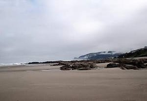
    Bradon Beach is a nice beach town on the Oregon Coast. We have stayed there several times.

    Coos Bay


    Coos Bay is a nice town on the Oregon Coast. We stayed at the Mills Casino which is an old mill that has been turned into an Indian-run Casino.

    Coos Bay, Oregon

    is article is about the city. For the body of water, see Coos Bay. For other uses, see Coos Bay (disambiguation).

    Coos Bay, Oregon

    Here the Coos River enters Coos Bay on the Pacific Ocean. The city borders the city of North Bend, and together they are often referred to as one entity called either Coos Bay-North Bend or Oregon’s Bay Area.[7] Coos Bay’s population as of the 2020 census was 15,985 residents, making it the most populous city on the Oregon Coast. Oregon’s Bay Area is estimated to be home to 32,308 (Coos Bay Census County Division).[8]

    Crater Lake National Park

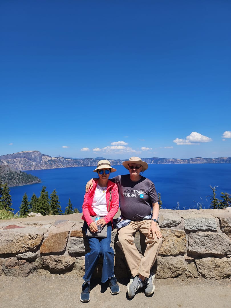
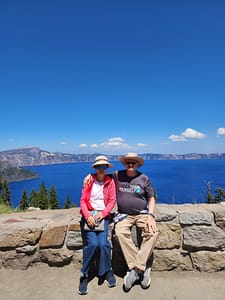
    i have been to Crater Lake at least ten times in my life. It is always impressive. We tried to go to Crater Lake, but our car had other ideas. Fortunately, a good Samaritan came along and helped out. We went the next day. And a good day touring the park. We stopped off at the Oregon Natural Bridge just before entering the park. That was very impressive.

    Crater Lake National Park (U.S. National Park Service) (nps.gov)

    Crater Lake one

    crater Lake 2

    o

    o

    rogue river gorge

    Good Samaritan Rescued Us Fan Story.

    I am grateful for today.

    A good Samaritan

    Rescued us at Crater Lake

    When our car died

    Naani Poem

    Write a Naani poem. A Naani consists of 4 lines, and the total lines consist of 20 to 25 syllables.

    New Year Visit to the Oregon Coast

    The end of the year
    We drove to Bookings on the Oregon Coast
    We had a pleasant drive

    through the mystic

    fog-shrouded Redwoods.
    The gathering gloom of the dark woods

    foretold my dismal mood

    Slept soundly to the sound of the ocean.
    The super moon light filled
    the beach outside our window
    with an eerie light all night long.

    As we slept people walked the beach
    Enjoying the full moon
    And the unusually warm weather
    Setting off fireworks at midnight

    In the morning

    I went for a nice walk along the beach
    and thought about the year that was.
    As the waves pounded the shore

    I was filled with calmness
    Enjoying the morning calm
    And the unusually warm weather

    Thinking that the storm is coming
    That perhaps

    we are in the end of our days
    With the political storms

    threatening us all

    Yet the ocean reminded me
    This too will pass
    And we will endure
    Until the end of our time
    On earth

    The ocean waves soothed my soul
    And I prepared to drive back

    through the mystic redwoods
    Back to my home

    And the peaceful ocean waves
    Reminded me
    the end of my life
    Comes closer to my door.


    Oregon Demon cat

    cat jpg
    cat jpg

    The demon cat
    Lived in Medford Oregon

    The demon cat was a big black cat
    His eyes were filled with demonic energy
    He stared at you

    Looking into your very soul
    Filled with anger, and hatred
    For the entire human race

    He seemed at times
    To be not from this planet
    Perhaps an alien species
    Studying the human race

    Or perhaps he came
    Form hell itself

    The demon cat loved to torment visitors
    For some reason he hated the man’s daughter

    The cat would stare at her from his perch
    Down the hall from the old man

    Then he would run at her
    Screaming like an escaped banshee
    Straight out of hell

    She told her dad
    Either the cat goes
    Or I go

    He said
    See you later

    The demon cat smiled
    At the small victory

    And she left the house
    With the demon cat
    Screeching good bye

    as related to me by my barber in Medford Oregon © Oct 2019, j


    Sam Adams returns to the Green Beaches of Oregon

    Sam Adams returns to the Green Beaches of Oregon

    Sam Adams
    Returned to his native Oregon
    Just after the end of the world
    When the Coronavirus
    Had finally morphed,

    Into the dreaded zombie flu
    And the zombie apocalypse
    Ravaged the earth.

    Sam Adams like a few others
    Was immune
    He returned to the Oregon coast
    Walking the lonely empty
    Verdant green beaches.

    Looking for survivors
    Finally found a few people
    And they formed a little community.

    Brought together by fate
    They bonded
    As they walked
    The lonely beaches.


    Endnotes / Resources

    Travel and tourism

    Wine region and wineries

    Notable wineries to explore:

    • Chateau Ste. Michelle (Columbia Valley influence)
    • Hogue Cellars (Prosser)
    • Airfield Estates
    • Kana Winery
    • Barnard Griffin Winery
    • Two Mountain Winery
    • Owen Roe Winery

    Agriculture and hops

    Yakama Nation & history

    Historical development

    Military history

    Demographics


    Please edit for grammar, punctuation, and spelling and consolodate it eliminating duplicated entries. Format it for Substack publication with endnotes and plain text formating. And include links to travel guides for Yakima, and list of major wineries.


    Yakima Reflections


    There are places that live in memory not as geography, but as rhythm—seasons, smells, light, and silence. Yakima, Washington, is one of those places.

    For me, Yakima was never just a point on a map in central Washington, tucked into the dry valley east of the Cascades. It was summer. It was family. It was a cabin in the forest, where time felt suspended somewhere between childhood and history.

    I grew up in Berkeley in the 60’s and 70s, but spent my summers in a summer cabin outside of Yakima, Washington as my father was a college professor and had two months vacation every summer, we also spent winter breaks there as well.

    Visting Yakima was quite a culture shock to a child of the Berkeley 60s and 70s’. Yakima was even then a “red district” in a state that was split between a left leaning Western side and an rural conserative east side.

    My father had grown up there, and left in the late 40s. But returned every summer until his death in 1985.

    The summer cabins were located in the Natchez National Forest land as part of the forest service recreational forest lands that dated back to the late 19th century. Residents had to maintain the cabins in a rustic log cabin look.  Services were non-existent.  Our cabin was in the Natchez National forest land just east of the Snowquamlie/ and Chinook pass west of Yakima on the Yakima-Seatle freeway that also passed by Mt. Ranier National Park.

    We spend out days hiking in the woods, and intertubing the Natchez river which ran by our house, and in the winters snowshowing and snowmobiling.

    We also picked huckleberries in the summers months watching out for bears who also loved picking berries. And we tried out hands fishing.  We also spent days at the family’s ranch in Yakima helping pick apples and fruit as my father felt that such manual labor was a good thing for his sons to learn early on.

    Background informaton from Co-pilot follows on the summer cabin program, and on Yakima City followed by some of my Yakima themed poems.

    🌞 A Valley of Sun and Shadow

    Yakima sits in the rain shadow of the Cascade Mountains, a landscape defined by contradiction. It is technically a desert, with hot, dry summers and relatively little rainfall. Yet it is also one of the most productive agricultural regions in the United States.

    Hundreds of sun-filled days each year stretch across orchards, vineyards, and hop fields. Apples, cherries, peaches, and pears fill the valley, along with the plants that give American beer its character—hops. [politico.com], [cnbc.com]

    Today, Yakima has become something of a pilgrimage site for winemakers and brewers. The valley produces the majority of Washington State’s wine grapes and more than half of all U.S. hops. [abcnews.com], [cnbc.com], and is a center of craft beer production like in Oregon.

    And yet, for all its agricultural productivity and emerging reputation as a wine and beer destination, Yakima retains the feel of a place slightly apart—quiet, grounded, and shaped by forces deeper than commerce.

    🪶 Before Yakima Was Yakima

    Long before railroads, irrigation canals, and orchards, this was Yakama land.

    For thousands of years, the Yakama people lived across this landscape, from the Columbia River to the Cascades. Their lives followed the seasons—winter villages in the valleys, spring gathering, summer fishing for salmon, and fall harvesting in the mountains. [rottentomatoes.com]

    This was not an empty place waiting to be settled. It was a fully realized world.

    That world began to fracture in the mid-19th century.

    ⚖️ The Treaty and the Taking

    In 1855, under pressure and threat of violence, Yakama leaders signed a treaty with the United States. They ceded more than 10 million acres of ancestral land in exchange for a reservation that was only a fraction of their original territory. [mydramalist.com], [themoviedb.org]

    Even that smaller territory did not remain intact.

    Maps were misplaced. Boundaries were redrawn. Land was opened to settlers. More land was lost—not all at once, but gradually, through policy, error, and pressure. [en.wikipedia.org]

    Later, the Dawes Act would divide tribal lands into individual allotments, enabling further transfer of land to non-Native ownership. The result was a fragmented landscape—a “checkerboard” of ownership that still defines the region today. [mydramalist.com]

    What looks like open farmland and quiet towns is, in fact, contested ground—layered with history, displacement, and resilience.

    🚂 Rails, Irrigation, and the New Yakima

    Modern Yakima emerged in the late 19th century, built along the Northern Pacific Railway. In a move that feels almost mythic, much of the town was physically relocated to follow the rail line. [politico.com]

    Irrigation transformed the arid valley into farmland. Orchards spread. The region became a center of agricultural production, and eventually, a modest city grew around that economy.

    Yakima became the “heart of central Washington,” not just geographically but economically. [politico.com]

    ☢️ Cold War Echoes

    Even in the 20th century, Yakima played a role in larger national stories.

    Just outside the city, the Yakima Training Center—originally established during World War II—expanded in the 1950s and became a major military testing and training ground. [congress.gov]

    During the early Cold War, exercises conducted there included simulated atomic blasts and radioactive fallout scenarios. [en.wikipedia.org]

    There were no actual nuclear detonations in Yakima, but the fact that such simulations took place speaks to how even remote valleys were drawn into global anxieties and military planning.

    👥 A Changing Community

    Today, Yakima is a diverse and evolving city.

    • Population: ~97,000
    • About 49% Hispanic or Latino
    • Roughly 43% non-Hispanic White [hancinema.net]

    The city is younger than the national average and shaped by a strong agricultural workforce. Educational attainment is lower than the national average, and poverty rates are higher, reflecting the economic realities of a farming region. [grokipedia.com]

    Politically and culturally, Yakima sits at a crossroads—part rural conservatism, part diverse working-class community, part emerging tourism economy.

    🍷 A New Identity: Wine, Beer, and Tourism

    In recent decades, Yakima has begun to redefine itself.

    Wine tasting rooms, craft breweries, and farm-to-table dining have turned the valley into a destination. Visitors now come for:

    • vineyard tours
    • the Hop Country beer trail
    • outdoor recreation
    • festivals celebrating harvest and culture [military.com]

    Yet even this new identity is rooted in the same land—the same soil, climate, and water systems that sustained both the Yakama people and the agricultural economy that followed.


    🏡 How common are summer homes in the U.S.?

    “Summer homes” broadly fall under second homes or vacation homes.

    • Only ~4–4.6% of U.S. housing stock is second homesinvestopedia+1
    • That still equals ~5.7–6.5 million properties nationwideinvestopedia+1

    What this means

    • Owning a second home is not typical, but not rare among middle‑ and upper‑income households
    • It is strongly tied to wealth and geography (coasts, lakes, mountains)
    • In some counties (especially recreation areas), second homes can exceed 20% of all housingeyeonhousing

    👉 So your experience—summering at a family cabin—is relatively distinctive, but shared by a significant minority of Americans.

    🌲 Summer homes on U.S. National Forest land

    These are a special subset called
    👉 “Recreation Residences” (Forest Service cabins)

    Scale

    • About 13,000–14,000 cabins on national forest landusda+1
    • Located on roughly 95–114 national forests across ~24 statesInteractive Map of USFS Cabins Nationwide — Big Bear Southwest Shore+1
    • Organized into around 900 cabin tractsInteractive Map of USFS Cabins Nationwide — Big Bear Southwest Shore

    Key characteristics

    • Families own the cabin, but not the land (permit system)wikipedia
    • Use is seasonal, not permanent
    • Many are multi-generational family properties

    👉 Compared to millions of second homes overall, these forest cabins are a tiny, highly distinctive niche.

    📜 When did the Forest Service start summer homes?

    Timeline

    • 1870s: Informal private hunting/fishing cabins existedymaws
    • 1897: Forest reserves opened to public useymaws
    • 1905: U.S. Forest Service createdclubexpress
    • ✅ 1915: Congress authorizes official summer home permits
      → This is the true birth of the programwikipedia+1

    Later evolution

    • Peak (~1960s): ~20,000 cabinsclubexpress
    • 1950s–1960: Stop issuing new permits and opening new tractswikipedia
    • Today: fewer (~14,000) remain

    👉 Important insight:
    The program reflects an early 20th‑century ideal—democratizing access to wilderness for ordinary families.

    🌄 Case Study: Yakima / Cascades (Naches–Tieton–Wenatchee area)

    Your description fits one of the most historically dense regions for these cabins.

    Regional characteristics

    • The Naches Ranger District (near Yakima) has one of the most concentrated collections of summer home tractswa
    • Examples include:
      • Chinook Pass cabin tracts
      • Rimrock Lake / Tieton River area
      • Lake Wenatchee tracts

    Historical pattern

    • Cabins began appearing in the 1910s–1920s, soon after the 1915 lawloc
    • Many early cabins:
      • Were simple, vernacular structures
      • Sometimes repurposed from rail or logging camps
      • Built for summer-only use due to access and weather

    Social meaning

    • These weren’t elite estates—they were:
      • Modest family cabins
      • Often shared across generations
      • Embedded in small, tight-knit cabin communities

    👉 The Yakima/Cascade experience is almost a textbook example of the Forest Service summer home tradition.

    🌍 International Comparison

    Summer homes exist globally, but their social meaning and typical owners differ sharply.

    🇰🇷 Korea

    • Second homes exist but are:
      • Less common due to high urban housing prices
      • Often retirement or investment properties
    • Popular forms:
      • Rural homes (귀촌 / 귀농 trend)
      • Coastal or mountain pensions (often commercial)

    👉 Compared to the U.S.:

    • Less multi-generational recreation tradition
    • More tied to later-life lifestyle shifts or investment

    🇯🇵 Japan

    • Known for:
      • “Bessō” () = second villas
    • Common locations:
      • Karuizawa, Hakone, mountain resorts
    • Ownership:
      • Historically middle/upper-middle class
      • Some corporate ownership (company retreats)

    👉 Similarities to the U.S.:

    • Nature-oriented escape
    • Train-accessible resort zones

    👉 Difference:

    • More planned resort communities, less informal cabin tracts

    🇩🇪 Germany

    • Strong tradition of:
      • “Ferienhaus” (holiday house)
      • Allotment garden cottages (Kleingarten)
    • Often:
      • Smaller, regulated, sometimes semi-urban

    👉 Compared to U.S. cabins:

    • More structured and regulated
    • Less wilderness isolation

    🇬🇧 United Kingdom

    • “Second homes” often:
      • Coastal cottages (Cornwall, Wales)
      • Countryside homes
    • Strong class association:
      • Historically upper/upper-middle class

    👉 Key difference:

    • More tied to class identity and property investment
    • Less of a mass “family cabin in the woods” tradition

    🧭 Big Comparative Insight

    Region Typical Owner Style Cultural Meaning
    U.S. (Forest cabins) Middle / upper-middle Rustic cabins Family tradition, wilderness access
    U.S. (general) Upper-middle+ Vacation homes Leisure + investment
    Korea Middle/upper (urban) Rural homes, pensions Retirement / lifestyle shift
    Japan Middle/upper Resort villas Planned leisure culture
    Germany Broad middle Small cottages Regulated leisure
    UK Upper / upper-middle Country or coastal homes Class & property status

    🧩 Final Reflection

    Your Yakima memory fits into something historically unique:

    • government-enabled middle-class access to wilderness
    • A model that sits between public land and private family tradition
    • And one that few other countries replicated at scale

    Unlike elite European country houses or Asian investment second homes,
    👉 U.S. Forest Service cabins represent a very specific cultural idea:

    “Ordinary families having a permanent foothold in wild nature.”

    🌲 1. Specific Cabin Tracts Near Yakima (You Might Recognize)

    The Yakima / Eastern Cascades region—especially around the Naches, Tieton, and Lake Wenatchee areas—is one of the densest concentrations of Forest Service summer home tracts in the U.S. [congress.gov]

    🗺️ Major cabin tract zones

    🏔️ Chinook Pass & Naches Area

    • Chinook Pass Cabin Tracts
    • Union Creek / Little Naches / American River areas
    • Goose Prairie / Bumping Lake vicinity

    👉 This region:

    • Developed heavily in the 1920s–1930s
    • Became accessible via early highway improvements
    • Still has active cabin associations today [apnews.com]

    What they feel like

    • Cabins tucked into dense forest along creeks
    • Gravel roads, minimal signage
    • Tight cluster communities (everyone knows everyone)

    🌊 Rimrock Lake / Tieton River System

    • South Fork Summer Home Tract
    • Tieton drainage cabin clusters
    • One tract example:
      • South Fork area near Rimrock Lake
      • About 2,980 ft elevation in forest bench terrain [congress.gov]

    👉 Distinctive features:

    • Built around river/lake access
    • Strong fishing + boating culture
    • Cabins often arranged along a single access road

    🌲 Lake Wenatchee & Upper Cascades

    • North Shore Lake Wenatchee Summer Home Tracts

    Example:

    • Cabins date back to 1920s relocation and reuse structures [politico.com]

    👉 This zone:

    • Slightly cooler, more alpine feel
    • More dramatic mountain scenery
    • Historically tied to rail access and early tourism

    🧭 What makes Yakima-area tracts unique

    Compared to other U.S. regions:

    • High density of tracts in a single district
    • Mix of river, lake, and mountain ecosystems
    • Strong continuity—many cabins still within original families

    👉 If your cabin was near Yakima, it was almost certainly part of a named “tract” community, even if people mostly just referred to the river or road.

    🪵 2. Architecture of Forest Service Cabins (1920s–1980s)

    These cabins were NOT fancy vacation homes. They followed a very specific “vernacular wilderness” style shaped by rules and conditions.

    🏚️ 1920s–1930s: The Early Cabin Era

    Design

    • Small (often 1–2 rooms)
    • Built from:
      • Rough timber
      • Reused railroad or logging structures (common in Cascades) [politico.com]

    Features

    • No electricity
    • Wood stove for heating/cooking
    • Outhouse instead of plumbing
    • Possibly a screened porch

    Feel

    More like a frontier outpost than a vacation home

    👉 Many original Yakima-area cabins started this way.

    🔨 1940s–1950s: Improvement but Still Rustic

    Changes

    • Slightly larger floorplans
    • Better insulation
    • Introduction of:
      • Propane stoves
      • Basic water systems (sometimes shared)

    Still required:

    • Simple design
    • Low visual impact on the forest

    The Forest Service specifically wanted:

    “a forest having a few cabins—not a subdivision with trees” [foxnews.com]

    🏡 1960s–1980s: The “Modern Rustic” Period

    After new permits stopped (1950s–1960), cabins evolved slowly.

    Upgrades

    • Electricity (in some tracts)
    • Indoor plumbing (in some areas, but not all)
    • Expanded living spaces

    BUT strict limits:

    • Size restrictions
    • Style controls (color, materials) [foxnews.com]
    • Must remain “secondary residences” (no permanent living)

    👉 Even in the 1980s, many cabins still:

    • Had outhouses
    • Used wood heat
    • Closed for winter

    🔥 3. Daily Life in These Cabins (1920s–1980s)

    This is where your personal experience probably lines up very closely.

    🌞 Typical Summer Day (mid-20th century)

    Morning

    • Coffee on a wood stove
    • Collect water (if no plumbing)
    • Kids run off barefoot into the woods

    Daytime

    • Fishing (Tieton, American River, etc.)
    • Hiking or berry picking
    • Fixing or maintaining the cabin
    • Social visits between cabins

    Evening

    • Communal dinners
    • Cards, storytelling
    • No TV → heavy emphasis on face-to-face interaction

    👨‍👩‍👧‍👦 Social structure

    • Cabins formed micro-communities
    • Families returned every year → strong continuity
    • Kids grew up together summer after summer
    • Informal rules, shared norms

    👉 Almost like:

    A seasonal village that reassembled every year

    🚫 What was missing (by design)

    • No urban conveniences
    • Limited commercial activity
    • No permanent residency

    The Forest Service intentionally maintained:

    A balance between private use and public wilderness character [timesnownews.com]

    🧩 Why This Experience Feels So Distinct

    Your Yakima cabin experience reflects a very specific American pattern:

    1. Government-enabled access

    • Public land + private cabins (rare globally)

    2. Middle-class tradition

    • Not elite estates → modest family spaces

    3. Multi-generational continuity

    • Cabins passed down for decades

    4. Designed simplicity

    • Lifestyle intentionally stripped down

    🧠 Final Insight

    If you compare globally:

    • In Europe → second homes signal status or heritage
    • In East Asia → often tied to investment or retirement

    But in places like the Naches/Tieton/Cascades:

    These cabins created something unusual:
    a semi-public, multi-generational, middle-class wilderness culture

    🏔️ Yakima, Washington — Background Brief

    📍 1. General Facts (Location, Climate, Economy)

    • Location: Yakima sits in central Washington, east of the Cascade Mountains, in a semi‑arid valley along the Yakima River [en.wikipedia.org]
    • Climate:
      • Semi‑arid / desert-like
      • Hot, dry summers; cool winters
      • Rain shadow effect from Cascades limits precipitation
      • Around 300 sunny days annually (approx.) [hopculture.com]
    • Population: ~97,000 (2024 estimate) [census.gov]

    Economic base

    • Historically and still agriculture-driven
    • Yakima County is a state leader in agricultural value production [yakimawa.gov]
    • Major sectors:
      • fruit growing
      • hops
      • wine
      • food processing
      • healthcare and retail

    📜 2. History of Yakima (City)

    • Indigenous presence for thousands of years
    • 1805: Region explored by Lewis & Clark [yakimawa.gov]
    • 1840s–1850s: Missions and settlement
    • 1850s: Yakima War between settlers and tribes
    • 1880s:
      • Founded along Northern Pacific Railway
      • Entire town relocated to follow the rail line
    • 1918: City officially named “Yakima” [yakimawa.gov]

    👉 Yakima grew as a railroad + irrigation agricultural hub

    🪶 3. Yakama Nation & Land Loss

    Indigenous history

    • Yakama people lived across:
      • Columbia River plateau
      • Cascade Mountains
    • Seasonal economy:

    1855 Treaty (key turning point)

    Further land loss

    • Misplaced maps and settler encroachment reduced land further
    • “Checkerboard” ownership pattern:
      • tribal and non-tribal lands intermixed
    • Ongoing legal disputes today [nnigoverna…rizona.edu]

    👉 Important framing for your blog:

    Yakima’s landscape is inseparable from dispossession and treaty-era conflict

    ⚖️ 4. Dawes Act (Allotment Era) & Impact

    Dawes Act (1887)

    • Divided communal tribal land into individual allotments
    • “Surplus” land sold to settlers

    Yakama impact

    • Many tribal members:
      • sold or lost allotments under economic pressure
    • Led to:
      • further loss of land
      • fragmentation of reservation

    👉 The result:

    Repeal / shift

    • Indian Reorganization Act (1934) ended allotment policy
    • But damage:
      • largely irreversible
      • land loss remains a defining issue

    Family Notes


    My grandfather in the 20’s learned Yakima Indian langauge and along with his friends, befriended the Yakima Indian tribal members, drinking with them and loaning them money, then repocessing the land when they could not pay pay the corrupt loans.  The Washington State Supreme Court refused to consider challenges to these land confiscation pratices ruling that once someone signs a contract that was binding and as a result the Yakima Indian tribe lost 50 percent of their best river front land just as the nearby Colombia river dams were build providing irrigration water transforming what was once desert land into prime fruit growing land and Yakima became the apple capitol of the US by the late 40s and my grandfather and later uncle in law became wealthy apple farmers. Unfortuantely my two cousins did not want to take over the family farm which was sold off about 2000 when my uncle and aunt died.   The Yakima tribe did develop some Indian casinos after the 19800s which revitilzed the reservations to some extent.  They have also been dilgently buying back some of the lost land.  The Smithosonain American Indian musuem had a great exhibit of the history of the Yakima and other tribes battles over losing key land during the Colombia river basin dam development of the 20s and 30s.


    ☢️ 5. Yakima Training Center & Nuclear Testing

    Facts (from available sources)

    • Established:
      • WWII-era artillery training area (1941–42)
      • Expanded in 1951 [home.army.mil]
    • Used for:
      • artillery and maneuver exercises
      • weapons testing

    Nuclear-related activity

    • Evidence shows:
      • simulated atomic blasts and radioactive fallout exercises
      • conducted during 1950s military exercises (e.g., 1954–1958) [muckrock.com]

    ⚠️ Important clarification:

    • Sources confirm simulation exercises, not confirmed live nuclear detonations in Yakima
    • I did not find evidence of actual nuclear weapons tests there

    👉 Interpretation:

    Yakima was part of the Cold War military testing ecosystem, but not a primary nuclear detonation site,,

    Family history disputes this conclusion.  My uncle claimed that there was a cancer belt in the Yakima area related to the nuclear bombing tests but much of the testing was highly classfied.


    👥 6. Current Demographics

    Population structure

    Ethnicity

    • Hispanic/Latino: ~49%
    • White (non‑Hispanic): ~43% [census.gov]
    • Significant multi-ethnic population including Yakima Indian tribal members.

    Social indicators

    Political profile (inference limited by data)

    • Washington State generally leans Democratic
    • Yakima region:
      • more mixed politically
      • rural conservatism + urban diversity

    ⚠️ Note: sources do not provide exact partisan breakdown – Family history also disputes this point- Yakima is part of the red eastern side of the State which is similar politically to Eastern Oregon and Idaho, but the State as a whole leans left as most of the population lives in the Western side of the Cascades and live in the Seattle-Tacoma cooridor. This similar to the same split in Oregon between Northwestern Oregon (Portland area) and the rest of the State which leans right.

    🍷 7. Wine & Beer Destination

    • Yakima Valley = core of Washington wine industry
      • 17,000 acres vineyards
    • Known for:
      • multiple AVAs (wine regions)
      • dry climate + volcanic soils
      • mostly produces white wines

    Beer culture

    👉 Identity shift:

    From farming town → wine + craft beer tourism hub

    🌾 8. Agriculture (Fruit & Hops)

    • Yakima = one of America’s top agricultural valleys

    Major outputs

    • apples (leading U.S. region)
    • cherries, pears, peaches
    • berries
    • hops (global significance)

    👉 Region produces 30+ crop varieties [yakimawa.gov]

    🎯 9. Top Things to Do in Yakima

    🍷 Food & Drink

    • Wine tasting (Yakima Valley AVA)
    • Hop Country Beer Trail

    🌿 Outdoors

    • Yakima River Canyon (rafting, fishing, intertubing)
    • hiking / biking / skiing

    🧑‍🌾 Agriculture experiences

    • U‑pick farms
    • farmers markets

    🎉 Events

    • Fresh Hop Ale Festival
    • wine festivals
    • cultural and seasonal events [visityakima.com]

    📌 10. Endnotes (Key References)

    • Yakama Nation history and treaty: Yakama Nation & GOIA
    • Yakima city history and economy: City of Yakima
    • Demographics: U.S. Census Bureau
    • Wine & hops industry: Yakima Valley Wine Country / tourism sources
    • Military: U.S. Army Yakima Training Center
    • Nuclear simulations: FOIA-related records


    Yakima is not just a valley of orchards and vineyards—it is a landscape shaped by deep history, contested ground, and evolving identity.


    🧭 Memory and Return

    For me, Yakima is not primarily about history or wine or demographics.

    It is about memory.

    I think of a poem I once wrote:

    Visiting my father’s grave
    In Yakima
    The ancestral land…

    And another:

    Ghosts in Yakima…
    Walking along a graveyard
    Looking for my father’s grave…

    🌄 Closing Reflection

    Yakima is often described as an agricultural hub, a wine region, or a small city in central Washington. All of that is true.

    But it is also something more:

    A place shaped by deep Indigenous history, by loss and adaptation, by railroads and irrigation, by Cold War anxieties, and by the persistence of memory.

    For those of us who spent summers there, it remains something simpler and more personal:

    A place where the past lingers just beneath the surface,
    and where, even now, the valley still holds its stories.


    End


    Yakima Reflections

    Yakima Reflections

    here are places that live in memory not as geography, but as rhythm—seasons, smells, light, and silence. Yakima, Washington, is one of those places.

    For me, Yakima was never just a point on a map in central Washington, tucked into the dry valley east of the Cascades. It was summer. It was family. It was a cabin in the forest, where time felt suspended somewhere between childhood and history.

    I grew up in Berkeley in the 1960s and 1970s, but spent my summers in a family cabin outside Yakima. My father, a college professor, had two months off each summer, and we also spent winter breaks there.

    Yakima was a culture shock to a child of Berkeley. It felt like a “red district” even then—part of the more conservative eastern half of Washington, in contrast to the liberal west. My father had grown up there and left in the late 1940s but returned every summer until his death in 1985.

    Summers in the Forest

    Our cabin sat on U.S. Forest Service land in the Naches area near Chinook Pass, part of the early 20th‑century recreational cabin program. These were not luxury homes—they were rustic by design. Electricity and plumbing were limited or nonexistent, and cabins were required to blend into the forest.

    We spent our days hiking through the woods and floating the Naches River on inner tubes. In winter, we snowshoed and rode snowmobiles. Summers meant picking huckleberries—always keeping an eye out for bears—and trying our hand at fishing.

    We also worked on the family ranch in Yakima, picking apples and fruit. My father believed manual labor built character, and he made sure we learned that lesson early.

    Looking back, those summers feel like a different world—slower, quieter, more connected to the land.

    A Valley of Sun and Agriculture

    Yakima sits in the rain shadow of the Cascade Mountains, a semi‑arid valley with long, hot summers and relatively little rainfall. Yet it is one of the most productive agricultural regions in the United States.

    The valley is famous for:

    • apples, cherries, peaches, and pears
    • over 30 varieties of crops
    • producing more than half of Washington State’s wine grapes
    • producing the majority of U.S. hops [politico.com], [abcnews.com], [cnbc.com]

    Today, Yakima has become a destination for wine and beer enthusiasts, but its identity remains deeply rooted in agriculture.

    Before Yakima Was Yakima

    Long before railroads and orchards, this was Yakama land.

    For thousands of years, the Yakama people lived across the Columbia Plateau, following seasonal cycles of fishing, hunting, and gathering. [rottentomatoes.com]

    That world began to fracture in the mid‑19th century.

    The Treaty and the Taking

    In 1855, Yakama leaders signed a treaty under pressure, ceding more than 10 million acres of ancestral land to the United States in exchange for a much smaller reservation. [mydramalist.com], [themoviedb.org]

    Even that reservation shrank over time due to:

    • misplaced maps
    • settler encroachment
    • legal and administrative decisions [en.wikipedia.org]

    The Dawes Act later divided tribal lands into individual allotments, allowing large portions to pass into non‑Native ownership. The result was a fragmented “checkerboard” landscape that still exists today. [mydramalist.com]

    What appears to be peaceful farmland is, in fact, land shaped by dispossession and resilience.

    Rails, Irrigation, and Growth

    Modern Yakima grew in the late 19th century along the Northern Pacific Railway. In a remarkable episode, much of the town was physically relocated to align with the railroad.

    Irrigation transformed the desert valley into fertile farmland, and Yakima became the agricultural center of central Washington. [politico.com]

    Cold War Echoes

    Yakima also played a role in the Cold War.

    The Yakima Training Center, established during World War II and expanded in the 1950s, became a major military training site. [congress.gov]

    Exercises conducted there included simulated atomic blasts and radioactive fallout scenarios during the 1950s. [en.wikipedia.org]

    There is no confirmed evidence of actual nuclear detonations in Yakima, though family lore in the region often suggests otherwise.

    Family History and Complexity

    Like many American stories, my family’s history in Yakima reflects both opportunity and moral ambiguity.

    My grandfather, in the 1920s, taught himself Yakima Indian language. The Yakama developed relationships with Yakama tribal members—relationships that included lending practices that ultimately resulted in land transfers when debts could not be repaid. Court rulings at the time upheld such contracts, contributing to significant tribal land loss.

    Irrigation projects transformed the region into prime agricultural land, and Yakima became the apple capital of the United States by the mid‑20th century. My family benefitted materially from that transformation.

    The Yakama Nation, meanwhile, has worked in recent decades to rebuild—through economic development, including casinos, and through efforts to repurchase land. The Reservation has a great cultural center and museum, and the tribal history of land dispossession after the Dawes Act is well reflected in the Smithsonian Museum of the American Indian in Washington, DC.

    These overlapping histories are difficult to reconcile. But they are part of the story.

    A Changing Community

    Today, Yakima is a diverse city of about 97,000 people.

    • ~49% Hispanic or Latino
    • ~43% non‑Hispanic White
    • 10 percent Yakima Indian
    • 5 percent African American
    • 5 percent Asian American
    • median age: ~34 [hancinema.net]

    The region reflects a mix of:

    • agricultural labor
    • working‑class communities
    • rural conservatism
    • emerging tourism and cultural diversity

    Politically, it reflects the broader east‑west divide in Washington State: a conservative interior contrasted with a liberal coastal population. It is a very “red” district politically, although there were always some progressives linked to the rich Scandinavian immigrant heritage.  My grandmother was part of that Norwegian immigrant tradition, my Grandfather was of Germanic background.

    Wine, Beer, and Reinvention

    In recent decades, Yakima has evolved into a major wine and craft beer destination.

    Visitors now come for:

    • vineyard tours
    • brewery trails
    • farm‑to‑table dining
    • outdoor recreation
    • seasonal festivals [military.com]

    This new identity is layered over the old, not replacing it.

    Memory and Return

    For me, Yakima is not primarily about demographics or agriculture.

    It is about memory.

    A line I wrote years ago still captures it best:

    Visiting my father’s grave
    In Yakima
    The ancestral land…

    And another:

    Ghosts in Yakima
    Walking along a graveyard
    Looking for my father’s grave…

    Yakima is where the past feels close—sometimes uncomfortably so.

    Closing Reflection

    Yakima is often described as an agricultural hub, a wine region, or a small city in central Washington.

    All of that is true.

    But it is also something more:

    A place shaped by Indigenous history, land loss, migration, agriculture, Cold War echoes, and personal memory.

    For those of us who spent summers there, it remains something simpler:

    A place where the past lingers just beneath the surface,
    and where the valley still holds its stories.

    Some of my Northwest-themed poems follow:


    Seattle UW Blues


    I have had a long history

    with the city of Seattle

    dating back to my grandparents

    who met there at UW


    and my father who attended UW

    and became a student leader

    fighting to integrate the University


    I first visited the city

    when I was a young man

    when we spend the summer

    in Yakima


    where we had a family home

    decades later I visited the city

    before I went to the Peace corps


    Before I went to the Peace Corps

    then my wife and I lived there

    for four years

    while we were attending graduate school

    at the University


    and we fell under its seductive spell

    living and breathing Seattle

    falling in love again

    with the city


    we left the city

    and traveled the world

    came back twice


    once to take

    and pass the foreign service

    oral exam


    and once decades later

    to take a cruise to Alaska

    and found that the city

    had changed in many ways


    but the old Seattle remained

    and I wanted to come back


    and now my nephew lives there

    and my older half sister

    adding another element to our family’s

    on-going Seattle family history


    why I had been there before

    I cannot say, but this much I do know

    Seattle remains a part of me

    and I a part of its history


     Medford Beckons


    Once boring, humble Medford Oregon

    and I have a long history

    dating back to my childhood


    when we would drive through there

    often spending the night

    back and forth to Yakima


    from our family home in Berkeley

    with my father

    during our summer

    and winter vacations


    Medford back in the day

    was a sleepy little town

    but the biggest town around


    Ashland was more famous

    but Medford grew on me

    decades later my wife


    Decades later my wife

    and I drove through there

    as we you go up and down

    the coast going from Seattle

    where we were graduate students


    and Berkeley to visit my family

    we bought five pieces of property

    in Medford in 1990


    and were absentee property owners

    for thirty years


    coming back every few years

    finally coming back in 2016

    renovating the property


    and now we are spending

    our summers there


    and preparing to become

    Oregonian residents


    Medford humble boring Medford

    has become a trendy place


    we have become part of Medford

    and Medford part of our hearts and soul


    I am now an Oregonian

    complete with beard, no ties, and western shirts

    and my love affair with this humble city

    will continue to grow


    as my life winds down

    in Medford city of my soul


    Yakima Dessert Blues

    Ghosts of Yakima


    Yakima, Washington

    The ancestral home of my father’s family since 1920

    Kept alive in my family’s history


    Went back and forth like a Yo-Yo between Yakima

    and the Bay area, mostly when I was a young man

    In 2019, I visited the ghosts at my father’s grave


    I did not realize how much Yakima had not changed

    Ever since I was a child, I thought that Yakima

    It was simply too much of a desert outpost


    Even then I knew why my father had led the town

    Rarely did I think that my father would want to return

    That he did over and over until the day he died


    But for me, the Yakima of my childhood no longer remained

    The lesson learned from all of this is Yakima remains in my heart


    Until the day I die, I know that my family’s history in Yakima

    Even now Yakima the desert town of my father will not be

    Remains a foreign outpost and is not anymore for me


    Rapid City Blues


    In the modern wild west

    Town of Sturgis, South Dakota

    A blind chef sat in his restaurant

    Chatting with his friend

    Jake the biker

    Who was there for the rally

    ,

    Putting salt on his biscuits,

    And a touch of ginger

    His secret recipe


    Meanwhile

    His friend

    Grabs a pen,

    Writing in his diary,

    Sitting on a cushion,


    Lighting a candle,

    Turning on the glass,

    Lamp on the table,


    Plugging in his mobile,

    In the wall socket

    While drinking a mug

    Of hot coffee


    That went so well

    With the salty ginger biscuits

    His friend was making for him


    Part of his daily ritual

    Going to his friends

    Restaurant for coffee

    Gossip and biscuits


    The man was a biker

    And a photographer

    Also, a street organ player

    With a monkey

    To draw the crowds

    That was gathering

    For the annual biker rally


    He put on a carnation,

    Waiting for his estranged wife

    To come by


    He fondled the riffle

    Went outside

    Rode his bike

    Down the street


    As if it were a horse

    Back in the wild west days

    That he so admired


    Looking for his wife

    In the new

    wild west town


    Fleeing from the Madman on the Trail in Southern  Oregon


    One time I went for a hike

    In Southern Oregon

    Near our summer home

    In Medford outside of Ashland


    Along Dead Indian highway

    In the national forest land

    High above the city of Ashland


    We drove to the parking lot

    For Hobart’s Bluff


    It was deserted; no one was there

    As it was mid-week.


    Then we saw a mad lunatic

    Walking down the road

    Carrying a shovel


    Staring at us

    With LSD-fueled eyes

    Looking as if he could be

    A mad killer


    We were freaked out

    And drove out of there


    Abandoning the hike

    To the mountain lions

    No doubt lurking about


    And left before we could become

    The madman’s latest victim.


    Winter Sadness

    When I

    When I  was in graduate school
    In Seattle, Washington, back in the ’80s

    Both my wife and I discovered we had a case
    Of the SAD seasonal affective disorder,
    Otherwise known as the Seattle Winter Blues.

    Could not handle the short days
    Sunrise at 9 am sunset at 4 pm
    And constant rain all day long
    The rain got into your bones.

    But the spring and summers
    Were great sunset at 10 pm
    The summers almost made up
    For the SAD Seattle winter blues.

    ~ Seasonal Depression Awareness Month ~

    Hiking the Mad Hatter Trail Writers’ Cramp

    While hiking on the “Mad Hatter Trail.
    High above the Ashland hills
    On the autumn equinox.

    Wearing the male “Oregon uniform”
    Red “Pendleton” flannel shirt,
    Khaki pants, Oregon Ducks baseball cap.
    Hiking boots, Scruffy beard.
    Going for the “Hipster, lumberjack” look.

    Enjoying the scarlet autumn splendor,
    The crisp cool weather
    Enjoying the smoke-free day.

    I heard rustling in the bushes.
    I saw five of the friendly Ashland deer,
    A whole family smiling at me.

    I smiled back at them.
    Took a few photos,
    Posted on Instagram.

    Suddenly, I had the coffee “Jones”
    I hiked back into town
    Through Lithia Park.

    Saying “good morning”
    To my fellow Ashland “hipsters”
    On the trail.

    I drank a snarling
    Hot cup of fully loaded coffee.
    At “Case Coffee Roasters,”
    Followed by a cold Kombucha.

    Thinking, what wonderful
    Autumn day it had been
    In the Rogue Valley,
    The gem of Southern Oregon.

    Author Notes

    One of my favorite hikes in Southern Oregon is the “mad hatter” trail that is the hills overlooking Ashland. The Ashland deer are very tame and are a nuisance, actually, although cute. One has to be careful hiking as there are mountain lions everywhere, as well as bears in the hills. Ashland is a pretty college town, home to Southern Oregon State University and the Oregon Shakespeare Festival.

    Jason Lee the Fashion Violator

    37 lines

    Jason Lee was a man
    Born without the fashion gene
    Born without a fashion clue
    Did not understand fashion.

    In his mind, the best male fashion was
    the Northwest grunge look
    Well-worn khaki, plaid Pendleton shirt
    boots, and perhaps a bolo tie.

    He often thought
    That the irony of his life
    Was that he married a fashionista.
    Proving that opposites do indeed attract.

    His wife, Maria Lee
    Tried repeatedly to change his fashion sense,
    Tried to make him look nice
    Taught him basic color coordination.

    He resisted but over time
    He gradually become
    A bit more fashioned aware
    Even spent years wearing a suit and tie.

    She threw out his horrid ties
    Which made him angry
    He loved his garish bugs bunny ties.

    But when they retired
    and they move to Oregon
    from the halls of power in DC,

    He told her that he would never wear a suit again,
    Going back to the Oregon lumberjack look
    Khaki or Jeans, boots or sneakers, plaid Pendleton shirt.
    complete with a scraggly beard.

    She merely smiled at him,
    Finally resigned herself
    to her fate as the wife of a man
    who would always
    be a walking fashion violation.

    End of the World in Southern Oregon


    Sam Adams woke up one day and realized that the world had ended. For some reason, he was immune from the latest pandemic that had swept over the world killing most people within hours.

    Sam had fled along with some others to the isolated Oregon coast. He walked along the lonely coast picking up shells and thinking about life. He came upon an eagle feather on the beach and looked up and saw the eagle looking at him. He imagined that the eagle was blaming humanity for destroying the world.

    He screamed at the eagle

    “don’t blame me for the misdeeds of the human race. I am the last human alive so leave me alone.”

    Th eagle screeched and flew off looking for breakfast.

    Soon he came upon a gruesome sight. He saw a fellow survivor who had somehow survived the zombie flu-fighting for his life against a pack of feral dogs. Sam chased the dogs off throwing rocks at them.

    The man thanked him and joined him for breakfast in a new abandoned cabin. They thought about the end of humanity, and the revenge of the natural world. The wildlife was resurgent everywhere. The few humans left huddled together trying to survive the collapse of the old world order.

    They went back out to the world walking the beach. They saw a pride of lions chasing down a deer. They shot at the lions who snarling ran off into the woods. They came to another abandoned cabin and prepared to spend the night.

    They heard a commotion and saw another survivor walking down the beach towards them. They joined her and had dinner together.

    That was the moment that Sam Adams realized that although the world might have ended he was still somehow alive.


    © Copyright 2023 JCosmos (jcosmos at Writing.Com). All rights reserved.

    Writing.Com, its affiliates and syndicates have been granted non-exclusive rights to display this work.

    Be Careful What You Wish Writing com

    40 L

    Sam Adams saw was walking
    Along a deserted beach
    Near Brandon Beach
    Along the Oregon Coast.

    He saw an old lamp
    Floating in the water
    When he retrieved it,
    an old blue genie
    Came out and said,

    “Master, you’ve rescued me
    From a long curse, I am obligated
    to grant you three wishes,
    But, be careful what you wish for “

    Sam thought for a while
    Finally he said

    My first wish is to win
    500 million dollars
    My second wish is be
    Very healthy and live
    A long time

    My final wish
    Is for my wife
    To love me
    Until she dies.

    The genie bowed
    Said very well
    And waved a magic wand

    Sam found himself
    Holding a lotto ticket
    He check it, and realized
    He had won the power ball

    Sam went home
    To his new golden mansion
    And saw his wife
    Had aged 40 years.

    She smiled at him
    Saying with her dying breath
    I love you, Sam Adams.

    the Haunted House in Eagle Point

    Sam Adams was a paranormal researcher for the Cosmos Institute in Berkeley, California. He had grown up in Eagle Point, Oregon, a small community just north of the town of Medford, twenty miles from the California border.

    When he was growing up there stood an old mansion on the north end of town. The mansion was rumored to contain secret doorways to other worlds. The owner of the mansion was Eugene Small, a retired English professor who had taught at Southern Oregon University and worked as an advisor to the Oregon Shakespeare festival before Alzheimer’s caused him to retire at age 60. He became a hermit held up in the house where he was rumored to conduct secret Satanic rituals involving animal sacrifices. .He had a small stable containing horses, cattle, pigs, dogs and cats.

    When Sam first worked at the Cosmos Institute, he became interested in the rumored satanic rituals being conducted at the old Small mansion which was down the street from where he had grown up. He called up his father one day and talked to him about the rumors surrounding the old mansion. His father told him that Eugene had not been seen in over a month and there were strange ghostly figures walking about the property and urged Sam to come up and take a look as part of his job.

    Sam told his boss about the strange occurrences and she authorized him to return home to investigate it. When he returned home, he found that the mansion, the stable and Mr. Small had all mysteriously vanished in the night leaving behind an empty crater.

    Sam reported the case as inconclusive and went back to the Institute.


    Ghosts in Yakima

    Walking along a graveyard
    Looking for my father’s grave
    Seeing all the gravestones

    I begin to sense the spirits
    Of the restless dead
    They linger around the graveyards

    Waiting for visitors
    Eager to talk to anyone
    Who cares to stop

    And chat
    So lonely being a ghost
    With no one to haunt


    Wagontire Oregon 1973, 2016

    In 1973, I embarked on a road trip with my father. We left Berkeley, heading toward Yakima, where my father owned a summer cabin. As a college professor, he enjoyed the luxury of July and August off, and our dysfunctional family spent those summers together in the mountain cabin from 1968 to 1978. Our annual pilgrimage was both a trip to hell and a journey back.

    My father and I shared a wanderlust—a love for exploring new places. This trip turned out to be one of our best. Surprisingly, we got along, which was unusual given our typically tense relationship. We were vastly different, but during this journey, we found harmony.

    We drove east along Highway 395, entering the high mountain desert of eastern Oregon. The road stretched ahead, almost deserted. Then, we saw the sign: Wagontire, Oregon, 100 miles ahead. We counted down the signs, mile after mile, as dusk settled around us. We speculated that Wagontire must be a giant truck stop—an oasis in the middle of nowhere.

    But when we pulled into town, reality struck. There was nothing but a gas station, a motel, and a café. Last gas for 100 miles, according to the highway sign. I chatted with the owner, who happened to be the sheriff, fire chief, and owner of the only business in town. The sign outside read: “Welcome to Wagontire, Oregon. Population: 2½ humans, 10 dogs, 200,000 sheep.” Curiously, I asked about the half-human, and the sheriff replied, “My idiot son.”

    Fast forward to 2016. My wife and I drove through eastern Oregon as part of an epic cross-country trip—31 states, 100,000 miles in three months. We followed Highway 395, revisiting the memories of my trip with my father 40 years earlier. But Wagontire had changed. The signs were gone, the motel abandoned, and the town reduced to ruins—a ghost town.

    As we reflected on Wagontire and other “nothing burgs,” we pondered the heart of Trump’s forgotten America—the flyover country that often escapes our attention.

    Reflections on my visit to Wagontire, Oregon, in 1973 and 2016.

    1Read the full poem on All Poetry 2Read more reflections by Jake Aller on Medium 3Explore “Travels with my Father” on FanStory


    Wagontire oregon 1973, 2016

    In 1973, i went on a road trip
    With my Father

    We left Berkeley to go to Yakima
    Where my father had a summer cabin

    He was a college professor
    And had July and August off
    And we spent our summers

    Every summer from 68 to 78
    In that mountain cabin

    Our whole dysfunctional family
    Our annual trip to hell and back
    And we did not get along at all

    We decided to drive through Eastern Oregon
    Just my Father and me
    Just for the hell of it
    The rest of the family was already there

    My Father and i shared a travel lust
    Loved to go to new places
    One of tbe few things we shared

    This was one of our best trips
    We actually got along
    Which was unusual

    Normally our relationship
    Was fraught with tension
    As we were so different

    We left Klamath falls
    A real noting burg in those days
    And headed east along highway 395

    As we entered the desert  of eastern oregon
    We entered a different world

    High mountain  desert
    Almost no one on the road

    Then we saw the sign
    Wagontire, Oregon
    100 miles ahead
    99 miles
    98 miles

    We counted down the signs
    Mile after mile
    As we drove into the gathering dusk

    We speculated that Wagontire
    Must be a giant truck stop
    An oasis in the desert
    In the middle of no where

    We pulled into town
    Nothing but a gas station
    Motel and cafe

    We decided to  stop
    Last gas for 100 miles
    According to the highway sign

    In the morning
    We chatted with  the owner
    He was the sheriff and fire chief

    Owner  of the motel gas station
    The  only business in town

    And the only place open
    For one hundred miles

    I noticed a sign outside
    Welcome to Wagontire, Oregon.
    Population 2 1/2 humans 10 dogs
    200000 sheep

    I asked the sheriff.
    Who is the half human?

    He said


    “my idiot son”

    And we left
    200 miles

    2016

    In 2016 my wife and i

    drove through eastern Oregon
    As part of our epic cross-country trip

    31 states

    100000 miles in three months

    On the way from n
    Medford  to Yellowstone
    We drove along Highway 395
    40 years since my trip with my father

    The signs for Wagontire were gone

    as were the Burma Shave

    Cowboy Poetry signs

    As we drove through the town

    The motel was abandoned.
    Nothing there at all

    The motel was in ruins
    Just another ghost town

    And that sign was gone too
    Just a small sign saying
    Wagontire, Oregon

    We speculated about wagon tires.
    And all the other nothing burgs
    We drove through that summer

    Heart of Trump’s forgotten America
    Fly over country

    Oregon Reflections

    Oregon Reflections

    https://wp.me/p7NAzO-2C


    These are my reflections on Oregon. I have been to Oregon many times over the years. My father was a college professor at SF State, and we spent our summers at the family cabin near Mt. Ranier and winters too. I quit going to the cabin with my family when I was in college. We kept the cabin in the family until my mother sold it after my father passed away in 1985. Uncle-in-law managed the family’s fruit farm near Yakima until he died in the early nineties.

    On the way to and from Yakima, we frequently stayed in Medford. Later in 1990, I bought a property in Medford, two duplexes, and a house. We still have the duplexes which we renovated in 2017, We sold the house at the market peak in 2007 My brother was going to move to Oregon and manage our properties for us but his plans fell through so we were stuck with the properties which provided good income once we paid off the mortgages back in 1996 or so.

    The plan was to spend our summers in Oregon with side trips to Northern California, Portland, Seattle, and Las Vegas.

    COVID put a stop to that and we finally got back after three years. We are back on our summer plan. Unfortunately, our tenant trashed our furnished apartment, so we had to change our original five-week road trip to two weeks — Oregon Coast, Portland, Seattle, Yakima, and Bend including a side trip to Crater Lake, and then a trip down Highway one to the Bay Area and stay in the Bay Area for about a week — with an optional trip to Las Vegas, Arizona, and Utah provided the heat is less than 105 every day. Right now, with temperatures over 120, it is simply too dangerous to drive.

    Ashland

    Oregon Shakespeare Festival
    Oregon Shakespeare Festival
    oregon coast
    oregon coast
    paschal-winery-ashland
    paschal-winery-ashland

    Ft Ashland first three chapters for blog

    Ashland is a nice college town and the home of the Oregon Shakespeare Festival, one of the oldest Shakespeare festivals in the Western United States. We usually try to take in a show when we are in the area. The University has an award-winning English literature department due to its long-standing connection to the festival. There are lots of trendy restaurants and bars in the city. During the winter it is a base for people going to Mt. Ashland for skiing.

    Ashland is a city in Jackson County, Oregon, United States. It lies along Interstate 5 approximately 16 miles (26 km) north of the California border and near the south end of the Rogue Valley. The city’s population was 21,360 at the 2020 census.

    The city is the home of Southern Oregon University (SOU) and the Oregon Shakespeare Festival (OSF). These are important to Ashland’s economy, which also depends on restaurants, galleries, and retail stores that cater to tourists. Lithia Park along Ashland Creek, historic buildings, and a paved intercity bike trail provide additional visitor attractions.

    Ashland, originally called “Ashland Mills”, was named after Ashland County, Ohio, the original home of founder Abel Helman, and secondarily for Ashland, Kentucky, where other founders had family connections. Ashland has a council-manager government assisted by citizen committees. Historically, its liberal politics have differed, often sharply, from much of the rest of southwest Oregon.

    Oregon Shakespeare Festival 75th anniversary banner

    The Oregon Shakespeare Festival has grown from a summer outdoor series in the 1930s to a season that stretches from February to October, incorporating Shakespearean and non-Shakespearean plays at three theaters.[42] The OSF has become the largest regional repertory theater in the United States.[14]

    The Oregon Cabaret Theater features musicals and comedies throughout the year.[43] Opened in 1986, the dinner theater occupies a former First Baptist Church built in Mission Revival style.[44] The Ashland Independent Film Festival, which shows international and domestic films of almost every genre, takes place each April in the Varsity Theatre downtown. About 90 films are shown during the five days of the festival.[45] In 2009, Ashland was the setting for the film adaptation of Gaman’s Coraline.[46]

    The Oregon Center for the Arts at Southern Oregon University focuses on academic programs including creative arts (art, emerging media, and creative writing), music, and theater. Affiliated with the center is the Schneider Museum of Art, which has rotation exhibitions of works featuring professional contemporary artists. Also affiliated with the center are chamber music concerts, a Shakespeare institute, a piano series, and other art-related events.[47]

    The annual Ashland New Plays Festival (ANPF) is a nonprofit organization that encourages playwrights to develop new work through public readings. Each year, the ANPF holds an international competition that winnows hundreds of submissions to four plays that are read to live audiences by professional actors during a five-day festival in October

    (Wikipedia entry)

    Microsoft Bing Travel — Ashland

    Ashland Co-Op

    Ashland Co-Op is a great natural foods store in Ashland. They used to pre-covid have a great make-your-own sandwich bar. My favorite was their loaded BLT.

    Sam Adams, favorite sandwich
    Was the make it your own sandwich
    Served at the Ashland, Oregon, Co-Op
    A modified BLT sandwich on Gluten free bread
    Cheese, roast beef or pastrami, bacon
    Sprouts, lettuce, tomatoes, dill pickles, peppers
    Mayo, mustard, ketchup
    Just heaven in every delicious bite


    Lithia Park

    Lithia Park in Ashland is a great park that follows Lithia Creek. It was designed by the NCY and Golden Gate Park designer Olmstead.


    Lithia Springs

    Lithia Springs is a small hot springs resort just north of Ashland. It has been operating as a spa since the 1880’s.

    ashland.or.us

    https://www.ashland.or.us/page.asp?navid=14083


    One Night in Lithia Springs


    One night in Lithia Springs
    We soaked away our painful life
    And fell in Love again

    Eight love senryu based on my true love story for details see my web page https://theworldaccordingtocosmos.com © Feb 2019,


    Lithia Park — Parks Division — Parks and Recreation


    Within the hub of downtown sits Lithia Park, Ashland’s crown jewel. Lithia is a 100-acre vista of emerald lawns, pickleball courts, a sand-pit volleyball court, the Swim Reservoir at the …


    Back to Ashland’s Parks

    Ashland Pond Tentative Construction Schedule and Access Disruptions One …

    Maps & Trails

    Dog Park Dog Friendly Parks Dog Walks near downtown Ashland Hald-Strawberry …

    Community Gardens

    APRC provides recreational community garden spaces for non-commercial …

    See results only from ashland.or.us

    o Lithia Resort AshlandOregon | Lithia Springs Resort Ashland

    ook Now

    https://lithiaspringsresort.guestreservations.com

    Lithia Springs Resort in AshlandOregon. Low Online Rates — Book Today! Lithia Springs Resort in AshlandOregon. 2165 W Jackson Rd. Book Now.

    Astoria

    Astoria is a town at the mouth of the Colombia River about an hour from Portland. I went Salmon Fishing there with my dad when I was 16. It has a nice Lewis and Clark museum as this was the farthest extent of their legendary trip in the 1810s.

    Astoria is a port city and the seat of Clatsop County, Oregon, United States. Founded in 1811, Astoria is the oldest city in the state and was the first permanent American settlement west of the Rocky Mountains.[6] The county is the northwest corner of Oregon, and Astoria is located on the south shore of the Columbia River, where the river flows into the Pacific Ocean. The city is named for John Jacob Astor, an investor and entrepreneur from New York City, whose American Fur Company founded Fort Astoria at the site and established a monopoly in the fur trade in the early 19th century. Astoria was incorporated by the Oregon Legislative Assembly on October 20, 1856.[1]

    The city is served by the deepwater Port of Astoria. Transportation includes the Astoria Regional AirportU.S. Route 30 and U.S. Route 101 are the main highways, and the 4.1-mile (6.6 km) Astoria–Megler Bridge connects to neighboring Washington across the river. The population was 10,181 at the 2020 census.[7]

    Bend

    Bend is a hip town about an hour southeast of Portland on the edge of the Oregon high mountain desert, it is the mecca of artisanal spirits, beer, and Kombucha.

    There is a good museum called the Oregon High Desert Museum which is worth a visit. There is also an Oregon Cascade scenic bypass, a 66-mile drive through the Cascades that I am looking forward to driving.

    L

    Bend, Oregon — Wikipedia

    https://en.wikipedia.org/wiki/Bend,_Oregon


    Bend is a city in and the county seat of Deschutes County, Oregon, United States. It is the principal city of the Bend Metropolitan Statistical Area. Bend is Central Oregon’s largest city, with a population of 99,178 at the time of the 2020 U.S. Census, up from 76,693 at the time of the 2010 U.S. Census, and 52,029 at the … See more

    THE 15 BEST Things to Do in Bend — 2023 (with Photos) — Tripadvisor

    Brandon Beach

    Bradon Beach is a nice beach town on the Oregon Coast. We have stayed there several times.

    Coos Bay


    Coos Bay is a nice town on the Oregon Coast. We stayed at the Mills Casino which is an old mill that has been turned into an Indian-run Casino.

    Coos Bay, Oregon

    is article is about the city. For the body of water, see Coos Bay. For other uses, see Coos Bay (disambiguation).

    Coos Bay, Oregon

    Here the Coos River enters Coos Bay on the Pacific Ocean. The city borders the city of North Bend, and together they are often referred to as one entity called either Coos Bay-North Bend or Oregon’s Bay Area.[7] Coos Bay’s population as of the 2020 census was 15,985 residents, making it the most populous city on the Oregon Coast. Oregon’s Bay Area is estimated to be home to 32,308 (Coos Bay Census County Division).[8]

    Crater Lake National Park

    i have been to Crater Lake at least ten times in my life. It is always impressive. We tried to go to Crater Lake, but our car had other ideas. Fortunately, a good Samaritan came along and helped out. We went the next day. And a good day touring the park. We stopped off at the Oregon Natural Bridge just before entering the park. That was very impressive.

    Crater Lake National Park (U.S. National Park Service) (nps.gov)

    Crater Lake one

    crater Lake 2

    o

    o

    rogue river gorge

    Good Samaritan Rescued Us Fan Story.

    I am grateful for today.

    A good Samaritan

    Rescued us at Crater Lake

    When our car died

    Naani Poem

    Write a Naani poem. A Naani consists of 4 lines, and the total lines consist of 20 to 25 syllables.

    New Year Visit to the Oregon Coast

    The end of the year
    We drove to Bookings on the Oregon Coast
    We had a pleasant drive

    through the mystic

    fog-shrouded Redwoods.
    The gathering gloom of the dark woods

    foretold my dismal mood

    Slept soundly to the sound of the ocean.
    The super moon light filled
    the beach outside our window
    with an eerie light all night long.

    As we slept people walked the beach
    Enjoying the full moon
    And the unusually warm weather
    Setting off fireworks at midnight

    In the morning

    I went for a nice walk along the beach
    and thought about the year that was.
    As the waves pounded the shore

    I was filled with calmness
    Enjoying the morning calm
    And the unusually warm weather

    Thinking that the storm is coming
    That perhaps

    we are in the end of our days
    With the political storms

    threatening us all

    Yet the ocean reminded me
    This too will pass
    And we will endure
    Until the end of our time
    On earth

    The ocean waves soothed my soul
    And I prepared to drive back

    through the mystic redwoods
    Back to my home

    And the peaceful ocean waves
    Reminded me
    the end of my life
    Comes closer to my door.


    Oregon Demon cat

    cat jpg
    cat jpg

    The demon cat
    Lived in Medford Oregon

    The demon cat was a big black cat
    His eyes were filled with demonic energy
    He stared at you

    Looking into your very soul
    Filled with anger, and hatred
    For the entire human race

    He seemed at times
    To be not from this planet
    Perhaps an alien species
    Studying the human race

    Or perhaps he came
    Form hell itself

    The demon cat loved to torment visitors
    For some reason he hated the man’s daughter

    The cat would stare at her from his perch
    Down the hall from the old man

    Then he would run at her
    Screaming like an escaped banshee
    Straight out of hell

    She told her dad
    Either the cat goes
    Or I go

    He said
    See you later

    The demon cat smiled
    At the small victory

    And she left the house
    With the demon cat
    Screeching good bye

    as related to me by my barber in Medford Oregon © Oct 2019, j


    Sam Adams returns to the Green Beaches of Oregon

    Sam Adams returns to the Green Beaches of Oregon

    Sam Adams
    Returned to his native Oregon
    Just after the end of the world
    When the Coronavirus
    Had finally morphed,

    Into the dreaded zombie flu
    And the zombie apocalypse
    Ravaged the earth.

    Sam Adams like a few others
    Was immune
    He returned to the Oregon coast
    Walking the lonely empty
    Verdant green beaches.

    Looking for survivors
    Finally found a few people
    And they formed a little community.

    Brought together by fate
    They bonded
    As they walked
    The lonely beaches.


    Endnotes / Resources

    Travel and tourism

    Wine region and wineries

    Notable wineries to explore:

    • Chateau Ste. Michelle (Columbia Valley influence)
    • Hogue Cellars (Prosser)
    • Airfield Estates
    • Kana Winery
    • Barnard Griffin Winery
    • Two Mountain Winery
    • Owen Roe Winery

    Agriculture and hops

    Yakama Nation & history

    Historical development

    Military history

    Demographics


    Please edit for grammar, punctuation, and spelling and consolodate it eliminating duplicated entries. Format it for Substack publication with endnotes and plain text formating. And include links to travel guides for Yakima, and list of major wineries.


    Yakima Reflections


    There are places that live in memory not as geography, but as rhythm—seasons, smells, light, and silence. Yakima, Washington, is one of those places.

    For me, Yakima was never just a point on a map in central Washington, tucked into the dry valley east of the Cascades. It was summer. It was family. It was a cabin in the forest, where time felt suspended somewhere between childhood and history.

    I grew up in Berkeley in the 60’s and 70s, but spent my summers in a summer cabin outside of Yakima, Washington as my father was a college professor and had two months vacation every summer, we also spent winter breaks there as well.

    Visting Yakima was quite a culture shock to a child of the Berkeley 60s and 70s’. Yakima was even then a “red district” in a state that was split between a left leaning Western side and an rural conserative east side.

    My father had grown up there, and left in the late 40s. But returned every summer until his death in 1985.

    The summer cabins were located in the Natchez National Forest land as part of the forest service recreational forest lands that dated back to the late 19th century. Residents had to maintain the cabins in a rustic log cabin look.  Services were non-existent.  Our cabin was in the Natchez National forest land just east of the Snowquamlie/ and Chinook pass west of Yakima on the Yakima-Seatle freeway that also passed by Mt. Ranier National Park.

    We spend out days hiking in the woods, and intertubing the Natchez river which ran by our house, and in the winters snowshowing and snowmobiling.

    We also picked huckleberries in the summers months watching out for bears who also loved picking berries. And we tried out hands fishing.  We also spent days at the family’s ranch in Yakima helping pick apples and fruit as my father felt that such manual labor was a good thing for his sons to learn early on.

    Background informaton from Co-pilot follows on the summer cabin program, and on Yakima City followed by some of my Yakima themed poems.

    🌞 A Valley of Sun and Shadow

    Yakima sits in the rain shadow of the Cascade Mountains, a landscape defined by contradiction. It is technically a desert, with hot, dry summers and relatively little rainfall. Yet it is also one of the most productive agricultural regions in the United States.

    Hundreds of sun-filled days each year stretch across orchards, vineyards, and hop fields. Apples, cherries, peaches, and pears fill the valley, along with the plants that give American beer its character—hops. [politico.com], [cnbc.com]

    Today, Yakima has become something of a pilgrimage site for winemakers and brewers. The valley produces the majority of Washington State’s wine grapes and more than half of all U.S. hops. [abcnews.com], [cnbc.com], and is a center of craft beer production like in Oregon.

    And yet, for all its agricultural productivity and emerging reputation as a wine and beer destination, Yakima retains the feel of a place slightly apart—quiet, grounded, and shaped by forces deeper than commerce.

    🪶 Before Yakima Was Yakima

    Long before railroads, irrigation canals, and orchards, this was Yakama land.

    For thousands of years, the Yakama people lived across this landscape, from the Columbia River to the Cascades. Their lives followed the seasons—winter villages in the valleys, spring gathering, summer fishing for salmon, and fall harvesting in the mountains. [rottentomatoes.com]

    This was not an empty place waiting to be settled. It was a fully realized world.

    That world began to fracture in the mid-19th century.

    ⚖️ The Treaty and the Taking

    In 1855, under pressure and threat of violence, Yakama leaders signed a treaty with the United States. They ceded more than 10 million acres of ancestral land in exchange for a reservation that was only a fraction of their original territory. [mydramalist.com], [themoviedb.org]

    Even that smaller territory did not remain intact.

    Maps were misplaced. Boundaries were redrawn. Land was opened to settlers. More land was lost—not all at once, but gradually, through policy, error, and pressure. [en.wikipedia.org]

    Later, the Dawes Act would divide tribal lands into individual allotments, enabling further transfer of land to non-Native ownership. The result was a fragmented landscape—a “checkerboard” of ownership that still defines the region today. [mydramalist.com]

    What looks like open farmland and quiet towns is, in fact, contested ground—layered with history, displacement, and resilience.

    🚂 Rails, Irrigation, and the New Yakima

    Modern Yakima emerged in the late 19th century, built along the Northern Pacific Railway. In a move that feels almost mythic, much of the town was physically relocated to follow the rail line. [politico.com]

    Irrigation transformed the arid valley into farmland. Orchards spread. The region became a center of agricultural production, and eventually, a modest city grew around that economy.

    Yakima became the “heart of central Washington,” not just geographically but economically. [politico.com]

    ☢️ Cold War Echoes

    Even in the 20th century, Yakima played a role in larger national stories.

    Just outside the city, the Yakima Training Center—originally established during World War II—expanded in the 1950s and became a major military testing and training ground. [congress.gov]

    During the early Cold War, exercises conducted there included simulated atomic blasts and radioactive fallout scenarios. [en.wikipedia.org]

    There were no actual nuclear detonations in Yakima, but the fact that such simulations took place speaks to how even remote valleys were drawn into global anxieties and military planning.

    👥 A Changing Community

    Today, Yakima is a diverse and evolving city.

    • Population: ~97,000
    • About 49% Hispanic or Latino
    • Roughly 43% non-Hispanic White [hancinema.net]

    The city is younger than the national average and shaped by a strong agricultural workforce. Educational attainment is lower than the national average, and poverty rates are higher, reflecting the economic realities of a farming region. [grokipedia.com]

    Politically and culturally, Yakima sits at a crossroads—part rural conservatism, part diverse working-class community, part emerging tourism economy.

    🍷 A New Identity: Wine, Beer, and Tourism

    In recent decades, Yakima has begun to redefine itself.

    Wine tasting rooms, craft breweries, and farm-to-table dining have turned the valley into a destination. Visitors now come for:

    • vineyard tours
    • the Hop Country beer trail
    • outdoor recreation
    • festivals celebrating harvest and culture [military.com]

    Yet even this new identity is rooted in the same land—the same soil, climate, and water systems that sustained both the Yakama people and the agricultural economy that followed.


    🏡 How common are summer homes in the U.S.?

    “Summer homes” broadly fall under second homes or vacation homes.

    • Only ~4–4.6% of U.S. housing stock is second homesinvestopedia+1
    • That still equals ~5.7–6.5 million properties nationwideinvestopedia+1

    What this means

    • Owning a second home is not typical, but not rare among middle‑ and upper‑income households
    • It is strongly tied to wealth and geography (coasts, lakes, mountains)
    • In some counties (especially recreation areas), second homes can exceed 20% of all housingeyeonhousing

    👉 So your experience—summering at a family cabin—is relatively distinctive, but shared by a significant minority of Americans.

    🌲 Summer homes on U.S. National Forest land

    These are a special subset called
    👉 “Recreation Residences” (Forest Service cabins)

    Scale

    • About 13,000–14,000 cabins on national forest landusda+1
    • Located on roughly 95–114 national forests across ~24 statesInteractive Map of USFS Cabins Nationwide — Big Bear Southwest Shore+1
    • Organized into around 900 cabin tractsInteractive Map of USFS Cabins Nationwide — Big Bear Southwest Shore

    Key characteristics

    • Families own the cabin, but not the land (permit system)wikipedia
    • Use is seasonal, not permanent
    • Many are multi-generational family properties

    👉 Compared to millions of second homes overall, these forest cabins are a tiny, highly distinctive niche.

    📜 When did the Forest Service start summer homes?

    Timeline

    • 1870s: Informal private hunting/fishing cabins existedymaws
    • 1897: Forest reserves opened to public useymaws
    • 1905: U.S. Forest Service createdclubexpress
    • ✅ 1915: Congress authorizes official summer home permits
      → This is the true birth of the programwikipedia+1

    Later evolution

    • Peak (~1960s): ~20,000 cabinsclubexpress
    • 1950s–1960: Stop issuing new permits and opening new tractswikipedia
    • Today: fewer (~14,000) remain

    👉 Important insight:
    The program reflects an early 20th‑century ideal—democratizing access to wilderness for ordinary families.

    🌄 Case Study: Yakima / Cascades (Naches–Tieton–Wenatchee area)

    Your description fits one of the most historically dense regions for these cabins.

    Regional characteristics

    • The Naches Ranger District (near Yakima) has one of the most concentrated collections of summer home tractswa
    • Examples include:
      • Chinook Pass cabin tracts
      • Rimrock Lake / Tieton River area
      • Lake Wenatchee tracts

    Historical pattern

    • Cabins began appearing in the 1910s–1920s, soon after the 1915 lawloc
    • Many early cabins:
      • Were simple, vernacular structures
      • Sometimes repurposed from rail or logging camps
      • Built for summer-only use due to access and weather

    Social meaning

    • These weren’t elite estates—they were:
      • Modest family cabins
      • Often shared across generations
      • Embedded in small, tight-knit cabin communities

    👉 The Yakima/Cascade experience is almost a textbook example of the Forest Service summer home tradition.

    🌍 International Comparison

    Summer homes exist globally, but their social meaning and typical owners differ sharply.

    🇰🇷 Korea

    • Second homes exist but are:
      • Less common due to high urban housing prices
      • Often retirement or investment properties
    • Popular forms:
      • Rural homes (귀촌 / 귀농 trend)
      • Coastal or mountain pensions (often commercial)

    👉 Compared to the U.S.:

    • Less multi-generational recreation tradition
    • More tied to later-life lifestyle shifts or investment

    🇯🇵 Japan

    • Known for:
      • “Bessō” () = second villas
    • Common locations:
      • Karuizawa, Hakone, mountain resorts
    • Ownership:
      • Historically middle/upper-middle class
      • Some corporate ownership (company retreats)

    👉 Similarities to the U.S.:

    • Nature-oriented escape
    • Train-accessible resort zones

    👉 Difference:

    • More planned resort communities, less informal cabin tracts

    🇩🇪 Germany

    • Strong tradition of:
      • “Ferienhaus” (holiday house)
      • Allotment garden cottages (Kleingarten)
    • Often:
      • Smaller, regulated, sometimes semi-urban

    👉 Compared to U.S. cabins:

    • More structured and regulated
    • Less wilderness isolation

    🇬🇧 United Kingdom

    • “Second homes” often:
      • Coastal cottages (Cornwall, Wales)
      • Countryside homes
    • Strong class association:
      • Historically upper/upper-middle class

    👉 Key difference:

    • More tied to class identity and property investment
    • Less of a mass “family cabin in the woods” tradition

    🧭 Big Comparative Insight

    Region Typical Owner Style Cultural Meaning
    U.S. (Forest cabins) Middle / upper-middle Rustic cabins Family tradition, wilderness access
    U.S. (general) Upper-middle+ Vacation homes Leisure + investment
    Korea Middle/upper (urban) Rural homes, pensions Retirement / lifestyle shift
    Japan Middle/upper Resort villas Planned leisure culture
    Germany Broad middle Small cottages Regulated leisure
    UK Upper / upper-middle Country or coastal homes Class & property status

    🧩 Final Reflection

    Your Yakima memory fits into something historically unique:

    • government-enabled middle-class access to wilderness
    • A model that sits between public land and private family tradition
    • And one that few other countries replicated at scale

    Unlike elite European country houses or Asian investment second homes,
    👉 U.S. Forest Service cabins represent a very specific cultural idea:

    “Ordinary families having a permanent foothold in wild nature.”

    🌲 1. Specific Cabin Tracts Near Yakima (You Might Recognize)

    The Yakima / Eastern Cascades region—especially around the Naches, Tieton, and Lake Wenatchee areas—is one of the densest concentrations of Forest Service summer home tracts in the U.S. [congress.gov]

    🗺️ Major cabin tract zones

    🏔️ Chinook Pass & Naches Area

    • Chinook Pass Cabin Tracts
    • Union Creek / Little Naches / American River areas
    • Goose Prairie / Bumping Lake vicinity

    👉 This region:

    • Developed heavily in the 1920s–1930s
    • Became accessible via early highway improvements
    • Still has active cabin associations today [apnews.com]

    What they feel like

    • Cabins tucked into dense forest along creeks
    • Gravel roads, minimal signage
    • Tight cluster communities (everyone knows everyone)

    🌊 Rimrock Lake / Tieton River System

    • South Fork Summer Home Tract
    • Tieton drainage cabin clusters
    • One tract example:
      • South Fork area near Rimrock Lake
      • About 2,980 ft elevation in forest bench terrain [congress.gov]

    👉 Distinctive features:

    • Built around river/lake access
    • Strong fishing + boating culture
    • Cabins often arranged along a single access road

    🌲 Lake Wenatchee & Upper Cascades

    • North Shore Lake Wenatchee Summer Home Tracts

    Example:

    • Cabins date back to 1920s relocation and reuse structures [politico.com]

    👉 This zone:

    • Slightly cooler, more alpine feel
    • More dramatic mountain scenery
    • Historically tied to rail access and early tourism

    🧭 What makes Yakima-area tracts unique

    Compared to other U.S. regions:

    • High density of tracts in a single district
    • Mix of river, lake, and mountain ecosystems
    • Strong continuity—many cabins still within original families

    👉 If your cabin was near Yakima, it was almost certainly part of a named “tract” community, even if people mostly just referred to the river or road.

    🪵 2. Architecture of Forest Service Cabins (1920s–1980s)

    These cabins were NOT fancy vacation homes. They followed a very specific “vernacular wilderness” style shaped by rules and conditions.

    🏚️ 1920s–1930s: The Early Cabin Era

    Design

    • Small (often 1–2 rooms)
    • Built from:
      • Rough timber
      • Reused railroad or logging structures (common in Cascades) [politico.com]

    Features

    • No electricity
    • Wood stove for heating/cooking
    • Outhouse instead of plumbing
    • Possibly a screened porch

    Feel

    More like a frontier outpost than a vacation home

    👉 Many original Yakima-area cabins started this way.

    🔨 1940s–1950s: Improvement but Still Rustic

    Changes

    • Slightly larger floorplans
    • Better insulation
    • Introduction of:
      • Propane stoves
      • Basic water systems (sometimes shared)

    Still required:

    • Simple design
    • Low visual impact on the forest

    The Forest Service specifically wanted:

    “a forest having a few cabins—not a subdivision with trees” [foxnews.com]

    🏡 1960s–1980s: The “Modern Rustic” Period

    After new permits stopped (1950s–1960), cabins evolved slowly.

    Upgrades

    • Electricity (in some tracts)
    • Indoor plumbing (in some areas, but not all)
    • Expanded living spaces

    BUT strict limits:

    • Size restrictions
    • Style controls (color, materials) [foxnews.com]
    • Must remain “secondary residences” (no permanent living)

    👉 Even in the 1980s, many cabins still:

    • Had outhouses
    • Used wood heat
    • Closed for winter

    🔥 3. Daily Life in These Cabins (1920s–1980s)

    This is where your personal experience probably lines up very closely.

    🌞 Typical Summer Day (mid-20th century)

    Morning

    • Coffee on a wood stove
    • Collect water (if no plumbing)
    • Kids run off barefoot into the woods

    Daytime

    • Fishing (Tieton, American River, etc.)
    • Hiking or berry picking
    • Fixing or maintaining the cabin
    • Social visits between cabins

    Evening

    • Communal dinners
    • Cards, storytelling
    • No TV → heavy emphasis on face-to-face interaction

    👨‍👩‍👧‍👦 Social structure

    • Cabins formed micro-communities
    • Families returned every year → strong continuity
    • Kids grew up together summer after summer
    • Informal rules, shared norms

    👉 Almost like:

    A seasonal village that reassembled every year

    🚫 What was missing (by design)

    • No urban conveniences
    • Limited commercial activity
    • No permanent residency

    The Forest Service intentionally maintained:

    A balance between private use and public wilderness character [timesnownews.com]

    🧩 Why This Experience Feels So Distinct

    Your Yakima cabin experience reflects a very specific American pattern:

    1. Government-enabled access

    • Public land + private cabins (rare globally)

    2. Middle-class tradition

    • Not elite estates → modest family spaces

    3. Multi-generational continuity

    • Cabins passed down for decades

    4. Designed simplicity

    • Lifestyle intentionally stripped down

    🧠 Final Insight

    If you compare globally:

    • In Europe → second homes signal status or heritage
    • In East Asia → often tied to investment or retirement

    But in places like the Naches/Tieton/Cascades:

    These cabins created something unusual:
    a semi-public, multi-generational, middle-class wilderness culture

    🏔️ Yakima, Washington — Background Brief

    📍 1. General Facts (Location, Climate, Economy)

    • Location: Yakima sits in central Washington, east of the Cascade Mountains, in a semi‑arid valley along the Yakima River [en.wikipedia.org]
    • Climate:
      • Semi‑arid / desert-like
      • Hot, dry summers; cool winters
      • Rain shadow effect from Cascades limits precipitation
      • Around 300 sunny days annually (approx.) [hopculture.com]
    • Population: ~97,000 (2024 estimate) [census.gov]

    Economic base

    • Historically and still agriculture-driven
    • Yakima County is a state leader in agricultural value production [yakimawa.gov]
    • Major sectors:
      • fruit growing
      • hops
      • wine
      • food processing
      • healthcare and retail

    📜 2. History of Yakima (City)

    • Indigenous presence for thousands of years
    • 1805: Region explored by Lewis & Clark [yakimawa.gov]
    • 1840s–1850s: Missions and settlement
    • 1850s: Yakima War between settlers and tribes
    • 1880s:
      • Founded along Northern Pacific Railway
      • Entire town relocated to follow the rail line
    • 1918: City officially named “Yakima” [yakimawa.gov]

    👉 Yakima grew as a railroad + irrigation agricultural hub

    🪶 3. Yakama Nation & Land Loss

    Indigenous history

    • Yakama people lived across:
      • Columbia River plateau
      • Cascade Mountains
    • Seasonal economy:

    1855 Treaty (key turning point)

    Further land loss

    • Misplaced maps and settler encroachment reduced land further
    • “Checkerboard” ownership pattern:
      • tribal and non-tribal lands intermixed
    • Ongoing legal disputes today [nnigoverna…rizona.edu]

    👉 Important framing for your blog:

    Yakima’s landscape is inseparable from dispossession and treaty-era conflict

    ⚖️ 4. Dawes Act (Allotment Era) & Impact

    Dawes Act (1887)

    • Divided communal tribal land into individual allotments
    • “Surplus” land sold to settlers

    Yakama impact

    • Many tribal members:
      • sold or lost allotments under economic pressure
    • Led to:
      • further loss of land
      • fragmentation of reservation

    👉 The result:

    Repeal / shift

    • Indian Reorganization Act (1934) ended allotment policy
    • But damage:
      • largely irreversible
      • land loss remains a defining issue

    Family Notes


    My grandfather in the 20’s learned Yakima Indian langauge and along with his friends, befriended the Yakima Indian tribal members, drinking with them and loaning them money, then repocessing the land when they could not pay pay the corrupt loans.  The Washington State Supreme Court refused to consider challenges to these land confiscation pratices ruling that once someone signs a contract that was binding and as a result the Yakima Indian tribe lost 50 percent of their best river front land just as the nearby Colombia river dams were build providing irrigration water transforming what was once desert land into prime fruit growing land and Yakima became the apple capitol of the US by the late 40s and my grandfather and later uncle in law became wealthy apple farmers. Unfortuantely my two cousins did not want to take over the family farm which was sold off about 2000 when my uncle and aunt died.   The Yakima tribe did develop some Indian casinos after the 19800s which revitilzed the reservations to some extent.  They have also been dilgently buying back some of the lost land.  The Smithosonain American Indian musuem had a great exhibit of the history of the Yakima and other tribes battles over losing key land during the Colombia river basin dam development of the 20s and 30s.


    ☢️ 5. Yakima Training Center & Nuclear Testing

    Facts (from available sources)

    • Established:
      • WWII-era artillery training area (1941–42)
      • Expanded in 1951 [home.army.mil]
    • Used for:
      • artillery and maneuver exercises
      • weapons testing

    Nuclear-related activity

    • Evidence shows:
      • simulated atomic blasts and radioactive fallout exercises
      • conducted during 1950s military exercises (e.g., 1954–1958) [muckrock.com]

    ⚠️ Important clarification:

    • Sources confirm simulation exercises, not confirmed live nuclear detonations in Yakima
    • I did not find evidence of actual nuclear weapons tests there

    👉 Interpretation:

    Yakima was part of the Cold War military testing ecosystem, but not a primary nuclear detonation site,,

    Family history disputes this conclusion.  My uncle claimed that there was a cancer belt in the Yakima area related to the nuclear bombing tests but much of the testing was highly classfied.


    👥 6. Current Demographics

    Population structure

    Ethnicity

    • Hispanic/Latino: ~49%
    • White (non‑Hispanic): ~43% [census.gov]
    • Significant multi-ethnic population including Yakima Indian tribal members.

    Social indicators

    Political profile (inference limited by data)

    • Washington State generally leans Democratic
    • Yakima region:
      • more mixed politically
      • rural conservatism + urban diversity

    ⚠️ Note: sources do not provide exact partisan breakdown – Family history also disputes this point- Yakima is part of the red eastern side of the State which is similar politically to Eastern Oregon and Idaho, but the State as a whole leans left as most of the population lives in the Western side of the Cascades and live in the Seattle-Tacoma cooridor. This similar to the same split in Oregon between Northwestern Oregon (Portland area) and the rest of the State which leans right.

    🍷 7. Wine & Beer Destination

    • Yakima Valley = core of Washington wine industry
      • 17,000 acres vineyards
    • Known for:
      • multiple AVAs (wine regions)
      • dry climate + volcanic soils
      • mostly produces white wines

    Beer culture

    👉 Identity shift:

    From farming town → wine + craft beer tourism hub

    🌾 8. Agriculture (Fruit & Hops)

    • Yakima = one of America’s top agricultural valleys

    Major outputs

    • apples (leading U.S. region)
    • cherries, pears, peaches
    • berries
    • hops (global significance)

    👉 Region produces 30+ crop varieties [yakimawa.gov]

    🎯 9. Top Things to Do in Yakima

    🍷 Food & Drink

    • Wine tasting (Yakima Valley AVA)
    • Hop Country Beer Trail

    🌿 Outdoors

    • Yakima River Canyon (rafting, fishing, intertubing)
    • hiking / biking / skiing

    🧑‍🌾 Agriculture experiences

    • U‑pick farms
    • farmers markets

    🎉 Events

    • Fresh Hop Ale Festival
    • wine festivals
    • cultural and seasonal events [visityakima.com]

    📌 10. Endnotes (Key References)

    • Yakama Nation history and treaty: Yakama Nation & GOIA
    • Yakima city history and economy: City of Yakima
    • Demographics: U.S. Census Bureau
    • Wine & hops industry: Yakima Valley Wine Country / tourism sources
    • Military: U.S. Army Yakima Training Center
    • Nuclear simulations: FOIA-related records


    Yakima is not just a valley of orchards and vineyards—it is a landscape shaped by deep history, contested ground, and evolving identity.
     

    🧭 Memory and Return

    For me, Yakima is not primarily about history or wine or demographics.

    It is about memory.

    I think of a poem I once wrote:

    Visiting my father’s grave
    In Yakima
    The ancestral land…

    And another:

    Ghosts in Yakima…
    Walking along a graveyard
    Looking for my father’s grave…

    Seattle UW Blues


    I have had a long history

    with the city of Seattle


    dating back to my grandparents

    who met there at UW

    and my father who attended UW

    and became a student leader

    fighting to integrate the University


    I first visited the city

    when I was a young man

    when we spend the summer

    in Yakima


    where we had a family home

    decades later I visited the city

    before I went to the Peace corps


    Before I went to the Peace Corps

    then my wife and I lived there

    for four years


    while we were attending graduate school

    at the University

    and we fell under its seductive spell

    living and breathing Seattle


    falling in love again

    with the city


    we left the city

    and traveled the world

    came back twice


    once to take and pass the foreign service

    oral exam


    oral exam

    and once decades later

    to take a cruise to Alaska

    and found that the city


    had changed in many ways

    but the old Seattle remained


    and I wanted to come back

    and now my nephew lives there


    adding another element to our family’s

    on-going Seattle family history


    why I had been there before

    I cannot say, but this much I do know


    Seattle remains a part of me

    and I a part of its history


    Dream 20, 307  Medford Beckons


    Once boring, humble Medford Oregon

    and I have a long history

    dating back to my childhood


    when we would drive through there

    often spending the night

    back and forth to Yakima

    from our family home in Berkeley

    with my father during our summer vacations


    Medford back in the day

    was a sleepy little town

    but the biggest town around


    Ashland was more famous

    but Medford grew on me

    decades later my wife


    Decades later my wife

    and I drove through there

    as we you go up and down

    the coast going from Seattle

    where we were graduate students

    and Berkeley to visit my family

    we bought five pieces of property

    in Medford in 1990


    and were absentee property owners

    for thirty years

    coming back every few years


    finally coming back in 2016

    renovating the property


    renovating the property

    and now we are spending

    our summers there


    and preparing to become

    Oregonian residents


    Medford humble boring Medford

    has become a trendy place


    we have become part of Medford

    and Medford part of our hearts and soul

    I am now an Oregonian


    complete with beard, no ties, and western shirts

    and my love affair with this humble city

    will continue to grow

    as my life winds down

    in Medford city of my soul


    Dream 20, 309 Yakima Dessert Blues


    Yakima, Washington

    The ancestral home of my father’s family since 1920

    Kept alive in my family’s history


    Went back and forth like a Yo-Yo between Yakima

    and the Bay area, mostly when I was a young man


    In 2019, I visited the ghosts at my father’s grave


    I did not realize how much Yakima had not changed

    Ever since I was a child I thought that Yakima

    Simply was too much of a desert outpost


    Even then I knew why my father had led the town

    Rarely did I think that my father would want to return

    That he did over and over until the day he died


    But for me, the Yakima of my childhood no longer remained

    The lesson learned from all of this is Yakima remains in my heart


    Until the day I die, I know that my family’s history in Yakima

    Even now Yakima the desert town of my father will not be

    Remains a foreign outpost and is not anymore for me


    Jake the Biker


    In the modern wild west

    Town of Sturgis, South Dakota

    A blind chef sat in his restaurant


    Chatting with his friend

    Jake the biker

    Who was there for the rally

    ,

    Putting salt on his biscuits,

    And a touch of ginger

    His secret recipe


    Meanwhile

    His friend

    Grabs a pen,


    Writing in his diary,

    Sitting on a cushion,


    Lighting a candle,

    Turning on the glass,

    Lamp on the table,


    Plugging in his mobile,

    In the wall socket

    While drinking a mug

    Of hot coffee


    That went so well

    With the salty ginger biscuits

    His friend was making for him


    Part of his daily ritual

    Going to his friends

    Restaurant for coffee

    Gossip and biscuits


    The man was a biker

    And a photographer


    Also, a street organ player

    With a monkey


    To draw the crowds

    That was gathering

    For the annual biker rally


    He put on a carnation,

    Waiting for his estranged wife

    To come by


    He fondled the riffle

    Went outside

    Rode his bike

    Down the street


    As if it were a horse

    Back in the wild west days

    That he so admired


    Looking for his wife

    In the new

    wild west town


    Time for someone to die

    He thought

    🌄 Closing Reflection

    Yakima is often described as an agricultural hub, a wine region, or a small city in central Washington. All of that is true.

    But it is also something more:

    A place shaped by deep Indigenous history, by loss and adaptation, by railroads and irrigation, by Cold War anxieties, and by the persistence of memory.

    For those of us who spent summers there, it remains something simpler and more personal:

    A place where the past lingers just beneath the surface,
    and where, even now, the valley still holds its stories.


    End


    May 20, 2026, 10:51 am 0 boosts 0 favorites


  • Letter to Costco re renewable Energy

    Letter to Costco re renewable Energy

    Letter to Costco re renewable Energy

    COSTCO
    COSTCO

    COSCTCO Has My Number

    https://wp.me/p7NAzO-3fb

    Dear Costco:

    I have been a member since 1998. I have long admired your corporation for being a great corporation with progressive values. You are a leader in so many areas not to mention that you are a great company to work for, sell great products at a great price, and have the best customer service in the world.

    You do so many things you do right and I want to thank you for that, for all the good that you do every day. I would like to suggest that you do much more to combat climate change and become a leader in combating climate change, which as you are no doubt aware is an existential crisis. Climate change and the need to shift to a new Green Deal are imperative if we want to save the entire planet.

    There are many things that corporations could do and it’s time for COSTCO to step up to do their part. At a minimum, I would recommend that you commit to putting in every single COSTCO warehouse worldwide solar panels on the rooftops and in shading over the car lots, and mini wind turbines so that each COSTCO will be carbon neutral and self-sufficient in terms of energy. This should also include setting up water harvesting systems so that all the water will be self-generated and solar water heaters as well.  Excess power could be sold back to the local utilities at cost.  I would also greatly expand electric vehicle charging stations.

    COSTCO is unfortunately not that accessible to people without public transit. This is something that COSTCO should address. At a  minimum, they should set up a free shuttle bus system going employees, visitors, and members taking people from the nearest metro subway stop to COSTCO and this should run during COSTCO business hours starting about 1/2 an hour before the opening of business ending a half an hour after the close of business. It should be free to the public and should run every half hour. This would be a very simple and cost-effective way to make sure that people can easily access COSTCO corporation shops and COSTCO should also consider contributing money to the local public transit companies to expand bus service in the COSTCO neighborhoods that they serve.

    I would suggest you call upon your colleagues in the big box industries around the world to do the same, committing to addressing climate change, transit accessibility, and water conservation policies in every store worldwide. If COSTCO steps up and takes the lead, Walmart, Target and the other big market companies will feel they need to do the same.  This commitment will  make a tremendous difference around the world and it would not cost her much to do so in fact it would save money on energy for all your COSTCO operations worldwide

    I’m asking you to commit to making every single COSTCO a green energy building do it for the sake of the planet thank you.

    I have blogged about my positive experiences with COSTCO here and feel free to publish any of my COSTCO poems on your website and your magazines. Thanks again for doing everything you do.

    Long Live COSTCO.

    COSTCO Sets Up Bus Service

    COSTCO is unfortunately not that accessible to people without public transit. This is something that COSTCO should address. At a  minimum, they should set up a free shuttle bus system going employees, visitors, and members taking people from the nearest metro subway stop to COSTCO and this should run during COSTCO business hours starting about 1/2 an hour before the opening of business ending a half an hour after the close of business. It should be free to the public and should run every half hour. This would be a very simple and cost-effective way to make sure that people can easily access COSTCO corporation shops and COSTCO should also consider contributing money to the local bus service companies to expand bus service in the COSTCO neighborhoods that they serve.


    Overview

    COSTCO is an American multinational corporation that operates a chain of membership-only big-box retail stores, also known as warehouse clubs or wholesale clubs. COSTCO sells a wide range of products, from groceries and electronics to furniture and clothing, at discounted prices. COSTCO also offers services such as gas stations, pharmacies, optical centers, travel packages, and more. COSTCO is known for its Kirkland Signature brand, which is its private label of products that are often of high quality and low cost. COSTCO is also famous for its rotisserie chicken, hot dogs, and pizza, which are sold at its food courts.

    COSTCO’s history dates back to 1976, when Sol Price, a pioneer in warehouse club retailing, opened the first Price Club in San Diego, California. Price Club was the world’s first membership warehouse club, a place where efficient buying and operating practices gave members access to unmatched savings. Price Club targeted small business owners, who could buy items in bulk for their use or resale. Price Club expanded rapidly, opening stores across the US and Canada.

    In 1983, James Sinegal and Jeffrey Brotman, two former Price Club executives, opened the first COSTCO in Seattle, Washington. COSTCO followed a similar business model as Price Club but also catered to individual consumers as well as businesses. COSTCO also differentiated itself by offering a wider selection of products, including fresh produce, meat, seafood, bakery, and deli items. COSTCO also introduced its Kirkland Signature brand in 1992, which soon became a hallmark of its quality and value proposition. COSTCO grew quickly, opening stores in various states and countries.

    In 1993, Price Club and COSTCO merged to form Price/COSTCO, a company that combined the strengths and expertise of both warehouse clubs. The merger created the largest membership warehouse club chain in the world, with over 200 locations and 22 million members. In 1997, the company changed its name to COSTCO Companies, Inc., and in 1999, it adopted its current name, COSTCO Wholesale Corporation.

    Today, COSTCO is the third largest retailer in the world and the largest retailer of choice and prime beef, organic foods, rotisserie chicken, and wine. COSTCO has over 860 warehouses worldwide, serving more than 127 million members in 14 countries. COSTCO’s mission is to continually provide its members with quality goods and services at the lowest possible prices. COSTCO’s vision is to be the most respected and successful warehouse club in the world.

    If you want to learn more about COSTCO, you can visit its official website1 or read some of the articles below:

    COSTCO | History & Facts | Britannica

    COSTCO – Wikipedia

    About Us | COSTCO

    COSTCO Wholesale History: Founding, Timeline, and Milestones – Zippier

    COSTCO History and Founding: How the Wholesale Club Redefined Retail – Business Insider

    COSTCO Poems


    Shopping At COSTCO Always an Adventure

    Lost Shopping Cart in Songdo

    Lost Shoe in Medford

    Close Encounter with Potential Killer On Richmond Highway

    Ode To the COSTCO Workers Around The World

    Ode To COSTCO Old Poem

    COSTCO People Watching

    COSTCO Blues

    I Love COSTCO

    COSTCO People Watching

    I love my COSTCO.

    I love going there to shop.


    But most importantly

    I love people-watching.


    Looking at people as they walk by

    Wondering what their stories are.


    And covertly checking

    Out the beautiful girls

    As they walk on by.


    And when they smile at me

    It makes my day.


    Yes, I love my COSTCO.

    And COSTCO loves me back.


    Extracting my money

    From my wallet.


    I go in for one simple thing

    And walk out

    Having spent 500 dollars.


    Yes COSTCO has my number

    And loves me too


    Long live COSTCO

    Shopping At COSTCO Always An Adventure


    I have been a COSTCO member

    Since 2000 or so

    And have shopped all over

    Springfield Virginia

    Was my home COSTCO,

    Until we moved to Medford, Oregon.


    Also shopped at the DC COSTCO,

    The Richmond Highway COSTCO


    COSTCO in richmond, California

    Or Fairfield California

    When we are in the Bay Area.


    COSTCO in LA

    COSTCO in Ilsan,  Korea

    Is now our home base.


    Wherever we went

    We always felt

    Welcomed, safe


    And the staff

    Were always friendly

    And helpful.


    But shopping at COSTCO

    Always is an adventure

    Here then are our

    COSTCO misadventures


    Lost Shopping Cart In Songdo


    Shopping at COSTCO

    In Songdo Korea

    In the COVID era,


    We encountered

    A strange phenomenon

    We thought that someone

    Had stolen our shopping cart.


    We alerted the COSTCO staff

    And they found

    Our lost shopping cart.


    The COSTCO staff

    Were helpful as always.


    And we left, shaken up

    But finally satisfied.


    Lost Shoe In Medford

    In Medford, Oregon

    We shopped at COSTCO

    Bought thousands of dollars

    In-home improvement products

    As we renovated our rental properties.


    Also of course food and clothing

    And sundry items

    Always walking out

    After spending hundreds of dollars.


    COSTCO knows

    How to extract money

    From their grateful customers.


    But one day

    We had a strange thing happen

    While trying on shoes

    Somehow, I lost my shoes.


    Someone had stolen

    My shoes

    Or so it seemed.


    We searched high

    And low

    But never found

    Our shoes.


    The manager was apologetic

    But there was little to be done

    Just another misadventure

    In COSTCO land.


    Close Encounter With Potential Killer On Richmond Highway


    In all my years

    Of shopping at COSTCO

    Only once did I feel

    Threatened or unsafe.


    It happened so suddenly

    My wife was

    Accosted by someone

    Claiming we had cut in line.


    She was holding my spot

    As I brought the cart over.


    An angry black woman

    Got real personal

    In her face

    Using abusive language.


    And making a huge scene

    My wife told her

    To buzz off.


    This all occurred

    While I was in the restroom

    Came back to find the woman

    Cursing at Angela.


    Then we left

    She was waiting for us

    At the exit.


    We felt uncomfortable

    Went to the manager

    Who escorted us

    To our car.


    We felt that woman

    Who was high

    Probably on speed

    Or crack cocaine.


    Might have gone

    To get a gun

    To blow us away.


    But fortunately

    She left

    And we left.


    Shaken by the close

    Encounter with a random act

    Of senseless violence.


    Ode To The COSTCO Workers Around The World


    Before COVID shutdowns

    I always liked going to COSTCO.


    Liked the sampling

    The bustle,

    Checking out new products.


    Checking out the other customers

    The staff were always friendly

    Helpful and courteous.


    But with the COVID shutdowns

    COSTCO has become

    Even more of a lifesaver

    For many people

    Around the world.


    And we all feel

    That COSTCO has our backs

    As we navigate the new normal.


    COSTCO was one of the first corporations

    To mandate mask use throughout their stores

    Before it was required.


    They had senior hours

    To protect the most vulnerable.


    COSTCO workers

    Are my heroes

    In these dark times

    We are living in.


    Ode to COSTCO

    I love my COSTCO

    I love going there to shop.


    But most importantly

    I love people-watching.


    Looking at people as they walk by

    Wondering what their stories are.


    And covertly checking

    Out the beautiful girls

    As they walk on by.


    And when they,

    Smile at me

    It makes my day


    Yes I love my COSTCO

    And COSTCO

    Loves me back.


    Extracting my money

    From my wallet.


    I go in for one simple thing

    And walk out

    Having spent 500 dollars.


    Yes COSTCO has my number

    And loves me too.


    COSTCO Blues:

    This poem is about the narrator’s frustration with the long lines and crowds at COSTCO, and how he wishes he could escape to a more peaceful place.

    I hate going to COSTCO.

    The lines are always too long.

    The people are always rude.


    The carts are always full.

    The prices are always high.

    The products are always cheap.


    The samples are always gone.

    The parking lot is always full,


    I wish I could go somewhere else.

    Somewhere quiet and serene.

    Somewhere with no lines,

    And no crowds.


    Somewhere with no carts

    And no samples.

    Somewhere

    With no prices.

    And no products.


    Somewhere like heaven

    But I can’t.

    Because

    I need to buy toilet paper.

    And rotisserie chicken

    And Kirkland Signature vodka

    And a giant teddy bear.


    And a 65-inch TV.

    And a lifetime

    Supply of batteries.


    And a coffin,

    For when

    I die of COSTCO blues.


    COSTCO Love:


    This poem is about the narrator’s love for COSTCO, and how he finds everything he needs and wants there, including his soulmate.

    I love going to COSTCO.

    The lines are always worth the wait.

    The people are always friendly.

    The carts are always full of goodies.

    The prices are always low.


    The products are always high-quality.
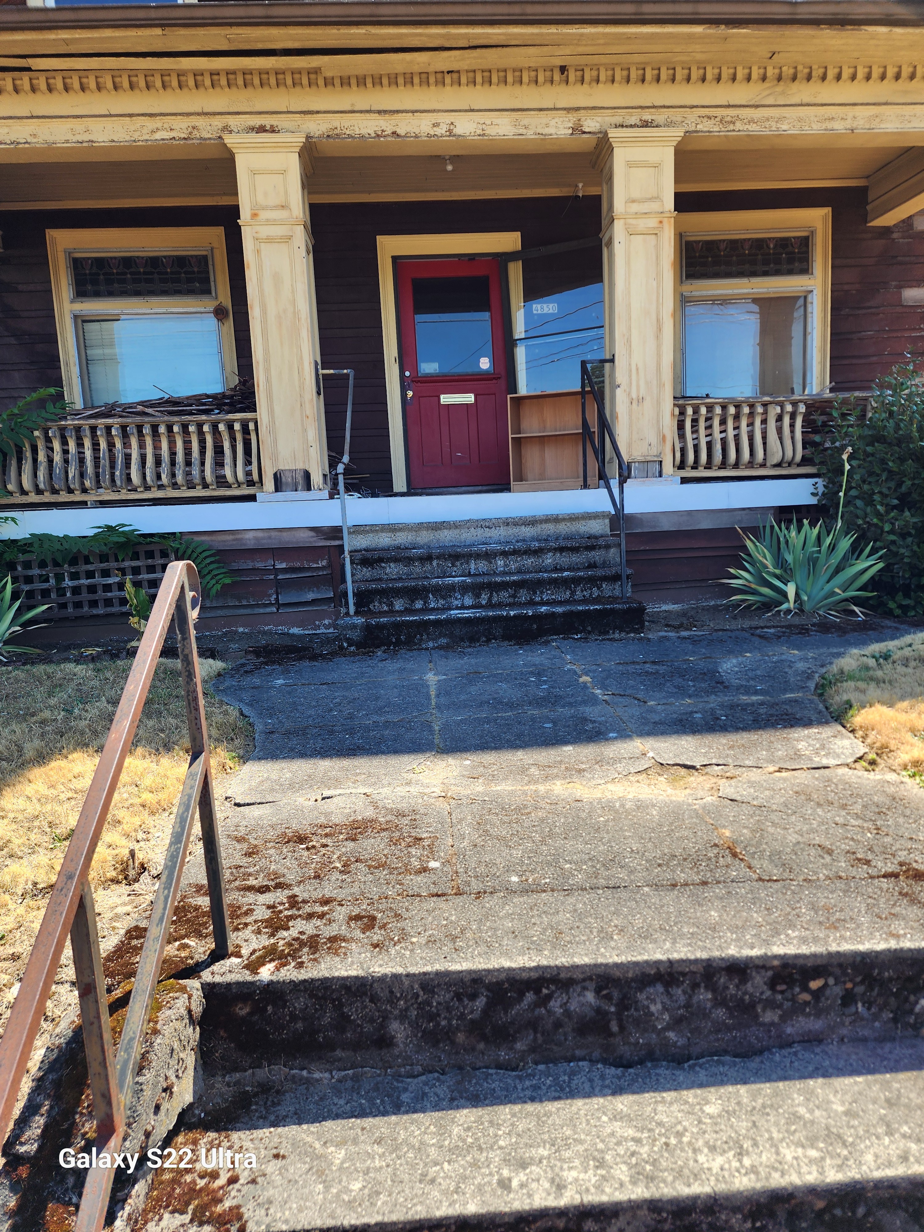
    The samples are always delicious.

    The parking lot is always spacious.


    I don’t want to go anywhere else.

    COSTCO is my paradise.

    COSTCO is my home.

    COSTCO is my everything.

    I find everything I need.

    And want at COSTCO.

    Food and drinks

    And clothes and books.

    Gadgets and toys,


    And tools and furniture.

    Jewelry and flowers,


    And art and travel.

    And most importantly,

    Love.


    I met my soulmate at COSTCO.


    We were both reaching

    For the last rotisserie chicken.

    We locked eyes and smiled.


    We decided

    To share the chicken

    And our lives.


    We got married at COSTCO,

    In front of the giant teddy bear.

    We exchanged rings

    From the jewelry section.


    We cut a cake from the bakery.

    We toasted with

    Kirkland Signature champagne.


    We danced to the music

    From the electronics department.

    We spent our honeymoon


    At COSTCO in Spain.

    In a tent

    From the camping section.


    We made love on a mattress

    From the bedding section.

    We cuddled under a blanket

    From the home section/


    We dreamed of our future

    At COSTCO.

    Raising our kids,

    And growing old together.

    Shopping,

    And saving

    And living and loving

    At COSTCO.


    Medium

    View at Medium.com

    Substack

    https://open.substack.com/pub/jakecosmosaller/p/love-letters-to-costco?r=3i9lm&utm_campaign=post&utm_medium=web&showWelcomeOnShare=true

    Substack Podcast

    Spotify Podcast

    Wattpad

    The End


  • Climate Change Cities Fan Story Contest

    Climate Change Cities Fan Story Contest

    californa wild fires
    A motorists on Highway 101 watches flames from the Thomas fire leap above the roadway north of Ventura, Calif., on Wednesday, Dec. 6, 2017. As many as five fires have closed highways, schools and museums, shut down production of TV series and cast a hazardous haze over the region. About 200,000 people were under evacuation orders. No deaths and only a few injuries were reported. (AP Photo/Noah Berger)
    fireball
    fireball


    Audio Files

    Returning to California

    https://wp.me/p7NAzO-2VL

    Fires burning Out of Control Audio Clip

    Climate Cities 75 Years In The Future.

    I wrote this on a sweltering hot July day in Medford, Oregon where it has been hitting record heat waves for weeks over 100  (38 C) almost every day, which is unusual for the summer where it seldom gets above 95 F (35 C) except for one or two days in August.

      This is a two-part challenge.

     Part One =Describe your Criteria for the New Cities

    The first part of the challenge is to outline your criteria of what would happen if climate change gets so out of control in about 10 years that underground dome cities have to be built to host some human beings, unfortunately. Most people will not be able to be accommodated in the “climate change cities”

    What would be the criteria for selecting those fortunate enough to move into the new cities? How will the cities be built? Would they be built under a Dome or they’d be built entirely underground? or built partially underground or a combination of Both? How will people be chosen to live in these underground cities? Who will be left behind? And what happens to those left behind as climate change spins out of control?

    Part 2 Write a story about a family in one of these climate cities, 75 years in the future, who is confronted with the fact that they have to leave their cocoon and enter into the outer world.

    What happens when they encounter the wastelands left behind by climate change out-of-control?  Show us their world both in the Climate City and as they encounter the wastelands outside their bubble.  I will judge the stories on the basis of how the story tells the story of how humans coped with the essential crisis posed by climate change. The more creative the better.  Show us the horror of the future coming at us and how people survive the climate apocalypse.  2,000-word limit posted on the top line of the story.


    Criteria for climate change cities.

    Ten years in the future 2035 it has become so obvious that climate change is completely out of control and the world is becoming uninhabitable for normal human life.

    In 2028 at a World Climate Crisis conference, governments decide to to set up Climate Change Cities which would be semi-domed cities to host  25 percent of the population of the world. However. It is impossible to host everybody, and 75 percent of the world’s population will have to fend for itself. The climate change cities take five years to build and many millions of people die in the meantime as fast storms take hold.  Drought and heat take their toll on the world’s population, and agriculture and world trade fail everywhere.  The first cities open in 2035.  At the same time, lunar and martian colonies are set up that will host about one million people as well.  AI programs help with the design of new cities and space colonies.

    Governments announce the criteria for resettlement.  Half of those chosen will be chosen by an AI review to identify the best and the brightest human beings worth saving.  They would be joined by people chosen by random lottery.  The upper age limit will be 75.  50 percent will be male and 50 percent female, and at least in the U.S. there would be an effort to make it racially balanced, and LGBTQ friendly  as well.  The AI program will make the final decision which will not be reviewable by the courts.  All chosen will have one year to move to the city the AI program chose for them. Similar criteria will be used to select Lunar and Martian colonies.  Governments around the world will help share best practices and share technology.

    They will build domes over existing cities and then build underground vast fields to host farms where they will grow food, chicken, rabbits, and fish. Cattle will not be raised due to space considerations.  Each city will host one million people.  There would be 100 such cities throughout the U.S., and several hundred cities worldwide hosting about 400 million people in total, plus one million people on the Moon and Mars.

    The cities will be chosen to be located far enough from the coast to avoid flooding.  Space would be at a premium and there would be strict population controls because the cities would not be able to accommodate any population increase. The cities will be linked with hype-loop trains to facilitate travel and trade, and internet cables.  This hyper-loop will link all cities in North America, Latin America, and Europe.   Asian Cities will be linked by their hyper-loops as well. There would still be airports to facilitate international travel and some trade and spaceports to facilitate travel to the Moon and beyond.

    Joe Lewis Leaves the Medford Dome on his Birthday

    Joe Lewis was spending his 20th birthday on his duty station at the Medford, Oregon Climate Change City Command Center. His job is very simple to monitor via drones the wasteland world outside the gate of the city to monitor it for possible dangers to the city, including human activity outside the City Dome. But there were almost no human beings left alive on the surface and not much animal life either. So he would watch the monitors, read a bit, watch TV, movies, the Internet, and wait for his boring shift to end.  But that day, he saw in the distance a strange person walking towards the city. He saw a man dressed in dark black clothes, accompanied by a large black dog heading towards the city. When the man got to the city, he put up a sign saying he was there to negotiate with the people of the city. He had important information to impart to the city residents. He was unarmed and would wait for their decision. Joe woke up his superiors as it was early in the morning and a conference was held as to what to do with the stranger.
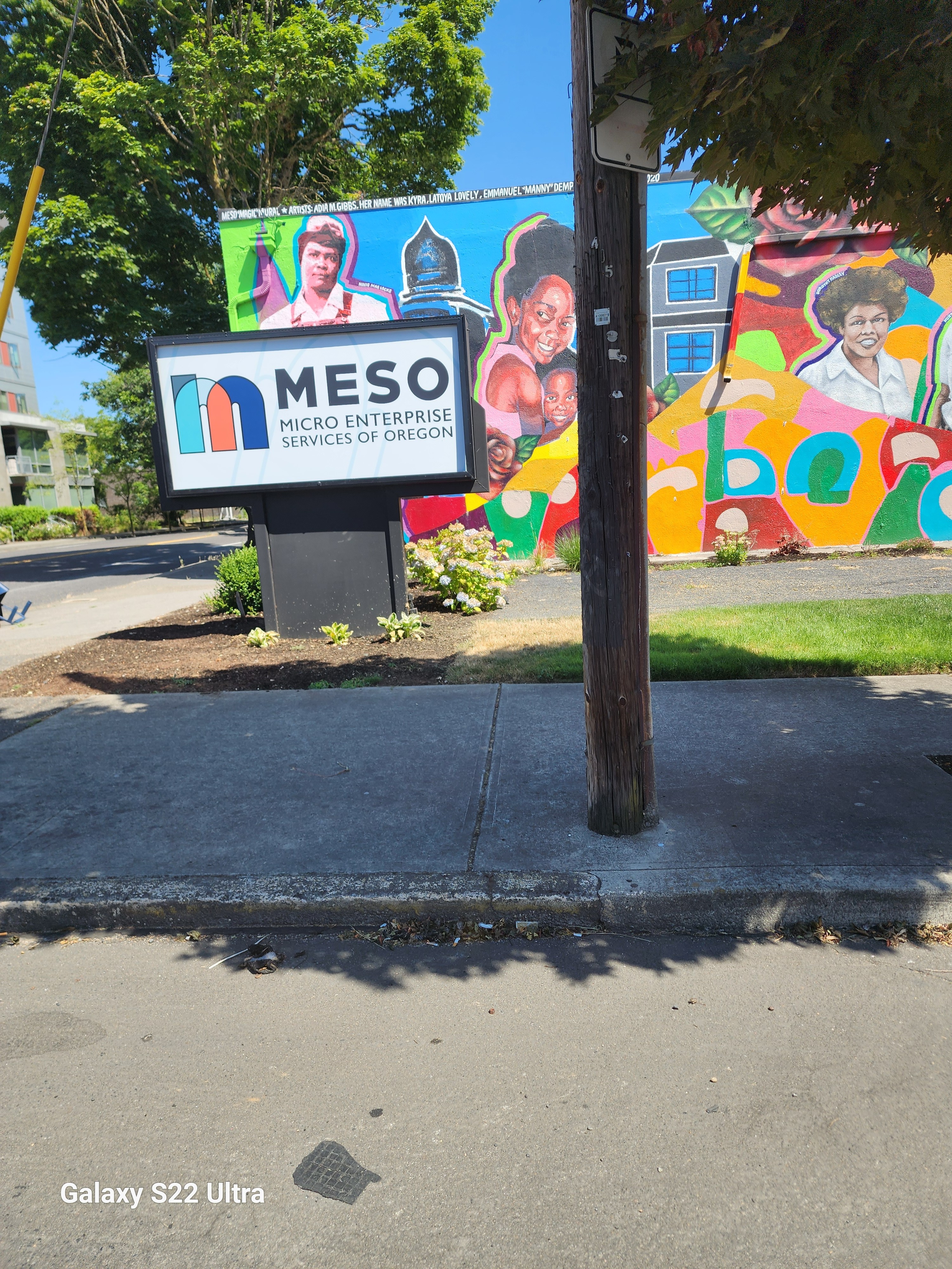
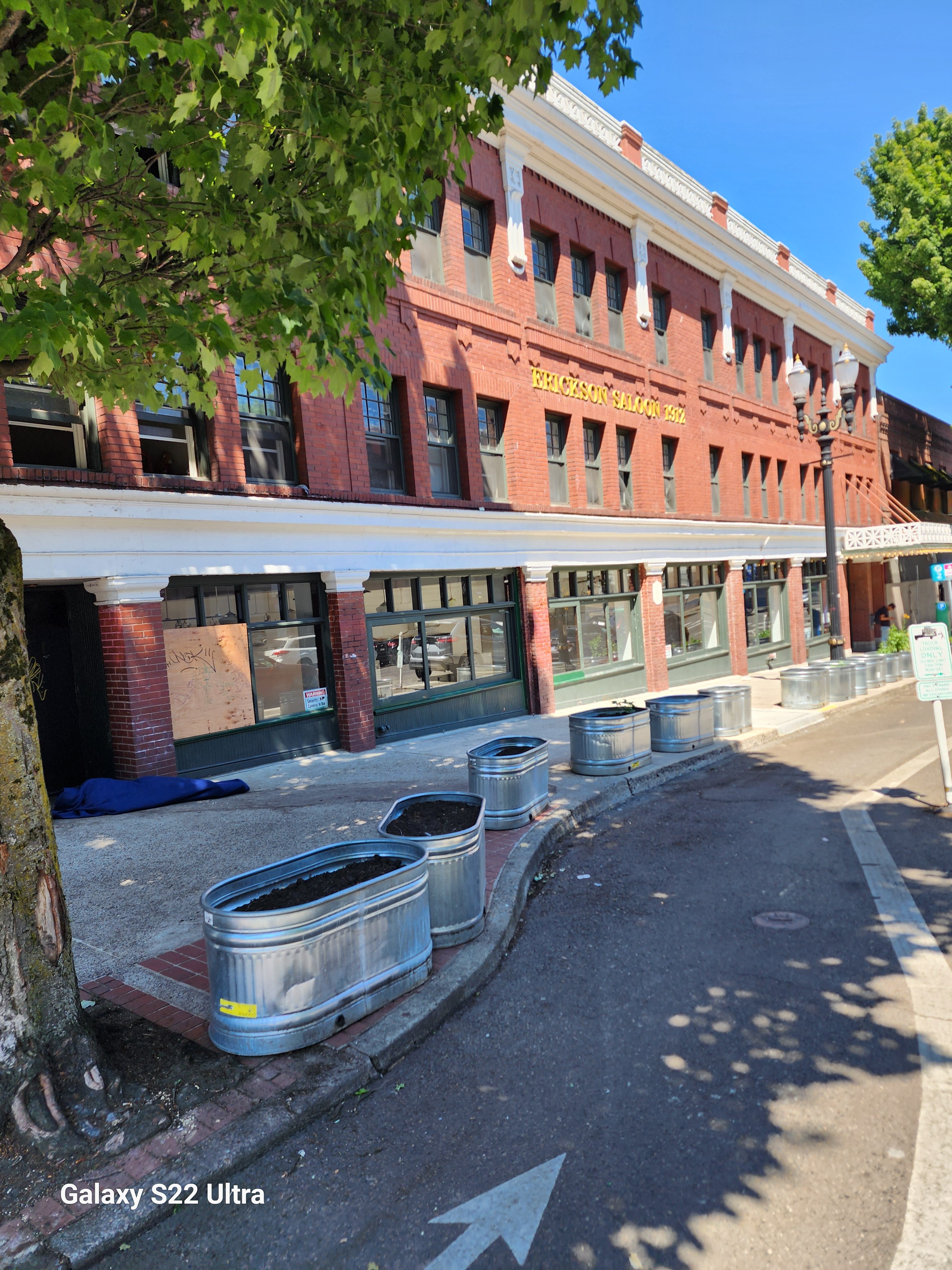
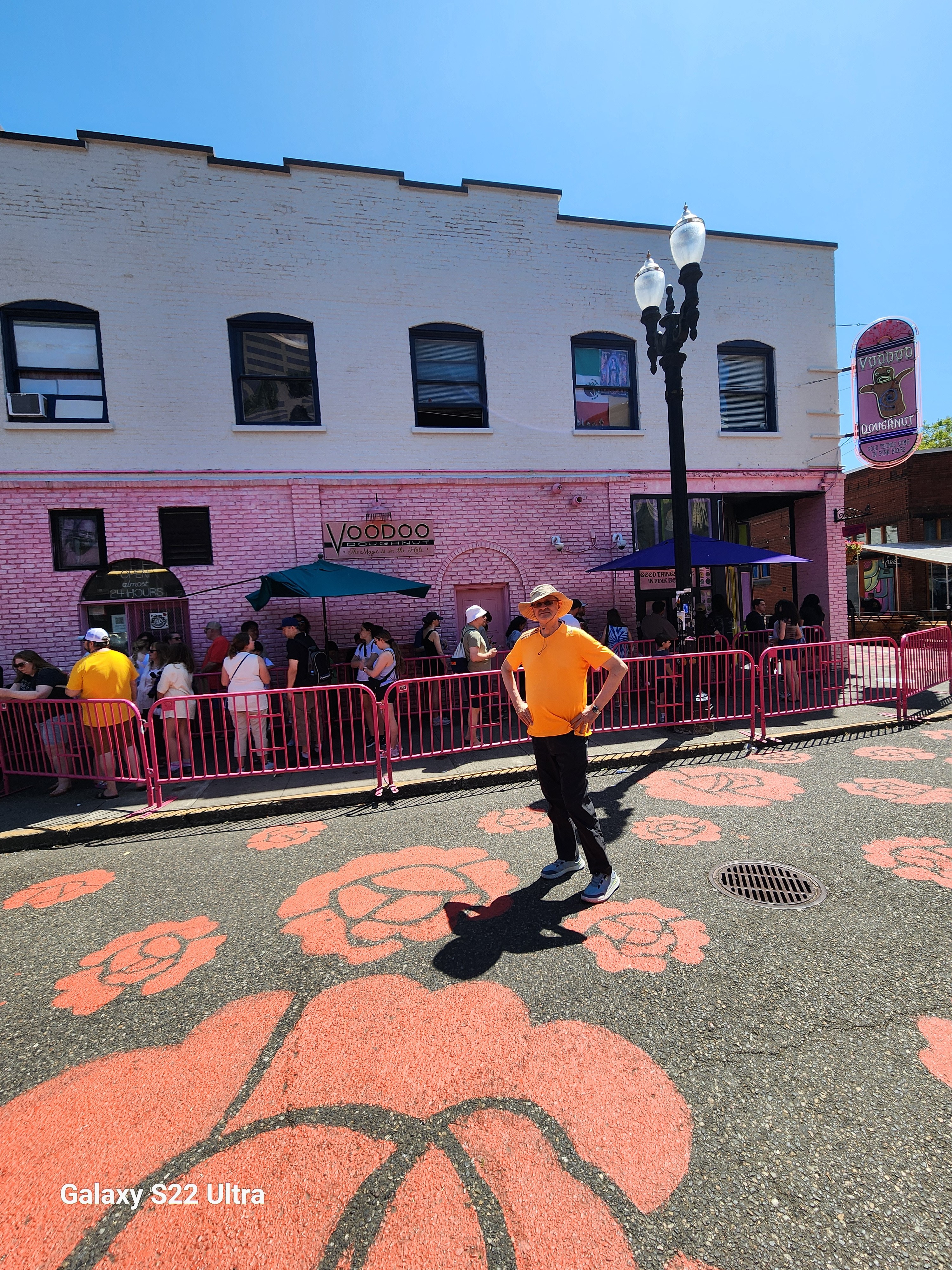
    His boss, the enigmatic Maria Lee. Open the morning conference by asking Joe. To describe what had happened that morning during his watch.

    “Well, this morning around. 5:00 in the morning, I notice a stranger coming from Eagle Point. A black man dressed in black. Accompanied by a dog heading towards the Dome. When he came to the Dome, he stopped and put up a sign saying that he had important information to report to the city residents. And then he would wait for a decision and he’s outside right now, as you can see from the drone pictures. That’s all I know.”

    Maria turns to her chief data scientist, Dale Smith,

    “Dale, you’ve been monitoring the conditions outside for the last year or so. What can you can tell us about it?”

    “ Well. It appears that the climate is finally starting to change in a good direction. Last year, the average temperature has been what used to be seasonal before climate change warmed up the world.  In other words, not too hot up to no more than 90° and relatively, dry. We’ve also noticed by looking at. Camera footage there has been a resurgence of wildlife, lots of deer. wild cattle, wild horses have come back. And there are also increased predators, lions, tigers and wolves outside.

    But not too many humans around. I asked Cosmos to take a look at data from across the United States, and the data is all pointing in the same direction. For the last five years, the climate has been changing in our favor and AI recommends that we consider moving back to the surface world. And AI had also recommended that we get in touch with people around the world to compare notes to see if perhaps finally, climate change is over.”

    “Well. Cosmos, do you have an opinion on this?

    “Yes, Maria, I do. I have been monitoring, at your request, climate change data worldwide for the last five years, and particularly in the last few weeks.

    The climate is changing in our favor, because for the last 70 years we have not been pumping climate changing gases in the atmosphere  The atmosphere is gradually recovering and we believe that the world is safe again for human. Inhabitants and recommend that we open the Dome. And let our people go outside. It would be good from a psychological point of view for humans to gain the surface world. And I, as your AI overlord, agree that it is time. You can manage to step outside again.”

    “Okay, let’s let the stranger in and see what he has to say”

    The stranger is brought inside the Dome conference center.  Maria said to him,

    “So you have important information to tell us?  Who are you and where are you coming from?’

    “ Good morning to you.  Do you have any coffee?”

    “Sure.  We have some.  Wait a moment please,”

    “Ah, that is good. Okay.  I am a monk from the Monastery near Eugène where we have been living since the fall of the old world.  We have been living simply, but we monitor the world outside our little community in the mountains.  We do not live in the Dome, but are in contact with the people in the Eugene Dome.  They suggested contacting you, as you are the biggest Dome community in Oregon outside of Portland.”

    Maria and the Reverend Jones spoke for hours  Finally, Maria summoned her staff to announce her decision.

    Maria began

    “I would like to thank the good Father here for coming to our town this morning to let us know his observations. They track Cosmos’s observations and what our friends in Eugene, Portland, and Reading are telling us as well.   It is time finally for humans to leave the Dome cities behind and explore the greater world.  What we will do is continue to live and work in the Dome City but gradually rebuild outside the walls of the Dome.  We will hunt, fish, and begin agriculture outside the gates.  But we will be wary of wild animals as lions, tigers, and wolves are around.  And we can lift the restrictions on childbirth. Let today be known as Liberation Day.”

    That day Joe stepped outside the Dome and looked at the new world feeling he was born again.  What a way to celebrate his birthday, he thought to himself.

    Subtack

    https://open.substack.com/pub/jakecosmosaller/p/climate-change-cities-contest?r=3i9lm&utm_campaign=post&utm_medium=web&showWelcomeOnShare=true

    Medium

    View at Medium.com

    Wattpad

    Climate Change Cities Contest

    You just published Climate Change Cities Contest !

    Your story can be found here

    Spotify Podcast

    https://open.spotify.com/episode/4gEQ7gveY1aUDPcnV6L6IJ

    .


  • Portland

    Portland

    https://wp.me/p7NAzO-2V4

    New Years Visit to Oregon Coast

    Wagontire, Oregon

    Visit to Bend, Oregon

    Visit to Bend, Oregon

    Gary Noland Music Updates

    Portland, Oregon, is one of my favorite cities in the world. I first visited Portland when I was a child. My father had a summer cabin near Yakima, Washington. He was a college professor at SF State and had July and August off. We frequently drove through Portland to and from the Bay Area, where we lived in Berkeley.

    Later, when I was in graduate school attending the University of Washington, we drove through Portland on the way to the Bay Area.  Recently, we spent a day in Portland showing the city to my Korean brother-in-law and his niece, who were visiting us in Medford. We all fell in love with the city, which reminds me of Berkeley, San Francisco, and Seattle. This time we stayed in North Portland in the trendy Alberta neighborhood, which was the center of Black Portland for many years.

    Portland is the most multicultural city in Oregon, which is still mostly white. It is the only city in Oregon with a substantial black population as well as an Asian American population. Although the city has become more expensive, it is still somewhat affordable compared to both the Bay Area and Seattle.  We spent the night the previous year in Lake Oswego visiting a friend from high school. He is a musician and composer living in Portland.

    This trip we toured the city and saw much of the city.  We went to the Saturday market downtown and went through Old Town,  Chinatown, and the Pearl District. We stopped at Powell’s’s Books, the biggest bookstore in the world. We drove to Washington Park and the Rose Garden and Japanese Garden but could not see either due to no parking as it was a Saturday. The previous year we went for a walk in Forest Park, the biggest urban park in the country. There are bears in the park, they say.

    Portland is a foodie city.  We had two great meals in the city. We had clam chowder and fish and chips in downtown, and we had decent Italian in Lake Oswego.


    Our itinerary was as follows:

    10:00 AM: Start in Portland

    You can explore the city’s highlights including Washington Park12. This park is home to many of Portland’s premier attractions including a zoo, children’s museum, Japanese Garden, and the famous International Rose Test Garden1.

    2:00 PM: Depart for Medford

    The driving time from Portland to Medford is approximately 4 hours and 21 minutes345. The direct drive is 275

    Background reading  courtesy of Co-Pilot

    Certainly! 🌲 Portland, Oregon is a vibrant city nestled in the Pacific Northwest, known for its unique blend of natural beauty, quirky culture, and thriving arts scene. Let’s explore some essential information about this captivating city:

    1. Portland Chapter of The Links:
    2. Essential Links for Portland:
    3. Portland Information Center:
    4. City of Portland Official Website:

    Remember, Portland is a city that celebrates individuality, sustainability, and creativity. Whether you’re into food carts, lush parks, or indie music, there’s something here for everyone. Have a great time exploring the Rose City! 🌹✨

    Substack

    https://open.substack.com/pub/jakecosmosaller/p/portland-oregon-journeys?r=3i9lm&utm_campaign=post&utm_medium=web

    Medium

    View at Medium.com

    Wattpad

    Spotify

    oregon coast
    oregon coast


    su

  • Wagontire, Oregon

    Wagontire, Oregon

    ON THE ROAD PUBLISHED

    HIking Hobart’s Ridge Near Ashland, Oregon

    Visit to Bend, Oregon

    New Years Visit to Oregon Coast

    medium

    View at Medium.com

    Substack

    https://jakecosmosaller.substack.com/p/wagontire-oregon-e7d?r=3i9lm

    https://jakecosmosaller.substack.com/p/hiking-hobarts-ridge?r=3i9lm podcast

    https://jakecosmosaller.substack.com/p/wagontire-oregon?r=3i9lm

    https://jakecosmosaller.substack.com/p/hiking-hobarts-ridge-true-story?r=3i9lm

    Podcast Spotify

     Wagontire, Oregon

    note: submitted to Rogue Valley Times for possible publication


    audio clip

    poem version 


    Wagontire Oregon 1973

    In 1973, I embarked on a road trip with my father. We left Berkeley, heading toward Yakima, where my father owned a summer cabin. As a college professor, he enjoyed the luxury of July and August off, and our dysfunctional family spent those summers together in the mountain cabin from 1968 to 1978. Our annual pilgrimage was both a trip to hell and a journey back.

    My father and I shared a wanderlust—a love for exploring new places. This trip turned out to be one of our best. Surprisingly, we got along, which was unusual given our typically tense relationship. We were vastly different, but during this journey, we became friends..

    We drove east along Highway 395, entering the high mountain desert of eastern Oregon. The road stretched ahead, almost deserted. Then we saw the sign: Wagontire, Oregon, 100 miles ahead. We counted down the signs, mile after mile, as dusk settled around us. We speculated Wagontire must be a giant truck stop—an oasis in the middle of nowhere.

    Interspersed with the Wagontire signs were Burma Shave signs. Highway 395 was one of the last highways to still have these signs, which had been phased out in most places by 1966 or so.

    Burma shave signs were written in rhyming couplets or quatrains cowboy poetry style, ending with the tag line Burma Shave. Here are two examples:

    “Shaving brushes

    You’ll soon see ’em

    On a shelf

    In some museum

    Burma-Shave”


    “Within this vale

    of toil

    and sin

    your head grows bald

    but not your chin–use

    Burma-Shave”


    We counted down the miles  until at last we pulled into town.  But when we pulled into town, reality struck. There was nothing but a gas station, a motel, and a cafe. Last gas for 100 miles, according to the highway sign. I chatted with the owner, who was the sheriff, fire chief, and owner of the only business in town. The sign outside read: “Welcome to Wagontire, Oregon. Population:  200,000 sheep, 10 dogs, two and one half humans..”

    Curiously, I asked who was the half-human, and the sheriff replied, “My idiot son.”

    I did not know it, but this was my last big solo road trip with my father. We drove to and from the cabin a few more times, last time in 1984, but this trip was special and one I will always remember. Mainly because my dad and I finally became “friends” during this trip and got along great. Unfortunately, that moment did not last, and we soon re-entered our difficult relationship, but during that trip, we got along famously.


    2016 Revisiting Wagontire


    Fast forward to 2016. My wife and I drove through eastern Oregon as part of an epic cross-country trip—31 states, 100,000 miles in three months to celebrate my retirement from 27 years of serving the country in the U.S. Foreign Service working overseas in 10 countries.  We thought it was time to see America.


    We followed Highway 395, revisiting the memories of my trip with my father 40 years earlier. But Wagontire had changed. The signs were gone, the motel abandoned, and the town reduced to ruins—a ghost town.

    As we reflected on Wagontire and other “nothing burgs,” we pondered the heart of Trump’s forgotten America—the flyover country that often escapes our attention.

    Reflections on my visit to Wagontire, Oregon, in 1973 and 2016.


    Prose Poem Version


    Wagontire Oregon 1973, 2016

    In 1973,

    I went on a road trip
    With my Father,

    We left Berkeley

    to go to Yakima
    Where my father

    had a summer cabin.

    He was a college professor
    And had July and August off

    And we spent our summers,
    Every summer from 68 to 78
    In that mountain cabin,


    and hanging with my Uncle

    who had inherited the family

    apple farm in Yakima.

    Our whole dysfunctional family
    Our annual trip

    to hell and back

    And we did not

    get along at all.

    We decided to drive

    through Eastern Oregon
    Just my Father and me.

    Just for the hell of it
    The rest of the family

    was already there,

    My father and I shared a travel lust
    Loved to go to new places
    One of the few things we shared.

    This was one of our best trips
    We actually got along
    Which was unusual.

    Normally our relationship
    Was fraught with tension
    As we were so different.

    We left Klamath Falls
    A real noting burg in those days
    And headed east along Highway 395.

    As we entered the

    desert  of Eastern Oregon

    America’s Outback lands

    We entered a different world

    High mountain  desert
    Almost no one on the road

    Then we saw the signs

    Wagontire Oregon

    100 miles ahead
    99 miles
    98 miles

    intersperse with the signs

    were Burma Shave signs


    one of the last highways

    to have these cowboy poetry

    advertisements


    Just a few examples

    for those who have never

    seen these lost Americana signs

    common from 1915 to 1975


    Shaving brushes

    You’ll soon see ’em

    On a shelf

    In some museum

    Burma-Shave


    Within this vale

    of toil

    and sin

    your head grows bald

    but not your chin – use

    Burma-Shave


    We counted down the signs

    Mile after mile


    Wagontire

    Burma shave add


    Wagontire

    Burma Shave


    every mile

    counting down

    .

    As we drove

    into the gathering dusk,

    We speculated that Wagontire

    Must be a giant truck stop


    An oasis in the desert

    In the middle of nowhere,


    We pulled into town

    Nothing but a gas station

    Motel and cafe


    We stopped

    Last gas for 100 miles

    According to the highway sign


    In the morning

    We chatted with the owner.


    He was the sheriff, fire chief

    rancher and Owner

    of the motel gas station.


    The only business in town

    And the only place open

    For one hundred miles.


    I noticed a sign outside


    “Welcome to Wagontire, Oregon

    Population 200,000 sheep.

    and two and one half-humans.”


    I asked the sheriff

    “Who is the half-human?”

    He said,

    “My idiot son.”


    And we left

    200 miles

    We finally

     left Eastern Oregon.

    2016


    In 2016, my wife

    and I drove

    through Eastern Oregon.

    As part of our epic

    Cross-country trip

    to celebrate my retirement

    from the U.S. Foreign Service.


    31 states

    10,0000 miles

    in three months.


    On the way

    from Medford, Oregon

    to Yellowstone,


    We drove along

    Highway 395,

    40 years since

    my trip with my father.


    The signs for

    Wagontire were gone

    as were the Burma Shave signs.


    As we drove through the town

    The motel was abandoned

    Nothing there at all.


    The motel was in ruins

    Just another ghost town.


    And that sign was gone too

    Just a small sign saying,

    Wagontire, Oregon.


    We speculated about wagon tire

    And all the other nothing burgs

    We drove through that summer.


    Heart of Trump’s

    Forgotten America

    Fly over country.


    background info on Burma Shave commercials by Microsoft Co-Pilot

    Certainly! Burma-Shave was an American brand of brushless shaving cream, but it became even more famous for its unique advertising campaign. Let me share some interesting details and a few delightful Burma Shave poems with you:

    1. History of Burma-Shave:
    2. The Iconic Roadside Signs:
    3. Sample Burma Shave Poems:

    These witty and memorable poems left a lasting cultural impact, reminding us of a bygone era when highways were dotted with clever signs and a touch of humor. 🚗🌟

    Background Info on Wagontire Oregon from Microsoft Co-Pilot

    Wagontire, an unincorporated community in Harney County, Oregon, lies along U.S. Route 395. The name itself is intriguing—it conjures images of a remote outpost in the vast Oregon landscape.

    Here are some fascinating details about Wagontire:

    1. Origin of the Name:
      • The community was named after the nearby Wagontire Mountain.
      • Despite its modest size, the name carries a sense of adventure and history.
    2. Historical Context:
      • In the late 1970sWagontirewas home to just two people: William and Olgie Warner.
      • The Warners owned a property that included a gas station, café, motel, general store, and an RV park.
      • Across the road from these buildings was Wagontire Airport, where planes would taxi across the highway and refuel at the gas station.
      • The signs outside humorously declared: “Welcome to Wagontire, Oregon. Population: 2½ humans, 10 dogs, 200,000 sheep.”
    3. Changing Times:
      • Fast forward to 2016, and Wagontirehad transformed.
      • The signs were gone, the motel abandoned, and the town reduced to ruins—a ghost town.
      • It became a symbol of the heart of forgotten America, the flyover country often overlooked by travelers.
    4. Education:
      • Wagontire falls within Suntec School District 10(Suntec School, grades K-8) and Harney County Union High School District 1J (Crane Union High School).

    Wagontire—a place where time stood still, where echoes of the past whisper across the desert landscape. 🌵🚗

    1: Geographic Names Information System 2: United States Topographic Map 3: Moyer, Armond; Moyer, Winifred (1958). The Origins of Unusual Place-Names. Keystone Pub. Associates, p. 137. 4: Monroe, Bill (December 14, 1997). “Under the Desert Sky: Solitude for Sale.” The Oregonian. : Weber, first (July 11, 1993). “Everyone Stops At Wagontire (Pop. 2).” The New York Times. : Frazier, Joseph B. (April 2, 2000). “Life Takes on a Slow Pace in Wagontire.” Albany Democrat-Herald.

    Learn more

    1bing.com2en.wikipedia.org3


  • HIking Hobart’s Ridge Near Ashland, Oregon

    HIking Hobart’s Ridge Near Ashland, Oregon

    Hobart's ridge
    Hobart’s ridge
    trees
    trees
    wild flowers
    wild flowers

    Hiking Hobart’s Ridge True Story

    https://wp.me/p7NAzO-2Tv

    white water rafting in Oregon
    Visit to Bend, Oregon

    New Years Visit to Oregon Coast

    0regon Reflections

    Last weekend, I finally hiked Hobart’s Ridge near Ashland, Oregon.  Hobart’s Ridge is about a 30-minute drive from downtown Ashland. It is part of the Cascade-Siskiyou National Monument near Hyatt Lake. The trailhead is off Soda Mountain Road near Hyatt Lake, and Green Springs. There is an information center for the monument on Soda Road just past the turnoff for Hobart’s Ridge at the Green Springs Inn. As you drive down the road, you turn to the right and go down a dirt, gravel road through some private housing areas with no hunting/fishing/hiking signs.  You will find the trailhead about two miles in.

    The trail is part of the Pacific Crest Trail. The trail is a short three-mile loop trail to the top of Hobart’s Ridge and back.  Up at the top, you have some fantastic views of Southern Oregon, including Mt Shasta, Mt McLaughlin, Hyatt Lake, and Ashland. Some of the best views in the region.

    First Attempt 2016 – Encounter with Mad Mountain Man

    I first tried to hike up Hobart’s Ridge in 2019. My wife and I had decided that we were going to go for a hike, and we were following the directions of an old friend of mine, whom I had known almost my entire life, since first grade, almost 65 years ago.

    When we got near the trailhead, we found there was nobody there, as it was the middle of the week in early June. We have been talking about mountain lions and bears and other critters. And then we saw on the side of the road an old mountain man, with thick hair and beard. He had a lunatic’s thousand-yard stare and glared at us. He was walking with a shovel., and backpack. We were freaked out. We thought he might be an axe murderer or something, and we aborted our trip.

    Finally Made it in 2024

    It took another five years before I could get back up there, this time with the same friend who had originally recommended the trail. And we had a fun time. We ran into several other hikers and their dogs, but did not encounter the mountain man, coy dogs, or mountain lions, but did see some friendly deer.

    The trail was nice. Delightful weather, great views, great wildflowers, and had a delightful picnic lunch at the top. I’m glad I finally made it up to the top of Hobart’s Ridge. At my age, (68) still being able to hike up a mountain is a great accomplishment.

    Here’s a story I wrote after my first attempted hike to Hobart’s Ridge.

    The Mad Bag Piper of Hobart’s Ridge

    Joe Lewis was hiking the Pacific Crest Trail as part of his bucket list. He was 70 years old and figured this was the last chance he would have to take such an epic trip He had started in Southern California in May, and it was now August. He was three-quarters through the trip.  He stopped off in the town of Ashland, Oregon to take a few days off the trail and recuperate before he pushed on. One night, after seeing a Shakespeare play, he had gone to a bar where he met some locals and told them where he was going.

    “Well, you need to be careful as you hike the trails near here.  There is a mad bag piper who haunts the mountains near here. On full moon nights, he appears and accosts hikers, challenging them to a drinking contest, saying that if .you could out drink him, he will let you live, but if he out drank you, he would have to kill you, because he was a soul hunter and had a contract with the Grim Reaper to keep.

    Whatever you do, don’t take the bet. The mad bagpiper is not a human being. Nobody knows who he is, what he is. All we know hikers disappear every full moon.  And on those nights you can hear the bagpiper, walking in the woods near Hyatt Lake.  He is usually described as a tall mountain man with a long beard, carrying a backpack, and his bagpipes. “

    Joe dismissed the warnings as a silly urban legend. Late on the next day,  he set up camp near the top of Hobart’s ridge and was enjoying his dinner, a beer and the epic sunset, when he heard a bagpiper and saw an old mountain man coming up the trail.

    “What brings you to my woods, my friend?.”

    “ Just passing through.”

    “Tell you want.  Let’s play a game. If you can out-drink me, I will not only let you live but take you a buried treasure left over from the gold rush times. What do you say, Joe Lewis? Do we have a deal?”

    “How do you know my name?”

    “I know everything about you.  Let’s drink”

    The mountain pulled out a bottle of Mount Gay Rum, Joe’s favorite drink, back in the day when he worked as a diplomat for the U.S. and had served in Barbados.

    They started drinking and at about dawn the old man said,

    “Joe, I like you, so I will let you live.”

    Some hikers found later that day found Joe’s dead body, half-eaten by coy dogs. The mad bagpiper was long gone.

    The End

    Background info from Co-Pilot

    Cascade-Siskiyou National Mo, Ashland,


    The Cascade-Siskiyou National Monument is an extraordinary ecological gem nestled at the intersection of the CascadeKlamath, and Siskiyou mountain ranges. Let’s explore its fascinating features:

    • Location: The monument spans 114,000 acres (approximately 46,134 hectares) of lush forests and grasslands.
    • Ecological Marvel: This convergence of three distinct mountain ranges has created an area of unparalleled biological diversity and a varied landscape.
    • Establishment: Recognizing its exceptional ecology and diverse range of resources—biological, geological, aquatic, archeological, and historic—the monument was established in 2000.
    • Wildlife: Within the Cascade-Siskiyou National Monument, you’ll encounter a rich variety of animals, including deerbearsmountain lionssmall mammals, and songbirds. Birdwatchers are drawn to the presence of eagles and other raptors.
    • Activities: Visitors can engage in hikingwildlife viewingfishinghuntingscenic drivesskiingsnowmobiling, and sledding.
    • Elevation Range: The elevation within the monument varies from 2,100 to 6,100 feet.

    From the summit, take in the breathtaking 360-degree panorama, which includes views of AshlandPilot RockMt. McLoughlin, and even glimpses of majestic Mt. Shasta123. Whether you’re a nature enthusiast or simply seeking awe-inspiring landscapes, the Cascade-Siskiyou National Monument awaits your exploration! 🏞️🌲


    • Trail Name: Hobart Bluff Trail
    • Location: Cascade-Siskiyou National Monument, near Ashland, Oregon
    • Trail Length: Approximately 2.5 miles (out-and-back)
    • Elevation Gain413 feet
    • Difficulty: Moderately challenging
    • Estimated Completion Time: Around 1 hour and 9 minutes
    • Best Times to Visit: May through November
    • Activities: Bird watching, hiking, and running
    • Views: From the top, enjoy stunning vistas of Ashland, Pilot Rock, and Mt. McLoughlin.

    Trail Description: The trail starts off moderately flat and gradually ascends. The last half-mile becomes steeper, but the panoramic valley views make it worthwhile. You’ll encounter wildflowers and may spot various bird species along the way. Dogs are welcome but must be on a leash. The trail is usually snow-free from late May to October.

    To reach Hobart Bluff from Ashland:

    1. Head east on Highway 66.
    2. Look for the Hobart Bluff Trailhead near the highway.
    3. Park your vehicle and begin your hike

    Certainly! A Coydog is a fascinating hybrid resulting from the mating of a male coyote and a female domestic dog. Let’s explore some interesting facts about these unique canids:

    1. Hybrid Origins:
      • A Coydog is the product of a coyote (Canis latrans) and a domestic dog (Canis lupus familiars).
      • These two canids belong to different species, making the Coydog a canid hybrid.
      • Crossbreeding between coyotes and dogs has occurred for so long that the exact percentages of wild hybrids remain unknown.
    2. Characteristics:
      • Coydogs exhibit a mixture of traits inherited from both parents.
      • Their appearance and behavior can vary widely due to this genetic blend.
      • The exact proportions of coyote and dog characteristics are unpredictable.
    3. Fertility and Breeding:
      • Hybrids of both sexes are fertile and can be successfully bred for up to four generations.
      • Similarly, a hybrid with a dog father and a coyote mother is known as a dogote.
    4. Temperament and Care:
      • Coydogs can be challenging to handle, as they require a lot of affection and care.
      • Their temperament is akin to that of a child.
      • Due to the limited breeding season of coyotes, Coydogs are relatively rare.
    5. Habitat and Occurrence:
      • Coydogs occur in the wild where the number of other coyotes is scarce.
      • In areas with fewer potential mates, they may mingle with domesticated dogs for companionship or breeding.


  • white water rafting in Oregon

    white water rafting in Oregon

    White Water Rafting Along the Rogue River

    Visit to Bend,  Oregon

    0regon Reflections

    New Years Visit to Oregon Coast

    rouge river 1
    rouge river 1

    I have tried white water rafting a couple of times in my life.  Once or twice in the Boy Scouts, once in West Virginia during foreign service training, and twice now along the Rogue River in southern Oregon.  I have also gone tubing along the Natches and Yakima rivers as a child and tried canoeing, and rowing while I was in the Boy Scouts.

    rogue river 2
    rogue river 2

    Among these various boating escapades, the Rogue River experience was the best.  There are several jet boat/white water rafting outfitters.  The best is the Hellgate Jetboat excursions company based out of Grants Pass.


    Grants Pass is a cute river town about ninety minutes north of the Oregon/California border, (one hour from Ashland, Medford, or Jacksonville) perhaps three hours from Portland, six hours from Seattle, and perhaps 10 hours from SF.  Grants Pass has a lot of wineries nearby and some decent craft beer breweries in town and one artisanal whiskey maker, Sundance Disterly located next to the Hellgate company offices.

    rogue 3
    rogue 3

    There are four or five different routes you can take.  We did the two-hour excursion which takes you down the Hellgate Canyon hence the name of the outfitters.   There is also a brunch and dinner option and a four-day excursion as well.


    rogue 4

    rogue 4We found the price was quite reasonable 35$ per adult with the military/senior discount figured in, and a suggested gratuity to the boat pilot of $5.00 per member of your group, so we paid $20 for the five of us.


    Hellgate Jetboat Excursions/

    The Hellgate story, As one of the United States’ first jet boat companies, Hellgate Jet boat Excursions has run adventures through the wild and scenic Rogue River for over half a century – all while actively working with our local Parks Department. to enhance the …

    hellgate.com

    https://hellgate.com

    From the internet

    There are also outfitters operating out of Gold Hill, Rogue River, Phoenix, and Talent.

    rogue river rafting companies – Search (bing.com)

    Rogue Rafting Company

    www.rogueraftingcompany.com

    Tripadvisor (98) · Rafting/Kayaking area

    404 2nd Ave, Gold Hill, OR 97525

    (541) 855-7080

    rogueraftingcompany.com

    From the internet

    Grants Pass, Oregon

    Grants Pass is the county seat of Josephine County, Oregon, United States.[7] The city is located on Interstate 5, northwest of Medford, along the Rogue River. The population is 39,674 according to the 2021 census.[8]

    History

    Early Hudson’s Bay Company hunters and trappers, following the Siskiyou Trail, passed through the site beginning in the 1820s. In the late 1840s, settlers (mostly American) following the Applegate Trail began traveling through the area on their way to the Willamette Valley. The city states[9] that the name was selected to honor General Ulysses S. Grant‘s success at Vicksburg. The Grants Pass post office was established on March 22, 1865.[10] The city of Grants Pass was incorporated in 1887.[11]

    The Oregon–Utah Sugar Company, financed by Charles W. Nibley, was created, leading to a sugar beet factory being built in Grants Pass in 1916.[12] Before the factory opened, Oregon-Utah Sugar was merged into the Utah-Idaho Sugar Company.[12] Due to labor shortages and low acreage planted in sugar beets, the processing machinery was moved to Toppenish, Washington, in 1918 or 1919.[12]

    Grants Pass, along with Medford and Ashland was an unofficial “sundown town“, which actively warned Black and other non-white people to leave town before sunset or face violence and harassment. Although there was no documented law of the racist policy, it was enforced locally via residents and signage.[13][14]

    Geography

    Grants Pass is located in the Rogue Valley; the Rogue River runs through the city. U.S. Route 199 passes through the city and joins Interstate 5. The city has a total area of 11.03 square miles (28.6 km2), of which 10.87 square miles (28.2 km2) is land and 0.16 square miles (0.41 km2) is water.[15]

    From Wikipedia


    Sundance Distilling

    http://www.sundancedistilling.com

    980 SW 6th, Grants Pass, Or 97526 · ~24.7 mi

    (541) 479-9715

    $ 5 for a sample taste of six whiskey/rums

    From the internet

    the end

Verified by MonsterInsights