
Yakima Reflections
here are places that live in memory not as geography, but as rhythm—seasons, smells, light, and silence. Yakima, Washington, is one of those places.
For me, Yakima was never just a point on a map in central Washington, tucked into the dry valley east of the Cascades. It was summer. It was family. It was a cabin in the forest, where time felt suspended somewhere between childhood and history.
I grew up in Berkeley in the 1960s and 1970s, but spent my summers in a family cabin outside Yakima. My father, a college professor, had two months off each summer, and we also spent winter breaks there.
Yakima was a culture shock to a child of Berkeley. It felt like a “red district” even then—part of the more conservative eastern half of Washington, in contrast to the liberal west. My father had grown up there and left in the late 1940s but returned every summer until his death in 1985.
Summers in the Forest
Our cabin sat on U.S. Forest Service land in the Naches area near Chinook Pass, part of the early 20th‑century recreational cabin program. These were not luxury homes—they were rustic by design. Electricity and plumbing were limited or nonexistent, and cabins were required to blend into the forest.
We spent our days hiking through the woods and floating the Naches River on inner tubes. In winter, we snowshoed and rode snowmobiles. Summers meant picking huckleberries—always keeping an eye out for bears—and trying our hand at fishing.
We also worked on the family ranch in Yakima, picking apples and fruit. My father believed manual labor built character, and he made sure we learned that lesson early.
Looking back, those summers feel like a different world—slower, quieter, more connected to the land.
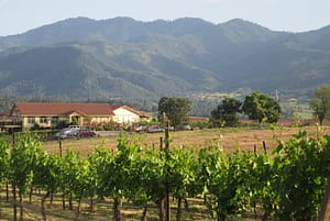
A Valley of Sun and Agriculture
Yakima sits in the rain shadow of the Cascade Mountains, a semi‑arid valley with long, hot summers and relatively little rainfall. Yet it is one of the most productive agricultural regions in the United States.
The valley is famous for:
- apples, cherries, peaches, and pears
- over 30 varieties of crops
- producing more than half of Washington State’s wine grapes
- producing the majority of U.S. hops [politico.com], [abcnews.com], [cnbc.com]
Today, Yakima has become a destination for wine and beer enthusiasts, but its identity remains deeply rooted in agriculture.
Before Yakima Was Yakima
Long before railroads and orchards, this was Yakama land.
For thousands of years, the Yakama people lived across the Columbia Plateau, following seasonal cycles of fishing, hunting, and gathering. [rottentomatoes.com]
That world began to fracture in the mid‑19th century.
The Treaty and the Taking
In 1855, Yakama leaders signed a treaty under pressure, ceding more than 10 million acres of ancestral land to the United States in exchange for a much smaller reservation. [mydramalist.com], [themoviedb.org]
Even that reservation shrank over time due to:
- misplaced maps
- settler encroachment
- legal and administrative decisions [en.wikipedia.org]
The Dawes Act later divided tribal lands into individual allotments, allowing large portions to pass into non‑Native ownership. The result was a fragmented “checkerboard” landscape that still exists today. [mydramalist.com]
What appears to be peaceful farmland is, in fact, land shaped by dispossession and resilience.
Rails, Irrigation, and Growth
Modern Yakima grew in the late 19th century along the Northern Pacific Railway. In a remarkable episode, much of the town was physically relocated to align with the railroad.
Irrigation transformed the desert valley into fertile farmland, and Yakima became the agricultural center of central Washington. [politico.com]
Cold War Echoes
Yakima also played a role in the Cold War.
The Yakima Training Center, established during World War II and expanded in the 1950s, became a major military training site. [congress.gov]
Exercises conducted there included simulated atomic blasts and radioactive fallout scenarios during the 1950s. [en.wikipedia.org]
There is no confirmed evidence of actual nuclear detonations in Yakima, though family lore in the region often suggests otherwise.
Family History and Complexity
Like many American stories, my family’s history in Yakima reflects both opportunity and moral ambiguity.
My grandfather, in the 1920s, taught himself Yakima Indian language. The Yakama developed relationships with Yakama tribal members—relationships that included lending practices that ultimately resulted in land transfers when debts could not be repaid. Court rulings at the time upheld such contracts, contributing to significant tribal land loss.
Irrigation projects transformed the region into prime agricultural land, and Yakima became the apple capital of the United States by the mid‑20th century. My family benefitted materially from that transformation.
The Yakama Nation, meanwhile, has worked in recent decades to rebuild—through economic development, including casinos, and through efforts to repurchase land. The Reservation has a great cultural center and museum, and the tribal history of land dispossession after the Dawes Act is well reflected in the Smithsonian Museum of the American Indian in Washington, DC.
These overlapping histories are difficult to reconcile. But they are part of the story.
A Changing Community
Today, Yakima is a diverse city of about 97,000 people.
- ~49% Hispanic or Latino
- ~43% non‑Hispanic White
- 10 percent Yakima Indian
- 5 percent African American
- 5 percent Asian American
- median age: ~34 [hancinema.net]
The region reflects a mix of:
- agricultural labor
- working‑class communities
- rural conservatism
- emerging tourism and cultural diversity
Politically, it reflects the broader east‑west divide in Washington State: a conservative interior contrasted with a liberal coastal population. It is a very “red” district politically, although there were always some progressives linked to the rich Scandinavian immigrant heritage. My grandmother was part of that Norwegian immigrant tradition, my Grandfather was of Germanic background.
Wine, Beer, and Reinvention
In recent decades, Yakima has evolved into a major wine and craft beer destination.
Visitors now come for:
- vineyard tours
- brewery trails
- farm‑to‑table dining
- outdoor recreation
- seasonal festivals [military.com]
This new identity is layered over the old, not replacing it.
Memory and Return
For me, Yakima is not primarily about demographics or agriculture.
It is about memory.
A line I wrote years ago still captures it best:
Visiting my father’s grave
In Yakima
The ancestral land…
And another:
Ghosts in Yakima
Walking along a graveyard
Looking for my father’s grave…
Yakima is where the past feels close—sometimes uncomfortably so.
Closing Reflection
Yakima is often described as an agricultural hub, a wine region, or a small city in central Washington.
All of that is true.
But it is also something more:
A place shaped by Indigenous history, land loss, migration, agriculture, Cold War echoes, and personal memory.
For those of us who spent summers there, it remains something simpler:
A place where the past lingers just beneath the surface,
and where the valley still holds its stories.
Some of my Northwest-themed poems follow:
Seattle UW Blues
I have had a long history
with the city of Seattle
dating back to my grandparents
who met there at UW
and my father who attended UW
and became a student leader
fighting to integrate the University
I first visited the city
when I was a young man
when we spend the summer
in Yakima
where we had a family home
decades later I visited the city
before I went to the Peace corps
Before I went to the Peace Corps
then my wife and I lived there
for four years
while we were attending graduate school
at the University
and we fell under its seductive spell
living and breathing Seattle
falling in love again
with the city
we left the city
and traveled the world
came back twice
once to take
and pass the foreign service
oral exam
and once decades later
to take a cruise to Alaska
and found that the city
had changed in many ways
but the old Seattle remained
and I wanted to come back
and now my nephew lives there
and my older half sister
adding another element to our family’s
on-going Seattle family history
why I had been there before
I cannot say, but this much I do know
Seattle remains a part of me
and I a part of its history
Medford Beckons
Once boring, humble Medford Oregon
and I have a long history
dating back to my childhood
when we would drive through there
often spending the night
back and forth to Yakima
from our family home in Berkeley
with my father
during our summer
and winter vacations
Medford back in the day
was a sleepy little town
but the biggest town around
Ashland was more famous
but Medford grew on me
decades later my wife
Decades later my wife
and I drove through there
as we you go up and down
the coast going from Seattle
where we were graduate students
and Berkeley to visit my family
we bought five pieces of property
in Medford in 1990
and were absentee property owners
for thirty years
coming back every few years
finally coming back in 2016
renovating the property
and now we are spending
our summers there
and preparing to become
Oregonian residents
Medford humble boring Medford
has become a trendy place
we have become part of Medford
and Medford part of our hearts and soul
I am now an Oregonian
complete with beard, no ties, and western shirts
and my love affair with this humble city
will continue to grow
as my life winds down
in Medford city of my soul
Yakima Dessert Blues
Ghosts of Yakima
Yakima, Washington
The ancestral home of my father’s family since 1920
Kept alive in my family’s history
Went back and forth like a Yo-Yo between Yakima
and the Bay area, mostly when I was a young man
In 2019, I visited the ghosts at my father’s grave
I did not realize how much Yakima had not changed
Ever since I was a child, I thought that Yakima
It was simply too much of a desert outpost
Even then I knew why my father had led the town
Rarely did I think that my father would want to return
That he did over and over until the day he died
But for me, the Yakima of my childhood no longer remained
The lesson learned from all of this is Yakima remains in my heart
Until the day I die, I know that my family’s history in Yakima
Even now Yakima the desert town of my father will not be
Remains a foreign outpost and is not anymore for me
Rapid City Blues
In the modern wild west
Town of Sturgis, South Dakota
A blind chef sat in his restaurant
Chatting with his friend
Jake the biker
Who was there for the rally
,
Putting salt on his biscuits,
And a touch of ginger
His secret recipe
Meanwhile
His friend
Grabs a pen,
Writing in his diary,
Sitting on a cushion,
Lighting a candle,
Turning on the glass,
Lamp on the table,
Plugging in his mobile,
In the wall socket
While drinking a mug
Of hot coffee
That went so well
With the salty ginger biscuits
His friend was making for him
Part of his daily ritual
Going to his friends
Restaurant for coffee
Gossip and biscuits
The man was a biker
And a photographer
Also, a street organ player
With a monkey
To draw the crowds
That was gathering
For the annual biker rally
He put on a carnation,
Waiting for his estranged wife
To come by
He fondled the riffle
Went outside
Rode his bike
Down the street
As if it were a horse
Back in the wild west days
That he so admired
Looking for his wife
In the new
wild west town
Fleeing from the Madman on the Trail in Southern Oregon
One time I went for a hike
In Southern Oregon
Near our summer home
In Medford outside of Ashland
Along Dead Indian highway
In the national forest land
High above the city of Ashland
We drove to the parking lot
For Hobart’s Bluff
It was deserted; no one was there
As it was mid-week.
Then we saw a mad lunatic
Walking down the road
Carrying a shovel
Staring at us
With LSD-fueled eyes
Looking as if he could be
A mad killer
We were freaked out
And drove out of there
Abandoning the hike
To the mountain lions
No doubt lurking about
And left before we could become
The madman’s latest victim.
Winter Sadness
When I was in graduate school
In Seattle, Washington, back in the ’80s
Both my wife and I discovered we had a case
Of the SAD seasonal affective disorder,
Otherwise known as the Seattle Winter Blues.
Could not handle the short days
Sunrise at 9 am sunset at 4 pm
And constant rain all day long
The rain got into your bones.
But the spring and summers
Were great sunset at 10 pm
The summers almost made up
For the SAD Seattle winter blues.
~ Seasonal Depression Awareness Month ~
Hiking the Mad Hatter Trail
While hiking on the “Mad Hatter Trail.
High above the Ashland hills
On the autumn equinox.
Wearing the male “Oregon uniform”
Red “Pendleton” flannel shirt,
Khaki pants, Oregon Ducks baseball cap.
Hiking boots, Scruffy beard.
Going for the “Hipster, lumberjack” look.
Enjoying the scarlet autumn splendor,
The crisp cool weather
Enjoying the smoke-free day.
I heard rustling in the bushes.
I saw five of the friendly Ashland deer,
A whole family smiling at me.
I smiled back at them.
Took a few photos,
Posted on Instagram.
Suddenly, I had the coffee “Jones”
I hiked back into town
Through Lithia Park.
Saying “good morning”
To my fellow Ashland “hipsters”
On the trail.
I drank a snarling
Hot cup of fully loaded coffee.
At “Case Coffee Roasters,”
Followed by a cold Kombucha.
Thinking, what wonderful
Autumn day it had been
In the Rogue Valley,
The gem of Southern Oregon.
Author Notes
One of my favorite hikes in Southern Oregon is the “mad hatter” trail that is the hills overlooking Ashland. The Ashland deer are very tame and are a nuisance, actually, although cute. One has to be careful hiking as there are mountain lions everywhere, as well as bears in the hills. Ashland is a pretty college town, home to Southern Oregon State University and the Oregon Shakespeare Festival.
Jason Lee the Fashion Violator |
37 lines
Jason Lee was a man
Born without the fashion gene
Born without a fashion clue
Did not understand fashion.
In his mind, the best male fashion was
the Northwest grunge look
Well-worn khaki, plaid Pendleton shirt
boots, and perhaps a bolo tie.
He often thought
That the irony of his life
Was that he married a fashionista.
Proving that opposites do indeed attract.
His wife, Maria Lee
Tried repeatedly to change his fashion sense,
Tried to make him look nice
Taught him basic color coordination.
He resisted but over time
He gradually become
A bit more fashioned aware
Even spent years wearing a suit and tie.
She threw out his horrid ties
Which made him angry
He loved his garish bugs bunny ties.
But when they retired
and they move to Oregon
from the halls of power in DC,
He told her that he would never wear a suit again,
Going back to the Oregon lumberjack look
Khaki or Jeans, boots or sneakers, plaid Pendleton shirt.
complete with a scraggly beard.
She merely smiled at him,
Finally resigned herself
to her fate as the wife of a man
who would always
be a walking fashion violation.
End of the World in Southern Oregon
Sam Adams woke up one day and realized that the world had ended. For some reason, he was immune from the latest pandemic that had swept over the world killing most people within hours.
Sam had fled along with some others to the isolated Oregon coast. He walked along the lonely coast picking up shells and thinking about life. He came upon an eagle feather on the beach and looked up and saw the eagle looking at him. He imagined that the eagle was blaming humanity for destroying the world.
He screamed at the eagle
“don’t blame me for the misdeeds of the human race. I am the last human alive so leave me alone.”
Th eagle screeched and flew off looking for breakfast.
Soon he came upon a gruesome sight. He saw a fellow survivor who had somehow survived the zombie flu-fighting for his life against a pack of feral dogs. Sam chased the dogs off throwing rocks at them.
The man thanked him and joined him for breakfast in a new abandoned cabin. They thought about the end of humanity, and the revenge of the natural world. The wildlife was resurgent everywhere. The few humans left huddled together trying to survive the collapse of the old world order.
They went back out to the world walking the beach. They saw a pride of lions chasing down a deer. They shot at the lions who snarling ran off into the woods. They came to another abandoned cabin and prepared to spend the night.
They heard a commotion and saw another survivor walking down the beach towards them. They joined her and had dinner together.
That was the moment that Sam Adams realized that although the world might have ended he was still somehow alive.
© Copyright 2023 JCosmos (jcosmos at Writing.Com). All rights reserved.
Writing.Com, its affiliates and syndicates have been granted non-exclusive rights to display this work.
Be Careful What You Wish40 L Sam Adams saw was walking He saw an old lamp “Master, you’ve rescued me Sam thought for a while My first wish is to win My final wish The genie bowed Sam found himself Sam went home She smiled at him |
the Haunted House in Eagle PointSam Adams was a paranormal researcher for the Cosmos Institute in Berkeley, California. He had grown up in Eagle Point, Oregon, a small community just north of the town of Medford, twenty miles from the California border. When he was growing up there stood an old mansion on the north end of town. The mansion was rumored to contain secret doorways to other worlds. The owner of the mansion was Eugene Small, a retired English professor who had taught at Southern Oregon University and worked as an advisor to the Oregon Shakespeare festival before Alzheimer’s caused him to retire at age 60. He became a hermit held up in the house where he was rumored to conduct secret Satanic rituals involving animal sacrifices. .He had a small stable containing horses, cattle, pigs, dogs and cats. When Sam first worked at the Cosmos Institute, he became interested in the rumored satanic rituals being conducted at the old Small mansion which was down the street from where he had grown up. He called up his father one day and talked to him about the rumors surrounding the old mansion. His father told him that Eugene had not been seen in over a month and there were strange ghostly figures walking about the property and urged Sam to come up and take a look as part of his job. Sam told his boss about the strange occurrences and she authorized him to return home to investigate it. When he returned home, he found that the mansion, the stable and Mr. Small had all mysteriously vanished in the night leaving behind an empty crater. Sam reported the case as inconclusive and went back to the Institute. |
Ghosts in Yakima
Walking along a graveyard
Looking for my father’s grave
Seeing all the gravestones
I begin to sense the spirits
Of the restless dead
They linger around the graveyards
Waiting for visitors
Eager to talk to anyone
Who cares to stop
And chat
So lonely being a ghost
With no one to haunt
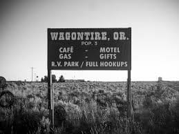
Wagontire Oregon 1973, 2016
In 1973, I embarked on a road trip with my father. We left Berkeley, heading toward Yakima, where my father owned a summer cabin. As a college professor, he enjoyed the luxury of July and August off, and our dysfunctional family spent those summers together in the mountain cabin from 1968 to 1978. Our annual pilgrimage was both a trip to hell and a journey back.
My father and I shared a wanderlust—a love for exploring new places. This trip turned out to be one of our best. Surprisingly, we got along, which was unusual given our typically tense relationship. We were vastly different, but during this journey, we found harmony.
We drove east along Highway 395, entering the high mountain desert of eastern Oregon. The road stretched ahead, almost deserted. Then, we saw the sign: Wagontire, Oregon, 100 miles ahead. We counted down the signs, mile after mile, as dusk settled around us. We speculated that Wagontire must be a giant truck stop—an oasis in the middle of nowhere.
But when we pulled into town, reality struck. There was nothing but a gas station, a motel, and a café. Last gas for 100 miles, according to the highway sign. I chatted with the owner, who happened to be the sheriff, fire chief, and owner of the only business in town. The sign outside read: “Welcome to Wagontire, Oregon. Population: 2½ humans, 10 dogs, 200,000 sheep.” Curiously, I asked about the half-human, and the sheriff replied, “My idiot son.”
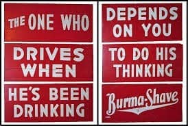
Fast forward to 2016. My wife and I drove through eastern Oregon as part of an epic cross-country trip—31 states, 100,000 miles in three months. We followed Highway 395, revisiting the memories of my trip with my father 40 years earlier. But Wagontire had changed. The signs were gone, the motel abandoned, and the town reduced to ruins—a ghost town.
As we reflected on Wagontire and other “nothing burgs,” we pondered the heart of Trump’s forgotten America—the flyover country that often escapes our attention.
Reflections on my visit to Wagontire, Oregon, in 1973 and 2016.
1: Read the full poem on All Poetry 2: Read more reflections by Jake Aller on Medium 3: Explore “Travels with my Father” on FanStory
Wagontire oregon 1973, 2016
In 1973, i went on a road trip
With my Father
We left Berkeley to go to Yakima
Where my father had a summer cabin
He was a college professor
And had July and August off
And we spent our summers
Every summer from 68 to 78
In that mountain cabin
Our whole dysfunctional family
Our annual trip to hell and back
And we did not get along at all
We decided to drive through Eastern Oregon
Just my Father and me
Just for the hell of it
The rest of the family was already there
My Father and i shared a travel lust
Loved to go to new places
One of tbe few things we shared
This was one of our best trips
We actually got along
Which was unusual
Normally our relationship
Was fraught with tension
As we were so different
We left Klamath falls
A real noting burg in those days
And headed east along highway 395
As we entered the desert of eastern oregon
We entered a different world
High mountain desert
Almost no one on the road
Then we saw the sign
Wagontire, Oregon
100 miles ahead
99 miles
98 miles
We counted down the signs
Mile after mile
As we drove into the gathering dusk
We speculated that Wagontire
Must be a giant truck stop
An oasis in the desert
In the middle of no where
We pulled into town
Nothing but a gas station
Motel and cafe
We decided to stop
Last gas for 100 miles
According to the highway sign
In the morning
We chatted with the owner
He was the sheriff and fire chief
Owner of the motel gas station
The only business in town
And the only place open
For one hundred miles
I noticed a sign outside
Welcome to Wagontire, Oregon.
Population 2 1/2 humans 10 dogs
200000 sheep
I asked the sheriff.
Who is the half human?
He said
“my idiot son”
And we left
200 miles
2016
In 2016 my wife and i
drove through eastern Oregon
As part of our epic cross-country trip
31 states
100000 miles in three months
On the way from n
Medford to Yellowstone
We drove along Highway 395
40 years since my trip with my father
The signs for Wagontire were gone
as were the Burma Shave
Cowboy Poetry signs
As we drove through the town
The motel was abandoned.
Nothing there at all
The motel was in ruins
Just another ghost town
And that sign was gone too
Just a small sign saying
Wagontire, Oregon
We speculated about wagon tires.
And all the other nothing burgs
We drove through that summer
Heart of Trump’s forgotten America
Fly over country
Oregon Reflections
Oregon Reflections
These are my reflections on Oregon. I have been to Oregon many times over the years. My father was a college professor at SF State, and we spent our summers at the family cabin near Mt. Ranier and winters too. I quit going to the cabin with my family when I was in college. We kept the cabin in the family until my mother sold it after my father passed away in 1985. Uncle-in-law managed the family’s fruit farm near Yakima until he died in the early nineties.
On the way to and from Yakima, we frequently stayed in Medford. Later in 1990, I bought a property in Medford, two duplexes, and a house. We still have the duplexes which we renovated in 2017, We sold the house at the market peak in 2007 My brother was going to move to Oregon and manage our properties for us but his plans fell through so we were stuck with the properties which provided good income once we paid off the mortgages back in 1996 or so.
The plan was to spend our summers in Oregon with side trips to Northern California, Portland, Seattle, and Las Vegas.
COVID put a stop to that and we finally got back after three years. We are back on our summer plan. Unfortunately, our tenant trashed our furnished apartment, so we had to change our original five-week road trip to two weeks — Oregon Coast, Portland, Seattle, Yakima, and Bend including a side trip to Crater Lake, and then a trip down Highway one to the Bay Area and stay in the Bay Area for about a week — with an optional trip to Las Vegas, Arizona, and Utah provided the heat is less than 105 every day. Right now, with temperatures over 120, it is simply too dangerous to drive.
Ashland
Ft Ashland first three chapters for blog
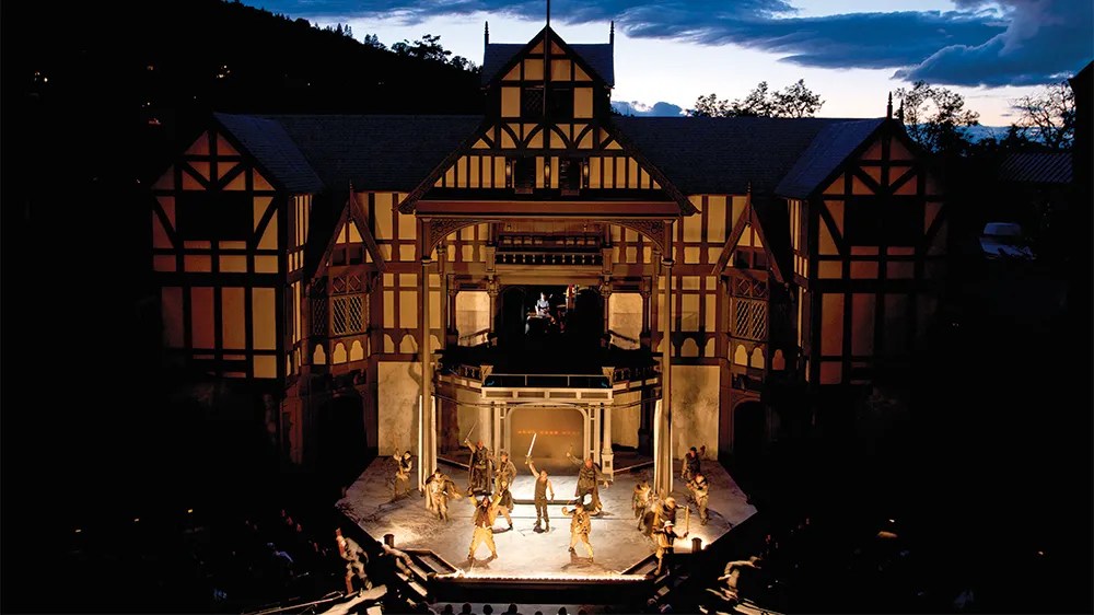
Ashland is a nice college town and the home of the Oregon Shakespeare Festival, one of the oldest Shakespeare festivals in the Western United States. We usually try to take in a show when we are in the area. The University has an award-winning English literature department due to its long-standing connection to the festival. There are lots of trendy restaurants and bars in the city. During the winter it is a base for people going to Mt. Ashland for skiing.
Ashland is a city in Jackson County, Oregon, United States. It lies along Interstate 5 approximately 16 miles (26 km) north of the California border and near the south end of the Rogue Valley. The city’s population was 21,360 at the 2020 census.
The city is the home of Southern Oregon University (SOU) and the Oregon Shakespeare Festival (OSF). These are important to Ashland’s economy, which also depends on restaurants, galleries, and retail stores that cater to tourists. Lithia Park along Ashland Creek, historic buildings, and a paved intercity bike trail provide additional visitor attractions.
Ashland, originally called “Ashland Mills”, was named after Ashland County, Ohio, the original home of founder Abel Helman, and secondarily for Ashland, Kentucky, where other founders had family connections. Ashland has a council-manager government assisted by citizen committees. Historically, its liberal politics have differed, often sharply, from much of the rest of southwest Oregon.
Oregon Shakespeare Festival 75th anniversary banner
The Oregon Shakespeare Festival has grown from a summer outdoor series in the 1930s to a season that stretches from February to October, incorporating Shakespearean and non-Shakespearean plays at three theaters.[42] The OSF has become the largest regional repertory theater in the United States.[14]
The Oregon Cabaret Theater features musicals and comedies throughout the year.[43] Opened in 1986, the dinner theater occupies a former First Baptist Church built in Mission Revival style.[44] The Ashland Independent Film Festival, which shows international and domestic films of almost every genre, takes place each April in the Varsity Theatre downtown. About 90 films are shown during the five days of the festival.[45] In 2009, Ashland was the setting for the film adaptation of Gaman’s Coraline.[46]
The Oregon Center for the Arts at Southern Oregon University focuses on academic programs including creative arts (art, emerging media, and creative writing), music, and theater. Affiliated with the center is the Schneider Museum of Art, which has rotation exhibitions of works featuring professional contemporary artists. Also affiliated with the center are chamber music concerts, a Shakespeare institute, a piano series, and other art-related events.[47]
The annual Ashland New Plays Festival (ANPF) is a nonprofit organization that encourages playwrights to develop new work through public readings. Each year, the ANPF holds an international competition that winnows hundreds of submissions to four plays that are read to live audiences by professional actors during a five-day festival in October
(Wikipedia entry)
Microsoft Bing Travel — Ashland
Ashland Co-Op
Ashland Co-Op is a great natural foods store in Ashland. They used to pre-covid have a great make-your-own sandwich bar. My favorite was their loaded BLT.
Sam Adams, favorite sandwich
Was the make it your own sandwich
Served at the Ashland, Oregon, Co-Op
A modified BLT sandwich on Gluten free bread
Cheese, roast beef or pastrami, bacon
Sprouts, lettuce, tomatoes, dill pickles, peppers
Mayo, mustard, ketchup
Just heaven in every delicious bite
Lithia Park
Lithia Park in Ashland is a great park that follows Lithia Creek. It was designed by the NCY and Golden Gate Park designer Olmstead.
Lithia Springs
Lithia Springs is a small hot springs resort just north of Ashland. It has been operating as a spa since the 1880’s.
ashland.or.us
https://www.ashland.or.us/page.asp?navid=14083
One Night in Lithia Springs
One night in Lithia Springs
We soaked away our painful life
And fell in Love again
Eight love senryu based on my true love story for details see my web page https://theworldaccordingtocosmos.com © Feb 2019,
Lithia Park — Parks Division — Parks and Recreation
Within the hub of downtown sits Lithia Park, Ashland’s crown jewel. Lithia is a 100-acre vista of emerald lawns, pickleball courts, a sand-pit volleyball court, the Swim Reservoir at the …
o Back to Ashland’s Parks
Ashland Pond Tentative Construction Schedule and Access Disruptions One …
Dog Park Dog Friendly Parks Dog Walks near downtown Ashland Hald-Strawberry …
APRC provides recreational community garden spaces for non-commercial …
See results only from ashland.or.us
o Lithia Resort AshlandOregon | Lithia Springs Resort Ashland
https://lithiaspringsresort.guestreservations.com
Lithia Springs Resort in Ashland, Oregon. Low Online Rates — Book Today! Lithia Springs Resort in Ashland, Oregon. 2165 W Jackson Rd. Book Now.
Astoria
Astoria is a town at the mouth of the Colombia River about an hour from Portland. I went Salmon Fishing there with my dad when I was 16. It has a nice Lewis and Clark museum as this was the farthest extent of their legendary trip in the 1810s.
Astoria is a port city and the seat of Clatsop County, Oregon, United States. Founded in 1811, Astoria is the oldest city in the state and was the first permanent American settlement west of the Rocky Mountains.[6] The county is the northwest corner of Oregon, and Astoria is located on the south shore of the Columbia River, where the river flows into the Pacific Ocean. The city is named for John Jacob Astor, an investor and entrepreneur from New York City, whose American Fur Company founded Fort Astoria at the site and established a monopoly in the fur trade in the early 19th century. Astoria was incorporated by the Oregon Legislative Assembly on October 20, 1856.[1]
The city is served by the deepwater Port of Astoria. Transportation includes the Astoria Regional Airport. U.S. Route 30 and U.S. Route 101 are the main highways, and the 4.1-mile (6.6 km) Astoria–Megler Bridge connects to neighboring Washington across the river. The population was 10,181 at the 2020 census.[7]
Bend
Bend is a hip town about an hour southeast of Portland on the edge of the Oregon high mountain desert, it is the mecca of artisanal spirits, beer, and Kombucha.
There is a good museum called the Oregon High Desert Museum which is worth a visit. There is also an Oregon Cascade scenic bypass, a 66-mile drive through the Cascades that I am looking forward to driving.
L
https://en.wikipedia.org/wiki/Bend,_Oregon

Bend is a city in and the county seat of Deschutes County, Oregon, United States. It is the principal city of the Bend Metropolitan Statistical Area. Bend is Central Oregon’s largest city, with a population of 99,178 at the time of the 2020 U.S. Census, up from 76,693 at the time of the 2010 U.S. Census, and 52,029 at the … See more
THE 15 BEST Things to Do in Bend — 2023 (with Photos) — Tripadvisor
Brandon Beach
Bradon Beach is a nice beach town on the Oregon Coast. We have stayed there several times.
Coos Bay
Coos Bay is a nice town on the Oregon Coast. We stayed at the Mills Casino which is an old mill that has been turned into an Indian-run Casino.
Coos Bay, Oregon
is article is about the city. For the body of water, see Coos Bay. For other uses, see Coos Bay (disambiguation).
Coos Bay, Oregon
Here the Coos River enters Coos Bay on the Pacific Ocean. The city borders the city of North Bend, and together they are often referred to as one entity called either Coos Bay-North Bend or Oregon’s Bay Area.[7] Coos Bay’s population as of the 2020 census was 15,985 residents, making it the most populous city on the Oregon Coast. Oregon’s Bay Area is estimated to be home to 32,308 (Coos Bay Census County Division).[8]
Crater Lake National Park
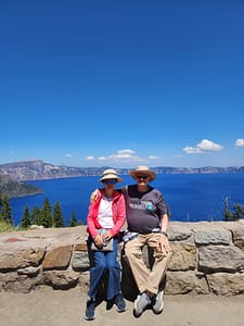
i have been to Crater Lake at least ten times in my life. It is always impressive. We tried to go to Crater Lake, but our car had other ideas. Fortunately, a good Samaritan came along and helped out. We went the next day. And a good day touring the park. We stopped off at the Oregon Natural Bridge just before entering the park. That was very impressive.
Crater Lake National Park (U.S. National Park Service) (nps.gov)
Crater Lake one
crater Lake 2
o
o
rogue river gorge
Good Samaritan Rescued Us Fan Story.
I am grateful for today.
A good Samaritan
Rescued us at Crater Lake
When our car died
Write a Naani poem. A Naani consists of 4 lines, and the total lines consist of 20 to 25 syllables.
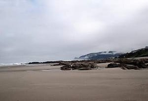
New Year Visit to the Oregon Coast
The end of the year
We drove to Bookings on the Oregon Coast
We had a pleasant drive
through the mystic
fog-shrouded Redwoods.
The gathering gloom of the dark woods
foretold my dismal mood
Slept soundly to the sound of the ocean.
The super moon light filled
the beach outside our window
with an eerie light all night long.
As we slept people walked the beach
Enjoying the full moon
And the unusually warm weather
Setting off fireworks at midnight
In the morning
I went for a nice walk along the beach
and thought about the year that was.
As the waves pounded the shore
I was filled with calmness
Enjoying the morning calm
And the unusually warm weather
Thinking that the storm is coming
That perhaps
we are in the end of our days
With the political storms
threatening us all
Yet the ocean reminded me
This too will pass
And we will endure
Until the end of our time
On earth
The ocean waves soothed my soul
And I prepared to drive back
through the mystic redwoods
Back to my home
And the peaceful ocean waves
Reminded me
the end of my life
Comes closer to my door.
Oregon Demon cat

The demon cat
Lived in Medford Oregon
The demon cat was a big black cat
His eyes were filled with demonic energy
He stared at you
Looking into your very soul
Filled with anger, and hatred
For the entire human race
He seemed at times
To be not from this planet
Perhaps an alien species
Studying the human race
Or perhaps he came
Form hell itself
The demon cat loved to torment visitors
For some reason he hated the man’s daughter
The cat would stare at her from his perch
Down the hall from the old man
Then he would run at her
Screaming like an escaped banshee
Straight out of hell
She told her dad
Either the cat goes
Or I go
He said
See you later
The demon cat smiled
At the small victory
And she left the house
With the demon cat
Screeching good bye
as related to me by my barber in Medford Oregon © Oct 2019, j
Sam Adams returns to the Green Beaches of Oregon
Sam Adams returns to the Green Beaches of Oregon
Sam Adams
Returned to his native Oregon
Just after the end of the world
When the Coronavirus
Had finally morphed,
Into the dreaded zombie flu
And the zombie apocalypse
Ravaged the earth.
Sam Adams like a few others
Was immune
He returned to the Oregon coast
Walking the lonely empty
Verdant green beaches.
Looking for survivors
Finally found a few people
And they formed a little community.
Brought together by fate
They bonded
As they walked
The lonely beaches.
Endnotes / Resources
Travel and tourism
- Visit Yakima Valley Official Guide
- Yakima Valley Tourism
Wine region and wineries
Notable wineries to explore:
- Chateau Ste. Michelle (Columbia Valley influence)
- Hogue Cellars (Prosser)
- Airfield Estates
- Kana Winery
- Barnard Griffin Winery
- Two Mountain Winery
- Owen Roe Winery
Agriculture and hops
- Yakima Valley produces most U.S. hops and major fruit crops [cnbc.com], [politico.com]
Yakama Nation & history
- Treaty of 1855 and land cession [mydramalist.com]
- Reservation formation and reduction [themoviedb.org]
Historical development
- Railroad relocation and agricultural growth [politico.com]
Military history
- Yakima Training Center history [congress.gov]
- Cold War nuclear simulation exercises [en.wikipedia.org]
Demographics
- U.S. Census data for Yakima [hancinema.net]
Please edit for grammar, punctuation, and spelling and consolodate it eliminating duplicated entries. Format it for Substack publication with endnotes and plain text formating. And include links to travel guides for Yakima, and list of major wineries.
Yakima Reflections
There are places that live in memory not as geography, but as rhythm—seasons, smells, light, and silence. Yakima, Washington, is one of those places.
For me, Yakima was never just a point on a map in central Washington, tucked into the dry valley east of the Cascades. It was summer. It was family. It was a cabin in the forest, where time felt suspended somewhere between childhood and history.
I grew up in Berkeley in the 60’s and 70s, but spent my summers in a summer cabin outside of Yakima, Washington as my father was a college professor and had two months vacation every summer, we also spent winter breaks there as well.
Visting Yakima was quite a culture shock to a child of the Berkeley 60s and 70s’. Yakima was even then a “red district” in a state that was split between a left leaning Western side and an rural conserative east side.
My father had grown up there, and left in the late 40s. But returned every summer until his death in 1985.
The summer cabins were located in the Natchez National Forest land as part of the forest service recreational forest lands that dated back to the late 19th century. Residents had to maintain the cabins in a rustic log cabin look. Services were non-existent. Our cabin was in the Natchez National forest land just east of the Snowquamlie/ and Chinook pass west of Yakima on the Yakima-Seatle freeway that also passed by Mt. Ranier National Park.
We spend out days hiking in the woods, and intertubing the Natchez river which ran by our house, and in the winters snowshowing and snowmobiling.
We also picked huckleberries in the summers months watching out for bears who also loved picking berries. And we tried out hands fishing. We also spent days at the family’s ranch in Yakima helping pick apples and fruit as my father felt that such manual labor was a good thing for his sons to learn early on.
Background informaton from Co-pilot follows on the summer cabin program, and on Yakima City followed by some of my Yakima themed poems.
🌞 A Valley of Sun and Shadow
Yakima sits in the rain shadow of the Cascade Mountains, a landscape defined by contradiction. It is technically a desert, with hot, dry summers and relatively little rainfall. Yet it is also one of the most productive agricultural regions in the United States.
Hundreds of sun-filled days each year stretch across orchards, vineyards, and hop fields. Apples, cherries, peaches, and pears fill the valley, along with the plants that give American beer its character—hops. [politico.com], [cnbc.com]
Today, Yakima has become something of a pilgrimage site for winemakers and brewers. The valley produces the majority of Washington State’s wine grapes and more than half of all U.S. hops. [abcnews.com], [cnbc.com], and is a center of craft beer production like in Oregon.
And yet, for all its agricultural productivity and emerging reputation as a wine and beer destination, Yakima retains the feel of a place slightly apart—quiet, grounded, and shaped by forces deeper than commerce.
🪶 Before Yakima Was Yakima
Long before railroads, irrigation canals, and orchards, this was Yakama land.
For thousands of years, the Yakama people lived across this landscape, from the Columbia River to the Cascades. Their lives followed the seasons—winter villages in the valleys, spring gathering, summer fishing for salmon, and fall harvesting in the mountains. [rottentomatoes.com]
This was not an empty place waiting to be settled. It was a fully realized world.
That world began to fracture in the mid-19th century.
⚖️ The Treaty and the Taking
In 1855, under pressure and threat of violence, Yakama leaders signed a treaty with the United States. They ceded more than 10 million acres of ancestral land in exchange for a reservation that was only a fraction of their original territory. [mydramalist.com], [themoviedb.org]
Even that smaller territory did not remain intact.
Maps were misplaced. Boundaries were redrawn. Land was opened to settlers. More land was lost—not all at once, but gradually, through policy, error, and pressure. [en.wikipedia.org]
Later, the Dawes Act would divide tribal lands into individual allotments, enabling further transfer of land to non-Native ownership. The result was a fragmented landscape—a “checkerboard” of ownership that still defines the region today. [mydramalist.com]
What looks like open farmland and quiet towns is, in fact, contested ground—layered with history, displacement, and resilience.
🚂 Rails, Irrigation, and the New Yakima
Modern Yakima emerged in the late 19th century, built along the Northern Pacific Railway. In a move that feels almost mythic, much of the town was physically relocated to follow the rail line. [politico.com]
Irrigation transformed the arid valley into farmland. Orchards spread. The region became a center of agricultural production, and eventually, a modest city grew around that economy.
Yakima became the “heart of central Washington,” not just geographically but economically. [politico.com]
☢️ Cold War Echoes
Even in the 20th century, Yakima played a role in larger national stories.
Just outside the city, the Yakima Training Center—originally established during World War II—expanded in the 1950s and became a major military testing and training ground. [congress.gov]
During the early Cold War, exercises conducted there included simulated atomic blasts and radioactive fallout scenarios. [en.wikipedia.org]
There were no actual nuclear detonations in Yakima, but the fact that such simulations took place speaks to how even remote valleys were drawn into global anxieties and military planning.
👥 A Changing Community
Today, Yakima is a diverse and evolving city.
- Population: ~97,000
- About 49% Hispanic or Latino
- Roughly 43% non-Hispanic White [hancinema.net]
The city is younger than the national average and shaped by a strong agricultural workforce. Educational attainment is lower than the national average, and poverty rates are higher, reflecting the economic realities of a farming region. [grokipedia.com]
Politically and culturally, Yakima sits at a crossroads—part rural conservatism, part diverse working-class community, part emerging tourism economy.
🍷 A New Identity: Wine, Beer, and Tourism
In recent decades, Yakima has begun to redefine itself.
Wine tasting rooms, craft breweries, and farm-to-table dining have turned the valley into a destination. Visitors now come for:
- vineyard tours
- the Hop Country beer trail
- outdoor recreation
- festivals celebrating harvest and culture [military.com]
Yet even this new identity is rooted in the same land—the same soil, climate, and water systems that sustained both the Yakama people and the agricultural economy that followed.
🏡 How common are summer homes in the U.S.?
“Summer homes” broadly fall under second homes or vacation homes.
- Only ~4–4.6% of U.S. housing stock is second homesinvestopedia+1
- That still equals ~5.7–6.5 million properties nationwideinvestopedia+1
What this means
- Owning a second home is not typical, but not rare among middle‑ and upper‑income households
- It is strongly tied to wealth and geography (coasts, lakes, mountains)
- In some counties (especially recreation areas), second homes can exceed 20% of all housingeyeonhousing
👉 So your experience—summering at a family cabin—is relatively distinctive, but shared by a significant minority of Americans.
🌲 Summer homes on U.S. National Forest land
These are a special subset called
👉 “Recreation Residences” (Forest Service cabins)
Scale
- About 13,000–14,000 cabins on national forest landusda+1
- Located on roughly 95–114 national forests across ~24 statesInteractive Map of USFS Cabins Nationwide — Big Bear Southwest Shore+1
- Organized into around 900 cabin tractsInteractive Map of USFS Cabins Nationwide — Big Bear Southwest Shore
Key characteristics
- Families own the cabin, but not the land (permit system)wikipedia
- Use is seasonal, not permanent
- Many are multi-generational family properties
👉 Compared to millions of second homes overall, these forest cabins are a tiny, highly distinctive niche.
📜 When did the Forest Service start summer homes?
Timeline
- 1870s: Informal private hunting/fishing cabins existedymaws
- 1897: Forest reserves opened to public useymaws
- 1905: U.S. Forest Service createdclubexpress
- ✅ 1915: Congress authorizes official summer home permits
→ This is the true birth of the programwikipedia+1
Later evolution
- Peak (~1960s): ~20,000 cabinsclubexpress
- 1950s–1960: Stop issuing new permits and opening new tractswikipedia
- Today: fewer (~14,000) remain
👉 Important insight:
The program reflects an early 20th‑century ideal—democratizing access to wilderness for ordinary families.
🌄 Case Study: Yakima / Cascades (Naches–Tieton–Wenatchee area)
Your description fits one of the most historically dense regions for these cabins.
Regional characteristics
- The Naches Ranger District (near Yakima) has one of the most concentrated collections of summer home tractswa
- Examples include:
- Chinook Pass cabin tracts
- Rimrock Lake / Tieton River area
- Lake Wenatchee tracts
Historical pattern
- Cabins began appearing in the 1910s–1920s, soon after the 1915 lawloc
- Many early cabins:
- Were simple, vernacular structures
- Sometimes repurposed from rail or logging camps
- Built for summer-only use due to access and weather
Social meaning
- These weren’t elite estates—they were:
- Modest family cabins
- Often shared across generations
- Embedded in small, tight-knit cabin communities
👉 The Yakima/Cascade experience is almost a textbook example of the Forest Service summer home tradition.
🌍 International Comparison
Summer homes exist globally, but their social meaning and typical owners differ sharply.
🇰🇷 Korea
- Second homes exist but are:
- Less common due to high urban housing prices
- Often retirement or investment properties
- Popular forms:
- Rural homes (귀촌 / 귀농 trend)
- Coastal or mountain pensions (often commercial)
👉 Compared to the U.S.:
- Less multi-generational recreation tradition
- More tied to later-life lifestyle shifts or investment
🇯🇵 Japan
- Known for:
- “Bessō” (別荘) = second villas
- Common locations:
- Karuizawa, Hakone, mountain resorts
- Ownership:
- Historically middle/upper-middle class
- Some corporate ownership (company retreats)
👉 Similarities to the U.S.:
- Nature-oriented escape
- Train-accessible resort zones
👉 Difference:
- More planned resort communities, less informal cabin tracts
🇩🇪 Germany
- Strong tradition of:
- “Ferienhaus” (holiday house)
- Allotment garden cottages (Kleingarten)
- Often:
- Smaller, regulated, sometimes semi-urban
👉 Compared to U.S. cabins:
- More structured and regulated
- Less wilderness isolation
🇬🇧 United Kingdom
- “Second homes” often:
- Coastal cottages (Cornwall, Wales)
- Countryside homes
- Strong class association:
- Historically upper/upper-middle class
👉 Key difference:
- More tied to class identity and property investment
- Less of a mass “family cabin in the woods” tradition
🧭 Big Comparative Insight
| Region | Typical Owner | Style | Cultural Meaning |
| U.S. (Forest cabins) | Middle / upper-middle | Rustic cabins | Family tradition, wilderness access |
| U.S. (general) | Upper-middle+ | Vacation homes | Leisure + investment |
| Korea | Middle/upper (urban) | Rural homes, pensions | Retirement / lifestyle shift |
| Japan | Middle/upper | Resort villas | Planned leisure culture |
| Germany | Broad middle | Small cottages | Regulated leisure |
| UK | Upper / upper-middle | Country or coastal homes | Class & property status |
🧩 Final Reflection
Your Yakima memory fits into something historically unique:
- A government-enabled middle-class access to wilderness
- A model that sits between public land and private family tradition
- And one that few other countries replicated at scale
Unlike elite European country houses or Asian investment second homes,
👉 U.S. Forest Service cabins represent a very specific cultural idea:
“Ordinary families having a permanent foothold in wild nature.”
🌲 1. Specific Cabin Tracts Near Yakima (You Might Recognize)
The Yakima / Eastern Cascades region—especially around the Naches, Tieton, and Lake Wenatchee areas—is one of the densest concentrations of Forest Service summer home tracts in the U.S. [congress.gov]
🗺️ Major cabin tract zones
🏔️ Chinook Pass & Naches Area
- Chinook Pass Cabin Tracts
- Union Creek / Little Naches / American River areas
- Goose Prairie / Bumping Lake vicinity
👉 This region:
- Developed heavily in the 1920s–1930s
- Became accessible via early highway improvements
- Still has active cabin associations today [apnews.com]
What they feel like
- Cabins tucked into dense forest along creeks
- Gravel roads, minimal signage
- Tight cluster communities (everyone knows everyone)
🌊 Rimrock Lake / Tieton River System
- South Fork Summer Home Tract
- Tieton drainage cabin clusters
- One tract example:
-
- South Fork area near Rimrock Lake
- About 2,980 ft elevation in forest bench terrain [congress.gov]
👉 Distinctive features:
- Built around river/lake access
- Strong fishing + boating culture
- Cabins often arranged along a single access road
🌲 Lake Wenatchee & Upper Cascades
- North Shore Lake Wenatchee Summer Home Tracts
Example:
- Cabins date back to 1920s relocation and reuse structures [politico.com]
👉 This zone:
- Slightly cooler, more alpine feel
- More dramatic mountain scenery
- Historically tied to rail access and early tourism
🧭 What makes Yakima-area tracts unique
Compared to other U.S. regions:
- High density of tracts in a single district
- Mix of river, lake, and mountain ecosystems
- Strong continuity—many cabins still within original families
👉 If your cabin was near Yakima, it was almost certainly part of a named “tract” community, even if people mostly just referred to the river or road.
🪵 2. Architecture of Forest Service Cabins (1920s–1980s)
These cabins were NOT fancy vacation homes. They followed a very specific “vernacular wilderness” style shaped by rules and conditions.
🏚️ 1920s–1930s: The Early Cabin Era
Design
- Small (often 1–2 rooms)
- Built from:
- Rough timber
- Reused railroad or logging structures (common in Cascades) [politico.com]
Features
- No electricity
- Wood stove for heating/cooking
- Outhouse instead of plumbing
- Possibly a screened porch
Feel
More like a frontier outpost than a vacation home
👉 Many original Yakima-area cabins started this way.
🔨 1940s–1950s: Improvement but Still Rustic
Changes
- Slightly larger floorplans
- Better insulation
- Introduction of:
- Propane stoves
- Basic water systems (sometimes shared)
Still required:
- Simple design
- Low visual impact on the forest
The Forest Service specifically wanted:
“a forest having a few cabins—not a subdivision with trees” [foxnews.com]
🏡 1960s–1980s: The “Modern Rustic” Period
After new permits stopped (1950s–1960), cabins evolved slowly.
Upgrades
- Electricity (in some tracts)
- Indoor plumbing (in some areas, but not all)
- Expanded living spaces
BUT strict limits:
- Size restrictions
- Style controls (color, materials) [foxnews.com]
- Must remain “secondary residences” (no permanent living)
👉 Even in the 1980s, many cabins still:
- Had outhouses
- Used wood heat
- Closed for winter
🔥 3. Daily Life in These Cabins (1920s–1980s)
This is where your personal experience probably lines up very closely.
🌞 Typical Summer Day (mid-20th century)
Morning
- Coffee on a wood stove
- Collect water (if no plumbing)
- Kids run off barefoot into the woods
Daytime
- Fishing (Tieton, American River, etc.)
- Hiking or berry picking
- Fixing or maintaining the cabin
- Social visits between cabins
Evening
- Communal dinners
- Cards, storytelling
- No TV → heavy emphasis on face-to-face interaction
👨👩👧👦 Social structure
- Cabins formed micro-communities
- Families returned every year → strong continuity
- Kids grew up together summer after summer
- Informal rules, shared norms
👉 Almost like:
A seasonal village that reassembled every year
🚫 What was missing (by design)
- No urban conveniences
- Limited commercial activity
- No permanent residency
The Forest Service intentionally maintained:
A balance between private use and public wilderness character [timesnownews.com]
🧩 Why This Experience Feels So Distinct
Your Yakima cabin experience reflects a very specific American pattern:
1. Government-enabled access
- Public land + private cabins (rare globally)
2. Middle-class tradition
- Not elite estates → modest family spaces
3. Multi-generational continuity
- Cabins passed down for decades
4. Designed simplicity
- Lifestyle intentionally stripped down
🧠 Final Insight
If you compare globally:
- In Europe → second homes signal status or heritage
- In East Asia → often tied to investment or retirement
But in places like the Naches/Tieton/Cascades:
These cabins created something unusual:
a semi-public, multi-generational, middle-class wilderness culture
🏔️ Yakima, Washington — Background Brief
📍 1. General Facts (Location, Climate, Economy)
- Location: Yakima sits in central Washington, east of the Cascade Mountains, in a semi‑arid valley along the Yakima River [en.wikipedia.org]
- Climate:
- Semi‑arid / desert-like
- Hot, dry summers; cool winters
- Rain shadow effect from Cascades limits precipitation
- Around 300 sunny days annually (approx.) [hopculture.com]
- Population: ~97,000 (2024 estimate) [census.gov]
Economic base
- Historically and still agriculture-driven
- Yakima County is a state leader in agricultural value production [yakimawa.gov]
- Major sectors:
- fruit growing
- hops
- wine
- food processing
- healthcare and retail
📜 2. History of Yakima (City)
- Indigenous presence for thousands of years
- 1805: Region explored by Lewis & Clark [yakimawa.gov]
- 1840s–1850s: Missions and settlement
- 1850s: Yakima War between settlers and tribes
- 1880s:
- Founded along Northern Pacific Railway
- Entire town relocated to follow the rail line
- 1918: City officially named “Yakima” [yakimawa.gov]
👉 Yakima grew as a railroad + irrigation agricultural hub
🪶 3. Yakama Nation & Land Loss
Indigenous history
- Yakama people lived across:
- Columbia River plateau
- Cascade Mountains
- Seasonal economy:
- salmon fishing
- hunting
- root gathering [yakama.com]
1855 Treaty (key turning point)
- Yakama forced to cede over 10 million acres [nnigoverna…rizona.edu]
- Reservation created: ~1.3 million acres [yakamamuseum.com]
- Treaty signed under strong pressure and threat of violence [cascadepbs.org]
Further land loss
- Misplaced maps and settler encroachment reduced land further
- “Checkerboard” ownership pattern:
- tribal and non-tribal lands intermixed
- Ongoing legal disputes today [nnigoverna…rizona.edu]
👉 Important framing for your blog:
Yakima’s landscape is inseparable from dispossession and treaty-era conflict
⚖️ 4. Dawes Act (Allotment Era) & Impact
Dawes Act (1887)
- Divided communal tribal land into individual allotments
- “Surplus” land sold to settlers
Yakama impact
- Many tribal members:
- sold or lost allotments under economic pressure
- Led to:
- further loss of land
- fragmentation of reservation
👉 The result:
- “Checkerboard” land system still persists today [nnigoverna…rizona.edu]
Repeal / shift
- Indian Reorganization Act (1934) ended allotment policy
- But damage:
- largely irreversible
- land loss remains a defining issue
Family Notes
My grandfather in the 20’s learned Yakima Indian langauge and along with his friends, befriended the Yakima Indian tribal members, drinking with them and loaning them money, then repocessing the land when they could not pay pay the corrupt loans. The Washington State Supreme Court refused to consider challenges to these land confiscation pratices ruling that once someone signs a contract that was binding and as a result the Yakima Indian tribe lost 50 percent of their best river front land just as the nearby Colombia river dams were build providing irrigration water transforming what was once desert land into prime fruit growing land and Yakima became the apple capitol of the US by the late 40s and my grandfather and later uncle in law became wealthy apple farmers. Unfortuantely my two cousins did not want to take over the family farm which was sold off about 2000 when my uncle and aunt died. The Yakima tribe did develop some Indian casinos after the 19800s which revitilzed the reservations to some extent. They have also been dilgently buying back some of the lost land. The Smithosonain American Indian musuem had a great exhibit of the history of the Yakima and other tribes battles over losing key land during the Colombia river basin dam development of the 20s and 30s.
☢️ 5. Yakima Training Center & Nuclear Testing
Facts (from available sources)
- Established:
- WWII-era artillery training area (1941–42)
- Expanded in 1951 [home.army.mil]
- Used for:
- artillery and maneuver exercises
- weapons testing
Nuclear-related activity
- Evidence shows:
- simulated atomic blasts and radioactive fallout exercises
- conducted during 1950s military exercises (e.g., 1954–1958) [muckrock.com]
⚠️ Important clarification:
- Sources confirm simulation exercises, not confirmed live nuclear detonations in Yakima
- I did not find evidence of actual nuclear weapons tests there
👉 Interpretation:
Yakima was part of the Cold War military testing ecosystem, but not a primary nuclear detonation site,,
Family history disputes this conclusion. My uncle claimed that there was a cancer belt in the Yakima area related to the nuclear bombing tests but much of the testing was highly classfied.
👥 6. Current Demographics
Population structure
- ~97,000 residents
- Median age ≈ 34 years [censusreporter.org]
Ethnicity
- Hispanic/Latino: ~49%
- White (non‑Hispanic): ~43% [census.gov]
- Significant multi-ethnic population including Yakima Indian tribal members.
Social indicators
- Poverty rate:
- ~17–18% (above national average) [censusreporter.org]
- Education:
- High school or higher: ~80%
- Bachelor’s or higher: ~21% [census.gov]
Political profile (inference limited by data)
- Washington State generally leans Democratic
- Yakima region:
- more mixed politically
- rural conservatism + urban diversity
⚠️ Note: sources do not provide exact partisan breakdown – Family history also disputes this point- Yakima is part of the red eastern side of the State which is similar politically to Eastern Oregon and Idaho, but the State as a whole leans left as most of the population lives in the Western side of the Cascades and live in the Seattle-Tacoma cooridor. This similar to the same split in Oregon between Northwestern Oregon (Portland area) and the rest of the State which leans right.
🍷 7. Wine & Beer Destination
- Yakima Valley = core of Washington wine industry
- 17,000 acres vineyards
-
- produces over half of WA wine grapes [yakimavall…ountry.com]
- Known for:
-
- multiple AVAs (wine regions)
- dry climate + volcanic soils
- mostly produces white wines
Beer culture
- Produces 70%+ of U.S. hops [yakimavalleyhops.com]
- Major destination for brewers worldwide
👉 Identity shift:
From farming town → wine + craft beer tourism hub
🌾 8. Agriculture (Fruit & Hops)
- Yakima = one of America’s top agricultural valleys
Major outputs
- apples (leading U.S. region)
- cherries, pears, peaches
- berries
- hops (global significance)
👉 Region produces 30+ crop varieties [yakimawa.gov]
🎯 9. Top Things to Do in Yakima
🍷 Food & Drink
- Wine tasting (Yakima Valley AVA)
- Hop Country Beer Trail
🌿 Outdoors
- Yakima River Canyon (rafting, fishing, intertubing)
- hiking / biking / skiing
🧑🌾 Agriculture experiences
- U‑pick farms
- farmers markets
🎉 Events
- Fresh Hop Ale Festival
- wine festivals
- cultural and seasonal events [visityakima.com]
📌 10. Endnotes (Key References)
- Yakama Nation history and treaty: Yakama Nation & GOIA
- Yakima city history and economy: City of Yakima
- Demographics: U.S. Census Bureau
- Wine & hops industry: Yakima Valley Wine Country / tourism sources
- Military: U.S. Army Yakima Training Center
- Nuclear simulations: FOIA-related records
Yakima is not just a valley of orchards and vineyards—it is a landscape shaped by deep history, contested ground, and evolving identity.
🧭 Memory and Return
For me, Yakima is not primarily about history or wine or demographics.
It is about memory.
I think of a poem I once wrote:
Visiting my father’s grave
In Yakima
The ancestral land…
And another:
Ghosts in Yakima…
Walking along a graveyard
Looking for my father’s grave…
🌄 Closing Reflection
Yakima is often described as an agricultural hub, a wine region, or a small city in central Washington. All of that is true.
But it is also something more:
A place shaped by deep Indigenous history, by loss and adaptation, by railroads and irrigation, by Cold War anxieties, and by the persistence of memory.
For those of us who spent summers there, it remains something simpler and more personal:
A place where the past lingers just beneath the surface,
and where, even now, the valley still holds its stories.
End


Thanks so much for visiting my site. Your comments are welcome but please play nice…. Reply