Grade: B – A Disappointing Stay at a Historic Property
Summary
For my wife’s birthday, I booked a one-night stay at the Sheraton Walkerhill Seoul, a property with deep historical roots dating back to the 1960s. Unfortunately, despite its legacy and five-star positioning, the experience fell short of expectations. While the hotel offers strong views, decent fitness facilities, and natural surroundings, it feels dated, overpriced, and uneven in execution.
The issues ranged from uninspired dining and subpar in-room amenities to questionable design choices and a location that makes it less convenient for most visitors. Overall, I would give the hotel a B rating—not terrible, but disappointing given its reputation and price point.
The Stay
Overall Impression: A Property in Need of Renewal
The Sheraton Walkerhill (now operating independently as part of the Walkerhill complex) shows its age. While the property has historical significance, the physical condition no longer matches modern expectations for a five-star hotel.
Rooms are serviceable but dated, with worn carpets and a general sense of decline. Renovation efforts appear to be underway, which is encouraging, but much of the current experience still feels stuck in a previous era.
Value for Money
The hotel is simply too expensive for what you receive. Comparable hotels in Seoul offer better rooms, dining, and amenities at similar—or lower—price points.
Dining
Dinner Buffet
The buffet was good, but not memorable. For a premium hotel, it lacked the variety and quality seen at competing properties in Seoul.
More concerning:
No room service available
On-site restaurants are overpriced relative to quality
There are plans for new restaurant openings, which may improve this aspect in the future.
In-Room Experience
Coffee Service: Substandard
The in-room coffee setup felt outdated:
A tea kettle and drip coffee in cup – appears dated
No capsule system (e.g., Nespresso/Keurig)
No decaffeinated options or proper creamer
For a five-star hotel, this is a surprisingly low standard.
TV & Entertainment: Limited and Dated
The TV offerings were underwhelming:
Only a few foreign news channels (CNBC, Euronews, China News, and Japanese news)
No major international networks like CNN or MSNBC
One foreign-language movie channel and mostly Korean programming
A small positive: the system was at least easy to navigate.
Room Design Issues
Poor Shower Design
One of the biggest annoyances:
Shower placed openly in the room
Ineffective curtain leading to water leakage
Awkward entry/exit
This is a clear design failure and detracts from the comfort of the room.
Location
Beautiful, But Inconvenient
The hotel sits on a hillside overlooking the Han River—picturesque, but impractical:
Far from central tourist areas
Requires shuttle or taxi to reach the subway
Long walk to the nearest station
While tranquil, it is not ideal for most visitors to Seoul.
Casino Experience (or Lack Thereof)
Korean casinos are restricted to foreign passport holders, but the Walkerhill casino’s policies were particularly frustrating:
Passports required (no acceptance of foreign resident cards or military ID)
Prevents spontaneous visits
In my case, this meant skipping the casino entirely—and presumably lost revenue for the hotel.
The Positives
To be fair, there are strengths:
Excellent views of the Han River
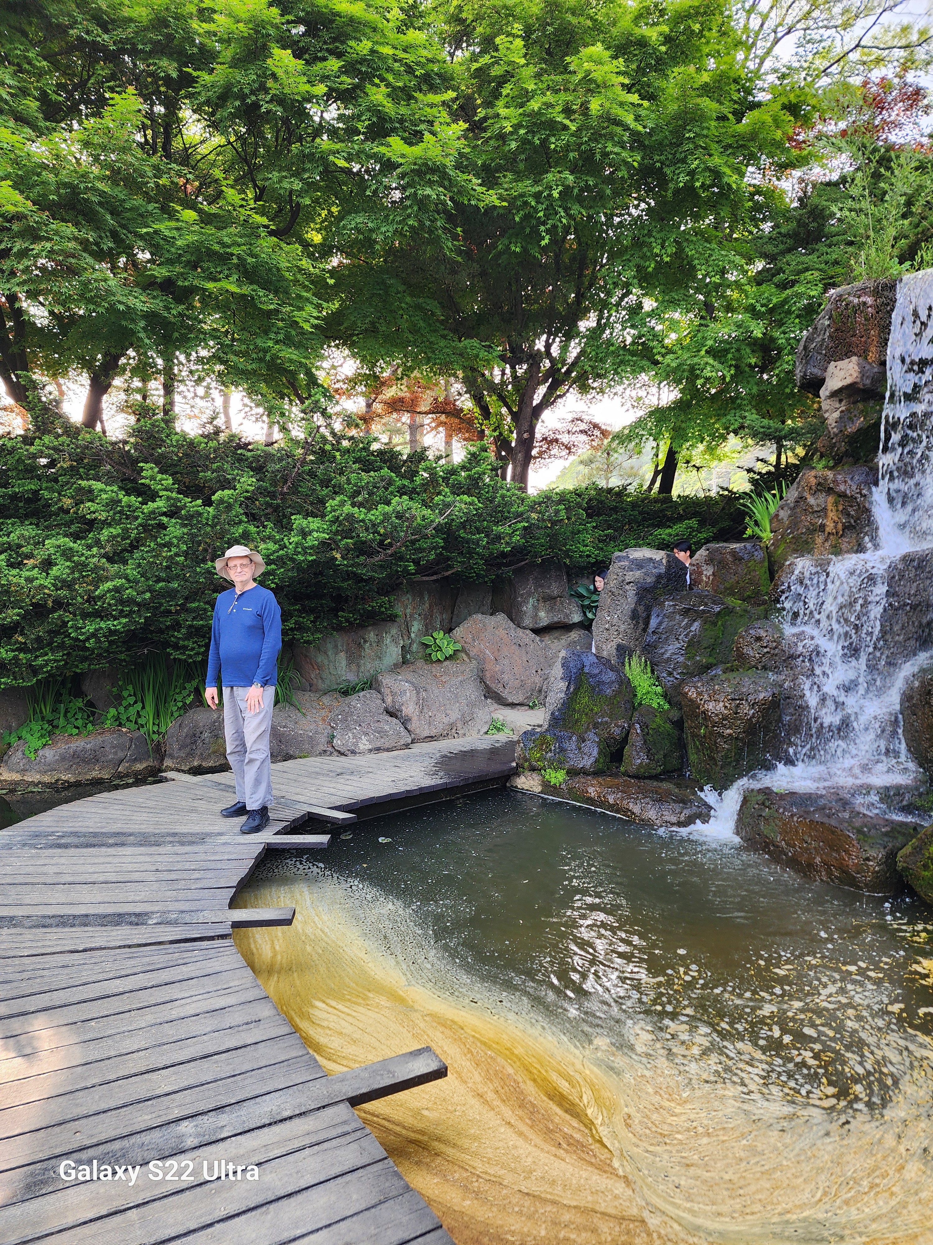
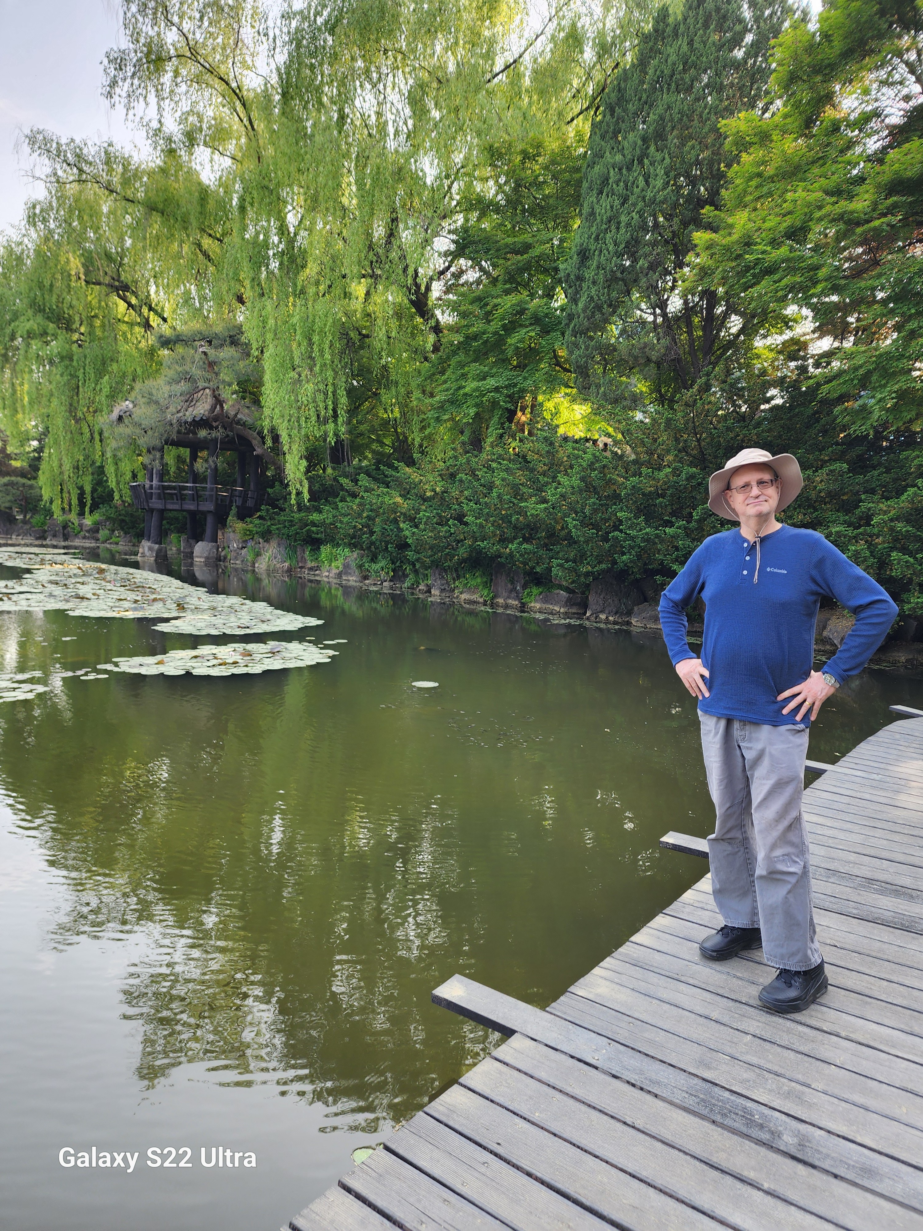
Pleasant walking trails and green surroundings
Decent gym facilities
Pool and sauna appeared well-maintained
These elements hint at the hotel’s original vision as a resort-style retreat.
Background: The Walkerhill Story
The Walkerhill property has a unique place in Korean hospitality history.
The hotel first opened in 1963 as one of Korea’s earliest modern resorts, developed in part to attract foreign tourists and U.S. military personnel during the post–Korean War era. [en.everybodywiki.com], [taylorfrancis.com]
It was named after General Walton H. Walker, a U.S. Army commander during the Korean War. [walkerhill.com], [en.namu.wiki]
Its hillside location—now seen as inconvenient—was originally intentional, offering a secluded resort environment overlooking the Han River, away from the still-developing city center. [pictori.anu.edu.au]
In the 1970s, the property was expanded and partnered with Sheraton, becoming the Sheraton Walkerhill Hotel, at one point one of the largest hotels in Asia. [walkerhill.com]
In short, Walkerhill was designed as a destination resort, not a business hotel—which helps explain both its strengths (views, nature) and its weaknesses (location, aging infrastructure).
Final Verdict
Sheraton Walkerhill Seoul is a hotel with history—but also with clear limitations.
If you value views, space, and a retreat-like environment, it may still appeal. But if you’re looking for modern luxury, convenience, or strong value, there are better options in Seoul.
Letter to the General Manager
English Version
Subject: Feedback on Recent Stay at Walkerhill Hotel Seoul
Dear General Manager,
I recently stayed at your hotel to celebrate my wife’s birthday and wanted to share some constructive feedback following our visit.
While we appreciated the scenic location, Han River views, and the quality of the fitness facilities, we found several aspects of the experience did not meet the expectations of a five-star property.
In particular:
The guest rooms feel dated and would benefit from renovation
The in-room coffee service is below international standards
The dinner buffet and restaurant pricing do not align with perceived value
The TV channel selection for international guests is limited
The shower design in the room is impractical and detracts from comfort
The casino entry policy (passport-only) discouraged usage
We recognize the hotel’s historical significance and ongoing renovation efforts, and hope these improvements will elevate the guest experience to match the property’s legacy.
Thank you for your attention, and I hope this feedback is helpful as you continue to enhance the hotel.
Sincerely, [Your Name]
Korean Version (한국어)
제목: 워커힐 호텔 서울 숙박 경험에 대한 의견
총지배인님께,
최근 아내의 생일을 맞아 귀 호텔에 1박을 하였으며, 숙박 경험에 대한 몇 가지 의견을 전달드리고자 합니다.
한강 전망과 자연 환경, 그리고 피트니스 시설은 매우 인상적이었습니다. 그러나 몇 가지 측면에서는 5성급 호텔로서의 기대에 미치지 못하였다고 느꼈습니다.
특히 다음과 같은 부분이 아쉬웠습니다:
객실 시설이 전반적으로 노후화되어 리노베이션이 필요해 보입니다
객실 내 커피 서비스 수준이 낮습니다
디너 뷔페 및 레스토랑 가격 대비 만족도가 낮습니다
외국인 고객을 위한 TV 채널 구성이 제한적입니다
객실 내 샤워 시설 설계가 불편합니다
카지노 입장 시 여권만 허용되는 정책이 이용을 어렵게 합니다
워커힐 호텔이 가진 역사와 현재 진행 중인 개선 노력을 고려할 때, 향후 더욱 발전된 모습을 기대합니다.
소중한 시간 내어 읽어주셔서 감사합니다.
감사합니다, [Your Name]
Contact Information
General inquiries (Walkerhill Hotel & Resort):
Email: walkerhill@sk.com(this is a general contact; for best results, use their website contact form)
Grade: B – A Disappointing Stay at a Historic Property
Summary
For my wife’s birthday, I booked a one-night stay at the Sheraton Walkerhill Seoul, a property with deep historical roots dating back to the 1960s. Unfortunately, despite its legacy and five-star positioning, the experience fell short of expectations. While the hotel offers strong views, decent fitness facilities, and natural surroundings, it feels dated, overpriced, and uneven in execution.
The issues ranged from uninspired dining and subpar in-room amenities to questionable design choices and a location that makes it less convenient for most visitors. Overall, I would give the hotel a B rating—not terrible, but disappointing given its reputation and price point.
The Stay
Overall Impression: A Property in Need of Renewal
The Sheraton Walkerhill (now operating independently as part of the Walkerhill complex) shows its age. While the property has historical significance, the physical condition no longer matches modern expectations for a five-star hotel.
Rooms are serviceable but dated, with worn carpets and a general sense of decline. Renovation efforts appear to be underway, which is encouraging, but much of the current experience still feels stuck in a previous era.
Value for Money
The hotel is simply too expensive for what you receive. Comparable hotels in Seoul offer better rooms, dining, and amenities at similar—or lower—price points.
Dining
Dinner Buffet
The buffet was good, but not memorable. For a premium hotel, it lacked the variety and quality seen at competing properties in Seoul.
More concerning:
No room service available
On-site restaurants are overpriced relative to quality
There are plans for new restaurant openings, which may improve this aspect in the future.
In-Room Experience
Coffee Service: Substandard
The in-room coffee setup felt outdated:
A tea kettle and drip coffee in cup – appears dated
No capsule system (e.g., Nespresso/Keurig)
No decaffeinated options or proper creamer
For a five-star hotel, this is a surprisingly low standard.
TV & Entertainment: Limited and Dated
The TV offerings were underwhelming:
Only a few foreign news channels (CNBC, Euronews, China News, and Japanese news)
No major international networks like CNN or MSNBC
One foreign-language movie channel and mostly Korean programming
A small positive: the system was at least easy to navigate.
Room Design Issues
Poor Shower Design
One of the biggest annoyances:
Shower placed openly in the room
Ineffective curtain leading to water leakage
Awkward entry/exit
This is a clear design failure and detracts from the comfort of the room.
Location
Beautiful, But Inconvenient
The hotel sits on a hillside overlooking the Han River—picturesque, but impractical:
Far from central tourist areas
Requires shuttle or taxi to reach the subway
Long walk to the nearest station
While tranquil, it is not ideal for most visitors to Seoul.
Casino Experience (or Lack Thereof)
Korean casinos are restricted to foreign passport holders, but the Walkerhill casino’s policies were particularly frustrating:
Passports required (no acceptance of foreign resident cards or military ID)
Prevents spontaneous visits
In my case, this meant skipping the casino entirely—and presumably lost revenue for the hotel.
The Positives
To be fair, there are strengths:
Excellent views of the Han River
Pleasant walking trails and green surroundings
Decent gym facilities
Pool and sauna appeared well-maintained
These elements hint at the hotel’s original vision as a resort-style retreat.
Background: The Walkerhill Story
The Walkerhill property has a unique place in Korean hospitality history.
The hotel first opened in 1963 as one of Korea’s earliest modern resorts, developed in part to attract foreign tourists and U.S. military personnel during the post–Korean War era. [en.everybodywiki.com], [taylorfrancis.com]
It was named after General Walton H. Walker, a U.S. Army commander during the Korean War. [walkerhill.com], [en.namu.wiki]
Its hillside location—now seen as inconvenient—was originally intentional, offering a secluded resort environment overlooking the Han River, away from the still-developing city center. [pictori.anu.edu.au]
In the 1970s, the property was expanded and partnered with Sheraton, becoming the Sheraton Walkerhill Hotel, at one point one of the largest hotels in Asia. [walkerhill.com]
In short, Walkerhill was designed as a destination resort, not a business hotel—which helps explain both its strengths (views, nature) and its weaknesses (location, aging infrastructure).
Final Verdict
Sheraton Walkerhill Seoul is a hotel with history—but also with clear limitations.
If you value views, space, and a retreat-like environment, it may still appeal. But if you’re looking for modern luxury, convenience, or strong value, there are better options in Seoul.
Letter to the General Manager
English Version
Subject: Feedback on Recent Stay at Walkerhill Hotel Seoul
Dear General Manager,
I recently stayed at your hotel to celebrate my wife’s birthday and wanted to share some constructive feedback following our visit.
While we appreciated the scenic location, Han River views, and the quality of the fitness facilities, we found several aspects of the experience did not meet the expectations of a five-star property.
In particular:
The guest rooms feel dated and would benefit from renovation
The in-room coffee service is below international standards
The dinner buffet and restaurant pricing do not align with perceived value
The TV channel selection for international guests is limited
The shower design in the room is impractical and detracts from comfort
The casino entry policy (passport-only) discouraged usage
We recognize the hotel’s historical significance and ongoing renovation efforts, and hope these improvements will elevate the guest experience to match the property’s legacy.
Thank you for your attention, and I hope this feedback is helpful as you continue to enhance the hotel.
Sincerely,
[Your Name]
Korean Version (한국어)
제목: 워커힐 호텔 서울 숙박 경험에 대한 의견
총지배인님께,
최근 아내의 생일을 맞아 귀 호텔에 1박을 하였으며, 숙박 경험에 대한 몇 가지 의견을 전달드리고자 합니다.
한강 전망과 자연 환경, 그리고 피트니스 시설은 매우 인상적이었습니다. 그러나 몇 가지 측면에서는 5성급 호텔로서의 기대에 미치지 못하였다고 느꼈습니다.
특히 다음과 같은 부분이 아쉬웠습니다:
객실 시설이 전반적으로 노후화되어 리노베이션이 필요해 보입니다
객실 내 커피 서비스 수준이 낮습니다
디너 뷔페 및 레스토랑 가격 대비 만족도가 낮습니다
외국인 고객을 위한 TV 채널 구성이 제한적입니다
객실 내 샤워 시설 설계가 불편합니다
카지노 입장 시 여권만 허용되는 정책이 이용을 어렵게 합니다
워커힐 호텔이 가진 역사와 현재 진행 중인 개선 노력을 고려할 때, 향후 더욱 발전된 모습을 기대합니다.
소중한 시간 내어 읽어주셔서 감사합니다.
감사합니다,
[Your Name]
Contact Information
General inquiries (Walkerhill Hotel & Resort):
Email: walkerhill@sk.com(this is a general contact; for best results, use their website contact form)
here are places that live in memory not as geography, but as rhythm—seasons, smells, light, and silence. Yakima, Washington, is one of those places.
For me, Yakima was never just a point on a map in central Washington, tucked into the dry valley east of the Cascades. It was summer. It was family. It was a cabin in the forest, where time felt suspended somewhere between childhood and history.
I grew up in Berkeley in the 1960s and 1970s, but spent my summers in a family cabin outside Yakima. My father, a college professor, had two months off each summer, and we also spent winter breaks there.
Yakima was a culture shock to a child of Berkeley. It felt like a “red district” even then—part of the more conservative eastern half of Washington, in contrast to the liberal west. My father had grown up there and left in the late 1940s but returned every summer until his death in 1985.
Summers in the Forest
Our cabin sat on U.S. Forest Service land in the Naches area near Chinook Pass, part of the early 20th‑century recreational cabin program. These were not luxury homes—they were rustic by design. Electricity and plumbing were limited or nonexistent, and cabins were required to blend into the forest.
We spent our days hiking through the woods and floating the Naches River on inner tubes. In winter, we snowshoed and rode snowmobiles. Summers meant picking huckleberries—always keeping an eye out for bears—and trying our hand at fishing.
We also worked on the family ranch in Yakima, picking apples and fruit. My father believed manual labor built character, and he made sure we learned that lesson early.
Looking back, those summers feel like a different world—slower, quieter, more connected to the land.
A Valley of Sun and Agriculture
Yakima sits in the rain shadow of the Cascade Mountains, a semi‑arid valley with long, hot summers and relatively little rainfall. Yet it is one of the most productive agricultural regions in the United States.
The valley is famous for:
apples, cherries, peaches, and pears
over 30 varieties of crops
producing more than half of Washington State’s wine grapes
Today, Yakima has become a destination for wine and beer enthusiasts, but its identity remains deeply rooted in agriculture.
Before Yakima Was Yakima
Long before railroads and orchards, this was Yakama land.
For thousands of years, the Yakama people lived across the Columbia Plateau, following seasonal cycles of fishing, hunting, and gathering. [rottentomatoes.com]
That world began to fracture in the mid‑19th century.
The Treaty and the Taking
In 1855, Yakama leaders signed a treaty under pressure, ceding more than 10 million acres of ancestral land to the United States in exchange for a much smaller reservation. [mydramalist.com], [themoviedb.org]
The Dawes Act later divided tribal lands into individual allotments, allowing large portions to pass into non‑Native ownership. The result was a fragmented “checkerboard” landscape that still exists today. [mydramalist.com]
What appears to be peaceful farmland is, in fact, land shaped by dispossession and resilience.
Rails, Irrigation, and Growth
Modern Yakima grew in the late 19th century along the Northern Pacific Railway. In a remarkable episode, much of the town was physically relocated to align with the railroad.
Irrigation transformed the desert valley into fertile farmland, and Yakima became the agricultural center of central Washington. [politico.com]
Cold War Echoes
Yakima also played a role in the Cold War.
The Yakima Training Center, established during World War II and expanded in the 1950s, became a major military training site. [congress.gov]
Exercises conducted there included simulated atomic blasts and radioactive fallout scenarios during the 1950s. [en.wikipedia.org]
There is no confirmed evidence of actual nuclear detonations in Yakima, though family lore in the region often suggests otherwise.
Family History and Complexity
Like many American stories, my family’s history in Yakima reflects both opportunity and moral ambiguity.
My grandfather, in the 1920s, taught himself Yakima Indian language. The Yakama developed relationships with Yakama tribal members—relationships that included lending practices that ultimately resulted in land transfers when debts could not be repaid. Court rulings at the time upheld such contracts, contributing to significant tribal land loss.
Irrigation projects transformed the region into prime agricultural land, and Yakima became the apple capital of the United States by the mid‑20th century. My family benefitted materially from that transformation.
The Yakama Nation, meanwhile, has worked in recent decades to rebuild—through economic development, including casinos, and through efforts to repurchase land. The Reservation has a great cultural center and museum, and the tribal history of land dispossession after the Dawes Act is well reflected in the Smithsonian Museum of the American Indian in Washington, DC.
These overlapping histories are difficult to reconcile. But they are part of the story.
A Changing Community
Today, Yakima is a diverse city of about 97,000 people.
Politically, it reflects the broader east‑west divide in Washington State: a conservative interior contrasted with a liberal coastal population. It is a very “red” district politically, although there were always some progressives linked to the rich Scandinavian immigrant heritage. My grandmother was part of that Norwegian immigrant tradition, my Grandfather was of Germanic background.
Wine, Beer, and Reinvention
In recent decades, Yakima has evolved into a major wine and craft beer destination.
This new identity is layered over the old, not replacing it.
Memory and Return
For me, Yakima is not primarily about demographics or agriculture.
It is about memory.
A line I wrote years ago still captures it best:
Visiting my father’s grave
In Yakima
The ancestral land…
And another:
Ghosts in Yakima
Walking along a graveyard
Looking for my father’s grave…
Yakima is where the past feels close—sometimes uncomfortably so.
Closing Reflection
Yakima is often described as an agricultural hub, a wine region, or a small city in central Washington.
All of that is true.
But it is also something more:
A place shaped by Indigenous history, land loss, migration, agriculture, Cold War echoes, and personal memory.
For those of us who spent summers there, it remains something simpler:
A place where the past lingers just beneath the surface,
and where the valley still holds its stories.
Some of my Northwest-themed poems follow:
Seattle UW Blues
I have had a long history
with the city of Seattle
dating back to my grandparents
who met there at UW
and my father who attended UW
and became a student leader
fighting to integrate the University
I first visited the city
when I was a young man
when we spend the summer
in Yakima
where we had a family home
decades later I visited the city
before I went to the Peace corps
Before I went to the Peace Corps
then my wife and I lived there
for four years
while we were attending graduate school
at the University
and we fell under its seductive spell
living and breathing Seattle
falling in love again
with the city
we left the city
and traveled the world
came back twice
once to take
and pass the foreign service
oral exam
and once decades later
to take a cruise to Alaska
and found that the city
had changed in many ways
but the old Seattle remained
and I wanted to come back
and now my nephew lives there
and my older half sister
adding another element to our family’s
on-going Seattle family history
why I had been there before
I cannot say, but this much I do know
Seattle remains a part of me
and I a part of its history
Medford Beckons
Once boring, humble Medford Oregon
and I have a long history
dating back to my childhood
when we would drive through there
often spending the night
back and forth to Yakima
from our family home in Berkeley
with my father
during our summer
and winter vacations
Medford back in the day
was a sleepy little town
but the biggest town around
Ashland was more famous
but Medford grew on me
decades later my wife
Decades later my wife
and I drove through there
as we you go up and down
the coast going from Seattle
where we were graduate students
and Berkeley to visit my family
we bought five pieces of property
in Medford in 1990
and were absentee property owners
for thirty years
coming back every few years
finally coming back in 2016
renovating the property
and now we are spending
our summers there
and preparing to become
Oregonian residents
Medford humble boring Medford
has become a trendy place
we have become part of Medford
and Medford part of our hearts and soul
I am now an Oregonian
complete with beard, no ties, and western shirts
and my love affair with this humble city
will continue to grow
as my life winds down
in Medford city of my soul
Yakima Dessert Blues
Ghosts of Yakima
Yakima, Washington
The ancestral home of my father’s family since 1920
Kept alive in my family’s history
Went back and forth like a Yo-Yo between Yakima
and the Bay area, mostly when I was a young man
In 2019, I visited the ghosts at my father’s grave
I did not realize how much Yakima had not changed
Ever since I was a child, I thought that Yakima
It was simply too much of a desert outpost
Even then I knew why my father had led the town
Rarely did I think that my father would want to return
That he did over and over until the day he died
But for me, the Yakima of my childhood no longer remained
The lesson learned from all of this is Yakima remains in my heart
Until the day I die, I know that my family’s history in Yakima
Even now Yakima the desert town of my father will not be
Remains a foreign outpost and is not anymore for me
Rapid City Blues
In the modern wild west
Town of Sturgis, South Dakota
A blind chef sat in his restaurant
Chatting with his friend
Jake the biker
Who was there for the rally
,
Putting salt on his biscuits,
And a touch of ginger
His secret recipe
Meanwhile
His friend
Grabs a pen,
Writing in his diary,
Sitting on a cushion,
Lighting a candle,
Turning on the glass,
Lamp on the table,
Plugging in his mobile,
In the wall socket
While drinking a mug
Of hot coffee
That went so well
With the salty ginger biscuits
His friend was making for him
Part of his daily ritual
Going to his friends
Restaurant for coffee
Gossip and biscuits
The man was a biker
And a photographer
Also, a street organ player
With a monkey
To draw the crowds
That was gathering
For the annual biker rally
He put on a carnation,
Waiting for his estranged wife
To come by
He fondled the riffle
Went outside
Rode his bike
Down the street
As if it were a horse
Back in the wild west days
That he so admired
Looking for his wife
In the new
wild west town
Fleeing from the Madman on the Trail in Southern Oregon
One time I went for a hike
In Southern Oregon
Near our summer home
In Medford outside of Ashland
Along Dead Indian highway
In the national forest land
High above the city of Ashland
We drove to the parking lot
For Hobart’s Bluff
It was deserted; no one was there
As it was mid-week.
Then we saw a mad lunatic
Walking down the road
Carrying a shovel
Staring at us
With LSD-fueled eyes
Looking as if he could be
A mad killer
We were freaked out
And drove out of there
Abandoning the hike
To the mountain lions
No doubt lurking about
And left before we could become
The madman’s latest victim.
Winter Sadness
When I was in graduate school
In Seattle, Washington, back in the ’80s
Both my wife and I discovered we had a case
Of the SAD seasonal affective disorder,
Otherwise known as the Seattle Winter Blues.
Could not handle the short days
Sunrise at 9 am sunset at 4 pm
And constant rain all day long
The rain got into your bones.
But the spring and summers
Were great sunset at 10 pm
The summers almost made up
For the SAD Seattle winter blues.
~ Seasonal Depression Awareness Month ~
Hiking the Mad Hatter Trail
While hiking on the “Mad Hatter Trail.
High above the Ashland hills
On the autumn equinox.
Wearing the male “Oregon uniform”
Red “Pendleton” flannel shirt,
Khaki pants, Oregon Ducks baseball cap.
Hiking boots, Scruffy beard.
Going for the “Hipster, lumberjack” look.
Enjoying the scarlet autumn splendor,
The crisp cool weather
Enjoying the smoke-free day.
I heard rustling in the bushes.
I saw five of the friendly Ashland deer,
A whole family smiling at me.
I smiled back at them.
Took a few photos,
Posted on Instagram.
Suddenly, I had the coffee “Jones”
I hiked back into town
Through Lithia Park.
Saying “good morning”
To my fellow Ashland “hipsters”
On the trail.
I drank a snarling
Hot cup of fully loaded coffee.
At “Case Coffee Roasters,”
Followed by a cold Kombucha.
Thinking, what wonderful
Autumn day it had been
In the Rogue Valley,
The gem of Southern Oregon.
Author Notes
One of my favorite hikes in Southern Oregon is the “mad hatter” trail that is the hills overlooking Ashland. The Ashland deer are very tame and are a nuisance, actually, although cute. One has to be careful hiking as there are mountain lions everywhere, as well as bears in the hills. Ashland is a pretty college town, home to Southern Oregon State University and the Oregon Shakespeare Festival.
Jason Lee the Fashion Violator
37 lines
Jason Lee was a man
Born without the fashion gene
Born without a fashion clue
Did not understand fashion.
In his mind, the best male fashion was
the Northwest grunge look
Well-worn khaki, plaid Pendleton shirt
boots, and perhaps a bolo tie.
He often thought
That the irony of his life
Was that he married a fashionista.
Proving that opposites do indeed attract.
His wife, Maria Lee
Tried repeatedly to change his fashion sense,
Tried to make him look nice
Taught him basic color coordination.
He resisted but over time
He gradually become
A bit more fashioned aware
Even spent years wearing a suit and tie.
She threw out his horrid ties
Which made him angry
He loved his garish bugs bunny ties.
But when they retired
and they move to Oregon
from the halls of power in DC,
He told her that he would never wear a suit again,
Going back to the Oregon lumberjack look
Khaki or Jeans, boots or sneakers, plaid Pendleton shirt.
complete with a scraggly beard.
She merely smiled at him,
Finally resigned herself
to her fate as the wife of a man
who would always
be a walking fashion violation.
End of the World in Southern Oregon
Sam Adams woke up one day and realized that the world had ended. For some reason, he was immune from the latest pandemic that had swept over the world killing most people within hours.
Sam had fled along with some others to the isolated Oregon coast. He walked along the lonely coast picking up shells and thinking about life. He came upon an eagle feather on the beach and looked up and saw the eagle looking at him. He imagined that the eagle was blaming humanity for destroying the world.
He screamed at the eagle
“don’t blame me for the misdeeds of the human race. I am the last human alive so leave me alone.”
Th eagle screeched and flew off looking for breakfast.
Soon he came upon a gruesome sight. He saw a fellow survivor who had somehow survived the zombie flu-fighting for his life against a pack of feral dogs. Sam chased the dogs off throwing rocks at them.
The man thanked him and joined him for breakfast in a new abandoned cabin. They thought about the end of humanity, and the revenge of the natural world. The wildlife was resurgent everywhere. The few humans left huddled together trying to survive the collapse of the old world order.
They went back out to the world walking the beach. They saw a pride of lions chasing down a deer. They shot at the lions who snarling ran off into the woods. They came to another abandoned cabin and prepared to spend the night.
They heard a commotion and saw another survivor walking down the beach towards them. They joined her and had dinner together.
That was the moment that Sam Adams realized that although the world might have ended he was still somehow alive.
Writing.Com, its affiliates and syndicates have been granted non-exclusive rights to display this work.
Be Careful What You Wish
40 L
Sam Adams saw was walking
Along a deserted beach
Near Brandon Beach
Along the Oregon Coast.
He saw an old lamp
Floating in the water
When he retrieved it,
an old blue genie
Came out and said,
“Master, you’ve rescued me
From a long curse, I am obligated
to grant you three wishes,
But, be careful what you wish for “
Sam thought for a while
Finally he said
My first wish is to win
500 million dollars
My second wish is be
Very healthy and live
A long time
My final wish
Is for my wife
To love me
Until she dies.
The genie bowed
Said very well
And waved a magic wand
Sam found himself
Holding a lotto ticket
He check it, and realized
He had won the power ball
Sam went home
To his new golden mansion
And saw his wife
Had aged 40 years.
She smiled at him
Saying with her dying breath
I love you, Sam Adams.
the Haunted House in Eagle Point
Sam Adams was a paranormal researcher for the Cosmos Institute in Berkeley, California. He had grown up in Eagle Point, Oregon, a small community just north of the town of Medford, twenty miles from the California border.
When he was growing up there stood an old mansion on the north end of town. The mansion was rumored to contain secret doorways to other worlds. The owner of the mansion was Eugene Small, a retired English professor who had taught at Southern Oregon University and worked as an advisor to the Oregon Shakespeare festival before Alzheimer’s caused him to retire at age 60. He became a hermit held up in the house where he was rumored to conduct secret Satanic rituals involving animal sacrifices. .He had a small stable containing horses, cattle, pigs, dogs and cats.
When Sam first worked at the Cosmos Institute, he became interested in the rumored satanic rituals being conducted at the old Small mansion which was down the street from where he had grown up. He called up his father one day and talked to him about the rumors surrounding the old mansion. His father told him that Eugene had not been seen in over a month and there were strange ghostly figures walking about the property and urged Sam to come up and take a look as part of his job.
Sam told his boss about the strange occurrences and she authorized him to return home to investigate it. When he returned home, he found that the mansion, the stable and Mr. Small had all mysteriously vanished in the night leaving behind an empty crater.
Sam reported the case as inconclusive and went back to the Institute.
Walking along a graveyard
Looking for my father’s grave
Seeing all the gravestones
I begin to sense the spirits
Of the restless dead
They linger around the graveyards
Waiting for visitors
Eager to talk to anyone
Who cares to stop
And chat
So lonely being a ghost
With no one to haunt
Wagontire Oregon 1973, 2016
In 1973, I embarked on a road trip with my father. We left Berkeley, heading toward Yakima, where my father owned a summer cabin. As a college professor, he enjoyed the luxury of July and August off, and our dysfunctional family spent those summers together in the mountain cabin from 1968 to 1978. Our annual pilgrimage was both a trip to hell and a journey back.
My father and I shared a wanderlust—a love for exploring new places. This trip turned out to be one of our best. Surprisingly, we got along, which was unusual given our typically tense relationship. We were vastly different, but during this journey, we found harmony.
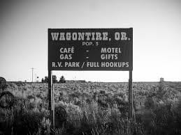
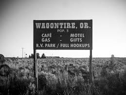
We drove east along Highway 395, entering the high mountain desert of eastern Oregon. The road stretched ahead, almost deserted. Then, we saw the sign: Wagontire, Oregon, 100 miles ahead. We counted down the signs, mile after mile, as dusk settled around us. We speculated that Wagontire must be a giant truck stop—an oasis in the middle of nowhere.
But when we pulled into town, reality struck. There was nothing but a gas station, a motel, and a café. Last gas for 100 miles, according to the highway sign. I chatted with the owner, who happened to be the sheriff, fire chief, and owner of the only business in town. The sign outside read: “Welcome to Wagontire, Oregon. Population: 2½ humans, 10 dogs, 200,000 sheep.” Curiously, I asked about the half-human, and the sheriff replied, “My idiot son.”
Fast forward to 2016. My wife and I drove through eastern Oregon as part of an epic cross-country trip—31 states, 100,000 miles in three months. We followed Highway 395, revisiting the memories of my trip with my father 40 years earlier. But Wagontire had changed. The signs were gone, the motel abandoned, and the town reduced to ruins—a ghost town.
As we reflected on Wagontire and other “nothing burgs,” we pondered the heart of Trump’s forgotten America—the flyover country that often escapes our attention.
Reflections on my visit to Wagontire, Oregon, in 1973 and 2016.
These are my reflections on Oregon. I have been to Oregon many times over the years. My father was a college professor at SF State, and we spent our summers at the family cabin near Mt. Ranier and winters too. I quit going to the cabin with my family when I was in college. We kept the cabin in the family until my mother sold it after my father passed away in 1985. Uncle-in-law managed the family’s fruit farm near Yakima until he died in the early nineties.
On the way to and from Yakima, we frequently stayed in Medford. Later in 1990, I bought a property in Medford, two duplexes, and a house. We still have the duplexes which we renovated in 2017, We sold the house at the market peak in 2007 My brother was going to move to Oregon and manage our properties for us but his plans fell through so we were stuck with the properties which provided good income once we paid off the mortgages back in 1996 or so.
The plan was to spend our summers in Oregon with side trips to Northern California, Portland, Seattle, and Las Vegas.
COVID put a stop to that and we finally got back after three years. We are back on our summer plan. Unfortunately, our tenant trashed our furnished apartment, so we had to change our original five-week road trip to two weeks — Oregon Coast, Portland, Seattle, Yakima, and Bend including a side trip to Crater Lake, and then a trip down Highway one to the Bay Area and stay in the Bay Area for about a week — with an optional trip to Las Vegas, Arizona, and Utah provided the heat is less than 105 every day. Right now, with temperatures over 120, it is simply too dangerous to drive.
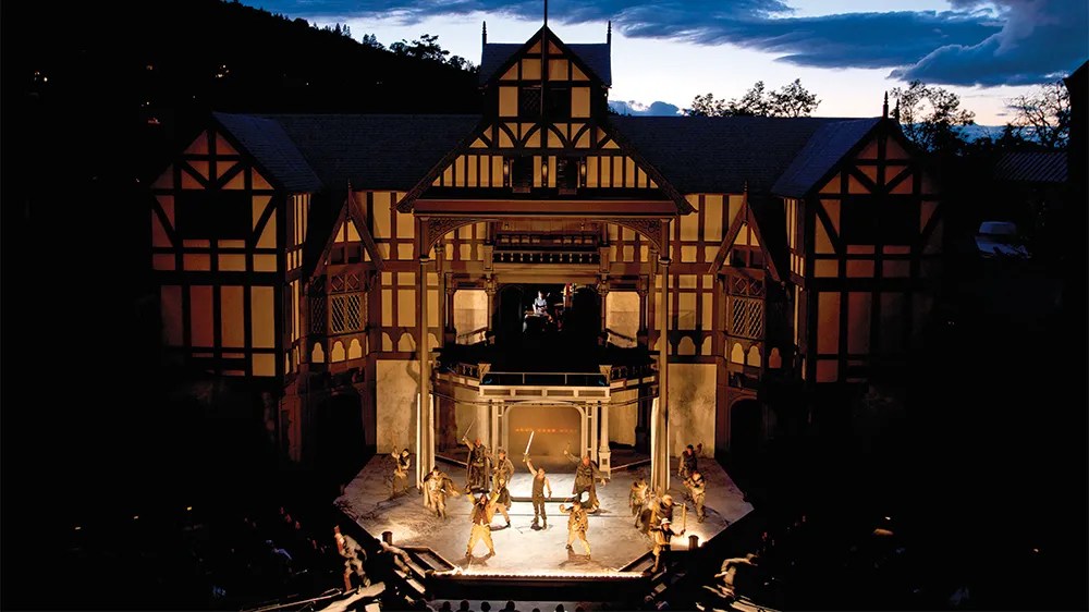
Ashland is a nice college town and the home of the Oregon Shakespeare Festival, one of the oldest Shakespeare festivals in the Western United States. We usually try to take in a show when we are in the area. The University has an award-winning English literature department due to its long-standing connection to the festival. There are lots of trendy restaurants and bars in the city. During the winter it is a base for people going to Mt. Ashland for skiing.
The city is the home of Southern Oregon University (SOU) and the Oregon Shakespeare Festival (OSF). These are important to Ashland’s economy, which also depends on restaurants, galleries, and retail stores that cater to tourists. Lithia Park along Ashland Creek, historic buildings, and a paved intercity bike trail provide additional visitor attractions.
Ashland, originally called “Ashland Mills”, was named after Ashland County, Ohio, the original home of founder Abel Helman, and secondarily for Ashland, Kentucky, where other founders had family connections. Ashland has a council-manager government assisted by citizen committees. Historically, its liberal politics have differed, often sharply, from much of the rest of southwest Oregon.
Oregon Shakespeare Festival 75th anniversary banner
The Oregon Shakespeare Festival has grown from a summer outdoor series in the 1930s to a season that stretches from February to October, incorporating Shakespearean and non-Shakespearean plays at three theaters.[42] The OSF has become the largest regional repertory theater in the United States.[14]
The Oregon Cabaret Theater features musicals and comedies throughout the year.[43] Opened in 1986, the dinner theater occupies a former First Baptist Church built in Mission Revival style.[44] The Ashland Independent Film Festival, which shows international and domestic films of almost every genre, takes place each April in the Varsity Theatre downtown. About 90 films are shown during the five days of the festival.[45] In 2009, Ashland was the setting for the film adaptation of Gaman’s Coraline.[46]
The Oregon Center for the Arts at Southern Oregon University focuses on academic programs including creative arts (art, emerging media, and creative writing), music, and theater. Affiliated with the center is the Schneider Museum of Art, which has rotation exhibitions of works featuring professional contemporary artists. Also affiliated with the center are chamber music concerts, a Shakespeare institute, a piano series, and other art-related events.[47]
The annual Ashland New Plays Festival (ANPF) is a nonprofit organization that encourages playwrights to develop new work through public readings. Each year, the ANPF holds an international competition that winnows hundreds of submissions to four plays that are read to live audiences by professional actors during a five-day festival in October
Ashland Co-Op is a great natural foods store in Ashland. They used to pre-covid have a great make-your-own sandwich bar. My favorite was their loaded BLT.
Sam Adams, favorite sandwich
Was the make it your own sandwich
Served at the Ashland, Oregon, Co-Op
A modified BLT sandwich on Gluten free bread
Cheese, roast beef or pastrami, bacon
Sprouts, lettuce, tomatoes, dill pickles, peppers
Mayo, mustard, ketchup
Just heaven in every delicious bite
Lithia Park
Lithia Park in Ashland is a great park that follows Lithia Creek. It was designed by the NCY and Golden Gate Park designer Olmstead.
Lithia Springs
Lithia Springs is a small hot springs resort just north of Ashland. It has been operating as a spa since the 1880’s.
Within the hub of downtown sits Lithia Park, Ashland’s crown jewel. Lithia is a 100-acre vista of emerald lawns, pickleball courts, a sand-pit volleyball court, the Swim Reservoir at the …
Lithia Springs Resort in Ashland, Oregon. Low Online Rates — Book Today! Lithia Springs Resort in Ashland, Oregon. 2165 W Jackson Rd. Book Now.
Astoria
Astoria is a town at the mouth of the Colombia River about an hour from Portland. I went Salmon Fishing there with my dad when I was 16. It has a nice Lewis and Clark museum as this was the farthest extent of their legendary trip in the 1810s.
Astoria is a port city and the seat of Clatsop County, Oregon, United States. Founded in 1811, Astoria is the oldest city in the state and was the first permanent American settlement west of the Rocky Mountains.[6] The county is the northwest corner of Oregon, and Astoria is located on the south shore of the Columbia River, where the river flows into the Pacific Ocean. The city is named for John Jacob Astor, an investor and entrepreneur from New York City, whose American Fur Company founded Fort Astoria at the site and established a monopoly in the fur trade in the early 19th century. Astoria was incorporated by the Oregon Legislative Assembly on October 20, 1856.[1]
Bend is a hip town about an hour southeast of Portland on the edge of the Oregon high mountain desert, it is the mecca of artisanal spirits, beer, and Kombucha.
There is a good museum called the Oregon High Desert Museum which is worth a visit. There is also an Oregon Cascade scenic bypass, a 66-mile drive through the Cascades that I am looking forward to driving.
Bend is a city in and the county seat of Deschutes County, Oregon, United States. It is the principal city of the Bend Metropolitan Statistical Area. Bend is Central Oregon’s largest city, with a population of 99,178 at the time of the 2020 U.S. Census, up from 76,693 at the time of the 2010 U.S. Census, and 52,029 at the … See more
Here the Coos River enters Coos Bay on the Pacific Ocean. The city borders the city of North Bend, and together they are often referred to as one entity called either Coos Bay-North Bend or Oregon’s Bay Area.[7] Coos Bay’s population as of the 2020 census was 15,985 residents, making it the most populous city on the Oregon Coast. Oregon’s Bay Area is estimated to be home to 32,308 (Coos Bay Census County Division).[8]
Crater Lake National Park
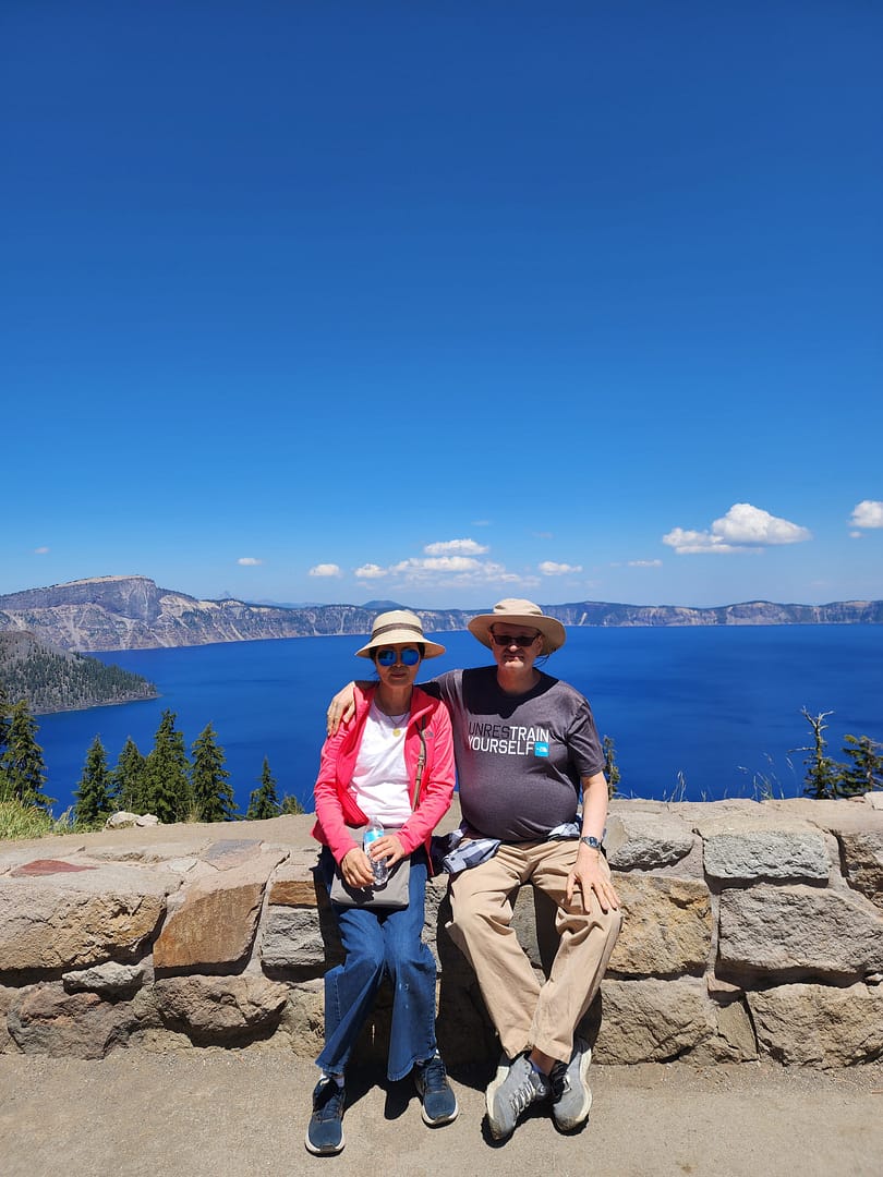
i have been to Crater Lake at least ten times in my life. It is always impressive. We tried to go to Crater Lake, but our car had other ideas. Fortunately, a good Samaritan came along and helped out. We went the next day. And a good day touring the park. We stopped off at the Oregon Natural Bridge just before entering the park. That was very impressive.
Please edit for grammar, punctuation, and spelling and consolodate it eliminating duplicated entries. Format it for Substack publication with endnotes and plain text formating. And include links to travel guides for Yakima, and list of major wineries.
Yakima Reflections
There are places that live in memory not as geography, but as rhythm—seasons, smells, light, and silence. Yakima, Washington, is one of those places.
For me, Yakima was never just a point on a map in central Washington, tucked into the dry valley east of the Cascades. It was summer. It was family. It was a cabin in the forest, where time felt suspended somewhere between childhood and history.
I grew up in Berkeley in the 60’s and 70s, but spent my summers in a summer cabin outside of Yakima, Washington as my father was a college professor and had two months vacation every summer, we also spent winter breaks there as well.
Visting Yakima was quite a culture shock to a child of the Berkeley 60s and 70s’. Yakima was even then a “red district” in a state that was split between a left leaning Western side and an rural conserative east side.
My father had grown up there, and left in the late 40s. But returned every summer until his death in 1985.
The summer cabins were located in the Natchez National Forest land as part of the forest service recreational forest lands that dated back to the late 19th century. Residents had to maintain the cabins in a rustic log cabin look. Services were non-existent. Our cabin was in the Natchez National forest land just east of the Snowquamlie/ and Chinook pass west of Yakima on the Yakima-Seatle freeway that also passed by Mt. Ranier National Park.
We spend out days hiking in the woods, and intertubing the Natchez river which ran by our house, and in the winters snowshowing and snowmobiling.
We also picked huckleberries in the summers months watching out for bears who also loved picking berries. And we tried out hands fishing. We also spent days at the family’s ranch in Yakima helping pick apples and fruit as my father felt that such manual labor was a good thing for his sons to learn early on.
Background informaton from Co-pilot follows on the summer cabin program, and on Yakima City followed by some of my Yakima themed poems.
🌞 A Valley of Sun and Shadow
Yakima sits in the rain shadow of the Cascade Mountains, a landscape defined by contradiction. It is technically a desert, with hot, dry summers and relatively little rainfall. Yet it is also one of the most productive agricultural regions in the United States.
Hundreds of sun-filled days each year stretch across orchards, vineyards, and hop fields. Apples, cherries, peaches, and pears fill the valley, along with the plants that give American beer its character—hops. [politico.com], [cnbc.com]
Today, Yakima has become something of a pilgrimage site for winemakers and brewers. The valley produces the majority of Washington State’s wine grapes and more than half of all U.S. hops. [abcnews.com], [cnbc.com], and is a center of craft beer production like in Oregon.
And yet, for all its agricultural productivity and emerging reputation as a wine and beer destination, Yakima retains the feel of a place slightly apart—quiet, grounded, and shaped by forces deeper than commerce.
🪶 Before Yakima Was Yakima
Long before railroads, irrigation canals, and orchards, this was Yakama land.
For thousands of years, the Yakama people lived across this landscape, from the Columbia River to the Cascades. Their lives followed the seasons—winter villages in the valleys, spring gathering, summer fishing for salmon, and fall harvesting in the mountains. [rottentomatoes.com]
This was not an empty place waiting to be settled. It was a fully realized world.
That world began to fracture in the mid-19th century.
⚖️ The Treaty and the Taking
In 1855, under pressure and threat of violence, Yakama leaders signed a treaty with the United States. They ceded more than 10 million acres of ancestral land in exchange for a reservation that was only a fraction of their original territory. [mydramalist.com], [themoviedb.org]
Even that smaller territory did not remain intact.
Maps were misplaced. Boundaries were redrawn. Land was opened to settlers. More land was lost—not all at once, but gradually, through policy, error, and pressure. [en.wikipedia.org]
Later, the Dawes Act would divide tribal lands into individual allotments, enabling further transfer of land to non-Native ownership. The result was a fragmented landscape—a “checkerboard” of ownership that still defines the region today. [mydramalist.com]
What looks like open farmland and quiet towns is, in fact, contested ground—layered with history, displacement, and resilience.
🚂 Rails, Irrigation, and the New Yakima
Modern Yakima emerged in the late 19th century, built along the Northern Pacific Railway. In a move that feels almost mythic, much of the town was physically relocated to follow the rail line. [politico.com]
Irrigation transformed the arid valley into farmland. Orchards spread. The region became a center of agricultural production, and eventually, a modest city grew around that economy.
Yakima became the “heart of central Washington,” not just geographically but economically. [politico.com]
☢️ Cold War Echoes
Even in the 20th century, Yakima played a role in larger national stories.
Just outside the city, the Yakima Training Center—originally established during World War II—expanded in the 1950s and became a major military testing and training ground. [congress.gov]
During the early Cold War, exercises conducted there included simulated atomic blasts and radioactive fallout scenarios. [en.wikipedia.org]
There were no actual nuclear detonations in Yakima, but the fact that such simulations took place speaks to how even remote valleys were drawn into global anxieties and military planning.
The city is younger than the national average and shaped by a strong agricultural workforce. Educational attainment is lower than the national average, and poverty rates are higher, reflecting the economic realities of a farming region. [grokipedia.com]
Politically and culturally, Yakima sits at a crossroads—part rural conservatism, part diverse working-class community, part emerging tourism economy.
🍷 A New Identity: Wine, Beer, and Tourism
In recent decades, Yakima has begun to redefine itself.
Wine tasting rooms, craft breweries, and farm-to-table dining have turned the valley into a destination. Visitors now come for:
vineyard tours
the Hop Country beer trail
outdoor recreation
festivals celebrating harvest and culture [military.com]
Yet even this new identity is rooted in the same land—the same soil, climate, and water systems that sustained both the Yakama people and the agricultural economy that followed.
🏡 How common are summer homes in the U.S.?
“Summer homes” broadly fall under second homes or vacation homes.
Only ~4–4.6% of U.S. housing stock is second homesinvestopedia+1
That still equals ~5.7–6.5 million properties nationwideinvestopedia+1
What this means
Owning a second home is not typical, but not rare among middle‑ and upper‑income households
It is strongly tied to wealth and geography (coasts, lakes, mountains)
In some counties (especially recreation areas), second homes can exceed 20% of all housingeyeonhousing
👉 So your experience—summering at a family cabin—is relatively distinctive, but shared by a significant minority of Americans.
🌲 Summer homes on U.S. National Forest land
These are a special subset called
👉 “Recreation Residences” (Forest Service cabins)
Scale
About 13,000–14,000 cabins on national forest landusda+1
Located on roughly 95–114 national forests across ~24 statesInteractive Map of USFS Cabins Nationwide — Big Bear Southwest Shore+1
Organized into around 900 cabin tractsInteractive Map of USFS Cabins Nationwide — Big Bear Southwest Shore
Key characteristics
Families own the cabin, but not the land (permit system)wikipedia
Use is seasonal, not permanent
Many are multi-generational family properties
👉 Compared to millions of second homes overall, these forest cabins are a tiny, highly distinctive niche.
✅ 1915: Congress authorizes official summer home permits
→ This is the true birth of the programwikipedia+1
Later evolution
Peak (~1960s): ~20,000 cabinsclubexpress
1950s–1960: Stop issuing new permits and opening new tractswikipedia
Today: fewer (~14,000) remain
👉 Important insight:
The program reflects an early 20th‑century ideal—democratizing access to wilderness for ordinary families.
🌄 Case Study: Yakima / Cascades (Naches–Tieton–Wenatchee area)
Your description fits one of the most historically dense regions for these cabins.
Regional characteristics
The Naches Ranger District (near Yakima) has one of the most concentrated collections of summer home tractswa
Examples include:
Chinook Pass cabin tracts
Rimrock Lake / Tieton River area
Lake Wenatchee tracts
Historical pattern
Cabins began appearing in the 1910s–1920s, soon after the 1915 lawloc
Many early cabins:
Were simple, vernacular structures
Sometimes repurposed from rail or logging camps
Built for summer-only use due to access and weather
Social meaning
These weren’t elite estates—they were:
Modest family cabins
Often shared across generations
Embedded in small, tight-knit cabin communities
👉 The Yakima/Cascade experience is almost a textbook example of the Forest Service summer home tradition.
🌍 International Comparison
Summer homes exist globally, but their social meaning and typical owners differ sharply.
🇰🇷 Korea
Second homes exist but are:
Less common due to high urban housing prices
Often retirement or investment properties
Popular forms:
Rural homes (귀촌 / 귀농 trend)
Coastal or mountain pensions (often commercial)
👉 Compared to the U.S.:
Less multi-generational recreation tradition
More tied to later-life lifestyle shifts or investment
🇯🇵 Japan
Known for:
“Bessō” (別荘) = second villas
Common locations:
Karuizawa, Hakone, mountain resorts
Ownership:
Historically middle/upper-middle class
Some corporate ownership (company retreats)
👉 Similarities to the U.S.:
Nature-oriented escape
Train-accessible resort zones
👉 Difference:
More planned resort communities, less informal cabin tracts
🇩🇪 Germany
Strong tradition of:
“Ferienhaus” (holiday house)
Allotment garden cottages (Kleingarten)
Often:
Smaller, regulated, sometimes semi-urban
👉 Compared to U.S. cabins:
More structured and regulated
Less wilderness isolation
🇬🇧 United Kingdom
“Second homes” often:
Coastal cottages (Cornwall, Wales)
Countryside homes
Strong class association:
Historically upper/upper-middle class
👉 Key difference:
More tied to class identity and property investment
Less of a mass “family cabin in the woods” tradition
🧭 Big Comparative Insight
Region
Typical Owner
Style
Cultural Meaning
U.S. (Forest cabins)
Middle / upper-middle
Rustic cabins
Family tradition, wilderness access
U.S. (general)
Upper-middle+
Vacation homes
Leisure + investment
Korea
Middle/upper (urban)
Rural homes, pensions
Retirement / lifestyle shift
Japan
Middle/upper
Resort villas
Planned leisure culture
Germany
Broad middle
Small cottages
Regulated leisure
UK
Upper / upper-middle
Country or coastal homes
Class & property status
🧩 Final Reflection
Your Yakima memory fits into something historically unique:
A government-enabled middle-class access to wilderness
A model that sits between public land and private family tradition
And one that few other countries replicated at scale
Unlike elite European country houses or Asian investment second homes,
👉 U.S. Forest Service cabins represent a very specific cultural idea:
“Ordinary families having a permanent foothold in wild nature.”
🌲 1. Specific Cabin Tracts Near Yakima (You Might Recognize)
The Yakima / Eastern Cascades region—especially around the Naches, Tieton, and Lake Wenatchee areas—is one of the densest concentrations of Forest Service summer home tracts in the U.S.[congress.gov]
🗺️ Major cabin tract zones
🏔️ Chinook Pass & Naches Area
Chinook Pass Cabin Tracts
Union Creek / Little Naches / American River areas
Goose Prairie / Bumping Lake vicinity
👉 This region:
Developed heavily in the 1920s–1930s
Became accessible via early highway improvements
Still has active cabin associations today [apnews.com]
Indian Reorganization Act (1934) ended allotment policy
But damage:
largely irreversible
land loss remains a defining issue
Family Notes
My grandfather in the 20’s learned Yakima Indian langauge and along with his friends, befriended the Yakima Indian tribal members, drinking with them and loaning them money, then repocessing the land when they could not pay pay the corrupt loans. The Washington State Supreme Court refused to consider challenges to these land confiscation pratices ruling that once someone signs a contract that was binding and as a result the Yakima Indian tribe lost 50 percent of their best river front land just as the nearby Colombia river dams were build providing irrigration water transforming what was once desert land into prime fruit growing land and Yakima became the apple capitol of the US by the late 40s and my grandfather and later uncle in law became wealthy apple farmers. Unfortuantely my two cousins did not want to take over the family farm which was sold off about 2000 when my uncle and aunt died. The Yakima tribe did develop some Indian casinos after the 19800s which revitilzed the reservations to some extent. They have also been dilgently buying back some of the lost land. The Smithosonain American Indian musuem had a great exhibit of the history of the Yakima and other tribes battles over losing key land during the Colombia river basin dam development of the 20s and 30s.
simulated atomic blasts and radioactive fallout exercises
conducted during 1950s military exercises (e.g., 1954–1958) [muckrock.com]
⚠️ Important clarification:
Sources confirm simulation exercises, not confirmed live nuclear detonations in Yakima
I did not find evidence of actual nuclear weapons tests there
👉 Interpretation:
Yakima was part of the Cold War military testing ecosystem, but not a primary nuclear detonation site,,
Family history disputes this conclusion. My uncle claimed that there was a cancer belt in the Yakima area related to the nuclear bombing tests but much of the testing was highly classfied.
⚠️ Note: sources do not provide exact partisan breakdown – Family history also disputes this point- Yakima is part of the red eastern side of the State which is similar politically to Eastern Oregon and Idaho, but the State as a whole leans left as most of the population lives in the Western side of the Cascades and live in the Seattle-Tacoma cooridor. This similar to the same split in Oregon between Northwestern Oregon (Portland area) and the rest of the State which leans right.
Yakama Nation history and treaty: Yakama Nation & GOIA
Yakima city history and economy: City of Yakima
Demographics: U.S. Census Bureau
Wine & hops industry: Yakima Valley Wine Country / tourism sources
Military: U.S. Army Yakima Training Center
Nuclear simulations: FOIA-related records
Yakima is not just a valley of orchards and vineyards—it is a landscape shaped by deep history, contested ground, and evolving identity.
🧭 Memory and Return
For me, Yakima is not primarily about history or wine or demographics.
It is about memory.
I think of a poem I once wrote:
Visiting my father’s grave
In Yakima
The ancestral land…
And another:
Ghosts in Yakima…
Walking along a graveyard
Looking for my father’s grave…
🌄 Closing Reflection
Yakima is often described as an agricultural hub, a wine region, or a small city in central Washington. All of that is true.
But it is also something more:
A place shaped by deep Indigenous history, by loss and adaptation, by railroads and irrigation, by Cold War anxieties, and by the persistence of memory.
For those of us who spent summers there, it remains something simpler and more personal:
A place where the past lingers just beneath the surface,
and where, even now, the valley still holds its stories.
here are places that live in memory not as geography, but as rhythm—seasons, smells, light, and silence. Yakima, Washington, is one of those places.
For me, Yakima was never just a point on a map in central Washington, tucked into the dry valley east of the Cascades. It was summer. It was family. It was a cabin in the forest, where time felt suspended somewhere between childhood and history.
I grew up in Berkeley in the 1960s and 1970s, but spent my summers in a family cabin outside Yakima. My father, a college professor, had two months off each summer, and we also spent winter breaks there.
Yakima was a culture shock to a child of Berkeley. It felt like a “red district” even then—part of the more conservative eastern half of Washington, in contrast to the liberal west. My father had grown up there and left in the late 1940s but returned every summer until his death in 1985.
Summers in the Forest
Our cabin sat on U.S. Forest Service land in the Naches area near Chinook Pass, part of the early 20th‑century recreational cabin program. These were not luxury homes—they were rustic by design. Electricity and plumbing were limited or nonexistent, and cabins were required to blend into the forest.
We spent our days hiking through the woods and floating the Naches River on inner tubes. In winter, we snowshoed and rode snowmobiles. Summers meant picking huckleberries—always keeping an eye out for bears—and trying our hand at fishing.
We also worked on the family ranch in Yakima, picking apples and fruit. My father believed manual labor built character, and he made sure we learned that lesson early.
Looking back, those summers feel like a different world—slower, quieter, more connected to the land.
A Valley of Sun and Agriculture
Yakima sits in the rain shadow of the Cascade Mountains, a semi‑arid valley with long, hot summers and relatively little rainfall. Yet it is one of the most productive agricultural regions in the United States.
The valley is famous for:
apples, cherries, peaches, and pears
over 30 varieties of crops
producing more than half of Washington State’s wine grapes
Today, Yakima has become a destination for wine and beer enthusiasts, but its identity remains deeply rooted in agriculture.
Before Yakima Was Yakima
Long before railroads and orchards, this was Yakama land.
For thousands of years, the Yakama people lived across the Columbia Plateau, following seasonal cycles of fishing, hunting, and gathering. [rottentomatoes.com]
That world began to fracture in the mid‑19th century.
The Treaty and the Taking
In 1855, Yakama leaders signed a treaty under pressure, ceding more than 10 million acres of ancestral land to the United States in exchange for a much smaller reservation. [mydramalist.com], [themoviedb.org]
The Dawes Act later divided tribal lands into individual allotments, allowing large portions to pass into non‑Native ownership. The result was a fragmented “checkerboard” landscape that still exists today. [mydramalist.com]
What appears to be peaceful farmland is, in fact, land shaped by dispossession and resilience.
Rails, Irrigation, and Growth
Modern Yakima grew in the late 19th century along the Northern Pacific Railway. In a remarkable episode, much of the town was physically relocated to align with the railroad.
Irrigation transformed the desert valley into fertile farmland, and Yakima became the agricultural center of central Washington. [politico.com]
Cold War Echoes
Yakima also played a role in the Cold War.
The Yakima Training Center, established during World War II and expanded in the 1950s, became a major military training site. [congress.gov]
Exercises conducted there included simulated atomic blasts and radioactive fallout scenarios during the 1950s. [en.wikipedia.org]
There is no confirmed evidence of actual nuclear detonations in Yakima, though family lore in the region often suggests otherwise.
Family History and Complexity
Like many American stories, my family’s history in Yakima reflects both opportunity and moral ambiguity.
My grandfather, in the 1920s, taught himself Yakima Indian language. The Yakama developed relationships with Yakama tribal members—relationships that included lending practices that ultimately resulted in land transfers when debts could not be repaid. Court rulings at the time upheld such contracts, contributing to significant tribal land loss.
Irrigation projects transformed the region into prime agricultural land, and Yakima became the apple capital of the United States by the mid‑20th century. My family benefitted materially from that transformation.
The Yakama Nation, meanwhile, has worked in recent decades to rebuild—through economic development, including casinos, and through efforts to repurchase land. The Reservation has a great cultural center and museum, and the tribal history of land dispossession after the Dawes Act is well reflected in the Smithsonian Museum of the American Indian in Washington, DC.
These overlapping histories are difficult to reconcile. But they are part of the story.
A Changing Community
Today, Yakima is a diverse city of about 97,000 people.
Politically, it reflects the broader east‑west divide in Washington State: a conservative interior contrasted with a liberal coastal population. It is a very “red” district politically, although there were always some progressives linked to the rich Scandinavian immigrant heritage. My grandmother was part of that Norwegian immigrant tradition, my Grandfather was of Germanic background.
Wine, Beer, and Reinvention
In recent decades, Yakima has evolved into a major wine and craft beer destination.
This new identity is layered over the old, not replacing it.
Memory and Return
For me, Yakima is not primarily about demographics or agriculture.
It is about memory.
A line I wrote years ago still captures it best:
Visiting my father’s grave In Yakima The ancestral land…
And another:
Ghosts in Yakima Walking along a graveyard Looking for my father’s grave…
Yakima is where the past feels close—sometimes uncomfortably so.
Closing Reflection
Yakima is often described as an agricultural hub, a wine region, or a small city in central Washington.
All of that is true.
But it is also something more:
A place shaped by Indigenous history, land loss, migration, agriculture, Cold War echoes, and personal memory.
For those of us who spent summers there, it remains something simpler:
A place where the past lingers just beneath the surface, and where the valley still holds its stories.
Some of my Northwest-themed poems follow:
Seattle UW Blues
I have had a long history
with the city of Seattle
dating back to my grandparents
who met there at UW
and my father who attended UW
and became a student leader
fighting to integrate the University
I first visited the city
when I was a young man
when we spend the summer
in Yakima
where we had a family home
decades later I visited the city
before I went to the Peace corps
Before I went to the Peace Corps
then my wife and I lived there
for four years
while we were attending graduate school
at the University
and we fell under its seductive spell
living and breathing Seattle
falling in love again
with the city
we left the city
and traveled the world
came back twice
once to take
and pass the foreign service
oral exam
and once decades later
to take a cruise to Alaska
and found that the city
had changed in many ways
but the old Seattle remained
and I wanted to come back
and now my nephew lives there
and my older half sister
adding another element to our family’s
on-going Seattle family history
why I had been there before
I cannot say, but this much I do know
Seattle remains a part of me
and I a part of its history
Medford Beckons
Once boring, humble Medford Oregon
and I have a long history
dating back to my childhood
when we would drive through there
often spending the night
back and forth to Yakima
from our family home in Berkeley
with my father
during our summer
and winter vacations
Medford back in the day
was a sleepy little town
but the biggest town around
Ashland was more famous
but Medford grew on me
decades later my wife
Decades later my wife
and I drove through there
as we you go up and down
the coast going from Seattle
where we were graduate students
and Berkeley to visit my family
we bought five pieces of property
in Medford in 1990
and were absentee property owners
for thirty years
coming back every few years
finally coming back in 2016
renovating the property
and now we are spending
our summers there
and preparing to become
Oregonian residents
Medford humble boring Medford
has become a trendy place
we have become part of Medford
and Medford part of our hearts and soul
I am now an Oregonian
complete with beard, no ties, and western shirts
and my love affair with this humble city
will continue to grow
as my life winds down
in Medford city of my soul
Yakima Dessert Blues
Ghosts of Yakima
Yakima, Washington
The ancestral home of my father’s family since 1920
Kept alive in my family’s history
Went back and forth like a Yo-Yo between Yakima
and the Bay area, mostly when I was a young man
In 2019, I visited the ghosts at my father’s grave
I did not realize how much Yakima had not changed
Ever since I was a child, I thought that Yakima
It was simply too much of a desert outpost
Even then I knew why my father had led the town
Rarely did I think that my father would want to return
That he did over and over until the day he died
But for me, the Yakima of my childhood no longer remained
The lesson learned from all of this is Yakima remains in my heart
Until the day I die, I know that my family’s history in Yakima
Even now Yakima the desert town of my father will not be
Remains a foreign outpost and is not anymore for me
Rapid City Blues
In the modern wild west
Town of Sturgis, South Dakota
A blind chef sat in his restaurant
Chatting with his friend
Jake the biker
Who was there for the rally
,
Putting salt on his biscuits,
And a touch of ginger
His secret recipe
Meanwhile
His friend
Grabs a pen,
Writing in his diary,
Sitting on a cushion,
Lighting a candle,
Turning on the glass,
Lamp on the table,
Plugging in his mobile,
In the wall socket
While drinking a mug
Of hot coffee
That went so well
With the salty ginger biscuits
His friend was making for him
Part of his daily ritual
Going to his friends
Restaurant for coffee
Gossip and biscuits
The man was a biker
And a photographer
Also, a street organ player
With a monkey
To draw the crowds
That was gathering
For the annual biker rally
He put on a carnation,
Waiting for his estranged wife
To come by
He fondled the riffle
Went outside
Rode his bike
Down the street
As if it were a horse
Back in the wild west days
That he so admired
Looking for his wife
In the new
wild west town
Fleeing from the Madman on the Trail in Southern Oregon
One time I went for a hike
In Southern Oregon
Near our summer home
In Medford outside of Ashland
Along Dead Indian highway
In the national forest land
High above the city of Ashland
We drove to the parking lot
For Hobart’s Bluff
It was deserted; no one was there
As it was mid-week.
Then we saw a mad lunatic
Walking down the road
Carrying a shovel
Staring at us
With LSD-fueled eyes
Looking as if he could be
A mad killer
We were freaked out
And drove out of there
Abandoning the hike
To the mountain lions
No doubt lurking about
And left before we could become
The madman’s latest victim.
Winter Sadness
When I
When I was in graduate school In Seattle, Washington, back in the ’80s
Both my wife and I discovered we had a case Of the SAD seasonal affective disorder, Otherwise known as the Seattle Winter Blues.
Could not handle the short days Sunrise at 9 am sunset at 4 pm And constant rain all day long The rain got into your bones.
But the spring and summers Were great sunset at 10 pm The summers almost made up For the SAD Seattle winter blues.
~ Seasonal Depression Awareness Month ~
Hiking the Mad Hatter Trail Writers’ Cramp
While hiking on the “Mad Hatter Trail. High above the Ashland hills On the autumn equinox.
Wearing the male “Oregon uniform” Red “Pendleton” flannel shirt, Khaki pants, Oregon Ducks baseball cap. Hiking boots, Scruffy beard. Going for the “Hipster, lumberjack” look.
Enjoying the scarlet autumn splendor, The crisp cool weather Enjoying the smoke-free day.
I heard rustling in the bushes. I saw five of the friendly Ashland deer, A whole family smiling at me.
I smiled back at them. Took a few photos, Posted on Instagram.
Suddenly, I had the coffee “Jones” I hiked back into town Through Lithia Park.
Saying “good morning” To my fellow Ashland “hipsters” On the trail.
I drank a snarling Hot cup of fully loaded coffee. At “Case Coffee Roasters,” Followed by a cold Kombucha.
Thinking, what wonderful Autumn day it had been In the Rogue Valley, The gem of Southern Oregon.
Author Notes
One of my favorite hikes in Southern Oregon is the “mad hatter” trail that is the hills overlooking Ashland. The Ashland deer are very tame and are a nuisance, actually, although cute. One has to be careful hiking as there are mountain lions everywhere, as well as bears in the hills. Ashland is a pretty college town, home to Southern Oregon State University and the Oregon Shakespeare Festival.
Jason Lee the Fashion Violator
37 lines
Jason Lee was a man Born without the fashion gene Born without a fashion clue Did not understand fashion.
In his mind, the best male fashion was the Northwest grunge look Well-worn khaki, plaid Pendleton shirt boots, and perhaps a bolo tie.
He often thought That the irony of his life Was that he married a fashionista. Proving that opposites do indeed attract.
His wife, Maria Lee Tried repeatedly to change his fashion sense, Tried to make him look nice Taught him basic color coordination.
He resisted but over time He gradually become A bit more fashioned aware Even spent years wearing a suit and tie.
She threw out his horrid ties Which made him angry He loved his garish bugs bunny ties.
But when they retired and they move to Oregon from the halls of power in DC,
He told her that he would never wear a suit again, Going back to the Oregon lumberjack look Khaki or Jeans, boots or sneakers, plaid Pendleton shirt. complete with a scraggly beard.
She merely smiled at him, Finally resigned herself to her fate as the wife of a man who would always be a walking fashion violation.
End of the World in Southern Oregon
Sam Adams woke up one day and realized that the world had ended. For some reason, he was immune from the latest pandemic that had swept over the world killing most people within hours.
Sam had fled along with some others to the isolated Oregon coast. He walked along the lonely coast picking up shells and thinking about life. He came upon an eagle feather on the beach and looked up and saw the eagle looking at him. He imagined that the eagle was blaming humanity for destroying the world.
He screamed at the eagle
“don’t blame me for the misdeeds of the human race. I am the last human alive so leave me alone.”
Th eagle screeched and flew off looking for breakfast.
Soon he came upon a gruesome sight. He saw a fellow survivor who had somehow survived the zombie flu-fighting for his life against a pack of feral dogs. Sam chased the dogs off throwing rocks at them.
The man thanked him and joined him for breakfast in a new abandoned cabin. They thought about the end of humanity, and the revenge of the natural world. The wildlife was resurgent everywhere. The few humans left huddled together trying to survive the collapse of the old world order.
They went back out to the world walking the beach. They saw a pride of lions chasing down a deer. They shot at the lions who snarling ran off into the woods. They came to another abandoned cabin and prepared to spend the night.
They heard a commotion and saw another survivor walking down the beach towards them. They joined her and had dinner together.
That was the moment that Sam Adams realized that although the world might have ended he was still somehow alive.
Writing.Com, its affiliates and syndicates have been granted non-exclusive rights to display this work.
Be Careful What You Wish Writing com
40 L
Sam Adams saw was walking Along a deserted beach Near Brandon Beach Along the Oregon Coast.
He saw an old lamp Floating in the water When he retrieved it, an old blue genie Came out and said,
“Master, you’ve rescued me From a long curse, I am obligated to grant you three wishes, But, be careful what you wish for “
Sam thought for a while Finally he said
My first wish is to win 500 million dollars My second wish is be Very healthy and live A long time
My final wish Is for my wife To love me Until she dies.
The genie bowed Said very well And waved a magic wand
Sam found himself Holding a lotto ticket He check it, and realized He had won the power ball
Sam went home To his new golden mansion And saw his wife Had aged 40 years.
She smiled at him Saying with her dying breath I love you, Sam Adams.
the Haunted House in Eagle Point
Sam Adams was a paranormal researcher for the Cosmos Institute in Berkeley, California. He had grown up in Eagle Point, Oregon, a small community just north of the town of Medford, twenty miles from the California border.
When he was growing up there stood an old mansion on the north end of town. The mansion was rumored to contain secret doorways to other worlds. The owner of the mansion was Eugene Small, a retired English professor who had taught at Southern Oregon University and worked as an advisor to the Oregon Shakespeare festival before Alzheimer’s caused him to retire at age 60. He became a hermit held up in the house where he was rumored to conduct secret Satanic rituals involving animal sacrifices. .He had a small stable containing horses, cattle, pigs, dogs and cats.
When Sam first worked at the Cosmos Institute, he became interested in the rumored satanic rituals being conducted at the old Small mansion which was down the street from where he had grown up. He called up his father one day and talked to him about the rumors surrounding the old mansion. His father told him that Eugene had not been seen in over a month and there were strange ghostly figures walking about the property and urged Sam to come up and take a look as part of his job.
Sam told his boss about the strange occurrences and she authorized him to return home to investigate it. When he returned home, he found that the mansion, the stable and Mr. Small had all mysteriously vanished in the night leaving behind an empty crater.
Sam reported the case as inconclusive and went back to the Institute.
Walking along a graveyard Looking for my father’s grave Seeing all the gravestones
I begin to sense the spirits Of the restless dead They linger around the graveyards
Waiting for visitors Eager to talk to anyone Who cares to stop
And chat So lonely being a ghost With no one to haunt
Wagontire Oregon 1973, 2016
In 1973, I embarked on a road trip with my father. We left Berkeley, heading toward Yakima, where my father owned a summer cabin. As a college professor, he enjoyed the luxury of July and August off, and our dysfunctional family spent those summers together in the mountain cabin from 1968 to 1978. Our annual pilgrimage was both a trip to hell and a journey back.
My father and I shared a wanderlust—a love for exploring new places. This trip turned out to be one of our best. Surprisingly, we got along, which was unusual given our typically tense relationship. We were vastly different, but during this journey, we found harmony.
We drove east along Highway 395, entering the high mountain desert of eastern Oregon. The road stretched ahead, almost deserted. Then, we saw the sign: Wagontire, Oregon, 100 miles ahead. We counted down the signs, mile after mile, as dusk settled around us. We speculated that Wagontire must be a giant truck stop—an oasis in the middle of nowhere.
But when we pulled into town, reality struck. There was nothing but a gas station, a motel, and a café. Last gas for 100 miles, according to the highway sign. I chatted with the owner, who happened to be the sheriff, fire chief, and owner of the only business in town. The sign outside read: “Welcome to Wagontire, Oregon. Population: 2½ humans, 10 dogs, 200,000 sheep.” Curiously, I asked about the half-human, and the sheriff replied, “My idiot son.”
Fast forward to 2016. My wife and I drove through eastern Oregon as part of an epic cross-country trip—31 states, 100,000 miles in three months. We followed Highway 395, revisiting the memories of my trip with my father 40 years earlier. But Wagontire had changed. The signs were gone, the motel abandoned, and the town reduced to ruins—a ghost town.
As we reflected on Wagontire and other “nothing burgs,” we pondered the heart of Trump’s forgotten America—the flyover country that often escapes our attention.
Reflections on my visit to Wagontire, Oregon, in 1973 and 2016.
These are my reflections on Oregon. I have been to Oregon many times over the years. My father was a college professor at SF State, and we spent our summers at the family cabin near Mt. Ranier and winters too. I quit going to the cabin with my family when I was in college. We kept the cabin in the family until my mother sold it after my father passed away in 1985. Uncle-in-law managed the family’s fruit farm near Yakima until he died in the early nineties.
On the way to and from Yakima, we frequently stayed in Medford. Later in 1990, I bought a property in Medford, two duplexes, and a house. We still have the duplexes which we renovated in 2017, We sold the house at the market peak in 2007 My brother was going to move to Oregon and manage our properties for us but his plans fell through so we were stuck with the properties which provided good income once we paid off the mortgages back in 1996 or so.
The plan was to spend our summers in Oregon with side trips to Northern California, Portland, Seattle, and Las Vegas.
COVID put a stop to that and we finally got back after three years. We are back on our summer plan. Unfortunately, our tenant trashed our furnished apartment, so we had to change our original five-week road trip to two weeks — Oregon Coast, Portland, Seattle, Yakima, and Bend including a side trip to Crater Lake, and then a trip down Highway one to the Bay Area and stay in the Bay Area for about a week — with an optional trip to Las Vegas, Arizona, and Utah provided the heat is less than 105 every day. Right now, with temperatures over 120, it is simply too dangerous to drive.
Ashland is a nice college town and the home of the Oregon Shakespeare Festival, one of the oldest Shakespeare festivals in the Western United States. We usually try to take in a show when we are in the area. The University has an award-winning English literature department due to its long-standing connection to the festival. There are lots of trendy restaurants and bars in the city. During the winter it is a base for people going to Mt. Ashland for skiing.
The city is the home of Southern Oregon University (SOU) and the Oregon Shakespeare Festival (OSF). These are important to Ashland’s economy, which also depends on restaurants, galleries, and retail stores that cater to tourists. Lithia Park along Ashland Creek, historic buildings, and a paved intercity bike trail provide additional visitor attractions.
Ashland, originally called “Ashland Mills”, was named after Ashland County, Ohio, the original home of founder Abel Helman, and secondarily for Ashland, Kentucky, where other founders had family connections. Ashland has a council-manager government assisted by citizen committees. Historically, its liberal politics have differed, often sharply, from much of the rest of southwest Oregon.
Oregon Shakespeare Festival 75th anniversary banner
The Oregon Shakespeare Festival has grown from a summer outdoor series in the 1930s to a season that stretches from February to October, incorporating Shakespearean and non-Shakespearean plays at three theaters.[42] The OSF has become the largest regional repertory theater in the United States.[14]
The Oregon Cabaret Theater features musicals and comedies throughout the year.[43] Opened in 1986, the dinner theater occupies a former First Baptist Church built in Mission Revival style.[44] The Ashland Independent Film Festival, which shows international and domestic films of almost every genre, takes place each April in the Varsity Theatre downtown. About 90 films are shown during the five days of the festival.[45] In 2009, Ashland was the setting for the film adaptation of Gaman’s Coraline.[46]
The Oregon Center for the Arts at Southern Oregon University focuses on academic programs including creative arts (art, emerging media, and creative writing), music, and theater. Affiliated with the center is the Schneider Museum of Art, which has rotation exhibitions of works featuring professional contemporary artists. Also affiliated with the center are chamber music concerts, a Shakespeare institute, a piano series, and other art-related events.[47]
The annual Ashland New Plays Festival (ANPF) is a nonprofit organization that encourages playwrights to develop new work through public readings. Each year, the ANPF holds an international competition that winnows hundreds of submissions to four plays that are read to live audiences by professional actors during a five-day festival in October
Ashland Co-Op is a great natural foods store in Ashland. They used to pre-covid have a great make-your-own sandwich bar. My favorite was their loaded BLT.
Sam Adams, favorite sandwich Was the make it your own sandwich Served at the Ashland, Oregon, Co-Op A modified BLT sandwich on Gluten free bread Cheese, roast beef or pastrami, bacon Sprouts, lettuce, tomatoes, dill pickles, peppers Mayo, mustard, ketchup Just heaven in every delicious bite
Lithia Park
Lithia Park in Ashland is a great park that follows Lithia Creek. It was designed by the NCY and Golden Gate Park designer Olmstead.
Lithia Springs
Lithia Springs is a small hot springs resort just north of Ashland. It has been operating as a spa since the 1880’s.
Within the hub of downtown sits Lithia Park, Ashland’s crown jewel. Lithia is a 100-acre vista of emerald lawns, pickleball courts, a sand-pit volleyball court, the Swim Reservoir at the …
Lithia Springs Resort in Ashland, Oregon. Low Online Rates — Book Today! Lithia Springs Resort in Ashland, Oregon. 2165 W Jackson Rd. Book Now.
Astoria
Astoria is a town at the mouth of the Colombia River about an hour from Portland. I went Salmon Fishing there with my dad when I was 16. It has a nice Lewis and Clark museum as this was the farthest extent of their legendary trip in the 1810s.
Astoria is a port city and the seat of Clatsop County, Oregon, United States. Founded in 1811, Astoria is the oldest city in the state and was the first permanent American settlement west of the Rocky Mountains.[6] The county is the northwest corner of Oregon, and Astoria is located on the south shore of the Columbia River, where the river flows into the Pacific Ocean. The city is named for John Jacob Astor, an investor and entrepreneur from New York City, whose American Fur Company founded Fort Astoria at the site and established a monopoly in the fur trade in the early 19th century. Astoria was incorporated by the Oregon Legislative Assembly on October 20, 1856.[1]
Bend is a hip town about an hour southeast of Portland on the edge of the Oregon high mountain desert, it is the mecca of artisanal spirits, beer, and Kombucha.
There is a good museum called the Oregon High Desert Museum which is worth a visit. There is also an Oregon Cascade scenic bypass, a 66-mile drive through the Cascades that I am looking forward to driving.
Bend is a city in and the county seat of Deschutes County, Oregon, United States. It is the principal city of the Bend Metropolitan Statistical Area. Bend is Central Oregon’s largest city, with a population of 99,178 at the time of the 2020 U.S. Census, up from 76,693 at the time of the 2010 U.S. Census, and 52,029 at the … See more
Here the Coos River enters Coos Bay on the Pacific Ocean. The city borders the city of North Bend, and together they are often referred to as one entity called either Coos Bay-North Bend or Oregon’s Bay Area.[7] Coos Bay’s population as of the 2020 census was 15,985 residents, making it the most populous city on the Oregon Coast. Oregon’s Bay Area is estimated to be home to 32,308 (Coos Bay Census County Division).[8]
Crater Lake National Park
i have been to Crater Lake at least ten times in my life. It is always impressive. We tried to go to Crater Lake, but our car had other ideas. Fortunately, a good Samaritan came along and helped out. We went the next day. And a good day touring the park. We stopped off at the Oregon Natural Bridge just before entering the park. That was very impressive.
Please edit for grammar, punctuation, and spelling and consolodate it eliminating duplicated entries. Format it for Substack publication with endnotes and plain text formating. And include links to travel guides for Yakima, and list of major wineries.
Yakima Reflections
There are places that live in memory not as geography, but as rhythm—seasons, smells, light, and silence. Yakima, Washington, is one of those places.
For me, Yakima was never just a point on a map in central Washington, tucked into the dry valley east of the Cascades. It was summer. It was family. It was a cabin in the forest, where time felt suspended somewhere between childhood and history.
I grew up in Berkeley in the 60’s and 70s, but spent my summers in a summer cabin outside of Yakima, Washington as my father was a college professor and had two months vacation every summer, we also spent winter breaks there as well.
Visting Yakima was quite a culture shock to a child of the Berkeley 60s and 70s’. Yakima was even then a “red district” in a state that was split between a left leaning Western side and an rural conserative east side.
My father had grown up there, and left in the late 40s. But returned every summer until his death in 1985.
The summer cabins were located in the Natchez National Forest land as part of the forest service recreational forest lands that dated back to the late 19th century. Residents had to maintain the cabins in a rustic log cabin look. Services were non-existent. Our cabin was in the Natchez National forest land just east of the Snowquamlie/ and Chinook pass west of Yakima on the Yakima-Seatle freeway that also passed by Mt. Ranier National Park.
We spend out days hiking in the woods, and intertubing the Natchez river which ran by our house, and in the winters snowshowing and snowmobiling.
We also picked huckleberries in the summers months watching out for bears who also loved picking berries. And we tried out hands fishing. We also spent days at the family’s ranch in Yakima helping pick apples and fruit as my father felt that such manual labor was a good thing for his sons to learn early on.
Background informaton from Co-pilot follows on the summer cabin program, and on Yakima City followed by some of my Yakima themed poems.
🌞 A Valley of Sun and Shadow
Yakima sits in the rain shadow of the Cascade Mountains, a landscape defined by contradiction. It is technically a desert, with hot, dry summers and relatively little rainfall. Yet it is also one of the most productive agricultural regions in the United States.
Hundreds of sun-filled days each year stretch across orchards, vineyards, and hop fields. Apples, cherries, peaches, and pears fill the valley, along with the plants that give American beer its character—hops. [politico.com], [cnbc.com]
Today, Yakima has become something of a pilgrimage site for winemakers and brewers. The valley produces the majority of Washington State’s wine grapes and more than half of all U.S. hops. [abcnews.com], [cnbc.com], and is a center of craft beer production like in Oregon.
And yet, for all its agricultural productivity and emerging reputation as a wine and beer destination, Yakima retains the feel of a place slightly apart—quiet, grounded, and shaped by forces deeper than commerce.
🪶 Before Yakima Was Yakima
Long before railroads, irrigation canals, and orchards, this was Yakama land.
For thousands of years, the Yakama people lived across this landscape, from the Columbia River to the Cascades. Their lives followed the seasons—winter villages in the valleys, spring gathering, summer fishing for salmon, and fall harvesting in the mountains. [rottentomatoes.com]
This was not an empty place waiting to be settled. It was a fully realized world.
That world began to fracture in the mid-19th century.
⚖️ The Treaty and the Taking
In 1855, under pressure and threat of violence, Yakama leaders signed a treaty with the United States. They ceded more than 10 million acres of ancestral land in exchange for a reservation that was only a fraction of their original territory. [mydramalist.com], [themoviedb.org]
Even that smaller territory did not remain intact.
Maps were misplaced. Boundaries were redrawn. Land was opened to settlers. More land was lost—not all at once, but gradually, through policy, error, and pressure. [en.wikipedia.org]
Later, the Dawes Act would divide tribal lands into individual allotments, enabling further transfer of land to non-Native ownership. The result was a fragmented landscape—a “checkerboard” of ownership that still defines the region today. [mydramalist.com]
What looks like open farmland and quiet towns is, in fact, contested ground—layered with history, displacement, and resilience.
🚂 Rails, Irrigation, and the New Yakima
Modern Yakima emerged in the late 19th century, built along the Northern Pacific Railway. In a move that feels almost mythic, much of the town was physically relocated to follow the rail line. [politico.com]
Irrigation transformed the arid valley into farmland. Orchards spread. The region became a center of agricultural production, and eventually, a modest city grew around that economy.
Yakima became the “heart of central Washington,” not just geographically but economically. [politico.com]
☢️ Cold War Echoes
Even in the 20th century, Yakima played a role in larger national stories.
Just outside the city, the Yakima Training Center—originally established during World War II—expanded in the 1950s and became a major military testing and training ground. [congress.gov]
During the early Cold War, exercises conducted there included simulated atomic blasts and radioactive fallout scenarios. [en.wikipedia.org]
There were no actual nuclear detonations in Yakima, but the fact that such simulations took place speaks to how even remote valleys were drawn into global anxieties and military planning.
The city is younger than the national average and shaped by a strong agricultural workforce. Educational attainment is lower than the national average, and poverty rates are higher, reflecting the economic realities of a farming region. [grokipedia.com]
Politically and culturally, Yakima sits at a crossroads—part rural conservatism, part diverse working-class community, part emerging tourism economy.
🍷 A New Identity: Wine, Beer, and Tourism
In recent decades, Yakima has begun to redefine itself.
Wine tasting rooms, craft breweries, and farm-to-table dining have turned the valley into a destination. Visitors now come for:
vineyard tours
the Hop Country beer trail
outdoor recreation
festivals celebrating harvest and culture [military.com]
Yet even this new identity is rooted in the same land—the same soil, climate, and water systems that sustained both the Yakama people and the agricultural economy that followed.
🏡 How common are summer homes in the U.S.?
“Summer homes” broadly fall under second homes or vacation homes.
Only ~4–4.6% of U.S. housing stock is second homesinvestopedia+1
That still equals ~5.7–6.5 million properties nationwideinvestopedia+1
What this means
Owning a second home is not typical, but not rare among middle‑ and upper‑income households
It is strongly tied to wealth and geography (coasts, lakes, mountains)
In some counties (especially recreation areas), second homes can exceed 20% of all housingeyeonhousing
👉 So your experience—summering at a family cabin—is relatively distinctive, but shared by a significant minority of Americans.
🌲 Summer homes on U.S. National Forest land
These are a special subset called 👉 “Recreation Residences” (Forest Service cabins)
Scale
About 13,000–14,000 cabins on national forest landusda+1
Located on roughly 95–114 national forests across ~24 statesInteractive Map of USFS Cabins Nationwide — Big Bear Southwest Shore+1
Organized into around 900 cabin tractsInteractive Map of USFS Cabins Nationwide — Big Bear Southwest Shore
Key characteristics
Families own the cabin, but not the land (permit system)wikipedia
Use is seasonal, not permanent
Many are multi-generational family properties
👉 Compared to millions of second homes overall, these forest cabins are a tiny, highly distinctive niche.
✅ 1915: Congress authorizes official summer home permits → This is the true birth of the programwikipedia+1
Later evolution
Peak (~1960s): ~20,000 cabinsclubexpress
1950s–1960: Stop issuing new permits and opening new tractswikipedia
Today: fewer (~14,000) remain
👉 Important insight: The program reflects an early 20th‑century ideal—democratizing access to wilderness for ordinary families.
🌄 Case Study: Yakima / Cascades (Naches–Tieton–Wenatchee area)
Your description fits one of the most historically dense regions for these cabins.
Regional characteristics
The Naches Ranger District (near Yakima) has one of the most concentrated collections of summer home tractswa
Examples include:
Chinook Pass cabin tracts
Rimrock Lake / Tieton River area
Lake Wenatchee tracts
Historical pattern
Cabins began appearing in the 1910s–1920s, soon after the 1915 lawloc
Many early cabins:
Were simple, vernacular structures
Sometimes repurposed from rail or logging camps
Built for summer-only use due to access and weather
Social meaning
These weren’t elite estates—they were:
Modest family cabins
Often shared across generations
Embedded in small, tight-knit cabin communities
👉 The Yakima/Cascade experience is almost a textbook example of the Forest Service summer home tradition.
🌍 International Comparison
Summer homes exist globally, but their social meaning and typical owners differ sharply.
🇰🇷 Korea
Second homes exist but are:
Less common due to high urban housing prices
Often retirement or investment properties
Popular forms:
Rural homes (귀촌 / 귀농 trend)
Coastal or mountain pensions (often commercial)
👉 Compared to the U.S.:
Less multi-generational recreation tradition
More tied to later-life lifestyle shifts or investment
🇯🇵 Japan
Known for:
“Bessō” (別荘) = second villas
Common locations:
Karuizawa, Hakone, mountain resorts
Ownership:
Historically middle/upper-middle class
Some corporate ownership (company retreats)
👉 Similarities to the U.S.:
Nature-oriented escape
Train-accessible resort zones
👉 Difference:
More planned resort communities, less informal cabin tracts
🇩🇪 Germany
Strong tradition of:
“Ferienhaus” (holiday house)
Allotment garden cottages (Kleingarten)
Often:
Smaller, regulated, sometimes semi-urban
👉 Compared to U.S. cabins:
More structured and regulated
Less wilderness isolation
🇬🇧 United Kingdom
“Second homes” often:
Coastal cottages (Cornwall, Wales)
Countryside homes
Strong class association:
Historically upper/upper-middle class
👉 Key difference:
More tied to class identity and property investment
Less of a mass “family cabin in the woods” tradition
🧭 Big Comparative Insight
Region
Typical Owner
Style
Cultural Meaning
U.S. (Forest cabins)
Middle / upper-middle
Rustic cabins
Family tradition, wilderness access
U.S. (general)
Upper-middle+
Vacation homes
Leisure + investment
Korea
Middle/upper (urban)
Rural homes, pensions
Retirement / lifestyle shift
Japan
Middle/upper
Resort villas
Planned leisure culture
Germany
Broad middle
Small cottages
Regulated leisure
UK
Upper / upper-middle
Country or coastal homes
Class & property status
🧩 Final Reflection
Your Yakima memory fits into something historically unique:
A government-enabled middle-class access to wilderness
A model that sits between public land and private family tradition
And one that few other countries replicated at scale
Unlike elite European country houses or Asian investment second homes, 👉 U.S. Forest Service cabins represent a very specific cultural idea:
“Ordinary families having a permanent foothold in wild nature.”
🌲 1. Specific Cabin Tracts Near Yakima (You Might Recognize)
The Yakima / Eastern Cascades region—especially around the Naches, Tieton, and Lake Wenatchee areas—is one of the densest concentrations of Forest Service summer home tracts in the U.S.[congress.gov]
🗺️ Major cabin tract zones
🏔️ Chinook Pass & Naches Area
Chinook Pass Cabin Tracts
Union Creek / Little Naches / American River areas
Goose Prairie / Bumping Lake vicinity
👉 This region:
Developed heavily in the 1920s–1930s
Became accessible via early highway improvements
Still has active cabin associations today [apnews.com]
Indian Reorganization Act (1934) ended allotment policy
But damage:
largely irreversible
land loss remains a defining issue
Family Notes
My grandfather in the 20’s learned Yakima Indian langauge and along with his friends, befriended the Yakima Indian tribal members, drinking with them and loaning them money, then repocessing the land when they could not pay pay the corrupt loans. The Washington State Supreme Court refused to consider challenges to these land confiscation pratices ruling that once someone signs a contract that was binding and as a result the Yakima Indian tribe lost 50 percent of their best river front land just as the nearby Colombia river dams were build providing irrigration water transforming what was once desert land into prime fruit growing land and Yakima became the apple capitol of the US by the late 40s and my grandfather and later uncle in law became wealthy apple farmers. Unfortuantely my two cousins did not want to take over the family farm which was sold off about 2000 when my uncle and aunt died. The Yakima tribe did develop some Indian casinos after the 19800s which revitilzed the reservations to some extent. They have also been dilgently buying back some of the lost land. The Smithosonain American Indian musuem had a great exhibit of the history of the Yakima and other tribes battles over losing key land during the Colombia river basin dam development of the 20s and 30s.
simulated atomic blasts and radioactive fallout exercises
conducted during 1950s military exercises (e.g., 1954–1958) [muckrock.com]
⚠️ Important clarification:
Sources confirm simulation exercises, not confirmed live nuclear detonations in Yakima
I did not find evidence of actual nuclear weapons tests there
👉 Interpretation:
Yakima was part of the Cold War military testing ecosystem, but not a primary nuclear detonation site,,
Family history disputes this conclusion. My uncle claimed that there was a cancer belt in the Yakima area related to the nuclear bombing tests but much of the testing was highly classfied.
⚠️ Note: sources do not provide exact partisan breakdown – Family history also disputes this point- Yakima is part of the red eastern side of the State which is similar politically to Eastern Oregon and Idaho, but the State as a whole leans left as most of the population lives in the Western side of the Cascades and live in the Seattle-Tacoma cooridor. This similar to the same split in Oregon between Northwestern Oregon (Portland area) and the rest of the State which leans right.
Yakama Nation history and treaty: Yakama Nation & GOIA
Yakima city history and economy: City of Yakima
Demographics: U.S. Census Bureau
Wine & hops industry: Yakima Valley Wine Country / tourism sources
Military: U.S. Army Yakima Training Center
Nuclear simulations: FOIA-related records
Yakima is not just a valley of orchards and vineyards—it is a landscape shaped by deep history, contested ground, and evolving identity.
🧭 Memory and Return
For me, Yakima is not primarily about history or wine or demographics.
It is about memory.
I think of a poem I once wrote:
Visiting my father’s grave In Yakima The ancestral land…
And another:
Ghosts in Yakima… Walking along a graveyard Looking for my father’s grave…
Seattle UW Blues
I have had a long history
with the city of Seattle
dating back to my grandparents
who met there at UW
and my father who attended UW
and became a student leader
fighting to integrate the University
I first visited the city
when I was a young man
when we spend the summer
in Yakima
where we had a family home
decades later I visited the city
before I went to the Peace corps
Before I went to the Peace Corps
then my wife and I lived there
for four years
while we were attending graduate school
at the University
and we fell under its seductive spell
living and breathing Seattle
falling in love again
with the city
we left the city
and traveled the world
came back twice
once to take and pass the foreign service
oral exam
oral exam
and once decades later
to take a cruise to Alaska
and found that the city
had changed in many ways
but the old Seattle remained
and I wanted to come back
and now my nephew lives there
adding another element to our family’s
on-going Seattle family history
why I had been there before
I cannot say, but this much I do know
Seattle remains a part of me
and I a part of its history
Dream 20, 307 Medford Beckons
Once boring, humble Medford Oregon
and I have a long history
dating back to my childhood
when we would drive through there
often spending the night
back and forth to Yakima
from our family home in Berkeley
with my father during our summer vacations
Medford back in the day
was a sleepy little town
but the biggest town around
Ashland was more famous
but Medford grew on me
decades later my wife
Decades later my wife
and I drove through there
as we you go up and down
the coast going from Seattle
where we were graduate students
and Berkeley to visit my family
we bought five pieces of property
in Medford in 1990
and were absentee property owners
for thirty years
coming back every few years
finally coming back in 2016
renovating the property
and now we are spending
our summers there
and preparing to become
Oregonian residents
Medford humble boring Medford
has become a trendy place
we have become part of Medford
and Medford part of our hearts and soul
I am now an Oregonian
complete with beard, no ties, and western shirts
and my love affair with this humble city
will continue to grow
as my life winds down
in Medford city of my soul
Dream 20, 309 Yakima Dessert Blues
Yakima, Washington
The ancestral home of my father’s family since 1920
Kept alive in my family’s history
Went back and forth like a Yo-Yo between Yakima
and the Bay area, mostly when I was a young man
In 2019, I visited the ghosts at my father’s grave
I did not realize how much Yakima had not changed
Ever since I was a child I thought that Yakima
Simply was too much of a desert outpost
Even then I knew why my father had led the town
Rarely did I think that my father would want to return
That he did over and over until the day he died
But for me, the Yakima of my childhood no longer remained
The lesson learned from all of this is Yakima remains in my heart
Until the day I die, I know that my family’s history in Yakima
Even now Yakima the desert town of my father will not be
Remains a foreign outpost and is not anymore for me
Jake the Biker
In the modern wild west
Town of Sturgis, South Dakota
A blind chef sat in his restaurant
Chatting with his friend
Jake the biker
Who was there for the rally
,
Putting salt on his biscuits,
And a touch of ginger
His secret recipe
Meanwhile
His friend
Grabs a pen,
Writing in his diary,
Sitting on a cushion,
Lighting a candle,
Turning on the glass,
Lamp on the table,
Plugging in his mobile,
In the wall socket
While drinking a mug
Of hot coffee
That went so well
With the salty ginger biscuits
His friend was making for him
Part of his daily ritual
Going to his friends
Restaurant for coffee
Gossip and biscuits
The man was a biker
And a photographer
Also, a street organ player
With a monkey
To draw the crowds
That was gathering
For the annual biker rally
He put on a carnation,
Waiting for his estranged wife
To come by
He fondled the riffle
Went outside
Rode his bike
Down the street
As if it were a horse
Back in the wild west days
That he so admired
Looking for his wife
In the new
wild west town
Time for someone to die
He thought
🌄 Closing Reflection
Yakima is often described as an agricultural hub, a wine region, or a small city in central Washington. All of that is true.
But it is also something more:
A place shaped by deep Indigenous history, by loss and adaptation, by railroads and irrigation, by Cold War anxieties, and by the persistence of memory.
For those of us who spent summers there, it remains something simpler and more personal:
A place where the past lingers just beneath the surface, and where, even now, the valley still holds its stories.
Birthdays are milestones, and this year I wanted mine to be unforgettable. Instead of a far-flung adventure, I chose a journey closer to home—a trip through Korea’s cultural heartlands and coastal beauty. From the historic streets of Jeonju to the romantic charm of Namwon and the cosmopolitan vibe of Busan, this was a celebration of life, history, and indulgence.
To celebrate my 70th birthday I did a local trip to Jeongju, Nawon and Busan.
I had last been to Jeongju and Namwon decades ago, and Busan about a year ago. Busan has always been one of my favorite Korean cities as it reminds me of my home -the SF Bay Area both in terms of its settings, sea, and mountains and its Bohemian spirit.
We took the KT Train and had a relaxing time of it. In Jeongju, we stayed at the Shilla Stay hotel near the famous Hanok village district, and in Busan we stayed at the Paradise Casino resort at Haeundae Beach..
Jeonju: Korea’s Cultural Heart
Our first night in Jeonju was rainy, but we still managed to stroll through the historic Hanok Village, soaking in the atmosphere despite the weather.
Jeonju is the capital of Jeollabuk-do Province and an important cultural hub with about 600,000 residents. It’s best known for Hanok Village, a cluster of traditional Korean houses—many now converted into restaurants and shops, though some remain private homes.
The village can feel a bit touristy, but the architecture is stunning, and photo opportunities abound. You can rent traditional Korean hanbok and wander the streets, though we opted not to.
Highlights
Gyeonggijeon Shrine
A secondary palace of the Joseon Dynasty, once home to royal portraits and a site for Confucian rituals. Restored after the war, it’s often used as a filming location for historical dramas.
Hilltop shrines overlooking Hanok Village with spectacular views.
Jeondong Catholic Church
The oldest Catholic church in Jeonju and one of Korea’s first—perfect for photos.
Pungnammun Gate & Nambu Market
The old city gate and Jeonju’s largest traditional market, where we enjoyed a hearty lunch.
Jaman Art Mural Village
A colorful neighborhood with whimsical street art by local artists.
Shilla Stay
Our stay at Shilla Stay was a treat. The breakfast buffet featured Jeonju specialties, including bibimbap, which we enjoyed every morning. The rooftop bar offered traditional Korean liquors—we savored some excellent rice wine on our second night.
Hotel info: https://www.shillastay.com
Namwon: Korea’s City of Love and Nature
On our third day, we took a day trip to Namwon, known as Korea’s “City of Love.” We went by taxi and returned by train (note: the station is a bit far from the main attractions).
Namwon is famous for the Chunhyangjeon love story—often called Korea’s Romeo and Juliet—and as the gateway to Jirisan National Park.
this love story has been made into numerous movies over the years in both South and North Korea. I saw a North Korean version at UW in the mid-80s when there was brief period of cultural exchanges between both countries, which unfortunately did not last long.
Here are some reviews of these movies from Co-pilot:
Chunhyangjeon: A Love Story Across Borders and Centuries
Few stories in Korean literature have captured the imagination like Chunhyangjeon, the tale of unwavering love and defiance against injustice. Rooted in the pansori tradition, this narrative has traveled from oral performance halls to silver screens, evolving with each era while preserving its timeless themes of loyalty, virtue, and resistance.
From Pansori to Page: The Origins
Chunhyangjeon began as Chunhyangga, one of Korea’s five great pansori works. Performed by a singer and drummer, pansori blends song, speech, and rhythm into a dramatic experience that could last up to eight hours. The story follows Chunhyang, the daughter of a courtesan, and Mongryong, a nobleman’s son, whose secret marriage defies rigid class boundaries. When Mongryong leaves for Seoul, Chunhyang endures imprisonment rather than submit to a corrupt magistrate—her steadfastness becomes a symbol of Confucian virtue and personal integrity.
UNESCO recognized pansori as an Intangible Cultural Heritage in 2003, underscoring its cultural significance. Learn more about pansori
South Korean Cinematic Adaptations
The story’s cinematic journey began in 1923 with a silent film during the colonial era. By 1935, sound brought new life to the narrative, and in 1955, Chun-Hyang Story marked a post-war revival. Directed by Lee Gyu-hwan, it showcased Chunhyang’s courage and Mongryong’s dramatic return as a secret royal inspector—a trope beloved in Korean storytelling.
The 1961 Shin Sang-ok version introduced color and grandeur, while the 1971 70mm adaptation pushed technical boundaries. In 2000, Im Kwon-taek’s Chunhyang reimagined the tale by weaving live pan sori narration into the film, earning international acclaim at Cannes. Explore the film history
Personal Note: I saw this version as well as well as a Pan sori version as this story is one of the most famous pan sori stories
. The North Korean Lens
In 1988, North Korea presented its own interpretation of Chunhyangjeon. While the core plot remained, the ideological framing shifted. Chunhyang’s resistance was portrayed less as romantic fidelity and more as a metaphor for class struggle and loyalty to socialist ideals. The tone was austere, emphasizing collective virtue over personal desire—a stark contrast to South Korea’s vibrant, pansori-infused versions that celebrated individual love and Confucian ethics.
Why These Differences Matter
South Korean adaptations often highlight emotional depth, artistry, and cultural heritage, while North Korean versions lean toward didactic narratives aligned with state ideology. This divergence reflects how art becomes a mirror of political and social values.
Literary Legacy
From oral tradition to modern cinema, Chunhyangjeon remains a cornerstone of Korean literature. Its enduring appeal lies in universal themes—love tested by adversity, integrity against corruption—that resonate across centuries and borders. Read more on the literary roots
Final Thoughts
Whether experienced through the rhythmic chants of pansori or the sweeping visuals of film, Chunhyangjeon is more than a love story—it’s a cultural touchstone that continues to inspire reinterpretation. Each version, from Seoul to Pyongyang, tells us as much about the storytellers as it does about Chunhyang herself.
Namwon Traditional Market
Must-try: chueotang (loach stew), the city’s signature dish.
Namwon River Walk: A Scenic Stroll Through Korea’s City of Love
Nestled in Namwon, Jeollabuk-do—famously known as the “City of Love” thanks to the legendary Chunhyangjeon story—the Nawon River Walk offers more than just a tranquil riverside path. It’s a journey through history, romance, and nature, making it a perfect addition to any cultural travel itinerary.
Autumn: Fiery foliage creates a stunning backdrop.
Evening: Soft lighting along the path makes for a romantic stroll.
Tips for Visitors
Rent a hanbok near Gwanghallu for an immersive cultural experience.
Combine the walk with a visit to Jirisan National Park for hiking enthusiasts.
Bring a camera—the river walk offers panoramic views of Namwon’s historic skyline.
Why It’s Special
Unlike urban river walks, the Nawon River Walk is infused with cultural symbolism. Every step echoes the themes of loyalty and love from Chunhyangjeon, making it more than a scenic route—it’s a living story.
Jirisan National Park
Korea’s first and largest mainland park, with hiking trails, temples, and stunning scenery.
Park info: https://english.knps.or.kr
Namwon is more than a destination—it’s a living storybook of romance, culture, and nature.
Our final stop was Busan, where we celebrated my 70th birthday in style at the Paradise Casino Resort on Haeundae Beach. We scored a VIP deal that included breakfast, afternoon tea, and happy hour in a private lounge. We even joined the casino membership program—they gave us $100 to play with, and we walked away with $180!
The resort also features a spa, sauna, and a solid fitness center. We spent two days exploring Haeundae and capped the trip with an incredible sushi lunch on our last day.
Bonus: The resort offers a generous 50% discount for U.S. military-affiliated guests—a great reason to return.
Hotel info: https://www.paradisehotel.co.kr
<iframe width=”1707″ height=”1067″ src=”https://www.youtube.com/embed/9ZUyB5dRwg0″ title=”Emerson, Lake & Palmer – Lucky Man (Official Lyric Video)” frameborder=”0″ allow=”accelerometer; autoplay; clipboard-write; encrypted-media; gyroscope; picture-in-picture; web-share” referrerpolicy=”strict-origin-when-cross-origin” allowfullscreen></iframe>
I also looked up my astrological charts etc and included it
And some of my birthday poems as well as events that happened on my birthday.
Incidentally, the Dodgers won the world series against the Yankees in 1955.
Enjoy
Hoping for many more to come
Jake
My Fan Story buddy, Debbie Pick Marquette, does great birthday tribute poems for her friends on their birthdays. This is her third birthday tribute, and I appreciate them all.
I had a good 69th birthday. Angela and I went to the Seven Feathers Indian Casino and I won 200 dollars and had a great steak dinner. Many people send me FB messages and emails congratulating me on my birthday.
Thanks
Debbie Pick Marquette is a Fan Story fan who writes great birthday tributes. She wrote one this year and last year. See below
Travel isn’t just about places—it’s about moments. This birthday trip gave me a tapestry of experiences: the quiet dignity of Jeonju’s shrines, the romantic whispers of Namwon’s legends, and the vibrant pulse of Busan’s coastline. If you’re looking for a journey that blends history, culture, and a touch of luxury, these three destinations are a perfect trio.
I recently had the opportunity to tour the new United States Army Museum, which opened last year at Fort Belvoir in Alexandria, VA. It’s open daily from 9 a.m. to 5 p.m. and accessible by metro bus from the Springfield Metro station on the Blue Line. Admission is free.
The museum moved me deeply. My spouse served 22 years in the U.S. Army before retiring as a major. She lived some of the very history captured on those walls. A trailblazer in her own right, she was the first Korean-born female U.S. Army officer to serve in Korea. That legacy echoes through the museum’s corridors.
Spanning 250 years of Army history, the collection walks you through America’s military evolution — from ragtag militias to global force. As a Civil War buff who’s visited most of the DC-area battlefields, I found myself drawn to the Revolutionary and Civil War halls, which capture the grit and chaos of a country torn and reborn. We didn’t have time to try the VR exhibit, which simulates a battlefield experience in startling clarity — “intense,” they say. Next time, for sure.
US Army Museum
🪖 National Museum of the United States Army – Fort Belvoir, VA
This is the official museum of the U.S. Army, opened on Veterans Day, November 11, 2020, and located just outside Washington, D.C. It’s the first museum to comprehensively tell the story of the Army’s entire history — from 1775 to today.
🧭 Highlights
Founding the Nation Gallery: Covers the Revolutionary War and early Army history.
Preserving the Nation Gallery: Civil War artifacts, including the “Napoleon” cannon.
Global War Gallery: WWII exhibits, including a Higgins boat from D-Day and the “Cobra King” Sherman tank.
Cold War & Changing World Galleries: Korea, Vietnam, and the Global War on Terror.
Army and Society Gallery: Explores the Army’s impact on American culture and innovation.
Medal of Honor Experience: Indoor and outdoor tributes to valor.
Experiential Learning Center: STEM-focused hands-on exhibits and VR battlefield simulations.
📍 Visitor Info
Address: 1775 Liberty Drive, Fort Belvoir, VA 22060
Access: Reachable via Metro bus from the Springfield Metro station (Blue Line)
⚓ National Museum of the United States Navy – Washington, D.C.
on my bucket list for my next trip to DC
Located at the Washington Navy Yard, this is the flagship museum of the U.S. Navy, chronicling naval history from the American Revolution to modern operations.
🧭 Highlights
Civil War ironclads, WWII submarines, and Cold War artifacts
Full-size replica of the USS Fletcher bridge
Exhibits on polar exploration, naval aviation, and spaceflight
Outdoor displays include a 14-inch naval railway gun, Swift Boat, and artifacts from USS Maine
Access: Located on an active military base — visitors may need to apply for a day pass or be escorted by someone with credentials
✈️ National Museum of the United States Air Force – Dayton, Ohio
This is the world’s largest military aviation museum, located at Wright-Patterson Air Force Base. It spans over 19 acres of indoor exhibits and features more than 350 aerospace vehicles and missiles.
🧭 Highlights
Presidential Aircraft Gallery: Tour planes used by JFK, Eisenhower, and Reagan
Space Gallery: Includes the Apollo 15 Command Module and NASA’s Crew Compartment Trainer
Cold War & Stealth Tech: See the B-2 Spirit, F-117 Nighthawk, and SR-71 Blackbird
Memphis Belle, Bockscar, and other legendary bombers
Interactive exhibits, STEM learning nodes, and a massive 3D theater
This visit sparked a deeper dive into other museums that carry the weight of war, memory, and identity — some stateside, some abroad, each revealing a different face of conflict.
🧬 National Museum of Health and Medicine – Silver Spring, MD
Military medicine through the ages, from battlefield surgeries to forensic identification.
🔗 medicalmuseum.health.mil | ☎️ (301) 319-3300
🛩️ Travis Air Force Base Aviation Museum – Fairfield, CA
Another impressive museum. I had a private tour of the museum conducted by an air force retiree. The museum has a full scale mock Fat Boy Hiroshima bomb.
Airpower on display — C-5 Galaxy, B-52 Stratofortress, and stories from the Berlin Airlift to modern deployments.
🔗 travisheritagecenter.org | ☎️ (707) 424-5605
Located about 50 miles north of SF. One has to arrange access to the base in advance but the museum is worth a trip.
⚔️ Sites of Blood and Resolve: Battlefields of the Revolution and Civil War
Here are some places that blur the line between history and haunting.
🕊️ Along the Edge: Touring the Korean DMZ & Aegibong Peak
I have toured this musuem many times over the years. I always come back with more knowledge about the Korean war.
Massive museum with over 33,000 artifacts
Features the “Statue of Brothers,” outdoor tanks, aircraft, and immersive exhibits
Address: 29 Itaewon-ro, Yongsan-gu, Seoul
Nearest subway is Samgaki on the blue line
Phone: +82-2-709-3144
Hours: 9:30 AM–6:00 PM (Closed Mondays)
🇰🇷 Korean DMZ Tour
I have toured the DMZ a number of times over the years. I also taught classes on the DMZ for four months in 1982.
Visit infiltration tunnels, overlook North Korea from observatories, and stand at Dorasan Station awaiting reunification.
🔗 dmztours.com | Klook DMZ Tours
🏞️ Aegibong Peace Ecological Park – Gimpo, South Korea
This is the closet spot one can get to overlooking North Korea. Once a bloody battleground, now a tranquil ridge watching over the North. The observatory and memorial hall make this a place of reflection.
🔗 aegibong.or.kr | ☎️ +82-31-5186-4030
I had the pleasure of getting a tour with the Director of the Museum, who retired from the Army Office of the Historian before taking charge of this impressive museum.
Patch by patch, battle by battle — this museum tracks the 2ID’s legacy in Korea and beyond.
🔗 2ID Museum Overview | ☎️ +82-50-3357-4011
A sobering look at the Vietnam War through Vietnamese eyes: Agent Orange, prison recreations, and chilling artifacts.
🔗 baotangchungtichchientranh.vn | ☎️ +84-28-3930-6664
🔫 Cu Chi Tunnels – Ho Chi Minh City
Comment: Very impressive and somber place. The Vietnamese defeated the US and the South Vietnamese Army largely through these network of tunnels that allowed them to send troops and supplies deep behind enemy lines. The US was never able to shut them down entirely, the tunnels were also too small for the average American GI to crawl through. End Comment
Guerrilla warfare beneath your feet — crawl through the tunnels, examine traps, and hear the stories of underground survival.
🔗 Cu Chi Tours by Les Rives | ☎️ +84-28-3794-8830
🧭 [Khe Sanh Combat Base – Quang Tri Province]
Site of the 1968 siege; includes museum and original fortifications
Tanks, helicopters, and bunkers left behind by U.S. forces
Capitol Hill Rag, the monthly newsletter for the Capitol Hill district in D.C., will publish four of my Lincoln Park Poems—plus Summer in D.C. Haiku—in their next issue, due in August. I’ll update this later with the link once it’s available. You can read the Capitol Hill Rag online at HillRag | Capital Community News.
Capitol Hill has changed dramatically over the past decade. It’s now a vibrant, lively, hipster neighborhood. We’ve owned a classic row house on East Capitol Street since 2015, and I lived there during my assignment with the State Department. I plan to move back in a few years’ time.
Lincoln Park has always been one of my favorite little parks in D.C. Back in the bad old days, it was an open-air drug market, and there were crack houses nearby. Those days are long gone. Capitol Hill used to be majority African American; now it’s majority white, and the average home price is close to a million dollars. It’s always had a fair number of congressional staff and members living nearby—and it still does. Many of the newer residents are lawyers and lobbyists.
The neighborhood is poised for significant redevelopment as the D.C. Commanders return to RFK Stadium, just a few blocks away. The site will be extensively redeveloped with housing, retail, the new stadium, and hotels in the coming years.
Here, then, are my Season of Lincoln Park Poems, written a few years ago, and my Summer in D.C. Haiku:
Four Lincoln Park Poems
Summer
Lincoln Park shines bright
in the summer,
The beating heart of the Imperial city,
On Capitol Hill, just blocks away
From the homes of the power elites.
Tall trees stand guard
Over the humans and their dog masters.
The trees have heard things,
Seen things—yet remain discreet,
Being trees, after all.
The park slumbers on
As the humid sauna of the day
Gives way to a tropical night.
Fireflies emerge,
gossiping with the trees and flowers
About what fools these mortals are.
As Capitol Hill residents retreat indoors,
Their air-conditioned classic row houses
Stand guard over the park.
Autumn
Autumn leaves fall
All around Lincoln Park,
At the center of the universe.
The trees shed their leaves,
A riot of brilliant color in the autumn light.
Part of the annual display,
God’s masterpiece,
A show for humankind
and their dog masters.
Nearby, self-proclaimed
masters of the universe
Are too busy saving the world
To pause and take
In Lincoln Park’s splendor.
Winter
As winter descends upon the city,
Lincoln Park transforms into a wonderland.
Snow blankets the ground,
And bare trees shiver in the cold.
The trees recall a time,
Not too long ago,
When Lincoln Park
Was an open-air drug market,
And crack houses stood nearby.
Those days are long gone.
The average home now
Sells for over a million dollars,
And the old African American community
Has largely been replaced by wealthy white residents.
But the trees remember—
And they mourn the loss.
The newcomers, nice enough,
Barely notice Lincoln Park.
Too busy in their important lives
To stroll through the winter’s quiet beauty.
The trees wish they could speak—
They have so much to say.
Springtime
My favorite season
In Lincoln Park is springtime,
When the park bursts into bloom.
Cherry blossoms, fresh green grass,
A welcoming sight for humans
And their dog masters.
Springtime breathes new life
Into the neighborhood—
Dogs walk their owners
Through the park,
People embrace the moment,
Filled with warmth and possibility.
Winter’s darkness fades,
And hope returns.
Cherry blossoms
begin to snow,
Petals littering the ground,
Reminding us all
That nothing lasts forever.
Lincoln Park, transient in nature,
Reflects the rhythm of the Imperial city.
Few remain for long—
The cycle continues.
But the trees endure,
Silent witnesses
To the passage of time.
Summer in D.C. Haiku
Summer in D.C.
Hot, humid, tropical days—
Madness on TV
Capitol Hill Background Info
Co-Pilot provided background info on Capitol Hill neighborhood.
Here’s a detailed snapshot of the Capitol Hill neighborhood in Washington, D.C., based on the most recent available data:
🧍 Total Population
8,745 residents live in Capitol Hill
Area: 0.519 square miles
Population density: 16,839 people per sq mi
👥 Population by Race
Race/Ethnicity
Percentage
White
59.9%
Black or African American
24.8%
Asian
4.2%
Hispanic or Latino
7.1%
Native American
0.1%
Other / Mixed
3.9%
🚻 Gender Breakdown
Gender
Population
Percentage
Male
4,416
50.5%
Female
4,329
49.5%
📊 Age Distribution
🏘️ Lincoln Park (Population ~7,763)
Trends Over the Last Decade:
Population Growth: Modest but steady, reflecting stable residential appeal
Median Age: 37 years — slightly older than Capitol Hill, suggesting a mix of professionals and established families
Racial Composition:
White: 74%
Black or African American: 13%
Hispanic: 5%
Asian: 5%
Household Size: Average of 2.13 people per household
Single-Parent Households: 3.39% — relatively low, indicating a high proportion of dual-income or child-free households
🌳 Capitol Hill East (Population ~13,486)
Trends Over the Last Decade:
Population Growth: Stronger than Lincoln Park, with a projected increase from ~9,164 in 2020 to over 10,000 by 2030
Median Age: ~34.8 years — younger than Lincoln Park, aligning with an influx of younger professionals and new families
Population Density: ~17,893 people per sq mi — slightly denser than Capitol Hill proper
Demographic Shifts:
Increasing share of White and Asian residents
Declining share of long-time Black residents, reflecting broader gentrification patterns
Household Composition: Similar to Capitol Hill, with a mix of singles, couples, and small families
The redevelopment of the RFK Stadium site in Washington, D.C. is shaping up to be one of the most ambitious urban projects in the city’s history. Here’s a comprehensive look at what’s planned and how it could reshape the surrounding neighborhoods:
🏟️ What the RFK Redevelopment Entails
Project Overview:
A $3.7 billion mixed-use development led by the Washington Commanders and the D.C. government
Anchored by a 65,000-seat covered stadium for year-round events, including NFL games, concerts, and conventions
Target opening: Fall 2030, with groundbreaking expected in 2026, pending D.C. Council approval
Key Features:
6,000 new housing units, with at least 30% designated affordable
A public SportsPlex for youth athletics and recreation ($89 million budgeted)
Entertainment districts, hotels, restaurants, and retail zones along the Anacostia River
8,000 parking spaces and improved public transit access, including a potential new Metro station
Preservation of the Fields at RFK for community sports during construction
🌆 Impact on Surrounding Neighborhoods
Economic Development:
Estimated $4 billion in tax revenue and $15.6 billion in direct spending over 30 years
Creation of 14,000 construction jobs and 2,000 permanent jobs
Potential to host major events like the Women’s World Cup, Super Bowl, and WrestleMania
Community Revitalization:
Promises of new grocery stores, green space, and recreation centers in underserved areas like Ward 7
Improved public access to the Anacostia River and preservation of wetlands
Plans to designate 30% of the campus as parkland for passive and active recreation
Concerns & Controversies:
Local groups like Homes Not Stadiums argue the stadium is not the community’s top priority, citing a lack of enforceable housing deadlines
Some residents worry about traffic, noise, and displacement, especially in Kingman Park and Hill East
The D.C. Council is still debating the deal, with a vote expected later this summer
Note: In my opinion, it would be extremely short-sighted to turn down this redevelopment project, and I do not foresee it becoming derailed.
The 2nd ID museum at Camp Humphreys is also worth a visit. The Director of the Museum is an affable retired US Army Colonel whose last job in active duty was as the chief of the US military historian office.
Co PIlot provided the following background information.
Base access is required to tour the museum which is located across from the USO.
Tell me Abut the 2nd ID museum at Camp Humphreys
Copilot:
The 2nd Infantry Division (2ID) Museum at Camp Humphreys, South Korea, is dedicated to preserving and showcasing the history of the 2nd Infantry Division and its role in various military operations. Here are some key highlights:
Educational Programs: The museum offers guided tours, staff rides to historical battle sites, and educational programs aimed at teaching soldiers, civilians, and students about the division’s history and the broader U.S. Army experience on the Korean peninsula2.
Since the 1960s, the 2nd Infantry Division’s primary mission has been the pre-emptive defense of South Korea in the event of an invasion from North Korea.
Approximately 17,000 soldiers serve in the division, with 10,000 stationed in South Korea—accounting for about 35% of the United States Forces Korea personnel.
Notably, the 2nd Infantry Division is unique: it includes South Korean soldiers (called KATUSA, or Korean Augmentation to the U.S. Army) who serve alongside their American counterparts.
In summary, the 2nd Infantry Division has a rich legacy spanning both world wars and continues to play a vital role in maintaining peace and stability on the Korean Peninsula. 🌟 If you ever visit South Korea, consider paying homage to this remarkable division and the brave men and women who have served under its banner.
I have been to this museum twice. Once right after the normalization of relations in 1995 and in 2019, pre-COVID shut down. Vietnam War tourism is sadly a thing. I also toured the infamous Chu Chi Tunnels. The Vietnam War ended when I turned 18, so I never served.
Co-Pilot provided the following background information.
The War Remnants Museum, located in District 3 of Ho Chi Minh City, Vietnam, is a powerful and moving museum dedicated to the history and impact of the Vietnam War. Here are some key highlights:
The Cu Chi Tunnels, located in the Cu Chi District of Ho Chi Minh City (formerly Saigon), Vietnam, are an extensive network of underground tunnels that played a significant role during the Vietnam War. Here are some key highlights:
I have been to the Vietnam War Memorial in DC a number of times over the years. Always impressive.
Co-Pilot provided the following additional information
The Vietnam Veterans Memorial in Washington, D.C., stands as a poignant tribute to those who served during the Vietnam War. Let’s delve into the details:
It’s a solemn and reflective space, nestled within the heart of the National Mall.
Design and Symbolism:
The memorial consists of two primary elements:
The Wall: This iconic feature is a black granite V-shaped wall inscribed with the names of approximately 58,000 men and women who were killed or went missing in action during the Vietnam War. The names are listed chronologically, emphasizing the sacrifice of each individual.
The Three Soldiers Statue: Adjacent to the wall, you’ll find a bronze statue depicting three soldiers—a representation of the diverse backgrounds and experiences of those who served.
The Vietnam War was deeply controversial, and the memorial serves as a place of healing, remembrance, and reconciliation.
Visitors often leave mementos—flowers, letters, and tokens of gratitude—near the names of their loved ones.
The stark black surface reflects the viewer, creating a powerful connection between the living and the fallen.
Vietnam Women’s Memorial:
Dedicated in 1993, the Vietnam Women’s Memorial stands nearby. It honors the more than 265,000 women who served during the Vietnam era. Their contributions often went unrecognized, and this memorial seeks to rectify that oversight.
Visiting the Memorial:
The Vietnam Veterans Memorial is open 24 hours a day, allowing visitors to pay their respects at any time.
Whether you visit during the day or at night, the experience is deeply moving. The quiet, contemplative atmosphere encourages reflection.
Remembering Sacrifice:
Each name on the wall represents a life cut short, a family forever changed. It’s a stark reminder of the cost of war.
As you trace your fingers over the engraved letters, you can’t help but feel the weight of history and honor the bravery of those who served.
If you ever find yourself in Washington, D.C., take a moment to visit this solemn memorial. It’s a place where gratitude and grief intersect—a testament to the resilience of the human spirit. 🌸🇺🇸
I have been to several war museums over the years. Korea has two war museums. The first is the official Korean War museum in Seoul near the old US Army Headquarters. I first visited in 2000 shortly after it opened and recently visited it again. The exhibits are first class.
Co-pilot provided the following background information
The War Memorial of Korea, located in Yongsan-gu, Seoul, is a comprehensive museum dedicated to the history of Korea’s military conflicts, with a significant focus on the Korean War (1950-1953). Here are some key highlights:
I have also been to the Korean War Memorial in Washington DC several times.
Sent by Copilot:
Certainly! The Korean War Veterans Memorial in Washington, D.C., stands as a solemn tribute to those who served during the Korean War (1950–1953). Here are some key details:
The memorial’s central theme is “Freedom Is Not Free.” It honors the men and women who answered the call to defend a country they never knew and a people they never met.
The design includes a Wall of Remembrance with etched images of soldiers, nurses, and other personnel who served during the war. The wall reflects the somber reality of sacrifice.
Stainless steel statues of 19 soldiers—representing a squad on patrol—stand in formation. These statues evoke a sense of duty, camaraderie, and the harsh conditions faced by those who fought.
The Pool of Remembrance reflects the soldiers and their surroundings, creating a contemplative space for visitors.
Visiting the Memorial:
The Korean War Veterans Memorial is open 24 hours a day, every day of the year. Whether you visit during the day or at night, the experience is moving.
Take your time to walk among the statues, read the inscriptions, and reflect on the sacrifices made during this often-called “Forgotten War.”
I am a big fan of quirky, unusual museums. in 2016, my wife and I drove across the country to celebrate my retirement from the U.S. Foreign Service, We covered 10,000 miles in three months hitting 35 States and seeing the sights along the way.
Rapid City Nowhere
In the summer of 2016,
We drove across the country
Just the wife and me
to celebrate
my retirement
from 27 Years
serving the country
as a diplomat
10,000 miles
35 states
Three months
on the road
I now know
why people don’t live
In South Dakota.
Hot, dry dusty
Windy as hell.
Black Hills are nice
But after seeing Mt. Rushmore
There is not much left to do
Rapid City
did not impress me
Nor did Sioux Falls
And “Wall Drugs”
Well, the free water
was nice
But it is a nothing town
In a nothing state.
On the edge of the badlands
And the Sioux reservation
There is a reason
the Indians live there
No one else wanted the land
And they are
warehoused there
So I drove through Rapid City
And thought that
it is the heart of Trump Land
The land of the forgotten
The left behind
Just another
nothing burger of a State
In the middle of nowhere
Truly flyover country
audio clips
Potato Museum
On the way to the Grand Tetons and Yellowstone, we stopped off at the Blackfoot Idaho Potato Museum dedicated to the lowly humble Idaho potato. Well worth the stop.
I was not a big fan of the Dakotas. The Badlands were interesting as was the town of Deadwood where we stopped off to drink in the Bar that is legendary where the 19th-century character Wild BIll Hitchcock met his demise cheating at poker – hence the famous Deadman’s hand Full house8s and two aces. Enjoyed drinking the Wyoming Whiskey which is a recreation of the legendary frontier drink.
We also stopped off at Walls Drug store for their legendary free water pit stop which dates back to the 1920s when they build the freeways across the Dakotas. it is about 90 miles from anywhere.
Another interesting stop along the way was the Corn Palace Museum in Mitchel, South Dakota outside of Sioux City, South Dakota. Another Mitchel attraction we did not stop off at was the George Mc Govern library honoring the late Senator George Mc Govern who famously lost to Richard Nixon in 1974 electoral wipe out, losing 49 states. . He was one the last of the great midwestern progressive populists which was a thing in the 20’s to the 80’s before the Republican party became too conservative for political leaders like Mc Govern.
Co-Piot has the details:
The Corn Palace, located in Mitchell, South Dakota, is a unique and iconic landmark known for its stunning murals made entirely from corn and other grains. Here are some key highlights:
There are also a lot of provincial parks in Korea as well. One of the most famous one is Manisan located on Gangwha Island about 90 minutes from Seoul which is reputed homeland of Korea. the founder of Korea Tan jun was a bear who wanted to become human and woke up from her hibernation to become the founding mother of the Korean race.
Dangun Wanggeom (or Tangun) was the legendary founder of Gojoseon (Gochoson or Old Choson), the first Korean state which ruled northern Korea in the second half of the first millennium BCE.
Due to the rapid urbanization of Korea, the Korean countryside has become depopulated. The Korean Government has rapidly expanded both the national parks and the national forest lands in Korea. With the decline in rural population, there has been a big increase in wildlife. Deer have made a big comeback, and there are bears in the mountains and wild boars. There is one Tiger preserve in Chitosan which has restricted entry to protect the tigers. There are feral cats everywhere, and wild dogs in the mountains as well. Hiking in the more isolated mountains is dangerous as well, as wild boars will attack humans, and there are criminal elements who hide out in the mountains preying on hikers.
During the course of my life, I have visited the majority of the 63 national parks in the United States, as well as most of the national monuments, and many of the battlegrounds as well.. One of my favorites has been the Redwood
s National Park located in Northwest California near my summer home in Medford, Oregon. I just got back from my 10th visit
over the years. I first visited this park in 1963 as a child and I awestruck by the beauty of the majestic redwoods.
All in on all great day.
here’s the list of List of national parks of the United States – I have bolded the ones I have visited, and put a star next to the ones still on my bucket list Now that I have visited all 50 states my remaining travel bucket list includes visiting all the national parks.
Interactive map (incomplete) of the National Parks of the United States.
The United States has 63 national parks, which are congressionally designated protected areas operated by the National Park Service, an agency of the Department of the Interior.[1] National parks are designated for their natural beauty, unique geological features, diverse ecosystems, and recreational opportunities, typically “because of some outstanding scenic feature or natural phenomena.”[2] While legislatively all units of the National Park System are considered equal with the same mission, national parks are generally larger and more of a destination, and hunting and extractive activities are prohibited.[3]National monuments, on the other hand, are also frequently protected for their historical or archaeological significance. Eight national parks (including six in Alaska) are paired with a national preserve, areas with different levels of protection that are administered together but considered separate units and whose areas are not included in the figures below. The 430 units of the National Park System can be broadly referred to as national parks, but most have other formal designations.[4]
There are 63 officially designated national parks in the United States and its dependent areas, as of 2021.[2] The national parks are considered the “crown jewels” of the system and are typically larger than other areas, including a variety of significant ecological and geological resources.
There are 129 national monuments, 84 of which are administered by the NPS and are listed below. Of these, 83 (all except Grand Canyon-Parashant) are NPS official units. The remaining 46 monuments are administered by five other federal agencies. Two, Grand Canyon–Parashant and Craters of the Moon National Monuments, are jointly administered by the NPS and the Bureau of Land Management, and Tule Lake National Monument is joint with the Fish and Wildlife Service. National monuments are typically smaller and protect just one or few major resources. They include both natural and historical sites and can be established by the president under the Antiquities Act. 34 former national monuments have been redesignated or incorporated into national parks.
The National Park Service areas of this monument were incorporated into Harriet Tubman Underground Railroad National Historical Park, and the National Park Service no longer recognizes their portions of the national monument as distinct from the national historical park. The remaining portions of Harriet Tubman Underground Railroad National Monument continue to be operated by the U.S. Fish and Wildlife Service.
Mukuntuweap National Monument (renamed Zion National Monument in 1918)
There are 18 national recreation areas administered by the National Park Service.[2] Another 22 national recreation areas are administered by the Forest Service and Bureau of Land Management.
There are four national rivers (marked with an asterisk) and ten national wild and scenic rivers administered as distinct units of the National Park System.[2] There are many more national wild and scenic rivers that run through other units.
National reserves are partnerships between federal, state, and local authorities. Within the boundaries of the three national reserves are combinations of federal land (Park Service or National Wildlife Refuges), state parks and forests, local public lands, and private properties. Two national reserves are currently managed as official units.
These National Park Service trails are part of the larger National Trails System. Only six of the trails are considered official units of the park system.[2]
Most national cemeteries are administered by the Department of Veterans Affairs, although a few are managed by the National Park Service and the U.S. Army. None of the cemeteries are considered official units of the system; they are all affiliated with other parks.
There are 11 NPS units of other designations, as well as other affiliated areas. The National Mall and National Capital Parks have many sites, some of which are also units of other designations.
In addition, there are sites where the NPS is authorized to provide financial and technical assistance to local authorities for interpretive or educational purposes, but do not have the right to acquire land or have a say in land use or zoning. These include the 55 National Heritage Areas, as well as National Commemorative Sites such as Quindaro Townsite or the Kennedy-King National Commemorative Site. There are also various administrative groups of listed parks, such as Manhattan Sites, National Parks of New York Harbor, and Western Arctic National Parklands. The NPS also owns conservation easements (but not the land itself) for part of the area called the Green Springs National Historic Landmark District.
In the 1930s and 1940s, the NPS developed dozens of recreational demonstration areas, most of which eventually became national or state parks.
A bill creating the first national park, Yellowstone, was signed into law by President Ulysses S. Grant in 1872, followed by Mackinac National Park in 1875 (decommissioned in 1895), and then Rock Creek Park (later merged into National Capital Parks), Sequoia and Yosemite in 1890. The Organic Act of 1916 created the National Park Service “to conserve the scenery and the natural and historic objects and wildlife therein, and to provide for the enjoyment of the same in such manner and by such means as will leave them unimpaired for the enjoyment of future generations.”[5] Many current national parks had been previously protected as national monuments by the president under the Antiquities Act or as other designations created by Congress before being redesignated by Congress; the newest national park is New River Gorge, previously a National River, and the most recent entirely new park is National Park of American Samoa. A few former national parks are no longer designated as such, or have been disbanded. Fourteen national parks are designated UNESCOWorld Heritage Sites (WHS),[6] and 21 national parks are named UNESCO Biosphere Reserves (BR),[7] with eight national parks in both programs.
Thirty states have national parks, as do the territories of American Samoa and the U.S. Virgin Islands. The state with the most national parks is California with nine, followed by Alaska with eight, Utah with five, and Colorado with four. The largest national park is Wrangell–St. Elias in Alaska: at over 8 million acres (32,375 km2), it is larger than each of the nine smallest states. The next three largest parks are also in Alaska. The smallest park is Gateway Arch National Park, Missouri, at 192.83 acres (0.7804 km2). The total area protected by national parks is approximately 52.4 million acres (212,000 km2), for an average of 833 thousand acres (3,370 km2) but a median of only 220 thousand acres (890 km2).[8]
During the course of my life, I have visited the majority of the 63 national parks in the United States, as well as most of the national monuments, and many of the battlegrounds as well.. One of my favorites has been the Redwood
s National Park located in Northwest California near my summer home in Medford, Oregon. I just got back from my 10th visit
over the years. I first visited this park in 1963 as a child and I awestruck by the beauty of the majestic redwoods.
All in on all great day.
here’s the list of List of national parks of the United States – I have bolded the ones I have visited, and put a star next to the ones still on my bucket list Now that I have visited all 50 states my remaining travel bucket list includes visiting all the national parks.
Interactive map (incomplete) of the National Parks of the United States.
The United States has 63 national parks, which are congressionally designated protected areas operated by the National Park Service, an agency of the Department of the Interior.[1] National parks are designated for their natural beauty, unique geological features, diverse ecosystems, and recreational opportunities, typically “because of some outstanding scenic feature or natural phenomena.”[2] While legislatively all units of the National Park System are considered equal with the same mission, national parks are generally larger and more of a destination, and hunting and extractive activities are prohibited.[3]National monuments, on the other hand, are also frequently protected for their historical or archaeological significance. Eight national parks (including six in Alaska) are paired with a national preserve, areas with different levels of protection that are administered together but considered separate units and whose areas are not included in the figures below. The 430 units of the National Park System can be broadly referred to as national parks, but most have other formal designations.[4]
There are 63 officially designated national parks in the United States and its dependent areas, as of 2021.[2] The national parks are considered the “crown jewels” of the system and are typically larger than other areas, including a variety of significant ecological and geological resources.
There are 129 national monuments, 84 of which are administered by the NPS and are listed below. Of these, 83 (all except Grand Canyon-Parashant) are NPS official units. The remaining 46 monuments are administered by five other federal agencies. Two, Grand Canyon–Parashant and Craters of the Moon National Monuments, are jointly administered by the NPS and the Bureau of Land Management, and Tule Lake National Monument is joint with the Fish and Wildlife Service. National monuments are typically smaller and protect just one or few major resources. They include both natural and historical sites and can be established by the president under the Antiquities Act. 34 former national monuments have been redesignated or incorporated into national parks.
The National Park Service areas of this monument were incorporated into Harriet Tubman Underground Railroad National Historical Park, and the National Park Service no longer recognizes their portions of the national monument as distinct from the national historical park. The remaining portions of Harriet Tubman Underground Railroad National Monument continue to be operated by the U.S. Fish and Wildlife Service.
Mukuntuweap National Monument
(renamed Zion National Monument in 1918)
There are 18 national recreation areas administered by the National Park Service.[2] Another 22 national recreation areas are administered by the Forest Service and Bureau of Land Management.
There are four national rivers (marked with an asterisk) and ten national wild and scenic rivers administered as distinct units of the National Park System.[2] There are many more national wild and scenic rivers that run through other units.
National reserves are partnerships between federal, state, and local authorities. Within the boundaries of the three national reserves are combinations of federal land (Park Service or National Wildlife Refuges), state parks and forests, local public lands, and private properties. Two national reserves are currently managed as official units.
These National Park Service trails are part of the larger National Trails System. Only six of the trails are considered official units of the park system.[2]
Most national cemeteries are administered by the Department of Veterans Affairs, although a few are managed by the National Park Service and the U.S. Army. None of the cemeteries are considered official units of the system; they are all affiliated with other parks.
There are 11 NPS units of other designations, as well as other affiliated areas. The National Mall and National Capital Parks have many sites, some of which are also units of other designations.
In addition, there are sites where the NPS is authorized to provide financial and technical assistance to local authorities for interpretive or educational purposes, but do not have the right to acquire land or have a say in land use or zoning. These include the 55 National Heritage Areas, as well as National Commemorative Sites such as Quindaro Townsite or the Kennedy-King National Commemorative Site. There are also various administrative groups of listed parks, such as Manhattan Sites, National Parks of New York Harbor, and Western Arctic National Parklands. The NPS also owns conservation easements (but not the land itself) for part of the area called the Green Springs National Historic Landmark District.
In the 1930s and 1940s, the NPS developed dozens of recreational demonstration areas, most of which eventually became national or state parks.
A bill creating the first national park, Yellowstone, was signed into law by President Ulysses S. Grant in 1872, followed by Mackinac National Park in 1875 (decommissioned in 1895), and then Rock Creek Park (later merged into National Capital Parks), Sequoia and Yosemite in 1890. The Organic Act of 1916 created the National Park Service “to conserve the scenery and the natural and historic objects and wildlife therein, and to provide for the enjoyment of the same in such manner and by such means as will leave them unimpaired for the enjoyment of future generations.”[5] Many current national parks had been previously protected as national monuments by the president under the Antiquities Act or as other designations created by Congress before being redesignated by Congress; the newest national park is New River Gorge, previously a National River, and the most recent entirely new park is National Park of American Samoa. A few former national parks are no longer designated as such, or have been disbanded. Fourteen national parks are designated UNESCOWorld Heritage Sites (WHS),[6] and 21 national parks are named UNESCO Biosphere Reserves (BR),[7] with eight national parks in both programs.
Thirty states have national parks, as do the territories of American Samoa and the U.S. Virgin Islands. The state with the most national parks is California with nine, followed by Alaska with eight, Utah with five, and Colorado with four. The largest national park is Wrangell–St. Elias in Alaska: at over 8 million acres (32,375 km2), it is larger than each of the nine smallest states. The next three largest parks are also in Alaska. The smallest park is Gateway Arch National Park, Missouri, at 192.83 acres (0.7804 km2). The total area protected by national parks is approximately 52.4 million acres (212,000 km2), for an average of 833 thousand acres (3,370 km2) but a median of only 220 thousand acres (890 km2).[8]
Seoul and DC opened their subways in 1974. I rode both for the first time in 1979. Both had about the same number of stations five or six stations on one line. What a difference 50 years has made. Seoul has build a world class subway system with over 24 lines, and over 600 stations stretching over 200 miles, while DC has build five lines and many people consider it to be among the worst subway systems in the world. I rode both for the first time in 1979 and I have been riding both ever since. I love the Seoul Metro and am glad that it has become one of the best subways in the world and I am very disappointed at the deterioration of the DC subway system and concur in the opinion that is now one of the worst mass transit systems in the world.
Seoul World Class System in 50 Years
50 years later since opening in 1974, the Seoul city subway has grown to be the biggest subway system in the world with 24 lines over 500 station stretching over 200 miles connecting many outlining cities too so as part of one integrated mass transit system connecting to subways in Eonjongbu, Incheon, Suwon and Taejon. it is cheap, efficient, fast. safe and foreigner-friendly. Most people in the Capital metro area live within a half a mile of a station. There are five more lines being planned and build. By 2025 there will be over 600 stations.
The GTX express subway lines are being built deep underground. When completed all parts of the capitol will be reachable within 30 minutes as opposed to two hours now. The first line opened in May this year, the remaining two lines open in 2028. Cities around the world are looking at this innovative new way of building mass transit systems.
The signs are and all announcements are in Korean, English, Chinese and Japanese, and are very clear. Each subway station has a has a TV screen for stop announcements in the four languages. The fair machines operate in four languages as well.
The subway attendance all speak some English and are very helpful and friendly. Every subway stop has clean restrooms. Every station has services and restaurants, a number of stations featuring long underground shopping malls. The metro system makes so much money in renting shops and services and advertising that the fares are heavily subsided. You can pay by phone, credit card or T transit card. The trains are very clean and people can eat on the train without fear of being arrested. Close to 70% use the train frequently . The trains are safe, violent crime is almost unheard of, and there has never been a derailment or serious accident, the trains are repaired quickly, maintenance is never neglected. Foreign visitors love the system and use it frequently as it is quite foreigner friendly. Ridership at night is quite strong due to newly imposed strict drunk driving laws. the system runs from 5 a.m. to 1 a.m.
The bus system is equally impressive and some lines run 24/7. They just rolled out a few driverless bus routes, and there are two driverless LRT systems in place.
DC Metro a Broken System
Contrast that with the DC Metro.
The DC Metro has five lines about 125 stations and will finally connect to the Dulles Airport next year, 50 years after first planning to extend to the airport. the system was planned before the dramatic development of suburban Virginia and Maryland and the system does not serve the suburban areas very well as the majority of the train stations are in DC, or Arlington county. Because there is only one tunnel under the river trains to Virginia are forced to use one tunnel making it difficult to schedule trains. The train are expensive, overcrowded, dangerous and only about 25% of the region are within a one mile walk to the a train stations. there have been a number of derailments, fires, and violent attacks on the subway.
It takes months to repair the escalators which are frequently broken. The stations do not have restrooms or any service and is against the law to eat or drink on the train. The Subway has just added Wifi, The loudspeaker system is very poor and most of the time you cannot hear the announcement; announcements are only in English, and Spanish. The transfer stations are few and far between. In one instance there are two stations on two different lines about 1/8 of a mile apart with no underground connections like you find all over the Seoul metro system.
The subway fare machines are also only in English. The cost to use the metro is about 10 times the cost of using the Seoul Metro, in recent years, a number of stations have been taken off-line for repairs. The attendants are not friendly or helpful. Only ten percent of the public use the metro but half of tourists use the metro. and the metro is confusing and foreigner unfriendly. The bus system is also inadequate although there are a few quasi Bus rapid lines open. Last year the system finally allowed one to pay by credit card or by phone, something that people have been able to do in Seoul for ten years. On the plus side, the metro has rolled out new cars, and completed repairs on many stations and opened a few in-filled stations like in Potomac Yards next to the new Amazon DC headquarters. There is also a commuter rail line in Virginia and In Maryland -VRE and MARC. Baltimore has its own metro line,
What Accounts for the Difference in Outcomes?
What accounts for these different outcomes for systems that were build in the same year?
In Korea, there was widespread support for the government to build a world class subway system, a willingness to spend tax dollars on it, and everyone uses the system not just the lower classes as in the U.S., fewer environmental regulations, and few areas to block construction unlike in the U.S. where excessive regulation and ability to block construction make building transit systems particularly challenging not to mention the widespread hostility to government infrastructure spending using tax money. Also given the low density nature of urban suburban sprawl in the U.S. metro areas, it is difficult to build out such a system. Although LA is doing a fantastic job of doing so.
Political Will to Construct a World Class System in Seoul
First, and foremost the Korean government put money, effort and political will into building a modern world class transportation and infrastructure. Much of the cost of the metro comes through rental revenues and advertisement income. Less than 50 % comes from fares because the government subsidizes fares to keep the cost of using the system very reasonable to ensure larger ridership.
Second ,in Korea public domain laws are very strong and it is almost impossible to block extensions of either subways or freeway system and there would be no support for blocking construction. In fact there is strong support for continuing expanding the system and five more lines are under planning or construction, including the GTX system which will make all areas of Seoul accessible within 30 minutes as opposed to the two hours it can sometimes take. The first line opened this May, the remaining two lines open by 2028.
Third, there is no requirements for environmental impact assessments or other regulatory burdens that make it difficult to build public infrastructure in the United States
Forth, there is broad public support for Government investment in infrastructure, and lack of hostility towards government spending.
Fifth, the subway system is managed very efficiently. There are actually four Corporation involved but coordination it’s very well-done and the user does not even know that there are four corporations involved, for the user there is only one system. Transfers between different lines is easy as there are always underground passageways connecting the different lines.
Sixth, the metro system goes everywhere in the metro area. Everyone is within a half a mile walk from the nearest subway station.
Finally, and most importantly, everyone uses the metro, even the wealthy use the system from time to time, It is truly a mass transit system for the benefit of the public.
Contrast this with the DC Metro Experience – Lack of Political Will to Construct and Maintain a World Class System
The DC Metro generates about half of revenues through fares, There is no rental income, but some advertisement income and parking fee income as well. . Keeping fares low was never a priority for the system. There is no dedicated funding. The system is run jointly by DC ,Virginia, Maryland and the federal government and they don’t often agree on fundamental issues, and no one is really in charge. Lack of funding especially no rental income and marginal ad revenue and parking revenues, has always meant that the system neglected maintenance to the point that they have to rebuild the system station by station at a very high cost. The constant construction has resulted in many riders fleeing the system, leading to decreased revenues and the need to increase fares due to the shortage of fare income. In many respects the DC metro system is a perfect case study of how not to manage a large transit system whereas the Seoul system is a poster child for proper transit system management.
Second, although there is support for the Metro among residents of DC there is not that much support. in the outer suburbs and congressman from rural areas are hostile to spending tax dollars to support public transit improvements as it does not benefit their constituents. Due to Gerrymandering and the requirement that each state has two Senators, rural interests are vastly over represented in Congress. Related to this is the widespread feeling that all government spending is somehow bad, and that the private sector will and should solve all problems. The Republican party is also committed to keeping taxes as low as possible especially for the rich donor class, and starving the federal government of needed funds for such things as infrastructure improvements. and will not consider raising taxes today for infrastructure especially mass transit. There is a wide spread feeling that transit systems should be funded entirely through fares, while freeways should be kept free to users.
Only Losers Use Public Transit
Since so few people actually use the system, and there is a widespread feeling that only lower class people use the system, there is little political support for the system which is used by other people. Or as Homer Simpson said once, “only losers ride the bus.” Unfortunately the view is widespread in the U.S. As a result, US infrastructure has been consistently rated a D- grade by the American Association for Civil Engineering. Even with the passage of the infrastructure bill, the amount of money being spent on infrastructure is a fraction of what is needed and there is no political will to raise taxes or borrow trillion of dollars to rebuild America’s crumbling third-world looking infrastructure, particularly mass transit systems which are mostly used by the poor.
Government Quit Investing in Infrastructure Starting in the late 70’s
Related to this the government starting in the 1980s, quit making investments in public infrastructure and the cost to rebuild American infrastructure will exceed $3 trillion. There is no political well to cut bloated defense and national security spending to devote to rebuilding infrastructure nor is there any willingness to raise taxes to pay for infrastructure investments. This corresponds with the rise of hostility to government spending on anything other than national defense, and the rise of the right-wing in the U.S. where hostility towards government, and government spending is the main motivational factor.. Not to mention, the strong desire to keep taxes as low as possible.
Third, environmental regulations, legal restrictions and the NIMBY ( Not in my backyard) feeling makes planning and funding infrastructure very difficult.
Fourth, the system was not planned out very well there’s no equivalent to the number two line circular line and transferring between stations is difficult . There is one station where two lines come together about a 1/8 a mile apart but there is no underground passageway connecting the two lines. When the system was planned in the late 60’s, most people commuted to jobs in the district or in Arlington county. No one anticipated the rapid development of Fairfax, London and Prince William counties in Virgina and suburban Maryland as well. Thus the stations no longer go where people need to go.
Kissinger Moved the Metro from the State Department Fearing Some One Would Bomb the State Department
An interesting anecdote is that the original plan was for a Metro stop under the State Department with an underground passageway to the Kennedy Center .Kissinger felt that someone might blow up the State Department ordered the line to be relocated 3/4 mile away, and an underground passage way to the Kennedy center was never built. But he did not have that fear about the Pentagon station which goes right underneath the Pentagon and has become a major bus transit station as well.
Georgetown Station Blocked by fear too many black people would use the system to go to Georgetown.
The planned station in Georgetown was block by opposition from mostly white locals who were afraid too many black undesirables would be able to easily get to Georgetown.
No One In Charge Divided Responsibilities
Finally, because the metro is divided between the District, Maryland and Virgina (DMV) and the federal government and no one is really charge it is very difficult to manage the system. This is compounded by the lack of dedicated funding and almost no rental income. All of which makes it difficult to keep up on maintenance or to expand the system which needs to be done. The DC metro area has grown to over 7 million people and is close to NYC in population density without the transit and other infrastructure to support such a large population.
Recommendations for DC Metro
My recommendations to the DC metro system is to ask for dedicated funding, to open retail services in all stations in order to the increase revenues and ridership. Add restrooms to each station. Lift the ban on eating and drinking on the trains. Fix the announcement system and make all announcements in English, Spanish and perhaps Chinese? make the fare boxes trilingual as well.
Reorganize the system to become the Metropolitan Metro authority with authority over the trains, the bus systems and the commuter railroads. An advisory committee consisting of representatives of DC, Maryland, Virginia, the Federal Government, staff members of Congress, Congressmen, riders and employees would advise the board.
Expand or Die
The DC metro needs to dramatically expand the number of stations, doubling the number of stations within ten years and expanding the system all the way to Quantico in Virginia and all the way to Baltimore where it would connect to the Baltimore transit system. They also need to construct another tunnel under the river.
The Metro system needs to develop an ambitious plan to double the number of station within ten years including building a new tunnel underground river under the Potomac River and building two Circular lines, an inner line and an outer line, perhaps on top of 495, 395 and 295, (Note: Seoul needs to build an outer circular line as well end note)
.
One line would go down to Quantico, going through Ford Belvoir, another line should connect Springfield to Tysons and a final line should be constructed along Columbia Pike and Little River Turnpike. in Maryland I would build a line along Rockville Pike, and build a line connecting Colombia to Baltimore connecting with the Baltimore metro system.
Visit Seoul for Inspiration and to Learn How to Do it Right
The metro board should travel to East Asia and see not only the Seoul Metro, but also the Beijing, Bangkok, Hong Kong,, Tapei, and the new Jarkata metros as well as the Calcuta, Dehli and Mumbai metro systems. They should also go to London, Mexico City, Madrid, Paris, Rome and Moscow to see what world class subways systems look like and how they were able to build these state of the art systems.
,The writer, a retired US diplomat living in Gimpo, Korea first rode both systems in 1979 and has used both systems over the years. He is very pleased at the development of the Seoul system into one of the best in the world, and very disappointed in the deterioration of the DC Metro over the same time period.
The Seoul Metropolitan Subway is a metropolitan railway system in Seoul, South Korea. This map includes the Incheon Metro system and the Shinbundang Line covering the Seoul metropolitan area. All together system consists of 24 lines and 580 stations. The Seoul Metropolitan Subway began operation in August 1974.
Seoul Metropolitan Subway Map
Metro Lines
Incheon Subway Line 1 (Gyeyang – International Business District)
Incheon Subway Line 2 (Geomdan Oryu – Unyeon)
e 1 (Soyosan – Gwangmyeong)
Line 1 (Soyosan – Seodongtan)
e 2 Seongsu Branch (Seongsu – Sinseol-dong)
Line 2 Sinjeong Branch (Sindorim – Kkachisan)
Line 3 (Daehwa – Ogeum)
Line 4 (Danggogae – Oido)
Line 5 Macheon Branch (Banghwa – Macheon)
e 7 (Jangam – Bupyeong-gu Office)
e 8 (Amsa – Moran)
Gyeongui–Jungang Line (Munsan – Yongmun)
Gyeongchun Line (Kwangwoon University – Chuncheon)
Riding through some of the world’s most impressive metro systems will make your urban trip more than just traveling from point A to point B. These metro stations will provide you with efficiency and cleanliness, a pinch of local flavor, or a story that will stay with you forever. Also, these metro systems elevate the ordinary to the extraordinary, housing anything from underground art galleries to cutting-edge wonders that whiz past historic sites.
1. Tokyo, Japan – A Timeliness System
Tokyo’s metro system sets the gold standard if you’re looking for punctuality. With a network that feels like a living, breathing entity, it’s a marvel of precision engineering and courteous service. The trains are famously timely, and the stations are immaculately clean. Plus, it’s more than simply transportation; it’s a whole cultural experience, with each line narrating the city’s history.
2. Seoul, South Korea – The Digital Dynamo
A haven for techies, the Seoul Metro integrates modern conveniences with state-of-the-art amenities. It is a futuristic system with features like digital screens showing real-time travel information and trains equipped with Wi-Fi. You can easily navigate this extensive network with the T-money card. In addition, the cleanliness is top-notch.
3. Moscow, Russia – An Underground Palace
Stepping into Moscow’s metro stations is like walking into a wealthy art gallery. Decorated with mosaics, statues, and chandeliers, each station has its own theme and history, making your commute feel like a cultural expedition. Despite its grandeur, Moscow’s metro is also one of the most efficient, carrying millions of passengers daily with minimal fuss.
4. London, England – The Historical Pioneer
The London Underground, affectionately known as “The Tube,” is the world’s oldest metro system. Its iconic map and roundel are recognized globally. While it might not always boast the punctuality of its Asian counterparts, the Tube holds a special place in the heart of Londoners and travelers alike for its role in shaping the modern city and its resilience during adversity.
5. Paris, France – The Artistic Commute
Paris’s metro is as much a part of the city’s fabric as its cafés and boulevards. The art-nouveau entrances of certain stations and the modern art on display at others tell distinct stories. Enjoy a trip that echoes memories of Paris’s vivid past and dynamic present on this distinctively Parisian network.
6. Singapore – The Clean and Green Express
The MRT system in Singapore is an example of the city-state’s dedication to environmental preservation and cleanliness. It’s one of the cleanest and most efficient in the world, where eating and drinking are strictly prohibited to maintain its pristine condition. The system is also a ride through a garden, with many stations integrating natural elements and greenery.
7. Hong Kong – The Compact Powerhouse
In the densely packed city of Hong Kong, the MTR system stands out for its efficiency and ease of use. Trains and stations are spotlessly clean, and the Octopus card system makes navigating this metropolis a breeze. It exemplifies how a metro system can become ingrained in a city’s core and easily carry millions of people.
8. Madrid, Spain – The Expansive Network
Although it is one of Europe’s most extensive metros, Madrid’s system stands out for its efficiency and user-friendliness. The stations are spotless, brightly lit, and decorated with artwork, and the trains operate without a hitch. In keeping with the city’s kind and inviting vibe, the system manages to be both massive and personal.
9. Berlin, Germany – The Historical Connector
Berlin’s U-Bahn takes you on a journey through time. The network navigates through a city that has seen profound changes, and its stations often serve as mini-museums. These stops display photos and artifacts. Beyond its historical allure, the U-Bahn is known for its punctuality, comprehensive coverage, and spirited station art.
10. New York City, USA – The Unstoppable Workhorse
The New York City Subway is the lifeblood of the Big Apple. It may not win any awards for cleanliness, but its 24/7 service and extensive network are unparalleled. Each line has its own personality, and the system serves as a melting pot, reflecting the city’s diverse cultures. It’s raw, it’s real, and it’s undeniably New York.
I just got back from a trip to Seattle, one of my favorite cities in the world. I have a long family connection to Seattle. My grandfather met my grandmother at the University of Washington and they were a campus couple before he settled in the Yakima Valley in the 1920s. He was German-American and fought in World War One under his German name despite the widespread prejudice of the time, his wife was Norwegian, like many people in Washington State in those days.
My father went to the University of Washington in the 1940s and was a student activist vice president of the university students association and led a successful fight to integrate the University of Washington. For that, he was rewarded by being put on the FBI list of possible suspicious people because in those days the communist party was the leader in the early civil rights movement and was in favor of integration. After the university capitulated and allowed black students to attend the university, they required black students to live off-campus or in black dormitories. Right after my father led the fight to integrate student housing. The. FBI investigated my father and put him on the list of suspected suspected suspected people. They interviewed my father’s roommate who told them to go “f…themselves”.
My father got a PH.D. and was offered a position at the University of Washington in the economics department, but opted to move to UC Berkeley where he ended up being my mom. He had been married briefly in Seattle and had a daughter who grew up in Seattle.
I went back and forth to Yakima during the summers because my father had a summer home there and I visited Seattle once or twice as a child. Later in my 30s, I went to the Jackson School of International Studies at the University of Washington and the Evans School of Public Affairs also at the University of Washington, My Korean-born wife and I became a campus couple as well. She attended the ROTC and was commissioned an officer after graduating from UW. While there we met a lot of the Korean- American community. Seattle has long had a large, vibrant Asian community and is the fifth-largest Korean community in the united states. We also visited Vancouver a lot and Yakima, Washington to visit my uncle who had taken over the family’s fruit business. Sadly, my father died in 1985 and we buried him in yakima. We visited his grave in Yakima in 2019.
Seattle weather blues
We liked Seattle very much, but only during the summer and springtime. The winters are cold, wet, and gloomy, with the sun setting at 4:00 pm and rising at 8:00 am. And we were gonna going to and from campus. In the dark, my wife did not like it. Neither did i, frankly.
I learned that in Seattle during the winter, the common greeting is
“nice weather for ducks”
because only the ducks like the cold, wet, rainy days. It rains there everyday for three or four months, but in the summer, it is delightful with sunset at about 10 p,m and sunrise at about 4:30 a.m.
Revisiting UW
So this time around. I spent a full day driving around with my wife and my Korean brother-in-law and my Korean niece. On the sides, when we drove up from Portland, where we were spending the night and spent the afternoon and early evening. We drove to the University of Washington campus, took a lot of pictures, and went out to old student housing at Sand Point Way, located at an abandoned navy base.
Visiting Seattle Center
We drove down to.the Seattle center and rode up to the space needle and took great pictures, i recalled my two memorable meals at the space needle. In 1988 my wife and i went there for my last meal in Seattle after graduating from UW. I also went there in 1979 for a pre-departure meet and greet when i joined the peace corps meeting in Seattle before flying to Narita, japan and onto Korea.
Pike Place Market – original Star Bucks
then we went to Pike Place Market and the original Starbucks and drove around.
Great food
Seattle is a foodie delight town. We left town around 8:00 pm and had a delightful seafood dinner in, of all places, federal way, where we found a restaurant called crawfish island which had some of the best crayfish, clams and. And fish that I’ve had in a long time. Ohh no, it was a great trip.
The previous time i’ve been in Seattle was a few years before when we drove up to Seattle, spent the night before taking my cruise to Alaska. . On that trip, we drove around the town as well and saw the things that had changed. Things had not changed. Ohh no. I was very impressed with Seattle this time around and i realized why it has become become a world-class city.
Northwest poems
I have had a long history
With the city of Seattle
Dating back to my grandparents
Who met there at UW and were
A campus couple.
And my father who attended UW
And became a student leader
Fighting to integrate the university.
I first visited the city
When i was a young man.
When we spend the summer
In Yakima
Where we had a family home.
Decades later, i visited the city
Before I went to the peace corps.
Then my wife and i lived there
For four years
While we were
Attending graduate school
At the University of Washington.
And we fell
under its seductive spell
Living and breathing Seattle.
Falling in love again
With the city in 1988.
We left the city
And traveled the world
Came back twice
Once to take
And pass the foreign service
Oral exam
And once decades later
To take a cruise to Alaska
And found that the city
Had changed in many ways
But the old Seattle remained
And i wanted to come back.
And now my nephew lives there
And my half-sister lives there
Adding another element to our family’s
On-going Seattle family history.
Why I had been there before
I cannot say, but this much I do know
Seattle remains a part of me
And i remain a part of its history.
Yakima Dessert blues
Yakima, Washington
The ancestral home
Of my father’s aller family
Since 1920.
Kept alive
In my family’s history
Went back and forth
Like a yo-yo between Yakima
And the Bay Area,
mostly when
I was a young man.
In 2019, i visited
The ghosts
at my father’s grave.
I did not realize
How much Yakima
had not changed
Ever since i was a child.
i thought that Yakima
Simply was too much
Of a desert outpost
Even then i knew.
Why my father
Had led the town
Rarely did I think
That my father
Would want to return
But, he did over
And over until
the day he died.
And was buried
In the ancestral homeland
Next to his parents.
But for me,
The Yakima of my childhood
No longer remained
The lesson learned
From all of this
Is Yakima
Remains in my heart.
Until the day i die,
i know that my family’s
History in Yakima
Even now Yakima
The desert town
of my father’s birth
Will not be
A home for me anymore.
It remains a foreign outpost
and is not anymore for me.
Because of you, i’m in a Seattle kind of mood
Because of you,
i’m in a Seattle kind of mood
When I look out my window.
And see the raindrops gently falling all around
And i feel that special Seattle kind of chill.
In my bones,
I think of you
With a Seattle kind of mood.
In the morning
Wherever I am in this
Crazy world
If i see raindrops.
Gently falling all around
Blue mood dissolves.
In the rain’s gentle mist
And I cry out
With all my heart
Because of you
I am in
A Seattle kind of mood.
As I walk down the street
In distant foreign lands.
Whether I am in Bangkok,
Barbados, Madrid., New York, Medford, Portland,
Seoul, Taipei, Tokyo,
San Francisco, Washington, DC
Whether I am in China, India, Thailand, or Spain
Whenever i feel
The rain’s gentle embrace
I get into that Seattle kind of mood
Seattle, a Seattle kind of mood.
Fresh salmon sizzling
Over a hickory smoke fire
Ivar’s clam chowder.
And red hook ale
Pike Place Market
Bums in pioneer square.
Great Asian food
In the international district
Or in the U district.
And angry hippies
preaching in red square.
Yuppies drinking downtown
Geeks in Redmond.
Making the world safe
For the Amazon, Microsoft, Nordstrom
Starbucks, Seattle corporations.
.
And the Mariners
loose again
While the Huskies dream
Of Rose Bowls to come
and the Seahawks
Dream of a Future Superbowl.
Someday..
And everywhere
Rain falling down
Oh yeah.
A Seattle kind of mood.
Because of you
I get into
That Seattle kind of mood.
In the morning
As I fight the horrendous traffic
And breathe in deadly, killer air.
I cough, cough, and remember
The green, green air of Seattle.
And because of you,
I get into that Seattle kind of mood
Seattle, Seattle, kind of mood.
The huskies
And the Seahawks
Are always number
one in my heart
While the mariners
Are always last in the nation.
But what the hell
I’m in a Seattle kind of mood.
I sit in the international district
Eating dim sum
And drinking ballad bitter.
Watching the crowds
Dodge the ever-present raindrops
Walking the streets
under their Bumbershoots.
Seattle kind of mood.
As I wake up
Each day in crazy foreign lands
I hear the falling raindrops
calling me home.
Oh why did you leave me
They cry out
In a Seattle sort of voice.
Whispering
In the gently falling rain
Seattle, Seattle kind of mood.
And so my dear
Wherever I roam
In this wide planet of ours.
From here to entreaty
And beyond.
All the way to
The red plains of Mars
Whenever I hear
The gentle patter of raindrops.
I’ll get into that
Seattle kind of mood
And dream of
Spending eternity with you.
Watching the Seattle rain
Gently falling
On our Bumbershoots.
As we walk down
The beach hand in hand
Digging the gooey ducks.
While drinking rainier ale
All because of you
I’ll always be in
A Seattle kind of mood.
Monkeys Run Amuck in Seattle
I am a member of Earth First, based in Seattle. We decide that we will do one action per month to radically change the environment and generate publicity for our efforts and gain recruits.
After much discussion we decide to liberate all the animals being used for testing at UW medical school and in other labs in the city and to free the animals in Zoo. We would take the animals out to the woods outside of town and let them run free.
We plan our attack with great care and we strike with military precision in the middle of the night one week and liberate 5,000 animals. We release the animals and film it on U Tube. The U Tube goes viral.
The animals run free and soon establish themselves in the forests near Seattle. The Tigers and lions soon breed and become established eating deer and other animals. The monkeys move into the city and the City of Seattle soon becomes their home. The monkeys do very well, and even survive the winter.
They soon become a tourist attraction. The zoo is closed down as they can’t afford to round up the animals who have all gone native. The UW Medical school denied that they were engage in animal testing so we publish their secret research on line.
It is a great victory for Earth First. Other animal liberation actions take place across the country.
Within five years monkey troops have become established throughout the US. Lions and Tigers have also flourished eating deer and helping to keep deer populations in check. There were isolated lion and tiger attacks on humans but for the most part the lions and tigers stick to deer meat.
Other animals also flourished – Elephants take to the Central valley and most of the African animals we had released were released into the Central Valley which became known as America’s Severgetti.
The wild animals become a huge tourist attraction.
Portland, Oregon, is one of my favorite cities in the world. I first visited Portland when I was a child. My father had a summer cabin near Yakima, Washington. He was a college professor at SF State and had July and August off. We frequently drove through Portland to and from the Bay Area, where we lived in Berkeley.
Later, when I was in graduate school attending the University of Washington, we drove through Portland on the way to the Bay Area. Recently, we spent a day in Portland showing the city to my Korean brother-in-law and his niece, who were visiting us in Medford. We all fell in love with the city, which reminds me of Berkeley, San Francisco, and Seattle. This time we stayed in North Portland in the trendy Alberta neighborhood, which was the center of Black Portland for many years.
Portland is the most multicultural city in Oregon, which is still mostly white. It is the only city in Oregon with a substantial black population as well as an Asian American population. Although the city has become more expensive, it is still somewhat affordable compared to both the Bay Area and Seattle. We spent the night the previous year in Lake Oswego visiting a friend from high school. He is a musician and composer living in Portland.
This trip we toured the city and saw much of the city. We went to the Saturday market downtown and went through Old Town, Chinatown, and the Pearl District. We stopped at Powell’s’s Books, the biggest bookstore in the world. We drove to Washington Park and the Rose Garden and Japanese Garden but could not see either due to no parking as it was a Saturday. The previous year we went for a walk in Forest Park, the biggest urban park in the country. There are bears in the park, they say.
Portland is a foodie city. We had two great meals in the city. We had clam chowder and fish and chips in downtown, and we had decent Italian in Lake Oswego.
Our itinerary was as follows:
10:00 AM: Start in Portland
You can explore the city’s highlights including Washington Park12. This park is home to many of Portland’s premier attractions including a zoo, children’s museum, Japanese Garden, and the famous International Rose Test Garden1.
2:00 PM: Depart for Medford
The driving time from Portland to Medford is approximately 4 hours and 21 minutes345. The direct drive is 275
Background reading courtesy of Co-Pilot
Certainly! 🌲 Portland, Oregon is a vibrant city nestled in the Pacific Northwest, known for its unique blend of natural beauty, quirky culture, and thriving arts scene. Let’s explore some essential information about this captivating city:
Portland Chapter of The Links:
The Portland Chapter of The Links has been serving the Portland, OR, and Southwest Washington areas since 1957. Their mission is to enhance the quality of life in the African American community through friendship, service, and collaboration. They focus on various facets, including services to youth, the arts, national and international trends, and health and human services. Additionally, they provide scholarships to high school seniors who demonstrate scholastic potential and leadership ability1. You can learn more about their impactful work on their official website.
Remember, Portland is a city that celebrates individuality, sustainability, and creativity. Whether you’re into food carts, lush parks, or indie music, there’s something here for everyone. Have a great time exploring the Rose City! 🌹✨
I have been to Japan about 10 times over the years. My first visit was in 1979 when I spent the night at Narita before going to Korea the next day. I last visited in April of this year doing a tour of Fukuoka and Kyushu. I spent five weeks doing a TDY in Sapporo and spent a week in Okinawa before the covid shutdowns. I also visited Tokyo a couple of times ,traveled to Kamakura and Kyoto and Nara. I even climbed Mt. Fuji.
When I was an undergraduate, I took courses in Japanese history and while in graduate school took courses in Japanese history, and business as part of my MA in Korean studies.
I also taught Asian studies at the University of Maryland in 1991 in Korea. I even picked up a few words of basic Japanese during my travels.
If you know Korean, you can learn Japanese pretty easily and vice versa. the grammar of the two languages are very similar and many vocabulary words are derived from Chinese characters. I can read about 500 characters.
Many expats who have been in both Korea and Japan prefer one or the other. I definitely prefer Korea but i like Japan and plan on future trips there.
Here then are some of my reflections on traveling in Japan.
Kyushu
I just came back from a trip to Kyushu Japan, a mostly rural part of Japan that I had never visited. I have been to Japan about eight times since 1979. I always contrast Japan with Korea where I now live part-time and with the U.S.. we are planning to come back next spring and spend a month in Japan -two weeks in Kyushu, one week in Tokyo, a few days in Kyoto/Nara and Hokkaido but might take another mini-tour hitting other parts of Japan. There is a good tour of Osaka/Kyoto and Nara we can do in September.
Overall the tour was a b – good choices of things to do, good food, got to know a few of our fellow participants and my Korean is getting quite good enough that I can continue a conversation and have people mostly understand me and I understand most of what people say to me.
Tuesday, April 17, 2024
Our first night we stayed in the Hilton in Fukuoka. I was a bit disappointed with the hotel. Just not up to what I might expect from a Hilton chain hotel. the breakfast was substandard. The TV did not work – everything was defaulting to Japanese and we could not figure it out.
Wednesday, April 18, 2024
Our second night was better.
Had a great breakfast Japanese style 5 stars one of the best I had so much better than the Hilton
Including the plates which had several places to place your food good choice of coffee and tea but no decafe
Looking forward to today ending with a sauna
Beepo Hot Springs – privage suana facilities
one of the highlights of the trip. The hotspring hotel had private sauna facilities for several people. It was very nice.
Morning Visit to Suspension Bridge, Mt. Kumho Observatory
Tawara marshes
The staff were very helpful spoke English and were friendly. Recommend staying in Beppu for a future trip. Saw the volcanic eruptions from a safe distance. The marsh lands are interesting.
Lunch
Better than yesterday. Spoke with a nice older couple and practiced my Korean which keeps getting better
Mari Grasslands, Volcano Views
Stopped off to see the Mari grassland and the reclining Buddha mountain in the background, saw cows and skydivers, and got good pictures. Felt better after getting my coffee out fix
Stopped off at an ice cream shop and a rose garden.
Hotel in Aso city
We stayed at a hotel/ryokan. The rooms and overall ambiance was quite backward. On the plus side, it was filled with museum-quality art. The outdoor bathing area was a joke! Little more than a hot tub but without a jacuzzi and no place to wash up, no place to even store you clothes. Very substandard. We did not use it. Quite a contrast to the world-class facilities at the hotel in Beppu which we had stayed in the night before. That hotel featured private sauna rooms. Very relaxing.
They gave us a nice dinner spread including for some reason horse sashimi!
Earthquake
We were woken up by an alert on my phone and an earthquake that shook everything up. Felt as far away as Busan in Korea.
Here’s the info as of this morning
A magnitude 6.6 earthquake, measuring a weak 6 on Japan’s seismic intensity scale, struck off the west coast of shikoku island on wednesday night.
There was no threat of a tsunami from the quake, which struck at 11:14 p.m., and initial reports suggested only minor injuries and damage.
The quake measured a weak 6 — the third highest level — in the Ehime prefecture town of Aina and the Kochi prefecture city of Sukuma. Striking at a depth of 39 kilometers, its epicenter was in the bungo channel, a straight separating the islands of Kyushu and shikoku.
Chief cabinet secretary Yoshimasa Hayashi, speaking at a news conference shortly after 1 a.m. Thursday, said several light injuries had been reported. Nhl reported minor damage in some areas, including broken water pipes, fallen streetlights, and a landslide on a national roadway.
Thursday, April 19
Final day
Today will do a Fukuoka city tour, looking forward to it and returning home. We stayed in an old-fashioned ryokan but they had a nice dinner spread and great artwork – took lots of pictures while I was in the lobby waiting for the all-clear.
Aso City is a very provincial town, rural Japan at its best and worst.
Another shocking thing is the lack of translation software. It seems to me that would be widely used particularly in the tourist industry, but you would be wrong. In some ways, Japan is very backward and insular looking. It is run by old men who are out of touch with how the world is changing.
And they are just emerging from the decades of deflation, the lost years as they put it, where everyone including the US which also has its backwardness jumped forward while Japan slept.
Tokyo v Seoul
Tokyo, like seoul, is a sprawling city, hard to get a real feel for it. Seoul is in some ways a prettier city with the mountains and the river but Tokyo has its charms too.
I stayed there several times. My favorite neighborhood is Roppongi which is near the us embassy and is close to an old us army base. The neighborhood started out as an army vile, when the us pulled out of central Tokyo, the neighborhood became Tokyo’s international quarter. A similar phenomenon is occurring in seoul as Itaewon moves from being an army vil to an international district after the us army pulled out of central seoul
Getting around is pretty easy. The subway is a bit confusing but one gets used to it.
Hokkaido Sapporo
I spent five weeks there in 2003 doing a TDY. It was a great trip and I enjoyed the city. Everything is connected via tunnels underground next to the excellent subway system so one does not have to get exposed to the cold that much. It snows there from September to May. I was there in late March and it snowed every day. I found an expat bar in town and hung out there and got to know some locals. I also found a sake place near my hotel and tried different sake every night. The hotel had a choice of Japanese or American breakfast –I chose the Japanese option and enjoyed Japanese breakfast every day for five weeks.
Kamakura
I went there by train for a day trip from Tokyo and had a great time touring the impressive temple complex.
Kyoto-Nara
Went there with my friend and enjoyed it. We stopped off at a Shinto shrine which features a giant penis statue. It is a fertility temple. There is another one nearby that features giant vaginas.
Mt fuji
I climbed it. In august. It was snowing at the top. But i can say i made it.
Okinawa
Here are the poems i wrote from my trip to Okinawa along with some photos
Okinawa poems:
Okinawa war thoughts
Okinawa beckons me
Ghosts of Okinawa
Asian linguistic confusion
Okinawa aquarium thoughts
Okinawa West Coast Highway
Okinawa war thoughts
these dark moods
follow me
Asi tour Okinawa
where the last battles
of World War 11
were fought
thousands died
in the first
and last outpost
of the American
East Asian empire
Okinawa beckons me
Okinawa Japan
kept calling to me
in a dream
Notifying me
always in the background
where my memories
always waiting for me
beckons me
everywhere i go
cosmic reflections
of past lives
Never seen before
seems lost in time
Maybe just the spirits
Of the dead
everywhere
I see ghosts
Okinawa street scene
walking the streets
of fabled Naha Okinawa
a lifetime dream
someday I would visit
i am surrounded
by ghosts of the past
and Japanese beauties
all around me
tempting me
with their sweet smiles
No wonder
so many soldiers
brought back
Japanese wives
ghosts of Okinawa
ghosts of Okinawa
touring the battlefields
of Okinawa
where so many young men
gave up their life
so many years ago
i see the ghosts
all around me
feel their spirits
floating through the air
Kilroy was here
there and everywhere
whoever that was
John Dean wannabes
Elvis wannabes
and so many other wannabes
I see the ghosts
of the fallen heroes
all around me
Asian Street Signs
Everywhere in Asia
you see strange variations
of English
Japlish,Konglish,Singlish
the street signs in Okinawa
are all in Chinese, Japanese,
English and Koreans
the bus and train
announcements as well
hard to get lost
even when you want to
but the random encounters
with English words
puts a smile on my face
as i drink my “boss coffee”
wondering who the “boss” is
and why is smoking a pipe?
And many years ago
i saw on a menu
at the old Gimpo airport
baked Rick
and in Korean
grocery stores
one can find
corn flights
i look forward
to many more years
of linguistic confusion
as I travel about Asia
Visit to Okinawa aquarium
whenever I visit an aquarium,
zoo or Wildlife park
I am reminded of a prison
the prison is filled with animals
who amuse us.
I am sure that the animals
hate us humans
who are watching them
do their animal thing
but looking into their eyes
the eyes of the sea turtles
swimming back and forth
in their prison cell
in the Okinawa aquarium
filled with hatred
for the humans
who had imprisoned them
and hunt their kind
and don’t get me started
on the dolphins and killer whales
who preform acrobatic feats
for their daily meals
and the sharks
the king of the ocean killers
they too
if they could
they surely would
escape
their prison cell
screaming
death to all humans
as they flee
back into the ocean’s depths
Okinawa West Coast road
Riding down
the West Coast road
of Okinawa
echoes of other beach roads
fill my head with memories
i am reminded of Hawaii
and driving along the Oregon coast
East Coast beach towns as well
and Barbados
and the Caribbean islands
all the roads
are lined with tourist resorts
beach views and restaurants
all very similar
yet different
and as the beach towns
fade away
behind us on the bus
my memories
of all the other beach towns
i have visited
note: submitted to Rogue Valley Times for possible publication
audio clip
poem version
Wagontire Oregon 1973
In 1973, I embarked on a road trip with my father. We left Berkeley, heading toward Yakima, where my father owned a summer cabin. As a college professor, he enjoyed the luxury of July and August off, and our dysfunctional family spent those summers together in the mountain cabin from 1968 to 1978. Our annual pilgrimage was both a trip to hell and a journey back.
My father and I shared a wanderlust—a love for exploring new places. This trip turned out to be one of our best. Surprisingly, we got along, which was unusual given our typically tense relationship. We were vastly different, but during this journey, we became friends..
We drove east along Highway 395, entering the high mountain desert of eastern Oregon. The road stretched ahead, almost deserted. Then we saw the sign: Wagontire, Oregon, 100 miles ahead. We counted down the signs, mile after mile, as dusk settled around us. We speculated Wagontire must be a giant truck stop—an oasis in the middle of nowhere.
Interspersed with the Wagontire signs were Burma Shave signs. Highway 395 was one of the last highways to still have these signs, which had been phased out in most places by 1966 or so.
Burma shave signs were written in rhyming couplets or quatrains cowboy poetry style, ending with the tag line Burma Shave. Here are two examples:
“Shaving brushes
You’ll soon see ’em
On a shelf
In some museum
Burma-Shave”
“Within this vale
of toil
and sin
your head grows bald
but not your chin–use
Burma-Shave”
We counted down the miles until at last we pulled into town. But when we pulled into town, reality struck. There was nothing but a gas station, a motel, and a cafe. Last gas for 100 miles, according to the highway sign. I chatted with the owner, who was the sheriff, fire chief, and owner of the only business in town. The sign outside read: “Welcome to Wagontire, Oregon. Population: 200,000 sheep, 10 dogs, two and one half humans..”
Curiously, I asked who was the half-human, and the sheriff replied, “My idiot son.”
I did not know it, but this was my last big solo road trip with my father. We drove to and from the cabin a few more times, last time in 1984, but this trip was special and one I will always remember. Mainly because my dad and I finally became “friends” during this trip and got along great. Unfortunately, that moment did not last, and we soon re-entered our difficult relationship, but during that trip, we got along famously.
2016 Revisiting Wagontire
Fast forward to 2016. My wife and I drove through eastern Oregon as part of an epic cross-country trip—31 states, 100,000 miles in three months to celebrate my retirement from 27 years of serving the country in the U.S. Foreign Service working overseas in 10 countries. We thought it was time to see America.
We followed Highway 395, revisiting the memories of my trip with my father 40 years earlier. But Wagontire had changed. The signs were gone, the motel abandoned, and the town reduced to ruins—a ghost town.
As we reflected on Wagontire and other “nothing burgs,” we pondered the heart of Trump’s forgotten America—the flyover country that often escapes our attention.
Reflections on my visit to Wagontire, Oregon, in 1973 and 2016.
He was a college professor
And had July and August off
And we spent our summers,
Every summer from 68 to 78
In that mountain cabin,
and hanging with my Uncle
who had inherited the family
apple farm in Yakima.
Our whole dysfunctional family
Our annual trip
to hell and back
And we did not
get along at all.
We decided to drive
through Eastern Oregon
Just my Father and me.
Just for the hell of it
The rest of the family
was already there,
My father and I shared a travel lust
Loved to go to new places
One of the few things we shared.
This was one of our best trips
We actually got along
Which was unusual.
Normally our relationship
Was fraught with tension
As we were so different.
We left Klamath Falls
A real noting burg in those days
And headed east along Highway 395.
As we entered the
desert of Eastern Oregon
America’s Outback lands
We entered a different world
High mountain desert
Almost no one on the road
Then we saw the signs
Wagontire Oregon
100 miles ahead
99 miles
98 miles
intersperse with the signs
were Burma Shave signs
one of the last highways
to have these cowboy poetry
advertisements
Just a few examples
for those who have never
seen these lost Americana signs
common from 1915 to 1975
Shaving brushes
You’ll soon see ’em
On a shelf
In some museum
Burma-Shave
Within this vale
of toil
and sin
your head grows bald
but not your chin – use
Burma-Shave
We counted down the signs
Mile after mile
Wagontire
Burma shave add
Wagontire
Burma Shave
every mile
counting down
.
As we drove
into the gathering dusk,
We speculated that Wagontire
Must be a giant truck stop
An oasis in the desert
In the middle of nowhere,
We pulled into town
Nothing but a gas station
Motel and cafe
We stopped
Last gas for 100 miles
According to the highway sign
In the morning
We chatted with the owner.
He was the sheriff, fire chief
rancher and Owner
of the motel gas station.
The only business in town
And the only place open
For one hundred miles.
I noticed a sign outside
“Welcome to Wagontire, Oregon
Population 200,000 sheep.
and two and one half-humans.”
I asked the sheriff
“Who is the half-human?”
He said,
“My idiot son.”
And we left
200 miles
We finally
left Eastern Oregon.
2016
In 2016, my wife
and I drove
through Eastern Oregon.
As part of our epic
Cross-country trip
to celebrate my retirement
from the U.S. Foreign Service.
31 states
10,0000 miles
in three months.
On the way
from Medford, Oregon
to Yellowstone,
We drove along
Highway 395,
40 years since
my trip with my father.
The signs for
Wagontire were gone
as were the Burma Shave signs.
As we drove through the town
The motel was abandoned
Nothing there at all.
The motel was in ruins
Just another ghost town.
And that sign was gone too
Just a small sign saying,
Wagontire, Oregon.
We speculated about wagon tire
And all the other nothing burgs
We drove through that summer.
Heart of Trump’s
Forgotten America
Fly over country.
background info on Burma Shave commercials by Microsoft Co-Pilot
Certainly! Burma-Shave was an American brand of brushless shaving cream, but it became even more famous for its unique advertising campaign. Let me share some interesting details and a few delightful Burma Shave poems with you:
History of Burma-Shave:
Introduced in 1925by the Burma-Vita company in Minneapolis, it was initially known for a liniment made from ingredients sourced from the Malay Peninsula and Burma.
Seeking wider appeal, they launched the Burma-Shavebrand of brushless shaving cream along with a clever advertising program.
At its peak, Burma-Shavewas the second-highest-selling brushless shaving cream in the US.
Unfortunately, sales declined in the 1950s, and in 1963, the company was sold to Philip Morris. The iconic roadside signs were removed at that time.
These witty and memorable poems left a lasting cultural impact, reminding us of a bygone era when highways were dotted with clever signs and a touch of humor. 🚗🌟
Background Info on Wagontire Oregon from Microsoft Co-Pilot
Wagontire, an unincorporated community in Harney County, Oregon, lies along U.S. Route 395. The name itself is intriguing—it conjures images of a remote outpost in the vast Oregon landscape.
Here are some fascinating details about Wagontire:
Origin of the Name:
The community was named after the nearby Wagontire Mountain.
Despite its modest size, the name carries a sense of adventure and history.
Historical Context:
In the late 1970s, Wagontirewas home to just two people: William and Olgie Warner.
The Warners owned a property that included a gas station, café, motel, general store, and an RV park.
Across the road from these buildings was Wagontire Airport, where planes would taxi across the highway and refuel at the gas station.
The signs outside humorously declared: “Welcome to Wagontire, Oregon. Population: 2½ humans, 10 dogs, 200,000 sheep.”
Changing Times:
Fast forward to 2016, and Wagontirehad transformed.
The signs were gone, the motel abandoned, and the town reduced to ruins—a ghost town.
It became a symbol of the heart of forgotten America, the flyover country often overlooked by travelers.
Education:
Wagontire falls within Suntec School District 10(Suntec School, grades K-8) and Harney County Union High School District 1J (Crane Union High School).
Wagontire—a place where time stood still, where echoes of the past whisper across the desert landscape. 🌵🚗
1: Geographic Names Information System 2: United States Topographic Map 3: Moyer, Armond; Moyer, Winifred (1958). The Origins of Unusual Place-Names. Keystone Pub. Associates, p. 137. 4: Monroe, Bill (December 14, 1997). “Under the Desert Sky: Solitude for Sale.” The Oregonian. : Weber, first (July 11, 1993). “Everyone Stops At Wagontire (Pop. 2).” The New York Times. : Frazier, Joseph B. (April 2, 2000). “Life Takes on a Slow Pace in Wagontire.” Albany Democrat-Herald.
Last weekend, I finally hiked Hobart’s Ridge near Ashland, Oregon. Hobart’s Ridge is about a 30-minute drive from downtown Ashland. It is part of the Cascade-Siskiyou National Monument near Hyatt Lake. The trailhead is off Soda Mountain Road near Hyatt Lake, and Green Springs. There is an information center for the monument on Soda Road just past the turnoff for Hobart’s Ridge at the Green Springs Inn. As you drive down the road, you turn to the right and go down a dirt, gravel road through some private housing areas with no hunting/fishing/hiking signs. You will find the trailhead about two miles in.
The trail is part of the Pacific Crest Trail. The trail is a short three-mile loop trail to the top of Hobart’s Ridge and back. Up at the top, you have some fantastic views of Southern Oregon, including Mt Shasta, Mt McLaughlin, Hyatt Lake, and Ashland. Some of the best views in the region.
First Attempt 2016 – Encounter with Mad Mountain Man
I first tried to hike up Hobart’s Ridge in 2019. My wife and I had decided that we were going to go for a hike, and we were following the directions of an old friend of mine, whom I had known almost my entire life, since first grade, almost 65 years ago.
When we got near the trailhead, we found there was nobody there, as it was the middle of the week in early June. We have been talking about mountain lions and bears and other critters. And then we saw on the side of the road an old mountain man, with thick hair and beard. He had a lunatic’s thousand-yard stare and glared at us. He was walking with a shovel., and backpack. We were freaked out. We thought he might be an axe murderer or something, and we aborted our trip.
Finally Made it in 2024
It took another five years before I could get back up there, this time with the same friend who had originally recommended the trail. And we had a fun time. We ran into several other hikers and their dogs, but did not encounter the mountain man, coy dogs, or mountain lions, but did see some friendly deer.
The trail was nice. Delightful weather, great views, great wildflowers, and had a delightful picnic lunch at the top. I’m glad I finally made it up to the top of Hobart’s Ridge. At my age, (68) still being able to hike up a mountain is a great accomplishment.
Here’s a story I wrote after my first attempted hike to Hobart’s Ridge.
The Mad Bag Piper of Hobart’s Ridge
Joe Lewis was hiking the Pacific Crest Trail as part of his bucket list. He was 70 years old and figured this was the last chance he would have to take such an epic trip He had started in Southern California in May, and it was now August. He was three-quarters through the trip. He stopped off in the town of Ashland, Oregon to take a few days off the trail and recuperate before he pushed on. One night, after seeing a Shakespeare play, he had gone to a bar where he met some locals and told them where he was going.
“Well, you need to be careful as you hike the trails near here. There is a mad bag piper who haunts the mountains near here. On full moon nights, he appears and accosts hikers, challenging them to a drinking contest, saying that if .you could out drink him, he will let you live, but if he out drank you, he would have to kill you, because he was a soul hunter and had a contract with the Grim Reaper to keep.
Whatever you do, don’t take the bet. The mad bagpiper is not a human being. Nobody knows who he is, what he is. All we know hikers disappear every full moon. And on those nights you can hear the bagpiper, walking in the woods near Hyatt Lake. He is usually described as a tall mountain man with a long beard, carrying a backpack, and his bagpipes. “
Joe dismissed the warnings as a silly urban legend. Late on the next day, he set up camp near the top of Hobart’s ridge and was enjoying his dinner, a beer and the epic sunset, when he heard a bagpiper and saw an old mountain man coming up the trail.
“What brings you to my woods, my friend?.”
“ Just passing through.”
“Tell you want. Let’s play a game. If you can out-drink me, I will not only let you live but take you a buried treasure left over from the gold rush times. What do you say, Joe Lewis? Do we have a deal?”
“How do you know my name?”
“I know everything about you. Let’s drink”
The mountain pulled out a bottle of Mount Gay Rum, Joe’s favorite drink, back in the day when he worked as a diplomat for the U.S. and had served in Barbados.
They started drinking and at about dawn the old man said,
“Joe, I like you, so I will let you live.”
Some hikers found later that day found Joe’s dead body, half-eaten by coy dogs. The mad bagpiper was long gone.
The Cascade-Siskiyou National Monument is an extraordinary ecological gem nestled at the intersection of the Cascade, Klamath, and Siskiyou mountain ranges. Let’s explore its fascinating features:
Location: The monument spans 114,000 acres (approximately 46,134 hectares) of lush forests and grasslands.
Ecological Marvel: This convergence of three distinct mountain ranges has created an area of unparalleled biological diversity and a varied landscape.
Establishment: Recognizing its exceptional ecology and diverse range of resources—biological, geological, aquatic, archeological, and historic—the monument was established in 2000.
Wildlife: Within the Cascade-Siskiyou National Monument, you’ll encounter a rich variety of animals, including deer, bears, mountain lions, small mammals, and songbirds. Birdwatchers are drawn to the presence of eagles and other raptors.
Activities: Visitors can engage in hiking, wildlife viewing, fishing, hunting, scenic drives, skiing, snowmobiling, and sledding.
Elevation Range: The elevation within the monument varies from 2,100 to 6,100 feet.
Location: Cascade-Siskiyou National Monument, near Ashland, Oregon
Trail Length: Approximately 2.5 miles (out-and-back)
Elevation Gain: 413 feet
Difficulty: Moderately challenging
Estimated Completion Time: Around 1 hour and 9 minutes
Best Times to Visit: May through November
Activities: Bird watching, hiking, and running
Views: From the top, enjoy stunning vistas of Ashland, Pilot Rock, and Mt. McLoughlin.
Trail Description: The trail starts off moderately flat and gradually ascends. The last half-mile becomes steeper, but the panoramic valley views make it worthwhile. You’ll encounter wildflowers and may spot various bird species along the way. Dogs are welcome but must be on a leash. The trail is usually snow-free from late May to October.
To reach Hobart Bluff from Ashland:
Head east on Highway 66.
Look for the Hobart Bluff Trailhead near the highway.
Park your vehicle and begin your hike
Certainly! A Coydog is a fascinating hybrid resulting from the mating of a male coyote and a female domestic dog. Let’s explore some interesting facts about these unique canids:
Hybrid Origins:
A Coydog is the product of a coyote (Canis latrans) and a domestic dog (Canis lupus familiars).
These two canids belong to different species, making the Coydog a canid hybrid.
Crossbreeding between coyotes and dogs has occurred for so long that the exact percentages of wild hybrids remain unknown.
Characteristics:
Coydogs exhibit a mixture of traits inherited from both parents.
Their appearance and behavior can vary widely due to this genetic blend.
The exact proportions of coyote and dog characteristics are unpredictable.
Fertility and Breeding:
Hybrids of both sexes are fertile and can be successfully bred for up to four generations.
Similarly, a hybrid with a dog father and a coyote mother is known as a dogote.
Temperament and Care:
Coydogs can be challenging to handle, as they require a lot of affection and care.
Their temperament is akin to that of a child.
Due to the limited breeding season of coyotes, Coydogs are relatively rare.
Habitat and Occurrence:
Coydogs occur in the wild where the number of other coyotes is scarce.
In areas with fewer potential mates, they may mingle with domesticated dogs for companionship or breeding.
Byukchoji garden is a wonderful, beautiful botanical garden located in Paju County north of Seoul and not too far from the DMZ. It spans over 130,000 square meters and has a mixture of Eastern and western themed gardens divided into six thematic areas – Sensational, Mythical, Mindful, Breathtaking, Adventurous, and Freedom. There is a decent coffee shop, bakery and restaurant on site. There is also a nice art gallery showing pictures of famous botanical gardens from around the world and photos of the gardens taken by visitors.
There is also a garden shop with flowers and plants for sale. At the entrance gate, be sure to pick up the useful bilingual (Korean and English) guide map. It takes about an hour to walk around and truly appreciate the gardens. There is a very nice lotus pound in the center–the lotus flowers are in bloom in mid to late summer. The park is especially pretty in the Spring and Fall season.
Transportation options
To visit Byukchoji Garden from Seoul, you have several transportation options:
Note: to get there from Camp Humphreys take the GTX train from Pyeongtaek station, get off at Yongsan Station, got to Seoul station, then either take the subway or bus. The total trip should take about two hours. The park entry closes at 6 pm. The cost is quite modest, about 9,000 won (US$ 7) per person.
To get to First Garden using public transportation, you can follow these steps:
From Camp Humphreys take the GTX line from Pyeongtaek station to Yongsan Station, then take the subway to Seoul station, take the Airport Express train one stop to Bangkok station then the Gyeongi Jungang subway and get off at Unjeong station and take either the bus or taxi. Total travel time is about two hours. The park is open until 9 pm seven days a week and has several restaurant options on site.
Subway: Take the Gyeongi Jungang subway line and get off at Unjeong Station.
Alternatively, taking a taxi from Unjeong Station to First Garden is also a convenient option, especially if you’re traveling in a group of 3-4 people. The taxi fare is approximately 10,000 won1.
The cost is also 9,000 won or US$7).
For more information, see the following:
The Paju Byukchoji Gardens, also known as The Botanical Garden BCJ, is one of the famous breathtaking tourist attractions in South Korea, which was founded in 1965. This garden is located in the village of Changman-ri in Paju’s Gwangtan Township. The BCJ Gardens is spread over a vast 130,000 square meters with the polyphony of Eastern Gardens and Western Gardens as its main theme. This is also one of the K-Dreamland staples.
Apart from that, the Garden is sorted into 6 amazing themes: Sensational, Mythical, Mindful, Breathtaking, Adventurous, and Freedom. As the name suggests, each themed portion of the Garden gives you a blissful experience.
Sensational Tour
The Sensational part of the garden greets you first as soon as you enter the BCJ Botanical Garden. This part of the garden has the majestic Queen’s Garden, which is surrounded by Wildflowers, potted herbs, and shrubs that look dramatically beautiful. The pine tree-lined grove is also a beautiful display to savor your eyes.
Mythical Tour
As you go through the tree-lined lane, you will find the Mythical area that is enclosed in Marley Castle’s gilded gates of Paju Byukchoji Gardens. This area covers some of the ancient sculpture gardens of Greece and Italy. Also, you can find a few sculptures that are done in honor of the Greek God Apollo and Italian artist Michaelangelo.
Mindful Tour
Then comes the Mindful-themed area, which is mostly covered by green natural forested paths, you will also find a nicely constructed wooden bridge over a pond which is one of the attractions of this area. The most captivating thing is the Waterfall in this area, which will comfort your eyes and release the tension from your body with its enchanting presence.
Breathtaking Tour
Right after the Waterfall comes to the Breathtaking area, and as the name suggests, it is truly a breathtaking sight. The wooden walkway on the Byukchoji Pond is just an amazing scene and bridge to walk upon, with many flowers in the pond. Needless to say, this is the pinnacle of BCJ Gardens.
Adventurous Tour
The Adventurous area is quite an adventure for kids, as it mainly consists of a birch forest playground and other things which attract kids to play in; other than that, there isn’t much to explore here.
Freedom Tour
Moving on to the final themed area Freedom. This part of the garden is filled with flower-covered arches, grassy fields, and a road completely dedicated to the harmonious reunification of North and South Korea.
European and Asian-style gardens are the main attraction that brings people from various parts to have a look and enjoy the moment. The main highlight of these gardens is that it is good for kids and also for the people around the place to spend a good day with their loved ones. They also provide Wheelchair accessibility at the entrance for the disabled, which is a plus point.
Timings and Entry Fee
The Paju Byukchoji Gardens is open every day from 9 am-7 pm. To enjoy this beautiful garden at a slow pace, you need at least 3hrs, so make sure you are on time. And the tourists who arrive after 6 pm are basically out of luck as the ticket sales close at 6 pm. The adult ticket is 9.500 KRW.
European and Asian-style gardens are the main attraction that brings people from various parts to have a look and enjoy the moment. The main highlight of these gardens is that it is good for kids and also for the people around the place to spend a good day with their loved ones. They also provide Wheelchair accessibility at the entrance for the disabled, which is a plus point.
Timings and Entry Fee
The Paju Byukchoji Gardens is open every day from 9 am-7 pm. To enjoy this beautiful garden at a slow pace, you need at least 3hrs, so make sure you are on time. And the tourists who arrive after 6 pm are basically out of luck as the ticket sales close at 6 pm. The adult ticket is 9.500 KRW.
My thoughts on the dismal state of Baseball and what can be done to bring it back. I sent this letter off to MLB, but they never responded. Their lost.
Letter to MLB
Commissioner
Baseball is in crisis. Its long-term viability as America’s pastime is in serious question as fewer people, especially younger viewers, are baseball fans. It is sad to say that more people watch soccer, and even cricket in the U.S. than watch baseball. The solution is for MLB to take bold steps to restore baseball as America’s pastime if not the world’s pastime.
Here’s my proposal to turn MLB around. It requires bold action, and considerable investment of time and resources to grow the sport.
There are four basic elements to my proposal.
Expand the Number of Teams
First, a dramatic expansion of baseball so that there are major league team teams in every state in the US, every province in Canada, and Mexico, and in Cuba, the DR, Nicaragua, USVI, and Venezuela. That would mean expanding the number of teams to 70 teams from the 35 teams that exist today.
I would add expansion teams to the following metro areas
Austin
Charlotte
Columbus
El Paso
Indianapolis
Louisville
Memphis
Nashville
Jacksonville
Sacramento
San Jose
San Antonio
as well as teams in Canada, the Caribbean, and Mexico.
Followed by an Asian Baseball league and a European Baseball league, with 70 teams each.
This would not be as difficult to accomplish as you might first think. First, you would convert minor league teams into major league teams. You would make sure that there is a major league team in each state in the U.S., each Canadian province, each Mexican State, and in the baseball-playing countries of the Caribbean, Asia, and Europe as well, making it a real-world sport.
Each team would play mostly in its region which will be as follows:
Northwest League
Southwest League
Southeast League
Northeast League
Central League
Africa League
And Caribbean/Mexican League
Asia League
European League
This would make it more affordable for teams to travel as they would mostly be playing against teams in their region.
The leagues would be adjusted a bit to ensure that they are all about the same number of teams.
And there would be intense regional rivals for example in the Bay Area there would be regular games between SF and Oakland.
There would also be expansion to ensure that all major markets have a team. For example. in California, we would add a team in Sacramento and San Jose. And we would add a team in Las Vegas, and Portland.
At the end of the season, the North American champion would be crowned and that champion would advance to the real-World Series, which will be a world cup format with 64 national teams (the national champions) competing with the four final games played in the U.S. which will remain as the spiritual home of baseball.
Second, each team would adopt a local school district and local college.
To grow baseball’s future fan base, each team would adopt a local school district and local college, fully funding baseball programs in the local school and college, including scholarships for talented students to go to college.
This would also involve players and team officials serving as coaches and advisors in the local schools, helping them develop and expand their baseball programs.
Only Allow College Graduates to Play
MLB would also recruit for their teams from the local colleges that they sponsor. And MLB would also only accept players athletes who have finished their college programs with a degree setting an example to the other major sports franchises that MLB values education and wants to ensure that their athletes finish their education before beginning their professional sporting careers.
I think that the NFL and NBA should follow suit. It is disgusting that major league sports take student athletes before they graduate and then after a few years spit them out without them having had a chance to earn their degrees.
So MBA should step up to the plate and say,
If you want to play in the majors, you must finish your degree before your first game, or within one year or we will cut you from playing. That would help the student-athletes, and well be the right thing to do.
Third, each team would guarantee that a certain percentage of their tickets would be affordable.
Attending a major sports event costs too much money. To grow the fan base. Each team would sell half-price tickets on game day and one hour before the game sell the remaining tickets for five dollars, thus making baseball affordable to everyone. And they would treat the families of their school programs and college programs to free baseball games. And they would also each week sponsor free tickets for those in need – people living in shelters, people living with chronic illnesses, etc.
Broadcast the Games for free everywhere
greatly expands broadcasting so that the games are available worldwide for free.
Fourth the World Series would be replaced by a world cup format.
All countries that play baseball would be invited to participate in the World Cup of Baseball. At the end of the season in October the national teams from at least 64 countries would play in the world cup which will be held every fourth year. The US will host the first World Cup, and then sponsorship will rotate around all the participating countries so all 64 countries will eventually get to host a World Cup of baseball. the winner of each national championship would represent their country in the real-world series.
If the MLB were to take these steps they would dramatically turn the sport around.
Thank you for taking the time to read my proposal. I look forward to hearing back from your staff and I hope that you can implement some of my ideas I hope that MLB will continue to expand and prosper.
I received a copy of Waide Riddle’s The Power of Summer as a reward for participating in the Poetry Superhighway’s Annual poetry contest. I also received a copy of his Children’s Horror story
Wiade is a writer who was living in LA when he wrote these poems a few years ago. They are evocative to look at summer in Southern California. I am from Northern California and Summers in the Bay Area, especially in San Francisco, San Mateo, and the East Bay are cool if not cold most of the summer with the fog burning off by late afternoon when I may get to the low 80s (26 C) F but mostly hits the 70’s. F (20 C), inland a bit, it can get hot by late afternoon, sometimes reaching over 100 degrees (37 C) Southern California can get a lot hotter, particularly inland as it is after all almost a desert.
Comments on each of these poems
Groove
This poem is about the power of music in a dance hall nightclub, where it can sweep you away if you feel the groove. I like the line,
“stay away from the hates, negatives, and dirges.
Ain’t no room for that sh*t here”
Summer in Santa Monica
My favorite poem is about a neighborhood if I had to live in LA I would live in.
Like these lines
“Santa Monica Blvd is like a catwalk with the hottest bodies in L.A.
Damn! Damn! Damn!
Bodies are so Fine! Tan Skin Shines!”
The Tom Hardy Party
The Tom Hardy poem is a poem about a friend who threw the hottest parties in LA. I love these lines
You’re invited to the Tom Hardy Party!
the coolest and baddest party in L.A.
Show your sickest, baddest, sexiest, and hottest movies
…..
Attitude
that’s it
You Got It”
Kiss Me, Chris Pine
a tribute to a gay lover
best lines
thank you for the way you make me feel
You make the girls’ eyes flutter and the gay boys stutter
You make the girls go “My, oh My” and the gay guys sigh
Kiss me, Chris Pine
Dance to the Beat of the Beach Boys
A nice tribute to the enduring popularity of the ultimate Southern California band, the Beach Boys
another ode to the LA Vibe, but not particularly summer, just LA in general
Best line
“That’s L.A. the A..blue-high. What a vibe.
Once it hooks out, you’re part of the blue.”
Take Me Home to Venice Beach
Another place I would live in if I lived in LA. I recall my few visits fondly, love the fake canals and the whole body-building scene on the beach and boardwalk.
Favorite lines:
“The Smell of Sage and incense are comforting on the Boardwalk
The chants of Peace and Love give the world a chance
The Chill vibe, the afternoon breeze against the crashing surf
Take me home to Venice Beach”
An Ode to a Summer’s Song
a final ode to the summer at the end of summer
best lines:
“Monday, Monday, brings a close to the summer
what a bummer”
Waide Riddle Bio notes
Waide Riddle is a poet, screenwriter who lives in LA. These poems were written during the COVID lockdown, recalling the summers of LA before and after the lockdowns.
The cities of Culver City, Santa Monica, Venice, West Hollywood, Hollywood, Studio City, Silver Lake, and Los Feliz were the inspiration.
Amazon review of the Power of Summer
Waide Riddle, screenwriter, editorial columnist, and rather lovely chippie has written a book of poems…”The Power of Summer.”
It’s a selection of nine poems, all summer-themed and blissfully, cheerfully rhythmic. Anthemic chants brimming with musicality and the fever of summer potential. Oh, how these lyrical grooves make me long for the beach. They reek of rum cocktails, suntan lotion, and the scent of tanning skin. Sticky ice cream hands, sandy toes, and wafts of beery breath and sea salt drying on red-tinged shoulders.
The poems are packed with hopefulness, something we dearly need right now. They remind us of a time when our only worry was finding somewhere to rinse off before we left the beach for the pub. Or where we left the car, or whether our friends would make it in time for high tide. In the UK, where I am from, summer was always a glittering horizon during the many many gloomy months of rain and bitter cold. I grew up near the coast and spent many days on beaches both sandy and pebbled, the salty Atlantic air is like the breath of god to me. So ready these poems of Waide’s, with his own deeply personal and love-packed memories, although quite different to my own, brought back so many similar love-packed days of old. Full of laughter, games, sunburn, and even a few tears. But truly wonderful.
They sing of the page, these melodic chants. Where’s the booming bass? The spiraling guitars? The swaying bodies. Poetry doesn’t have to be stuffy you know. Poetry can move us in so many ways, uplift, invigorate, empower. These poems, “Groove,” “Summer in Santa Monica,” “The Tom Hardy Party,” “Kiss Me Chris Pine” and many more are achingly LA. Like a Hockney swimming pool, all glamorous, sultry, and bold. If we ever get back to the beach again, with our lilts and magazines and flip-flops flapping we should chant our favorite of these collected poems like a prayer into the Pacific Ocean air, in gratitude for our lives…more, please!!!
You can find Waide’s poems and much more of his work on his Amazon page
Snow swirled and spun. Falling from the gray December sky. High above the Denver skyline. Winter has its calm… floating white powder… a white Heaven. The crystals gently tickle… they pass my nose… frozen on my overcoat. Washington Park. Under the gray-white. The pines with ice-coated bark, and a light blue radiant tint hits it just right. The cold holds charm, a billowing breeze, the crackling of ice-covered trees. Fresh powdered snow. The gusts dust me with the frozen glitter. The snow falls more heavily from above… He sits next to me on the park bench. With no words, he hints. His gloved hand holds mine. Time means nothing… He is my Love. He whispers the most beautiful words, ever so quietly, into my ear. I listen. I hear his Love. His head rests on my shoulder. It’s suddenly warmer than colder. The bow of his neck is smooth… I love that part of him. The short trim of his mussed hair. The hint of the scent of Cool Water lends to this moment. He is my Love. From the gray, white, and blue… blankets cover the park in brilliant white and blue hues. Washington Park. With my Love… my muse1
The Maid of Orleans:
As I gazed at the flames of the fire my heart, with all there that day, broke – such strength could not help but inspire.
The Maid of Orleans, a warrior spoke, her voice, a clarion call to arms, her courage, a light that never broke.
She led the charge, she fought the harm, she stood for France, she stood for God, and she stood for all that was right and calm.
And when the English, with their rod, did burn her at the stake, she smiled, for she knew she had done what was good.
Review Of Waide Riddle’s The Chocolate Man A Children’s Horror Story
A powerful and gripping tale of old-fashioned evil monsters that terrorized a town in New York at the turn of the 20th century. The Monster kills children and turns them into chocolate treats he then treats other children and adults with. The townspeople eventually defeat him, locking him up in his mansion, where he vows he will come again someday.
The story was written in a series of free-verse stanzas that drive the story forward to its horrific ending.
I received a copy of Waide Riddle’s The Power of Summer as a reward for participating in the Poetry Superhighway’s Annual poetry contest. I also received a copy of his Children’s Horror story
Wiade is a writer who was living in LA when he wrote these poems a few years ago. They are evocative to look at summer in Southern California. I am from Northern California and Summers in the Bay Area, especially in San Francisco, San Mateo, and the East Bay are cool if not cold most of the summer with the fog burning off by late afternoon when I may get to the low 80s (26 C) F but mostly hits the 70’s. F (20 C), inland a bit, it can get hot by late afternoon, sometimes reaching over 100 degrees (37 C) Southern California can get a lot hotter, particularly inland as it is after all almost a desert.
Comments on each of these poems
Groove
This poem is about the power of music in a dance hall nightclub, where it can sweep you away if you feel the groove. I like the line,
“stay away from the hates, negatives, and dirges.
Ain’t no room for that sh*t here”
Summer in Santa Monica
My favorite poem is about a neighborhood if I had to live in LA I would live in.
Like these lines
“Santa Monica Blvd is like a catwalk with the hottest bodies in L.A.
Damn! Damn! Damn!
Bodies are so Fine! Tan Skin Shines!”
The Tom Hardy Party
The Tom Hardy poem is a poem about a friend who threw the hottest parties in LA. I love these lines
You’re invited to the Tom Hardy Party!
the coolest and baddest party in L.A.
Show your sickest, baddest, sexiest, and hottest movies
…..
Attitude
that’s it
You Got It”
Kiss Me, Chris Pine
a tribute to a gay lover
best lines
thank you for the way you make me feel
You make the girls’ eyes flutter and the gay boys stutter
You make the girls go “My, oh My” and the gay guys sigh
Kiss me, Chris Pine
Dance to the Beat of the Beach Boys
A nice tribute to the enduring popularity of the ultimate Southern California band, the Beach Boys
another ode to the LA Vibe, but not particularly summer, just LA in general
Best line
“That’s L.A. the A..blue-high. What a vibe.
Once it hooks out, you’re part of the blue.”
Take Me Home to Venice Beach
Another place I would live in if I lived in LA. I recall my few visits fondly, love the fake canals and the whole body-building scene on the beach and boardwalk.
Favorite lines:
“The Smell of Sage and incense are comforting on the Boardwalk
The chants of Peace and Love give the world a chance
The Chill vibe, the afternoon breeze against the crashing surf
Take me home to Venice Beach”
An Ode to a Summer’s Song
a final ode to the summer at the end of summer
best lines:
“Monday, Monday, brings a close to the summer
what a bummer”
Waide Riddle Bio notes
Waide Riddle is a poet, screenwriter who lives in LA. These poems were written during the COVID lockdown, recalling the summers of LA before and after the lockdowns.
The cities of Culver City, Santa Monica, Venice, West Hollywood, Hollywood, Studio City, Silver Lake, and Los Feliz were the inspiration.
Amazon review of the Power of Summer
Waide Riddle, screenwriter, editorial columnist, and rather lovely chippie has written a book of poems…”The Power of Summer.”
It’s a selection of nine poems, all summer-themed and blissfully, cheerfully rhythmic. Anthemic chants brimming with musicality and the fever of summer potential. Oh, how these lyrical grooves make me long for the beach. They reek of rum cocktails, suntan lotion, and the scent of tanning skin. Sticky ice cream hands, sandy toes, and wafts of beery breath and sea salt drying on red-tinged shoulders.
The poems are packed with hopefulness, something we dearly need right now. They remind us of a time when our only worry was finding somewhere to rinse off before we left the beach for the pub. Or where we left the car, or whether our friends would make it in time for high tide. In the UK, where I am from, summer was always a glittering horizon during the many many gloomy months of rain and bitter cold. I grew up near the coast and spent many days on beaches both sandy and pebbled, the salty Atlantic air is like the breath of god to me. So ready these poems of Waide’s, with his own deeply personal and love-packed memories, although quite different to my own, brought back so many similar love-packed days of old. Full of laughter, games, sunburn, and even a few tears. But truly wonderful.
They sing of the page, these melodic chants. Where’s the booming bass? The spiraling guitars? The swaying bodies. Poetry doesn’t have to be stuffy you know. Poetry can move us in so many ways, uplift, invigorate, empower. These poems, “Groove,” “Summer in Santa Monica,” “The Tom Hardy Party,” “Kiss Me Chris Pine” and many more are achingly LA. Like a Hockney swimming pool, all glamorous, sultry, and bold. If we ever get back to the beach again, with our lilts and magazines and flip-flops flapping we should chant our favorite of these collected poems like a prayer into the Pacific Ocean air, in gratitude for our lives…more, please!!!
You can find Waide’s poems and much more of his work on his Amazon page
Snow swirled and spun. Falling from the gray December sky. High above the Denver skyline. Winter has its calm… floating white powder… a white Heaven. The crystals gently tickle… they pass my nose… frozen on my overcoat. Washington Park. Under the gray-white. The pines with ice-coated bark, and a light blue radiant tint hits it just right. The cold holds charm, a billowing breeze, the crackling of ice-covered trees. Fresh powdered snow. The gusts dust me with the frozen glitter. The snow falls more heavily from above… He sits next to me on the park bench. With no words, he hints. His gloved hand holds mine. Time means nothing… He is my Love. He whispers the most beautiful words, ever so quietly, into my ear. I listen. I hear his Love. His head rests on my shoulder. It’s suddenly warmer than colder. The bow of his neck is smooth… I love that part of him. The short trim of his mussed hair. The hint of the scent of Cool Water lends to this moment. He is my Love. From the gray, white, and blue… blankets cover the park in brilliant white and blue hues. Washington Park. With my Love… my muse1
The Maid of Orleans:
As I gazed at the flames of the fire my heart, with all there that day, broke – such strength could not help but inspire.
The Maid of Orleans, a warrior spoke, her voice, a clarion call to arms, her courage, a light that never broke.
She led the charge, she fought the harm, she stood for France, she stood for God, and she stood for all that was right and calm.
And when the English, with their rod, did burn her at the stake, she smiled, for she knew she had done what was good.
Review Of Waide Riddle’s The Chocolate Man A Children’s Horror Story
A powerful and gripping tale of old-fashioned evil monsters that terrorized a town in New York at the turn of the 20th century. The Monster kills children and turns them into chocolate treats he then treats other children and adults with. The townspeople eventually defeat him, locking him up in his mansion, where he vows he will come again someday.
The story was written in a series of free-verse stanzas that drive the story forward to its horrific ending.
Thank you for submitting your literary work to us. We are delighted to share the exciting news that our team has reviewed your piece and it has been chosen for publication on Spillwords.com. Congratulations!
We are currently finalizing the publication details. In the near future, you can expect another message from us with all the necessary information, including the publication date, time, and the link to your published work. Make sure to mark your calendar and share this wonderful news with your friends, family, and fellow writers.
We are eager to celebrate your publication and witness the impact your words will have on readers worldwide.
The Mean Streets of Bombay
One wild night in Bombay, India,
I walked into an evil bar
20 drinks too sober
on the wicked-wrong end of
a Friday night booze run.
On the bad side of the Moon
where Martian men drank,
ogling the Venus girls and leering
at Earth women in skin-tight pants
that made their eyeballs hurt.
I gave into the spirit
and decided to join them,
getting drunk on Martian whiskey and
smoking that good old-fashioned
Mars dust as well.
Next thing I knew,
I was on my way to Jupiter,
on a lark with a gal who
said she was from Saturn.
Didn’t learn she was from Pluto
until I woke the next day,
naked and in jail somewhere
near Alpha Centauri.
A million miles away,
a thousand years in the future,
with no money, no honey,
and no fucking way home.
Still 20 drinks too sober,
I just pissed away my time
with fine Pluto whisky
and cold-ass alien wine.
Then one day
I found myself outside that bar again,
enveloped in the miasmic mists
by the old Martian whorehouse,
down near the Gate of India.
Walked up to my Pluto babe
and said, man,
that was some bad shit;
let’s do it again sometime.
Knew the day
would come again,
I’d be drinking with
those Martian men.
Something bad
my way would come,
another night
of wicked fun.
On the wrong side of the Moon,
on just the right night,
in the mean streets
I finally made it back to California after a three-year absence. Overall, not too bad. Expensive as hell, crowded, too many homeless people, too many druggies, too much crime. But it is not the dystopian hell hole portrayed on FOX News and the right-wing media.
Here are my reflections, along with some photos and some of my Bay Area-based stories and poems.
I was traveling with my wife, her brother, his wife, and their 12-year-old Korean niece. First time for my sister-in-law and niece to visit the Bay Area. We stayed at Travis AFB near Fairfield because the hotel costs were so high in the Bay Area.
Berkeley
Berkeley 1975 Street Scenes
Berkeley Time Travels
674 Santa Rosa My Childhood Home
Free Roaming in Berkeley as a Child
As you may know, I grew up almost 55 years ago in the Thousand Oaks Neighborhood of Berkeley. Solano Avenue was the local commercial street lined with restaurants and called Berkeley’s Chinatown because of all the Asian restaurants and Asian residents living there. It was also along with the hills, the “white republican sector” of town. Now there are almost no Republicans living in the city.
Berkeley has a lot of nice new housing, mostly high-rise apartments all over the place, who knows one of them could be mine in a few years. Solano Avenue had a lot of new restaurants to check out and lots of my favorite old ones are there.
Sad to see some of the Movie places closed, I think that there are only two movies left in Berkeley except for a Bollywood Indian movie theater in little Bombay.
For those of you who don’t know, Berkeley is so much more than Cal. There are ten official neighborhoods according to the Berkeley tourism office. Demographically the city has about 130k permanent residents, with an additional 30k when school is in session.
From Wikipedia, the free encyclopedia
Berkeley (/ˈbɜːrkli/ BURK-lee) is a city on the eastern shore of San Francisco Bay in northern Alameda County, California, United States. It is named after the 18th-century Anglo-Irish bishop and philosopher George Berkeley. It borders the cities of Oakland and Emeryville to the south the city of Albany and the unincorporated community of Kensington to the north. Its eastern border with Contra Costa County generally follows the ridge of the Berkeley Hills. The 2020 census recorded a population of 124,321.
Berkeley is home to the oldest campus in the University of California, the University of California, Berkeley, and the Lawrence Berkeley National Laboratory, which is managed and operated by the university. It also has the Graduate Theological Union, one of the largest religious studies institutions in the world. Berkeley is considered one of the most socially progressive cities in the United States.
The 2020 United States Census[90] reported that Berkeley had a population of 124,321. The population density was 11,874 people per square mile of land area (4,584/km2). The racial makeup of Berkeley was 62,450 (50.2%) White, 9,495 (7.6%) Black or African American, 24,701 (19.9%) Asian, 253 (0.2%) Pacific Islander, 226 (0.2%) from Native American, 1,109 (0.9%) from other races, and 9,069 (7.2%) multiracial (two or more races). There were 17,018 (13.7%) of Hispanic or Latino ancestry, of any race.
The neighborhoods are.
The Hills
The hills are mostly white and wealthy. Many people commute to SF or are affiliated with the University. At the top of the hills is Grizzly Peak BLD which features the best views of the entire East Bay. Behind the hills lie Tilden Park, Wildlife Canyon, and Inspiration Point. Favorite haunts of my growing up.
Tilden Regional Park is a regional park in the East Bay of California. It is between the Berkeley Hills and San Pablo Ridge.
Thousand Oaks/Solano
Thousand Oaks neighborhood, where I grew up, lies at the bottom of the hills, and is centered on Solano Avenue which is lined with restaurants and shops. It blends into Albany which was a white working-class enclave back in the day. It was known as Berkeley’s Chinatown due to the numerous Asian restaurants in the area, which are still there. I went to Thousand Oaks Elementary where Kamala Harris went a few years after I went there. The movie theater unfortunately closed.
North Berkeley
Has several sub-neighborhoods and has a BART station. It is also the location of King Middle School where I went as a teenager. There are several small restaurants and businesses throughout the neighborhood. Along Shattuck, the main street is Berkeley’s Gourmet Ghetto and the home of the original Peets Coffee – the best coffee shop in Berkeley and where the premium coffee revolution started in the late 50s.
Downtown
Downtown has been transformed with lots of high-rise apartments and a thriving Arts District. Sadly, the five movie theaters have all closed, leaving the Pacific Film Institute the only theater in town. There are a lot of restaurants and coffee shops downtown as well as office buildings. There are several rooftop terrace restaurants. We had dinner in the Study Room on top of the new Marriot. Great views, and decent though expensive food. We dropped $350 for seven people. Berkeley High School is located downtown as is the main public library. Downtown is a booming area filled with apartments, resturants and several live theathers including Berkeley Rep. It is also the site of the Berkeley Film Archives, the last movie theather in Berkeley, and the Berkeley Art Museum.
berkeley friends
Campus
the University Campus domiantes the city as is to be expected. there are three student districts near the campus known as Northside, Southside and College Avenue. Each features resturants, shopping and housing for student, faculty and staff. The northside is also called seminary hill because of all the religious seminaries there – Buddhist, Christian and now a Muslim seminary as well.
.The campus is huge and spreads out from downtown to the hills but most of the campus is the center of the campus a short block away from Telegraph on the South and Hearst on the North. Despite the banning of affirmative action, CAL has done a good job – lots of Asian students, international studies, some Hispanic and some blacks, and less than 50 percent white.
Lots of activities on Campus, music, and free lectures open to the public. About half the students live on or near Campus but housing students faculty and staff is a huge problem for the University community. Just west of the Campus is the new home of the Berkeley Art Museum and The Pacific Film Institute which screens classic, art, and international movies every night
“Gorgeous sunset from UC Berkeley!”
Telegraph Avenue runs south from the Campus and into Oakland. It is lined with services for students, and lots of restaurants. Lots of apartments nearby. Used to have a lot of independent bookstores, but a few are still there.
Dwight Street and Telegraph seems stuck in 1969. People’s Park is being torn down to be turned into more student housing although they are going to keep a small park there. Right now, it is a homeless encampment and has been an eyesore for years.
South Berkeley
South Berkeley lies between Telegraph, Shattuck, and Sacramento along Ashby Avenue where there is BART station. It also has lots of restaurants and places to go. Back in the day, it was also the unofficial heart of Black Berkeley as Berkeley was 40 percent black, now it is about 6 percent black due to the high cost of real estate in Berkeley where the medium price of a house is over a million and the average rent is over $2,500 per month.
College Avenue Elmwood Rockridge
College Aveue is just west of Telegraph and is lined with residential housing, including the fraternities and sororities. It also has the International House which is a dormitory for foreign students. Elwood is a residential shopping district as is Claremont and Rockrige which is just across the border in Oakland and borders on Piedmont, a traditional wealthy enclave independent of Oakland.
Elmwood is on College Avenue and is similar to Solano Avenue but a bit smaller. Nearby is the Claremont Hotel and neighborhood one of the wealthiest enclaves in Berkeley.
Gilman Street
Gilman is in northwest Berkeley and was a working-class enclave -still is to a certain extent. Nice neighborhood eateries, and live music spaces
Albany
Albany is a suburban neighborhood just west of Berkeley between El Cerito and Gilman district centered on Solano and San Pablo Avenues. It use to be mostly white working class, but is not close to 50 Asian American.
Lorin and North Oakland including Korean Town
To the west of South Berkeley is the Lorin neighborhood which is an up-and-coming neighborhood. To the south is North Oakland including the second-largest Korean town on the West Coast after LA.
This was the traditional heart of Black Berkeley. There are still a lot of blacks living in Berkeley but due to the high rent and housing costs, the city is only seven percent black, when I was a young lad, it was 40 percent black and Oakland was 60 percent black.
West Berkely/Marina
West Berkeley has been gentrified beyond recognition. Back in the day, it was 90 percent black. I spent my first few years there as that was the only neighborhood a junior Cal professor could afford. It is no longer mostly black and is a hipster neighborhood. Lots of brew pubs in the area. Lots of students live here too.
The marina is on the bay. The bay trail runs through the neighborhood. There are restaurants on the bay and the dock of the Bay which is the site of the famous song.
SItting on the Dock of the Bay
the dock of the bay
<iframe width=”780″ height=”439″ src=”https://www.youtube.com/embed/rTVjnBo96Ug” title=”Otis Redding – (Sittin' On) The Dock Of The Bay (Official Music Video)” frameborder=”0″ allow=”accelerometer; autoplay; clipboard-write; encrypted-media; gyroscope; picture-in-picture; web-share” allowfullscreen></iframe>
Sittin’ in the morning sun
I’ll be sittin’ when the evening comes
Watching the ships roll in
Then I watch ’em roll away again, yeah
I’m sittin’ on the dock of the bay
Watchin’ the tide roll away, ooh
I’m just sittin’ on the dock of the bay
Wastin’ time
I left my home in Georgia
Headed for the Frisco Bay
‘Cause I’ve had nothing to live for
And look like nothing’s gonna come my way
So, I’m just gon’ sit on the dock of the bay
Watchin’ the tide roll away, ooh
I’m sittin’ on the dock of a bay
Wastin’ time
Looks like nothing’s gonna change
Everything still remains the same
I can’t do what ten people tell me to do
So I guess I’ll remain the same, listen
Sittin’ here resting my bones
And this loneliness won’t leave me alone
2,000 miles I roam
Just to make this dock my home, now
I’m just gon’ sit at the dock of a bay
Watchin’ the tide roll away, ooh
Sittin’ on the dock of the bay
Wastin’ time
Nearby are Albany, El Cerrito, Oakland, Richmond, and Emeryville. I heard good things about Alameda but did not have time to visit.
Berkeley poems
How Berkeley Can You Be?
Berkeley is what it is,
and sometimes
Berkeley is what it ain’t.
tell me.
How Berkeley can you be?
How Berkeley do you wanna be?
Tell me
tell me.
if you think you know
How Berkeley can you be?
How Berkeley do you wanna be?
How Berkeley can you be?
Berkeley is everything.
Berkeley is the center.
of the universe
How Berkeley can you be?
How Berkeley do you wanna be?
and Berkeley
in Berkeley.
and you are Berkeley.
How Berkeley can you be?
How Berkeley do you wanna be?
You have a Berkeley thing going on.
You have Berkeley in your soul.
Berkeley has taken over your soul,
How Berkeley can you be?
How Berkeley do you wanna be?
And you are Berkeley.
Born and raised.
Berkeley until you die, dude.
How Berkeley can you be?
How Berkeley do you wanna be?
Berkeley is more than just the students.
Berkeley is more than that.
As you know
How Berkeley can you be?
How Berkeley do you wanna be?
Berkeley is more than just weed and beer.
Which is all you need?
How Berkeley can you be?
How Berkeley do you wanna be?
Berkeley is more.
That is the best food.
In the universe
How Berkeley can you be?
How Berkeley do you wanna be?
Berkeley is more than the best coffee.
In the world
Peet’s coffee of course
Nothing else will do.
If you are true, Berkeley.
How Berkeley can you be?
How Berkeley do you wanna be?
Berkeley is more.
That Cal Football
Which rules?
How Berkeley can you be?
How Berkeley do you wanna be?
How Berkeley can you be?
How Berkeley do you wanna be?
Berkeley is Asian
Berkeley is Gay
How Berkeley can you be?
How Berkeley do you wanna be?
Berkeley is white.
Berkeley is black.
How Berkeley can you be?
How Berkeley do you wanna be?
Berkeley is brown.
Berkeley is Jewish
How Berkeley can you be?
How Berkeley do you wanna be?
Berkeley is free-thinking.
Berkeley hate
How Berkeley can you be?
How Berkeley do you wanna be?
How Berkeley can you be?
How Berkeley do you wanna be?
Berkeley is free to love.
Berkeley is rock and roll.
Until you die
How Berkeley can you be?
How Berkeley do you wanna be?
Berkeley if Funk
Berkeley is Hip Hop
Berkeley is hipness itself.
How Berkeley can you be?
How Berkeley do you wanna be?
Berkeley is all of that.
And so much more.
How Berkeley can you be?
How Berkeley do you wanna be?
let your inner Berkeley out.
feel the Berkeley Freak come out.
how Berkeley can you be.
How Berkeley do you wanna be?
Join the Berzerkly Vibe
Feel the Berkeley in your soul.
How Berkeley can you be?
Can you be in Berkeley,
Until you die?
How Berkeley can you be,
How Berkeley do you wanna be?
Long live Berkeley
The best city
In the universe.
How Berkeley can you be?
How Berkeley do you wanna be?
And it is your city.
Your responsibility
To be as Berkeley
As you wanna be.
Until the day you die.
How Berkeley can you be?
How Berkeley do you wanna be?
Hark, I Hear the Spirits of Berkeley Calling Me Home. Berkeley
Long Version
Hark,
I hear the spirits.
Of Berkeley
Call me home.
The more I roam in this world.
The more I am drawn.
Back to the land
From whence I came.
Berkeley, California
Is what it is?
And sometimes
It is what it ain’t.
Berkely is a “how Berkeley, can you be vibe” town,
Home to CAL with 40,000 students who flood into the city nine months of the year, University professors, staff, and students,
Yet Berkeley is so much more the ultimate college town.
It is delicious food is everywhere around the corner sort of town, An artisanal craft beer, and spirits, coffee, herbal tea, Kombucha, and wine-drinking city, where coca-cola is seldom served, gourmet ghetto, inventor of the new American cuisine revolution, home of Chez Panisse, the French Laundry, and so many other restaurants, a place where you can find every cuisine of the world at a most affordable price, a town where there are more restaurants per capita than anywhere else, where if you wanted to eat dinner at a different restaurant every day it would take you years to do so, with new places opening and closing every day.
an anti-big box store vibe, yet with a lively small business sector, more restaurants and coffee shops per capita than almost anywhere else, lots of upscale groceries, used have a large Co-op (my father was the President), and ethnic foods markets, organic food markets, Berkeley Bowl market, farmers markets, plus usual corporate chain food stores.
MOES book rules, where Howl was written, where the Beatnik writers and culture types used to hang out, and their spiritual descendants still do.
Philip K Dicks hometown, (Philip K dick dated my mom before she met my father, end personal disclosures) Thornton Wilder and so many other great writers back in the day and here and now, Jack Kerouac and Alan Ginsberg lived and loved there,
Craft beer paradise, the hometown of Peets coffee, still the best damn coffee even though they have gone corporate, the coffee revolution of the late 50s and 60’s started here in the Coffee mecca of the United States, where Café Med proudly proclaimed to one and all.
‘We Don’t Serve Establishment Coffee,
They invented the American version of the Latte” It seems there are more coffee shops in Berkeley per capita than almost anywhere else in the country,
Berkeley is also the home of vibrant tea, smoothies, artisanal spirits, craft beer, and wine culture with urban wineries and brew pubs everywhere.
a gluten-friendly city with the best GF pizza in the world the Berkeley Cheese Collective, a foodies delight,
a diverse although less day by day as it is now a very expensive city,
a very ethnic town, used to have the largest Finnish community in the U.S, lots of Russians and Eastern Europeans back in the day, a city with people, from all over the known world, where 250 different languages are spoken at home, an African-American town, used to be a very black town, 40 percent back in the 70’s now perhaps twenty percent, a middle-class suburb of Oakland back in the day, but with a black lower class, working class, who are still hanging on somehow, but still a lot of my African Americans brothers and sisters hanging on despite the high rents and housing costs, many properties rich but cash poor, joined by so many African immigrants and Caribbean African immigrants as well, an Asian American city, home of a vibrant Chinese-American community, Korean-American, Hispanic City, Ohlone Tribal city, Native Americans from all different tribes still around the city, Japanese-American, Indian-American city, an Iranian diaspora, and now Afghani diaspora as well,
French people, European people, Jewish people, but no Jewish space Lazers yet, Indian American little Mumbai community where you can get the latest Bollywood movies, food, and Indian political gossip,
an artistic city, a creative city, a Great art Museum at CAL, home of the Pacific Film Archives a real treasure for movie lovers, with more movie theaters per capita than anywhere else,
, same for bookstores, music stores,
Rock n Roll fantasy world,
A Motown-friendly city,
A funk lovers paradise
A Blues lover mecca
And there are even country fans.
a musical city -hometown to the Earthquake, Green Day, Jimmi Hendrix’s last high school, Smoke and Fog,
New flash for Tju Dave – hey dude, I loved your song, you ain’t Berkeley enough” just want to say I represent that remark, but I represent Berkeley worldwide dude and I am still as Berkeley as I wanna be, anywhere in the world, dude, end news flash.
the Psychotic Pineapple, Rubinoos, and so many others.
Tower of Power “East Bay Grease sort of town,
A Berkeley High School rocks place, (personal disclosures I was the BHS student body president in 1973-1974),
the home of the song, “Sitting by the Dock of the Bay,”
An anti-establishment sort of city yet filled with students studying to be part of that despised establishment, all vowing to change the world but the world always changes them into yet more high-price corporate drones.
with zany wacked-out politics, a city at times lost in 1969, or lost in the future, A city where being called a “conservative “is considered a vile insult,
a very progressive city, probably the most progressive city in the country, which in my opinion is a good thing, not something to be ashamed of,
a PC is a cool city that invented PC before it became a curse word of sorts, a city where there are real live Marxists, communists, and socialists but no one takes them seriously, and there are a few proto-fascist political science professors as well,
the spiritual home of the beatniks, the hippies, the yippies, and sadly the weathermen
the city that gave us “the Symbionese Liberation Army,” kidnapper of Patty Hearst,
(personal disclosure: the SLA briefly terrorized the Bay Area, and my family during the 70s calling my father “a fascist insect that preys on the life of the people, his offense = demanding that students and staff at the Peralta College be required to wear ID’s to combat a rise in violent crime on the campuses, my father not having a sense of humor did not like my joke when one morning I said,
“Good morning fascist Insect how are you today?” My mother loved it and spoke.
“Yeah, he is a fascist insect but he is our fascist insect” and laughed. My father merely glared at the two of us. End Personal disclosure)
a Political city up the Yazoo town, a one-party town but with two rival political factions, republicans and there are some of them in town, feel like they are an endangered species, (another personal disclosure, my Dad was Curtis Cosmos Aller, the President of the Berkeley Co-op from 1968 to 1985 when he died, the President of the Peralta board of Colleges, who ran for Congress in 1974 in the Democratic primary against the legendary Ron Dellums, end personal disclosure) very few Q nuts but I am sure there are some, just as there are no doubt people who believe in the lizard shapeshifter conspiracy,
(Personal note: I am a human being but once I took an online quiz to determine whether I could be part alien and the quiz said I was an alien, go figure)
A very anti-Q town, pro-science, rational type of town, filled with humanists and secular humanist types,
A hate bigotry town. Where Ann Coulter and her fellow right-wing followers are not welcome,
a town that proudly voted against Trump – 90 percent in 2016 and 2020) proud center of the “resistance” home of Antifa, BLM rules, the birthplace of the black panthers who met at the first African American high school history class in the US in the early 60s, at BHS of course, and home of the Gray Panthers, a city whose representative in Congress. Representative Barbara Lee, was the only representative to vote against the Iraq war in 2003, noting that Iraq had nothing to do with 9-11, to the rest of the country she was a dangerous left-wing radical, to the Bay Area, and me, a real American Patriotic hero.
a very marijuana-friendly city where the joke has always been pulling out a joint and it cool, pulling out a cigarette and everyone wants to send you to jail, smoking cigarettes being so uncool nowadays,
at times, a very joyful city but not enough joy due to the political disputes and anger as people in Berkeley are very into political discussions and are news junkies,
A very frank town where everyone has an opinion and is not afraid to speak up,
bike friendly, environmentally friendly city, a recycling mecca, renewable energy, friendly, where the university engineers are working to solve the world.
s energy problems and coming up with solutions to the climate change crisis, solar panels everywhere, transit-friendly, zip car friendly, uber/lift friendly, BART friendly, walkable sort of town.
at times hot city, living with the constant fear of the mega drought, fires and the big one, atmospheric rivers, polar vortexes, and another global warming phenomenon as climate change becomes nightmarishly real, but most days the same, foggy cool mornings, nice pleasant in the 70s afternoons, then more fog dipping into high 40s by midnight, used to be no rain between April and October just the cool morning fog, but nowadays with climate change, we get rain even in the summer, and they joke there are two seasons now in California the rainy season October to March and fire season April to October, all due to the non-existent climate change hoax,
To the rest of the world, a very “Berserkly place”
a Buddhist-friendly city, including a Buddhist Zen Center, Chinese, Japanese, and Korean Buddhist temples a Buddhist Seminary, A Tai-Chi mecca, A centric, very zen attitude sort of town,
a liberal Christian city where fundamentalists are not welcomed, where atheists, free thinkers, liberal Muslims, liberal Hindus, new age types, and Wiccans are welcomed, home of several liberal Christian seminaries, a Buddhist seminary, and now a Muslim seminary all located on Seminary Hill)
A city where making fun of the street preachers is a fun game for the militant atheists of the city (personal disclosures that were me back in the day, I loved to heckle Holly Hubert joined at times by my old friend Julia Vinograd, the bubble lady who used to blow bubbles at Holly Herbert as he ranted about how we would all go to hell for our heathen ways, Holly Hubert is long gone by now as that was almost 45 years ago)
a crazy city. a cool city, and at times a cold city,
filled with the scent of good craziness, and sometimes very bad craziness as sometimes on a bad night things can go bad if you are in the wrong place, at the wrong time, with the wrong people, or are the victim of a drug deal gone bad when the guns come out to play to settle disputes, or knives are drawn and people get very crazy or are just unlucky to be caught up in the crossfire, or on a bad trip on bad drugs, just too many damn drugs and too many people whose minds were fried by the same damn drugs, in short Berkeley does have a dark side to it,
a city of big dreamers, a fast-paced city,
but for the most part, it is a friendly town, but not too friendly, A freaky place filled with freakazoids, A funky vibe, a funny town all around,
and you can have fun there as well as get lucky and meet the woman or man of your dreams, as there are lots of young single men and women looking for Mr. Good, or Ms. Good as the case may be,
An Oakland A, and SF giants town, forty-niners (although some hate them for moving to San Jose, the Northern California clone of LA. And Golden States warriors but everyone now hates the Las Vegas Raiders, as much every person born in Berkeley must hate LA, sort of part of Berkeley and the Northern Californian DNA to be hating on LA, the LA Dodgers, and now the Las Vegas Raiders.,
A live and let live z tude, A loony tunes place, A happy go lucky sort of vibe city,
“Hella Berkeley “city, A historical city, A Hippie town back in the day, A hip hop center, A hip city where everyone knows what hip is but can say what it is, what is hip, yal? Do you know? Hipness, like Berkeley, is what it is and sometimes is what is not,
too many homeless people living on the streets city, panhandling, and becoming a nuisance, getting into everyone’s face, destroying everyone’s mellow, lonely at times city where many people have thousands of virtual friends but few real friends.
very LGBTQ-friendly, a feminist city, a very pro-choice town,
An only in Berkeley kind of vibe,
a city where people still read a lot, where newspapers have not died but are mostly read online,
home of a rich alternative press history, although sadly most have gone by the wayside, I remember the Berkeley Barb, the Berkeley Gazette, the SF Chronicle, the Bay Guardian, the East Bay Express, the Berkeley Voice, the great underground comics like Fritz the Cat, reading online Berkeley news outlets just not the same thing at all. And BHS used to have a daily newspaper, now a weekly paper although the CAL daily is still mostly read online.
A very sad town, a special city, A city that would welcome space aliens who might already be there, an OMG place,
a rainy blues sort of day place.,
Robots are a cool city where new robots are being developed every day, a city where people are building the singularity not fearing it,
A Mask Up follows the science town badly hit by the COVID pandemic, particularly the small business that took it on the chin,
the birth of NaNoWriMo, the November Write a Novel in a Month contest, (personal disclosure -I completed three of these)
A poet-friendly place where people get poetry,
rents are insane, housing prices too, the only people who can afford to buy are people with boatloads of money, and somehow there are lots of those types hanging out, and lots of people who don’t have money who somehow manage to get by, who can afford to live here? It takes serious piles of moolah, big piles of money, lots of cash, dollars up the yazoo, trust baby parents, or selling your soul to a start-up from hell, to be able to pay the rent or lots of roommates, yet people still flock to the city, how they can afford it is still a mystery to me.
a stand-up guy sort of city,
student-friendly, kind of a suburb of Oakland and SF, yet doing its own very Berkeley thing,
home of great city parks,
San Pablo Park (home
of the annual BHS alumnus picnic)
Indian Rock Peoples Park
Inspiration point,
Ho Chi Min Park in the 70s
the Rose Garden
Strawberry canyon,
Tilden Park,
Wildcat canyon
part of the Bay Area Ridge Trails and Bay Area Bay Trails which are almost complete, doing a thru-hike of both, the Appalachian, the cross-continental, and the PC trails are among my bucket list dreams,
too cool for school,
sometimes a traffic hell place, BART trains too crowded, pickpockets and other unsavory criminal types hanging out by the BART train stations, along with high school students, druggies,
a “west Coast Rap kingdom, wine drinkers paradise, the former home of the weathermen and other leftist domestic terrorists) a wonderful world for the young at heart, a unique city, a pro-vac place, vibrant, vegetarian, and vegan friendly, yet still offering enough meat options for the carnivores, and still the ultimate university town but as you can see by now, so much more than that, yoga is God kind of town where yoga is mandatory, Yuppie place, a zany city, a zestful town, and lately a zoom work by home town, Berkeley is all of that and so more in short. Berkely is a kind sort of place, unique in all the universe and it is my homeland,
But still, I am drawn.
And want to return.
Before my time is done,
As it remains
My spiritual homeland.
Berkeley Time Travels
I grew up in Berkeley, California
In the turbulent fabled late ’60s
And in Berkeley in those days
Time seems to stand at a standstill.
On the corner of Dwight and Telegraph
Across from People’s Park
It seems to be always May 1969
With the man
Down the street
Oppressing the hippies
On the street
As they smoked their weed
Dodging the bored cops
Who looked the other way?
If they did not partake
And then I went to college
In the valley
As I drove into Stockton
I felt I was traveling again.
In time
Back to the fabled ’50s
Stockton was also.
Stuck in a time warp of sorts.
And as I left the Bay area.
And traveled the world.
I would come back.
To that corner
And just be there.
Stuck in May 1969
Again
Marveling at the changes
That had and had not occurred.
To the corner of the land
Forever stuck in time
And space
San Francisco
We toured much of San Franciso and saw the Giants Lose at Oracle Park.
The neighborhoods are still vibrant but everything is too expensive.
We drove through South Beach, Mission District, Filmore, Haight-Ashbury, Castro District, Noe Valley, Presidio, Richmond, Sunset, North Beach, and Chinatown and walked through Union Square. Ran out of time to fully explore the city.
South Beach is a newly developed neighborhood west of downtown near Ball Park and the vibrant
Dogpatch neighborhood which was recently been officially rated the 17th coolest neighborhood in the world. An ethnically diverse community with and bohemian hipster feeling.
The Mission district is south of the ballpark and is the heart of San Francisco’s Hispanic district. Still mostly Hispanic but gentrifying.
The Filmore used to be the heart and soul of Black San Franciso. It has been heavily gentrified as has the adjacent Western addition but recently there has been a revival of the jazz scene in the area.
We walked through the famous counter-cultural neighborhood of Haight-Ashbury. It still has the 67 vibe and like Telegraph in Berkeley, it seems stuck in a time warp.
We drove through the Presidio which is now an urban national park based on the old Presidio military base which closed in the early 90s. I remember shopping at the commissary back in the day. Cristy Field is a
nice, restored beach.
We toured Fisherman’s Wharf and Piere 39. A bit of a tourist trap but still worth a visit, bought chocolate at Ghirardelli Square.
We also drove through Russian Hill and Nob Hill neighborhoods which are among the wealthiest in the city and saw the famous Lombard Street but did not drive down it.
We walked through Chinatown and North Beach. Chinatown has seen better days as has North Beach. Still work visiting and walking about.
Union Square was strangely deserted as many people felt that it was just too dangerous a place – there were homeless people everywhere in the city and there was a fear of crime. Everything is just so damn expensive.
We drove through the CIVIC center which was impressive from an architecture point of view. Did not see homeless people shooting up and defecating there despite the hysteria of Fox News.
We drove through the edges of the tenderloin. I think that the Tenderloin, the highest crime area in the city, is ripe for gentrification given its central location. We did see a lot of homeless people hanging about, but again no people shooting up or defecating on the street.
The sunset area is nice. We had a great Mexican dinner at Cecilia’s by the Beach which was not too bad. Ocean Blvd was great. The beach was great but a bit cold.
SF Time Travels
Visitng SF After Being Gone for Three Years
In the summer of 2023,
I found myself.
Back in San Franciso
My homeland.
Last visited pre-covid
2018
Touring the city
With my Korean -in Laws
We stopped in Haigh Ashbury
Took photos.
Wearing flowers
In our hair
Our video
Of our San Franciso adventures
Particularly our hiking
The seven hills
And having croissants
And coffee in North Beach
Became a surprise TikTok hit.
Note: grew up in Berkeley, visiting every other year since I left in 1979 Found San Franciso is still a fascinating city to visit, is not the dystopian nightmare that Fox News portrays, but too expensive, with too many homeless and too much street crime.
Use in your story or poem the following – bold these words for tomorrow’s judge:
after our tour of SF and Berkeley, we drove down to Standford and SIlicon Valley. We walked across the Campus and drove aroud Menlo Park saw the Google main Campus. Ran out of time to further explore San Jose and Santa Clara country which is the heart of Silicon Valley. Silcion Valley started near Standford as many of the engineers that started all the tech firms were Standford Computer science engineers including the founders of Google, Apple and HP. And Thomas Edison lived in Menlo Park where he came up with many of his revolutionary inventions in his labs located there.
Travis AFB/Fairfield/Vacaville
when I visit the Bay Area, we usually stay up at Travis Air Force Base in Fairfield CA which is about a 45-minute minutes drive from Berkeley in light traffic, and there is a CAL Trans train nearby as well.
It is a typical Air Force Base with a commissary, PX, hospitals, and all the conveniences and it is a lot cheaper staying there than staying in the central Bay Area.
This time around I was staying with my Korean In-laws, and we decided to check out the neighboring cities while we were there. We found that the base had a very nice military aviation museum so it’s worth a visit but non-military-affiliated people may have a hard time getting on base to see the museum.
replica of Fat Boy the H Bomb dropped on Hiroshima
The nearby towns of Dixon, Fairfield, and Vacaville are all worth a visit, as are the Delta towns nearby.
Factoid
California is the rice basket of the U.S., growing most of the U.S. rice in the vast San Joaquin-Sacramento River delta communities which are just southeast of Travis. And they are also the biggest sake producers in the world exporting raw Sakae back to Japan!
These little towns are worth a future visit.
They have lots of outlet malls nearby, the biggest shopping malls in the Northern California region., Vacaville has the Jelly Bean museum which was worth a visit as well as hosting a nice wine and vine festival when we were there.
There are wineries nearby and there are regional parks nearby with lots of hiking opportunities. Most of the year it’s not too hot except for the afternoons when they can get into the hundreds occasionally. It is not a bad place to be based for a visit to the San Francisco Bay area, especially if you can stay on base.
Dixon
My niece lives in Dixon which is about half an hour from Sacramento, and Travis and 45 minutes to the central Bay Area. While I did not get to see much of the city, it seemed to be a nice community with a cute downtown. Reminds me of Medford, Oregon where we were spending the summer.
for more info see the following Bing AI Chat info
Here are some of the top things to do near Travis Air Force Base: • Travis Air Force Base Heritage Center: A museum that highlights the history of Travis Air Force Base and the United States Air Force. It has a collection of aircraft, engines, and other artifacts that are sure to fascinate aviation enthusiasts 1.
• Jelly Belly Factory Tour: A fun and interactive tour of the Jelly Belly candy factory in Fairfield. You can learn about the history of the company, see how the candy is made, and even sample some of the flavors 1.
Note: worth a visit. loved it,
• Western Railway Museum: A museum that displays historic electric railway cars and other artifacts from the early 20th century. You can take a ride on one of the restored streetcars and learn about the history of electric transportation 1.
• Lagoon Valley/Pena Adobe Regional Park: A beautiful park with hiking trails, picnic areas, and a lake. You can enjoy a leisurely hike, have a picnic, or go fishing 1.
• Brenden Vacaville 16: A movie theater that shows the latest Hollywood releases. It has comfortable seating, a large screen, and excellent sound quality 1.
• Wooden Valley Winery: A winery that produces a variety of wines, including Cabernet Sauvignon, Chardonnay, and Merlot. You can take a tour of the winery, taste some of the wines, and enjoy the
beautiful scenery 1.
• Suisun City Marina and Boat Ramp: A marina that offers boat rentals, fishing charters, and other water
activities. You can rent a boat and explore the Delta, go fishing, or just enjoy the scenic views 1.
• Vezer Family Vineyard: A family-owned winery that produces award-winning wines. You can take a tour of the vineyard, taste some of the wines, and enjoy the beautiful surroundings 2.
• Rockville Hills Regional Park: A park with hiking trails, picnic areas, and scenic views. You can enjoy a leisurely hike, have a picnic, or just relax and take in the scenery 3.
• Scandia Family Center: An amusement park with mini-golf, batting cages, bumper boats, and other attractions. It’s a great place to spend a fun-filled day with family and friends 2.
• Sonoma Harvest Olive Oil & Winery: A winery that produces high-quality olive oil and wine. You can take a tour of the winery, taste some of the products, and learn about the production process 2.
I have tried white water rafting a couple of times in my life. Once or twice in the Boy Scouts, once in West Virginia during foreign service training, and twice now along the Rogue River in southern Oregon. I have also gone tubing along the Natches and Yakima rivers as a child and tried canoeing, and rowing while I was in the Boy Scouts.
rogue river 2
Among these various boating escapades, the Rogue River experience was the best. There are several jet boat/white water rafting outfitters. The best is the Hellgate Jetboat excursions company based out of Grants Pass.
Grants Pass is a cute river town about ninety minutes north of the Oregon/California border, (one hour from Ashland, Medford, or Jacksonville) perhaps three hours from Portland, six hours from Seattle, and perhaps 10 hours from SF. Grants Pass has a lot of wineries nearby and some decent craft beer breweries in town and one artisanal whiskey maker, Sundance Disterly located next to the Hellgate company offices.
rogue 3
There are four or five different routes you can take. We did the two-hour excursion which takes you down the Hellgate Canyon hence the name of the outfitters. There is also a brunch and dinner option and a four-day excursion as well.
rogue 4We found the price was quite reasonable 35$ per adult with the military/senior discount figured in, and a suggested gratuity to the boat pilot of $5.00 per member of your group, so we paid $20 for the five of us.
The Hellgate story, As one of the United States’ first jet boat companies, Hellgate Jet boat Excursions has run adventures through the wild and scenic Rogue River for over half a century – all while actively working with our local Parks Department. to enhance the …
Early Hudson’s Bay Company hunters and trappers, following the Siskiyou Trail, passed through the site beginning in the 1820s. In the late 1840s, settlers (mostly American) following the Applegate Trail began traveling through the area on their way to the Willamette Valley. The city states[9] that the name was selected to honor General Ulysses S. Grant‘s success at Vicksburg. The Grants Pass post office was established on March 22, 1865.[10] The city of Grants Pass was incorporated in 1887.[11]
Grants Pass, along with Medford and Ashland was an unofficial “sundown town“, which actively warned Black and other non-white people to leave town before sunset or face violence and harassment. Although there was no documented law of the racist policy, it was enforced locally via residents and signage.[13][14]
Geography
Grants Pass is located in the Rogue Valley; the Rogue River runs through the city. U.S. Route 199 passes through the city and joins Interstate 5. The city has a total area of 11.03 square miles (28.6 km2), of which 10.87 square miles (28.2 km2) is land and 0.16 square miles (0.41 km2) is water.[15]
The other day I returned to Bend, Oregon. I last visited there in 2019 and enjoyed both visits. Growing up in Berkeley, I spent my summer with my family in Yakima staying at the family’s cabin in the national forest near Mt. Ranier. My father was a college professor and had July and August off, so we went to the cabin during the summers. We frequently drove through Bend as it was on the route from Yakima to the Bay Area. We usually stayed in Medford or Weed, but sometimes we stopped in Bend or the small town of Chemult.
Bend in those days was a backwater little town, a little bigger than the town of CHemul or Klamath Falls. It was a boring agricultural town.
Over the years it has become a trendy, hip town filled with the best beer in the country, great wine as well, and decent food as it is a foodie’s delight. Bend is a hip town about an hour southeast of Portland on the edge of the Oregon high mountain desert, it is the mecca of artisanal spirits, beer, and Kombucha. There is a good museum called the Oregon High Desert Museum which is worth a visit. There is also an Oregon Cascade scenic bypass, a 66-mile drive through the Cascades that I am looking forward to driving on my next trip
The city is the second fastest-growing city in Oregon if not the country. It is increasingly diverse, no longer a backwater. There is a new State college there as well. Mostly tourism based now, but there are some hi-tech companies set up there.
The city is lined with beautiful parks along the Deschutes River which runs through the city. The city is the second most fit city in the country and we saw lots of people, walking, biking, boating, or hitting the gym.
We walked about Drake Park and Juniper Park before trying the beer at Bend Brewing Company downtown. We drove around town after touring downtown and having some great Gelato. We stopped off at the last Blockbuster left in the country, stopped off at Humms’s Kombucha, and then had a beer sampler at Long Barrel Beer one of the bigger brew pubs in town.
We drove by several of the many parks in Bend, stopping off at Jupiter Park and Drake’s park. the city is building a long trail along the Deschutes River which flows through town.
bend park
last Blockbuster
The last blockbuster video store in the world is located in Bend, Oregon. Blockbusters used to be everywhere. Then they weren’t with the advent of Netflix and streaming services. But, somehow they manage to thrive in trendy little Bend Oregon. Seeing a blockbuster brought back memories. We used to go every Friday night to get movies for the weekend picking three to five to watch every weekend.
Conveniently located downtown along the mirror pound park near Drakes Park. It has lots of places to sit outside and enjoy the weather. The beer is great.
Welcome to Bend Brewing Co. We were established in 1995, and are the second oldest brew pub in Bend, Oregon. We have a rich history of award winning craft beer brewed at our
humm original. We didn’t invent kombucha, we perfected it. We’ve always had one primary goal: to make people feel good. And as more and more people are drinking kombucha …
We stopped by their tasting room and tried a number of samples. we drove by the factory as well.
my Brother-in-law and his wife have a Kombucha business in Korea. So they were quite interested in seeing how it is made.
Bend is a city in and the county seat of Deschutes County, Oregon, United States. It is the principal city of the Bend Metropolitan Statistical Area. Bend is Central Oregon’s largest city, with a population of 99,178 at the time of the 2020 U.S. Census, up from 76,693 at the time of the 2010 U.S. Census, and 52,029 at the … See more
On the way to Bend, we stopped off at the High Desert Museum which is worth a visit. The highlights of the museum are the outdoor walks that go through the high desert forest with a great otter exhibit and a bird of prey exhibit with eagles, and other birds of prey. There are lots of chipmunks running around as well. The otters were very cute as otters tend to be.
The museum had a decent Native American exhibit as well as an outdoor recreation of a settler’s camp circa 1890 or so.
The High Desert Museum is located near Bend, Oregon, United States. Opened in 1982, it brings regional wildlife, culture, art, and natural resources together to promote an understanding of the natural and cultural heritage of North America’s high desert country. The museum uses indoor and outdoor exhibits, wildlife in natural-like habitats, and living history demonstrations to help people discover and appreciate the high desert environment. The museum is accredited by the American Association of Museums.
Facilities :
The High Desert Museum sits on 135 acres (0.55 km square) of pine-covered forest land in Central Oregon. South of Bend on U.S. Route 97, the museum includes various indoor and outdoor exhibits, a library, a desertarium, and a cafe. Portland’s GHA Architects designed the original museum building. That structure contains walls built from volcanic rocks and slate flooring. The outdoor exhibits and various buildings are connected by a half-mile-long paved path.
Collections :
The museum has more than 18,500 artifacts in its collections. Artwork includes works from Edward Curtis, Edward Borein, Charles Marion Russell, Philip Hyde (photographer), and Alfred Jacob Miller among others. Historical artifacts include those of Native American origin and post-Euro-American settlement of the region. Many of the Native American items are from the Doris Swayze Bounds Collection of American Indian Art and Artifacts, and the Doris Bounds Swayze collection.
This unique museum reveals the West’s High Desert region through artful exhibits, alluring animals, engaging programs and meaningful history. Whether you’re a local or planning to visit Bend, Oregon, discover why …
Chemult
One of the towns we drove through is the town of Celmult, Oregon. It is a town now, I recalled it being bigger when we drove through back in the 70s. We often spend the night there. It is the snowiest town in Oregon if not in the United States. Now there is not much there.
The locale was originally established in 1924 as a station on the Southern Pacific Cascade Line named “Knott” during construction.[4] The station’s name was changed to Chemult when the line opened in 1926 and a post office was established the same year.[4] The name Chemult comes from a Klamath chief who was one of the 26 who signed the Klamath Lake Treaty of October 14, 1864.[4][5]
The area around Chemult is commonly used for hiking, snowmobiling, cross-country skiing, dog sled racing, fishing, and hunting. Chemult also offers the annual Sled Dog Races where mushers come to race their sled dogs and compete for cash prizes.
Chemult is Trump country as many smaller towns in Oregon are. Oregon is a blue state with much of the population in the Portland -Eugune corridor. Central Oregon, (with the exception of Bend) eastern Oregon and Southern Oregon (with the exception of Ashland) are ruby red, politically speaking. But in general, people in Oregon are not as partisan as people in many other states tend to be. They are a pretty tolerant and friendly lot.
Rogue Gorge and Natural Bridge
(from internet article)
On the way to Bend we stopped off at the Rogue River gorge = a long waterfall near Crater Lake that is worth a visit, the other day we visited the natural bridge nearby which is also spectacular.
Nature’s own magic act
Everyone loves a good magic trick, and nature seems to have figured out a way to create one- without the smoke and mirrors. Natural Bridge, a point along the upper reaches of the Rogue River, is where the magic happens. At this point, the Rogue River disappears underground into a 250-foot lava tube, with a small amount of water escaping from the tube, forming a pool under the bridge. All the water, slowly but surely, reappears at the surface further down the river.
There are many ways to hike this stretch of the Rogue River. Natural Bridge itself can be reached via the Upper Rogue River trail. The easy hiking 2.4-mile loop option includes views of Natural Bridge and is accessible for all ages. For this route, start at the Natural Bridge viewing area. Stay on the near side of the river and start hiking upstream. Hike upstream until you reach Woodruff Bridge. Cross the bridge here and head downstream back to another foot bridge right near your starting point. The loop can be done in either direction with no substantial advantages either way. The trail itself has amazing river views, views of Natural Bridge, and ancient old-growth forests.
There are different campsites in the area, all of which have easy access to Natural Bridge, and the many surrounding recreation areas. This area is 10-15 minutes away from Crater Lake National Park and is a great place to stay to enjoy the park. Longer hiking options continue upstream to the Rogue Gorge along the river. You can also do a very short hike to the Rogue Gorge viewpoint just off the highway, this option is more of a leg stretch than a “hike” but has amazing views of the gushing river. More details and directions on different hiking routes here.
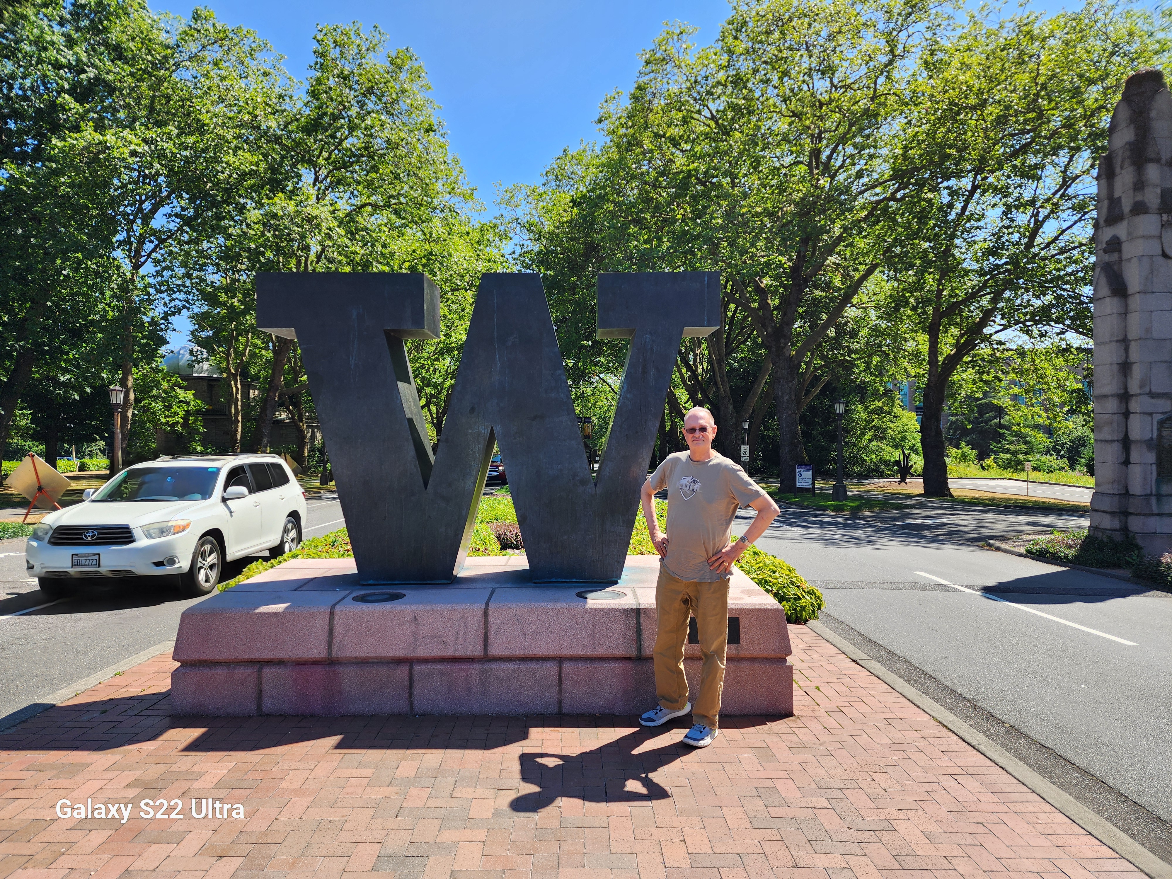
While this natural wonder is as impressive as the lush forests around it, it is not protected. If you want to help protect one of nature’s own magic acts, be sure to sign the petition and support the Crater Lake Wilderness region for generations to come.